Category : Resources
-
 2024-06-25 23:33
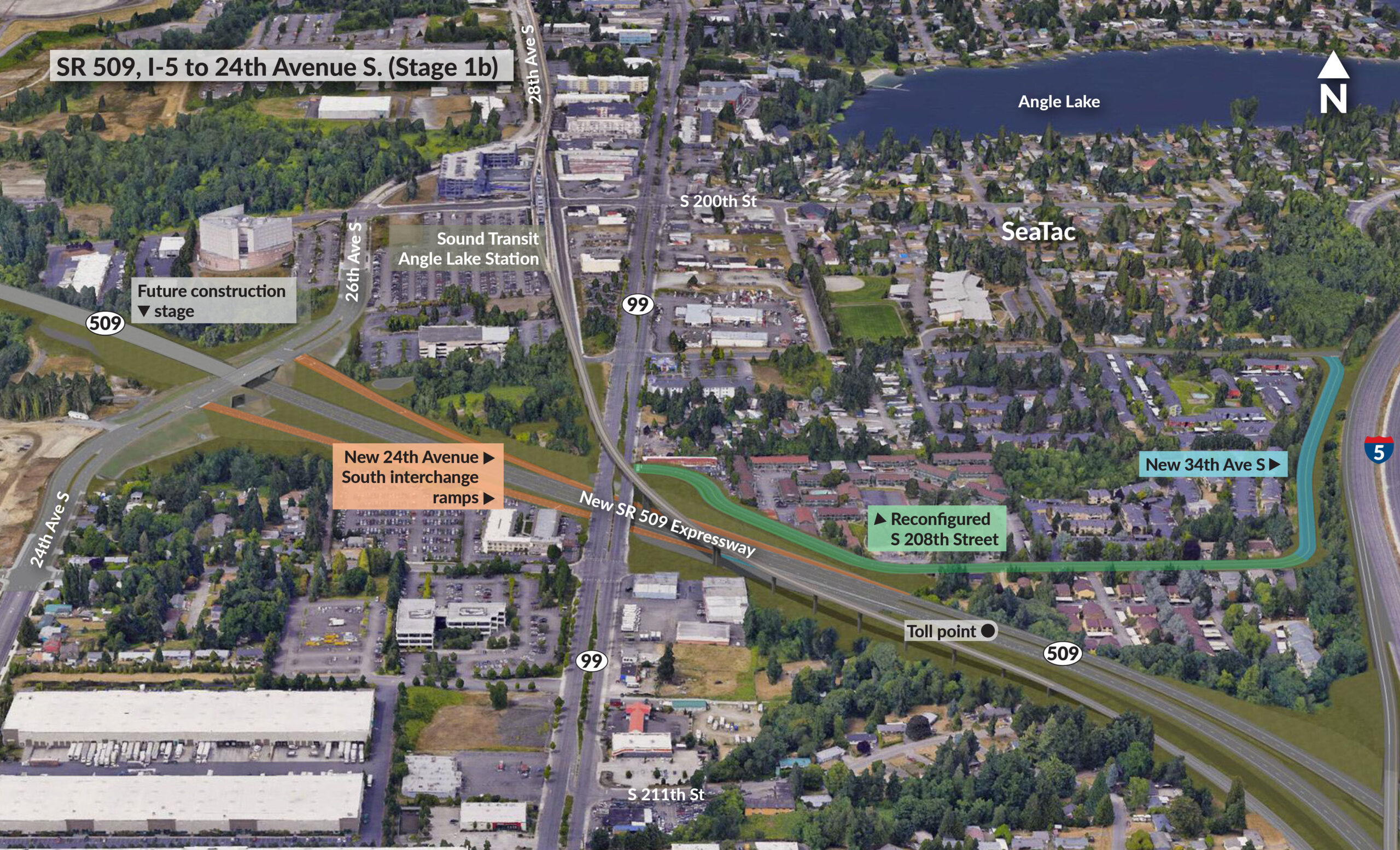
SR 509, I-5 to 24th Avenue S. (Stage 1b)
Aerial map showing planned SR 509 expressway construction from I-5 to 24th Avenue South, including new interchange ramps and reconfigured streets near SeaTac and Angle Lake areas. The map displays future construction stages, toll points, and connections to existing highways and Sound Transit stations. -
2023-09-28 01:23
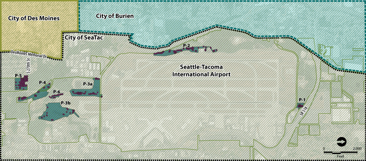
Ecology Shoreline Photo Viewer
-
-
 2023-04-24 15:11
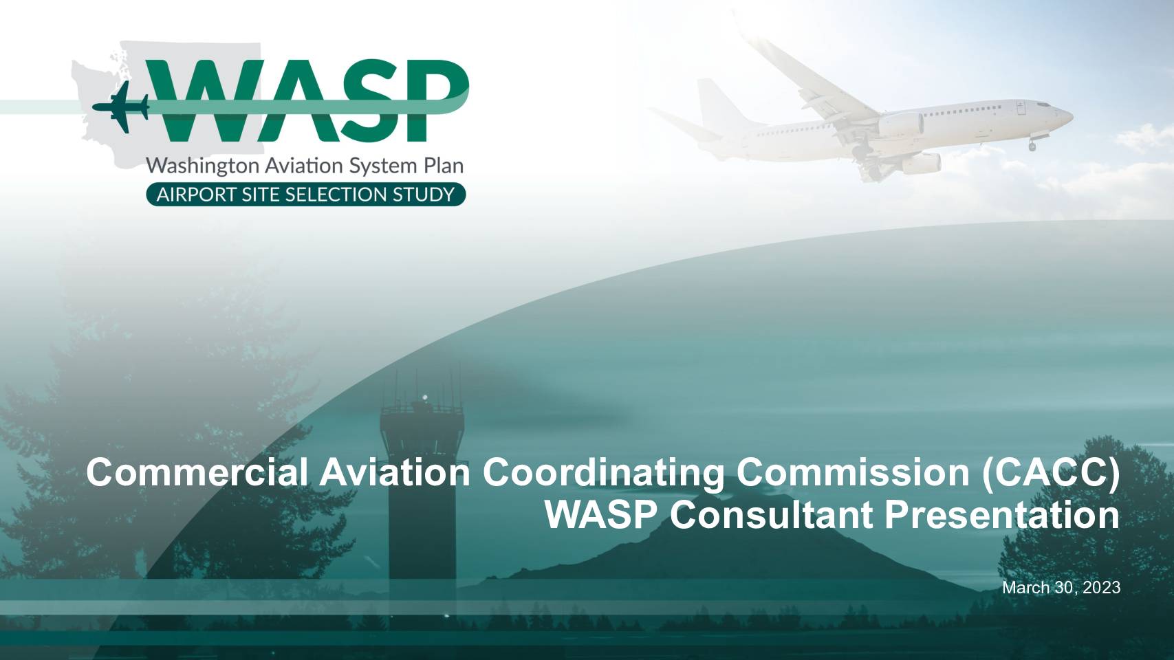
WASP March 2023 CACC Consultant Presentation
• Greenfield Airport – Secondary Screening Analysis • Greenfield Airport – Airspace Review • Preliminary Air Cargo Forecasts Introductions AIRPORT SITE SELECTION STUDY Introductions Pam Keidel-Adams Project Principal David Williams Project Manager Laura Holthus Senior Aviation Planner Ken Bukauskas Air Cargo/Forecasting Michael Yablonski Airspace Greenfield Airport – Secondary Screening Analysis AIRPORT SITE SELECTION STUDY Greenfield Sites – Secondary Screening Analysis • Environmental factors • Transportation/access analysis • Infrastructure analysis • Airspace review* * Airspace Review is covered separately from all other secondary screening criteria ** King County Southeast site is not included in the options for the CACC but is reviewed in the WASP ** AIRPORT SITE SELECTION STUDY Criterion Category Evaluation Element Measure Operational Capability and Capacity Potential Airspace Impacts and Constraints Airspace Complexity Airspace Terrain Penetrations Impacts to Military Operations Runway Procedure Opportunity Ground Access Ground Transportation Connectivity Highway Connectivity Transit Connectivity Passenger Rail Connectivity Development Costs Utilities Access Power Utilities Water Utilities Fiber Internet Potential Environmental Impacts Farmlands Impacts Farmlands Impact Aquifers and Water Supply Impacts Critical Aquifer Recharge Areas Wellhead Protection Areas Tribal Interests Impacts Tribal Fishing Rights Essential Public Facilities Impacts Landfills High Voltage Power Lines Secondary Screening Evaluation Elements Market Factors Criterion Category not evaluated in secondary analysis AIRPORT SITE SELECTION STUDY Secondary Measure Descriptions Measure Description Airspace Complexity Complexity of shelving/cutouts required to accommodate airspace Airspace Terrain Penetrations Amount of terrain penetrating greenfield airspace Impacts to Military Operations Impacts of greenfield airspace on existing military airspace/operations Runway Procedure Opportunity Ability to accommodate greenfield… -
 2023-04-19 19:54
Hagens-Berman: Seattle-Tacoma International Airport (Sea-Tac) Pollution
Do you live within a five-mile radius of Seattle-Tacoma International Airport? Fill out the form to find out your rights » CASE STATUS Active ATTORNEYS Steve W. Berman Sean R. Matt Thomas E. Loeser Martin D. McLean Garth Wojtanowicz Shelby R. Smith Jacob Berman Abigail D. Pershing PRACTICE AREAS Class Action Environmental Litigation COURT Superior Court -
2022-10-09 23:14
Microsoft Worklab: Great Expectations — Making Hybrid Work, Work
Since the beginning of the COVID pandemic, Microsoft has been tracking the shift to remote work through their Worklab research division. But unlike other companies and pundits with various agenda, it has been doing something approaching unbiased research and legitimate analysis. Microsoft is doing a great public service in pursuing these studies. As we’ve pointed -
2022-10-08 21:24
EPA Enforcement and Compliance History Online (EPA)
Use EPA’s Enforcement and Compliance History Online website to search for facilities in your community to assess their compliance with environmental regulations. You can use ECHO to: Search for Facilities Investigate Pollution Sources Search for EPA Enforcement Cases Examine and Create Enforcement-Related Maps Analyze Trends in Compliance & Enforcement Data -
2022-09-09 23:35
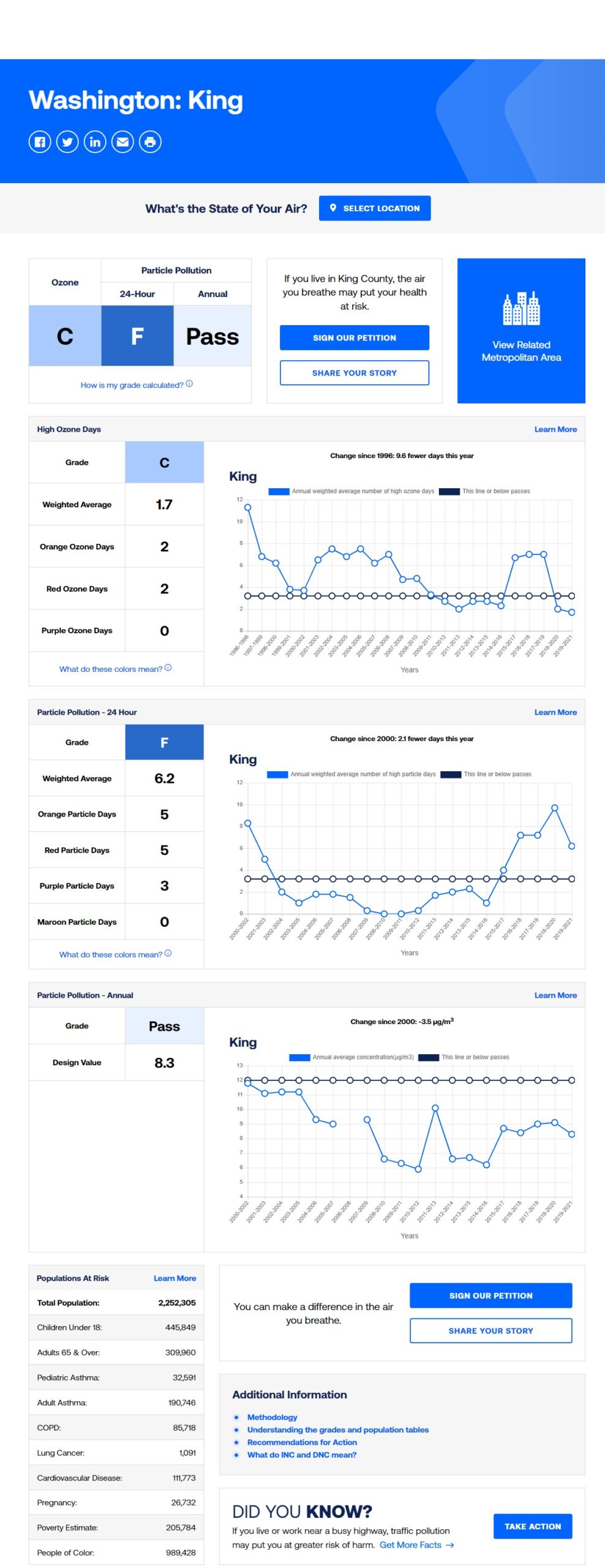
Washington Air Monitoring Network: Air Quality Program
Washington State Department of Ecology -
2021-08-04 11:10
Topographic Map.com (King County)
Topographic Map is a free Internet site that aggregates content from ESRI and OpenStreetMaps to create heat maps for given areas. This particular image shows the plateau (partially man-made) on which the airport sits. -
 2021-07-19 20:54
Flight Corridor Safety Program On-line Open House
The Port of Seattle has an ongoing program to remove trees around SEA to improve safety during takeoffs and landings and replant in their place, native, low-growing trees. The first phase of work, completed in 2019, centered around removing and replanting trees on Port property. During this phase, the Port established low-growing native forests onsite