TagDNL65(39)
-
 2032-01-01
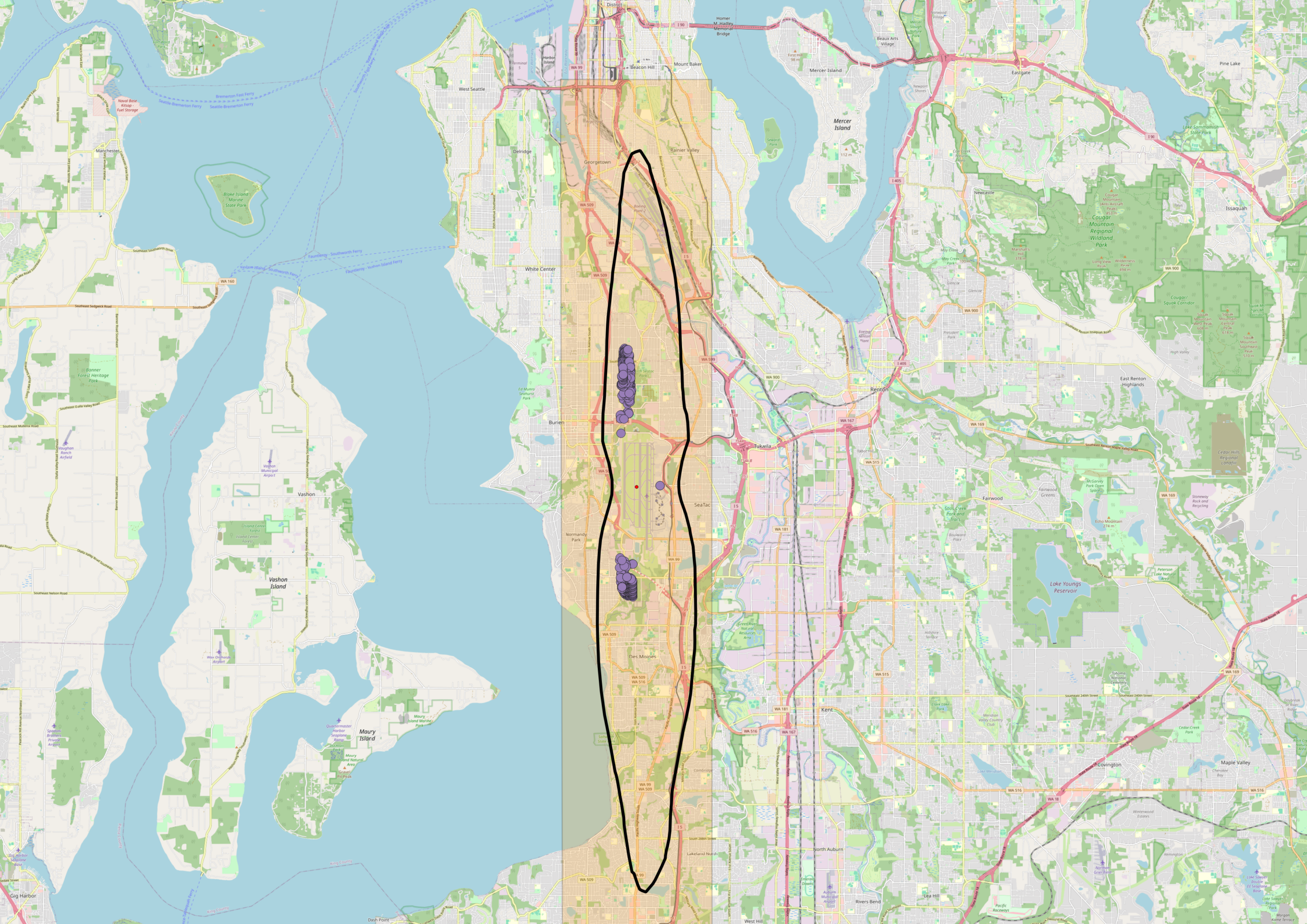
DNL 65 Noise Contour Map — Sea-Tac Airport Area with Noise Complaint Markers
An OpenStreetMap-based map centered on the Seattle–Tacoma (Sea-Tac) Airport area showing a highlighted corridor (shaded in orange/yellow) and a black oval outline delineating what appears to be a flight path or noise impact study zone. Clustered purple markers, likely representing noise complaint locations or monitoring stations, are visible near Burien and a southern cluster near Des Moines/Federal Way, with Sea-Tac Airport identifiable near the center of the map. -
 2026-08-30
Appendix G Comments and Responses
This document is Appendix G of the Seattle-Tacoma International Airport Part 150 Noise Study, compiling public comments and official responses gathered during the study's development. It covers a wide range of topics organized into three main areas: Part 150 regulations and noise exposure maps (including noise metrics, flight tracks, and FAA guidelines), current airport operations and community concerns (such as flight paths, nighttime operations, and the sound insulation program), and miscellaneous issues like health effects, air quality, and property values. Comments were collected through multiple channels including public open houses, workshops, the study website, and email. -
2026-08-30
Appendix G Comments and Responses
This document is Appendix G of the Seattle-Tacoma International Airport Part 150 Noise Study, compiling public comments and official responses gathered during the study's development. It covers a wide range of topics organized into three main areas: Part 150 regulations and noise exposure maps (including noise metrics, flight tracks, and FAA guidelines), current airport operations and community concerns (such as flight paths, nighttime operations, and the sound insulation program), and miscellaneous issues like health effects, air quality, and property values. Comments were collected through multiple channels including public open houses, workshops, the study website, and email. -
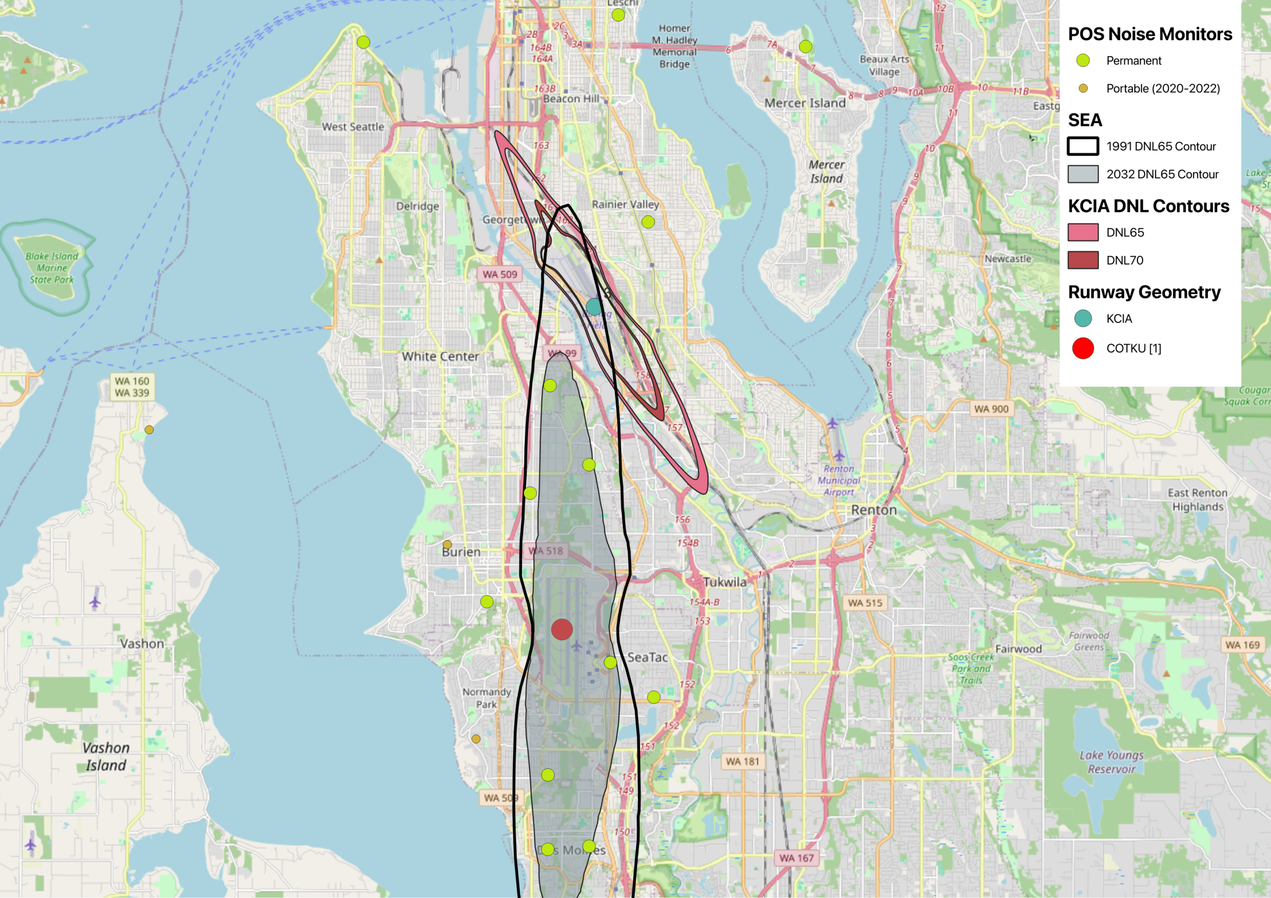
Map of Sea-Tac and KCIA DNL contours with Port of Seattle Noise Monitors
This map displays noise exposure contours for Seattle-Tacoma International Airport (SEA) comparing the 1991 and 2032 DNL65 projections, alongside KCIA DNL65 and DNL70 contours near Georgetown/South Seattle. It also shows POS (Port of Seattle) permanent and portable noise monitor locations (2020–2022) across the South Seattle, Burien, SeaTac, Tukwila, and Renton areas, with runway geometry markers for KCIA and COTKU [1]. -
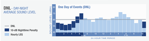
Day-Night Average Sound Level Calculation
This diagram explains the DNL (Day-Night Average Sound Level) metric used in airport noise policy, showing a bar chart of hourly LEQ sound levels (in dBA) over a 24-hour period labeled 'One Day of Events (DNL).' It highlights the 10-dB nighttime penalty applied to noise events occurring during nighttime hours, which is a standard FAA methodology for calculating community noise exposure. -
Part 150 for Dummies
Read this, including the recent update, and then attend the upcoming Port of Seattle Part 150 workshops. -
 2025-06-09
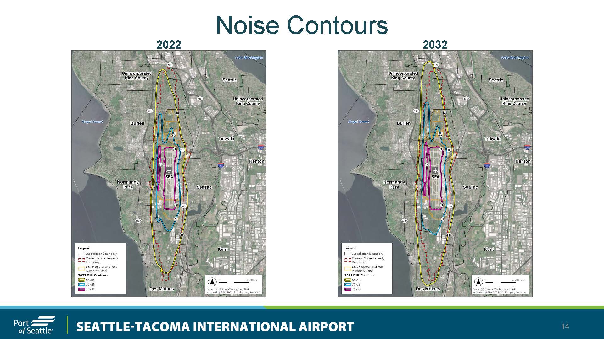
Sea-Tac Airport Part 150 DNL Noise Contour Maps: 2022 vs. 2032 Projected Conditions
A Port of Seattle presentation slide comparing DNL noise contour maps for Seattle-Tacoma International Airport (SEA) for 2022 and projected 2032 conditions, showing 65 dB, 70 dB, and 75 dB contours overlaid on aerial maps of surrounding communities including Burien, SeaTac, Normandy Park, Tukwila, and Renton. The 2032 map shows expanded noise contours relative to 2022, with reference to the Current Noise Remedy Boundary and SEA Property and Port Authority land. -
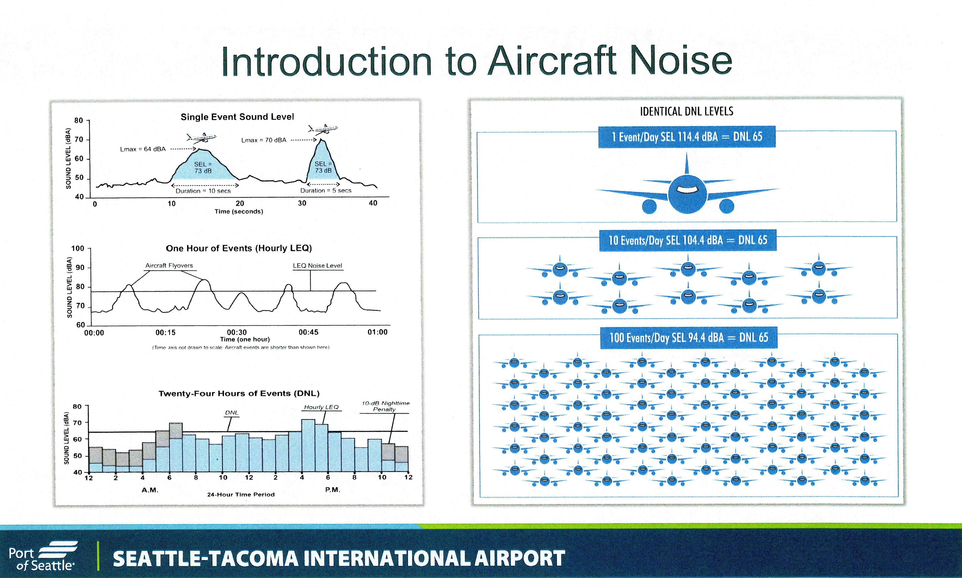
SEL and DNL 65 Noise Metrics Educational Slide — Port Of Seattle Part 150 Study
An educational slide produced by the Port of Seattle for Seattle-Tacoma International Airport explaining aircraft noise metrics, including Single Event Sound Level (SEL), Hourly LEQ, and Day-Night Level (DNL). The slide illustrates how varying numbers of daily flight events (1, 10, or 100) can produce identical DNL 65 noise levels, and includes charts showing sound levels over time periods ranging from seconds to 24 hours. -
 2024-05-22
Part 150 Noise and Land Use Compatibility Study Update: Highline Forum Presentation
The Port of Seattle presented an update on the Part 150 Noise and Land Use Compatibility Study to the Highline Forum in May 2024. This federally required study, governed by FAA guidelines, maps aircraft noise contours around Seattle-Tacoma International Airport and identifies areas where noise levels exceed 65 decibels, helping determine which properties qualify for sound insulation and other mitigation measures. Airports that complete an FAA-approved Part 150 Study become eligible to receive federal Airport Improvement Program grants covering 80% of qualifying noise reduction projects. -
 2023-06-27
Noise policy review
The FAA's Noise Policy Review examines the growing problem of aircraft noise around airports, comparing historical and current annoyance levels among nearby residents. A Neighborhood Environmental Survey found a substantial increase in the percentage of people highly annoyed by aircraft noise, with annoyance rising consistently across all levels of noise exposure — well above what older models like the Schultz Curve had predicted.