TagRunways(144)
-
 2026-10-01
October Plane Talk – King County International Airport-Boeing Field Newsletter
Airport Roundtable to meet October 5, October 26 Due to the Indigenous Peoples Day holiday, the regular Airport Roundtable meeting for October will be held one week earlier than normal, on Monday, October 5. The regular Roundtable Zoom link will work to attend virtually. To receive the link, register to attend. An agenda and meeting -
 2026-08-15
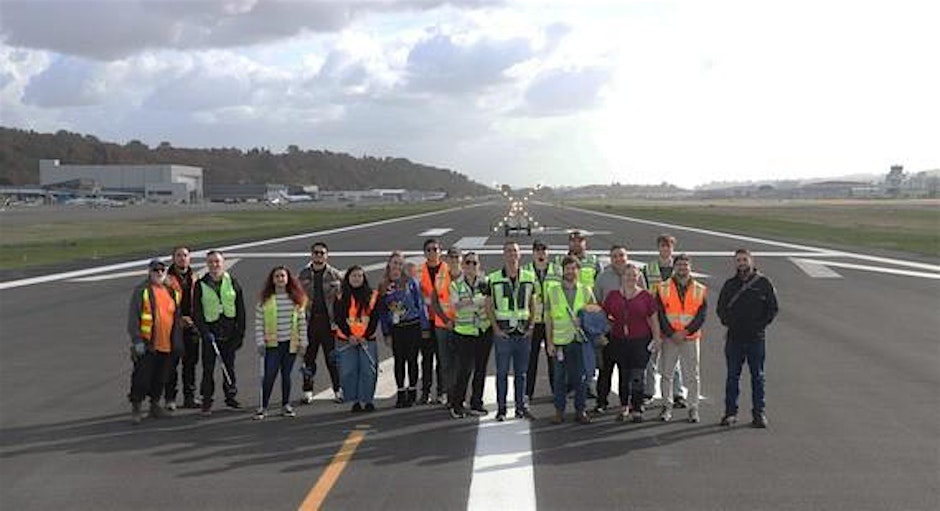
KCIA 2026 FOD Walk
Join Us for the KCIA 2026 FOD Walk! Get ready to step out and enjoy an awesome in-person event all about keeping our spaces clean and safe! The FOD Walk is a great chance to connect, learn, and have fun while helping out. Whether you’re a pro or just curious, everyone’s welcome to join the -

Sea-Tac Airport third runway project banner
A stylized graphic depicting an airplane silhouetted against a sunset sky approaching a runway lined with approach lights. The text 'Sea-Tac Airport Third Runway' is displayed prominently, indicating this image relates to the third runway project at Seattle-Tacoma International Airport. -
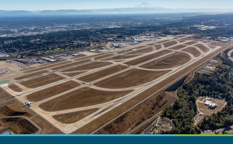
Sea-Tac Airport Aerial View Showing Parallel Runways and Terminal Facilities
Aerial photograph of Seattle-Tacoma International Airport (Sea-Tac) showing its parallel runway configuration, taxiways, terminal facilities, and surrounding communities. Mount Rainier is visible on the horizon to the southeast, confirming the Pacific Northwest location. -
 2024-05-07
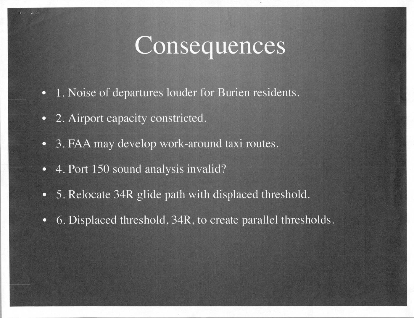
Consequences of parallel runway operations at Sea-Tac Airport
This presentation examines the consequences of runway configuration changes at Seattle-Tacoma International Airport (Sea-Tac), including louder departure noise for Burien residents, reduced airport capacity, and potential FAA workaround taxi routes. It references Seattle Air Traffic Control Tower standard operating procedures for opening and closing runways, and analyzes the feasibility of simultaneous parallel runway operations under FAA Order JO 7110.65. Key technical challenges identified include the need to relocate the Instrument Landing System, extreme ramp congestion, and the possibility of displacing the Runway 34R threshold by approximately 3,400 feet to achieve parallel threshold alignment. -
 2024-02-22
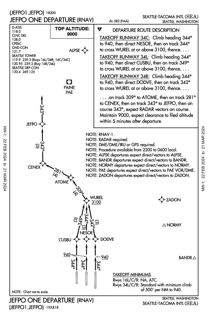
JEFPO One Departure (RNAV) — Seattle-Tacoma International Airport Standard Instrument Departure Procedure
The JEFPO One Departure is an RNAV instrument departure procedure at Seattle-Tacoma International Airport (SEA), available only between 10 PM and 6 AM local time, designed to route departing aircraft northwestward via a series of waypoints toward JEFPO. Aircraft departing runways 34L, 34C, and 34R must climb on a heading of 344° and maintain a minimum climb rate of 500 feet per nautical mile up to 940 feet, then follow specific tracks depending on their runway. Departures from runways 16L, 16C, and 16R are not authorized under this procedure, reflecting noise abatement and air traffic control considerations for the surrounding communities. -
 2024-02-22
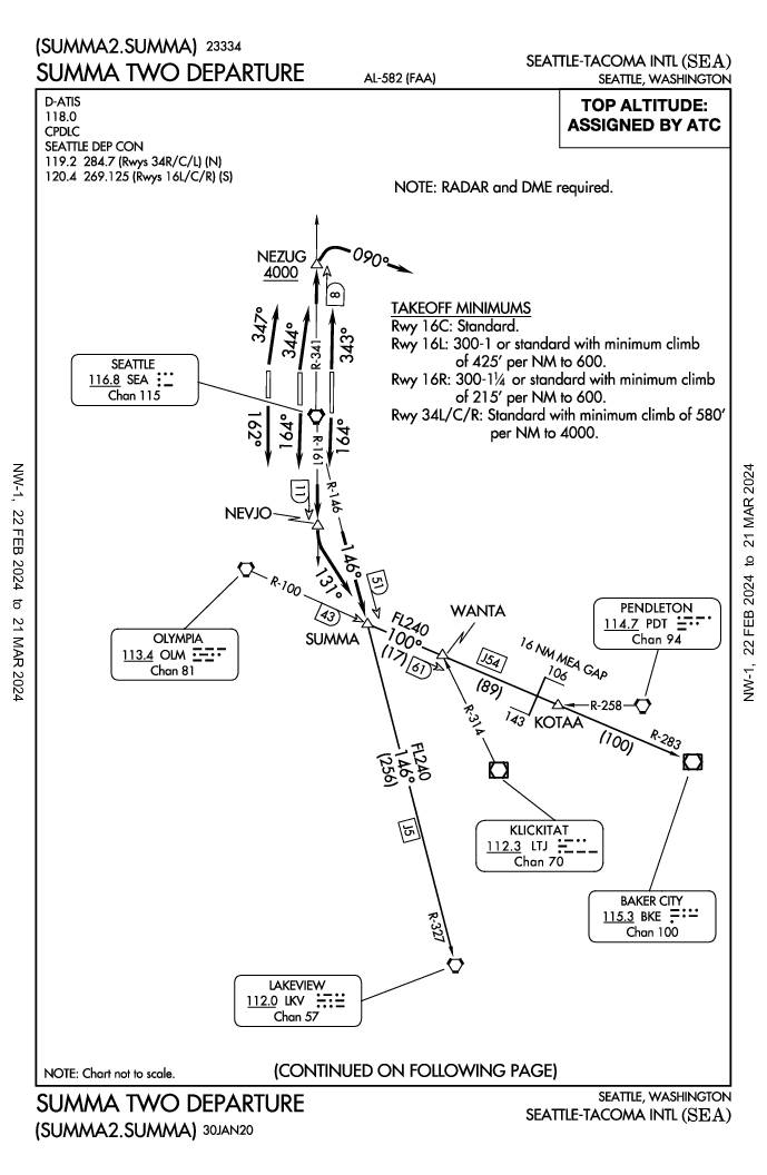
SUMMA Two Departure (SUMMA2.SUMMA) — Seattle-Tacoma International Airport Standard Instrument Departure
The SUMMA TWO Departure (SUMMA2.SUMMA) is a standard instrument departure procedure for Seattle-Tacoma International Airport (SEA) in Seattle, Washington, requiring both RADAR and DME equipment. Aircraft departing on runways 16L, 16C, 16R, 34L, 34C, and 34R follow specific headings and VOR radials through waypoints NEVJO, NEZUG, and SUMMA intersection before proceeding on assigned transitions toward destinations such as Baker City or Lakeview. Takeoff minimums vary by runway, with some requiring minimum climb gradients of up to 580 feet per nautical mile, and top altitude is assigned by ATC up to FL240. -
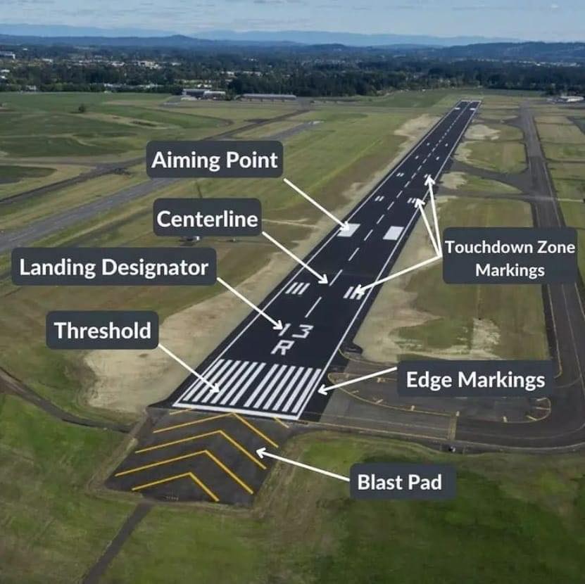
Runway Diagram
Aerial photograph of an airport runway with labeled markings including Threshold, Centerline, Aiming Point, Landing Designator, Touchdown Zone Markings, Edge Markings, and Blast Pad. The runway designator visible is '13R', but the specific airport is not confirmed from visible text alone. -
 2023-08-22
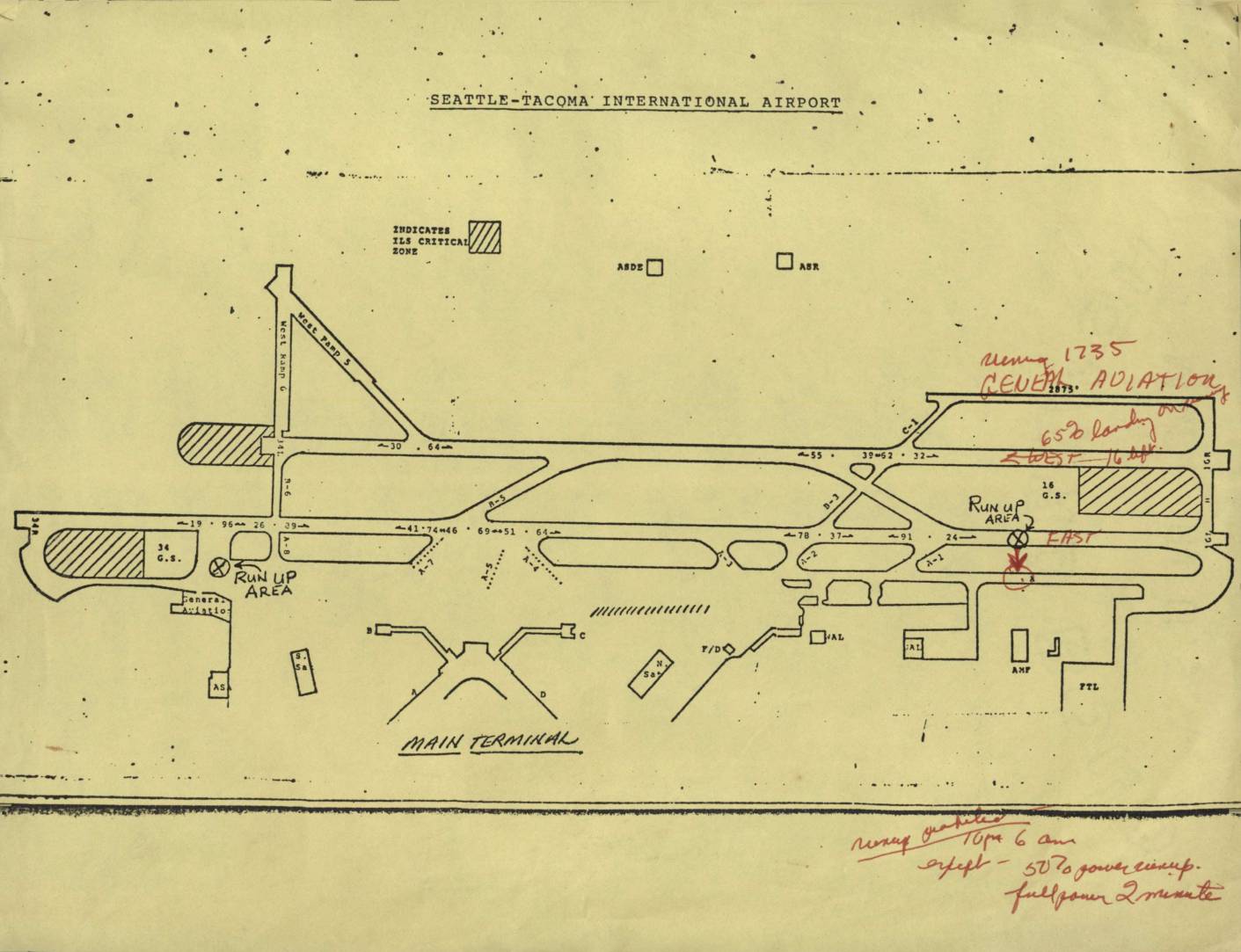
Seattle-Tacoma International Airport map
This document is an airport diagram of Seattle-Tacoma International Airport showing runways, taxiways, run-up areas, and terminal facilities. Handwritten annotations in red ink reference noise abatement procedures, including a note about 'General Aviation' operations and restrictions on runways, specifying limits such as '650 landings' and directions (East/West). Additional handwritten notes at the bottom outline runway use prohibitions from 10 PM to 6 AM, with exceptions for 50% power run-ups and full-power checks limited to 2 minutes. -
 2023-07-18
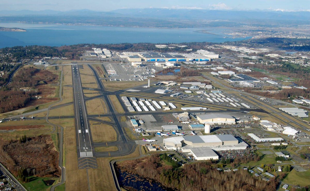
Paine Field Aerial View
Aerial photograph looking north showing Paine Field (KAWO/PAE) with runway 34 threshold markings visible in the foreground, and the Boeing Everett production facility — the world's largest building by volume — visible in the background with characteristic blue-roofed structures. Puget Sound and the city of Everett are visible in the upper background. This facility is distinct from Sea-Tac Airport.