TagFlight Tracks(58)
-
 2026-09-16
BNA Procedure Boards: Nashville International Airport Air Traffic Control and Flight Procedures Overview
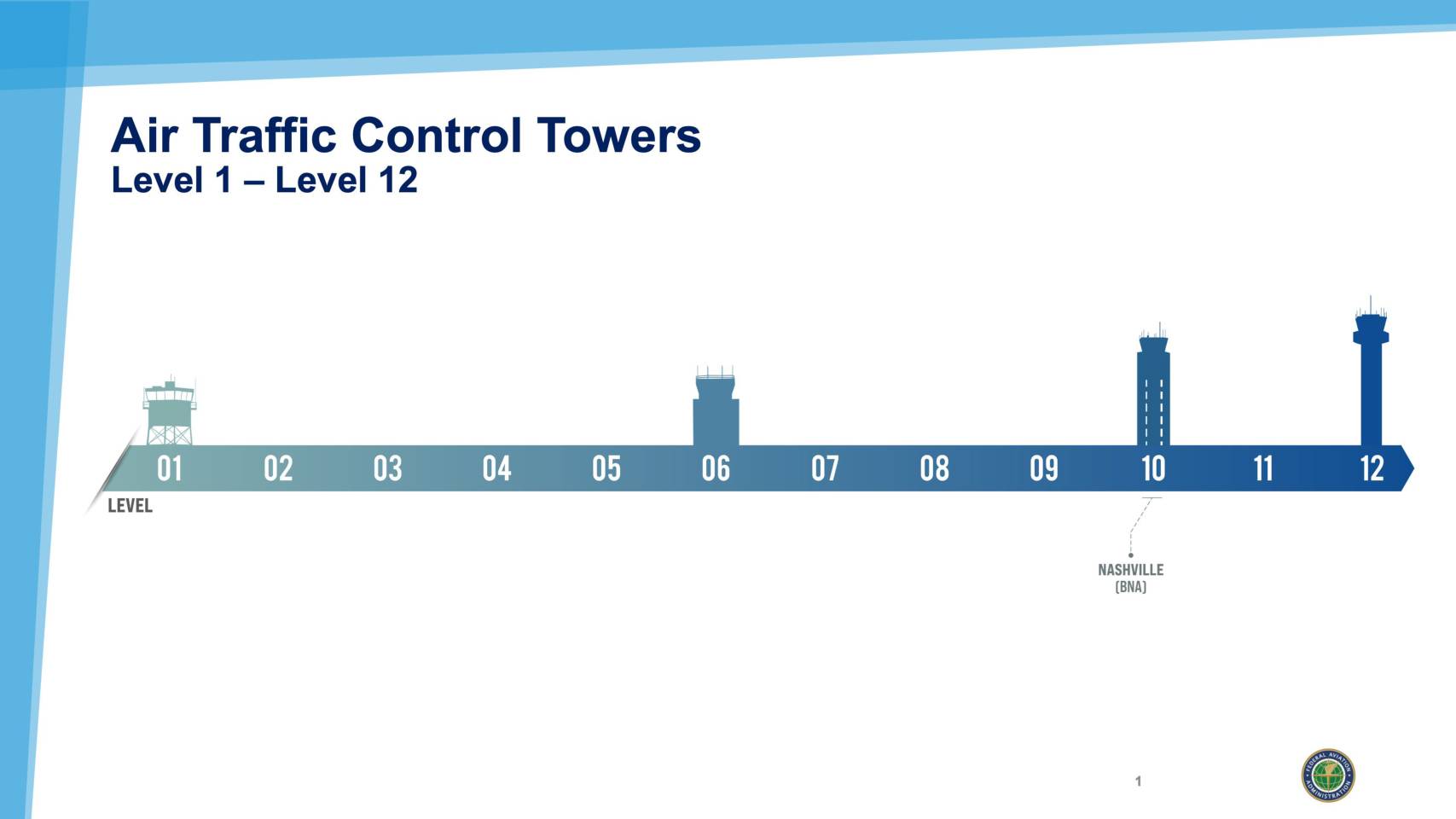
FAA community engagement presentation for Nashville International Airport (BNA) covering Air Traffic Control tower levels (Level 1 through Level 12), BNA’s classification as a Level 10 facility, and procedure board overview for Nashville metro area flight operations. Includes SID (Standard Instrument Departure) and STAR (Standard Terminal Arrival) procedures with five-letter designations such as PARDN, SWFFT, -
 2026-09-16
BNA Procedure Boards: Nashville International Airport Air Traffic Control and Flight Procedures Overview
FAA community engagement presentation for Nashville International Airport (BNA) covering Air Traffic Control tower levels (Level 1 through Level 12), BNA’s classification as a Level 10 facility, and procedure board overview for Nashville metro area flight operations. Includes SID (Standard Instrument Departure) and STAR (Standard Terminal Arrival) procedures with five-letter designations such as PARDN, SWFFT, -
 2026-06-29
Appendix H Official Noise Exposure Maps
This document presents the official Noise Exposure Maps (NEMs) for Seattle-Tacoma International Airport (SEA), developed as part of the FAA Part 150 noise study. It includes maps showing 2022 existing noise conditions and projected 2032 future conditions, along with the flight tracks used in the Aviation Environmental Design Tool (AEDT) modeling for both north and south flow operations. The maps illustrate the geographic extent of aircraft noise impacts across surrounding communities, including Seattle, Burien, SeaTac, Tukwila, and Des Moines. -
2026-06-29
Appendix H Official Noise Exposure Maps
This document presents the official Noise Exposure Maps (NEMs) for Seattle-Tacoma International Airport (SEA), developed as part of the FAA Part 150 noise study. It includes maps showing 2022 existing noise conditions and projected 2032 future conditions, along with the flight tracks used in the Aviation Environmental Design Tool (AEDT) modeling for both north and south flow operations. The maps illustrate the geographic extent of aircraft noise impacts across surrounding communities, including Seattle, Burien, SeaTac, Tukwila, and Des Moines. -
 2026-06-20
Appendix H: Official Noise Exposure Maps — 2024 Part 150 Study
Appendix H of the Seattle-Tacoma International Airport (Sea-Tac Airport) Part 150 Study, containing official Noise Exposure Maps (NEMs) for 2022 Existing Conditions and 2032 Future Conditions, signed by Sarah Cox, Director of Aviation Environment & Sustainability, Port of Seattle, dated 06/20/26. Includes Aviation Environmental Design Tool (AEDT) flight tracks — North Flow and South Flow -
 2025-03-18
Invoice #1209 – Vianair Inc. Alexandria consulting January-February 2025
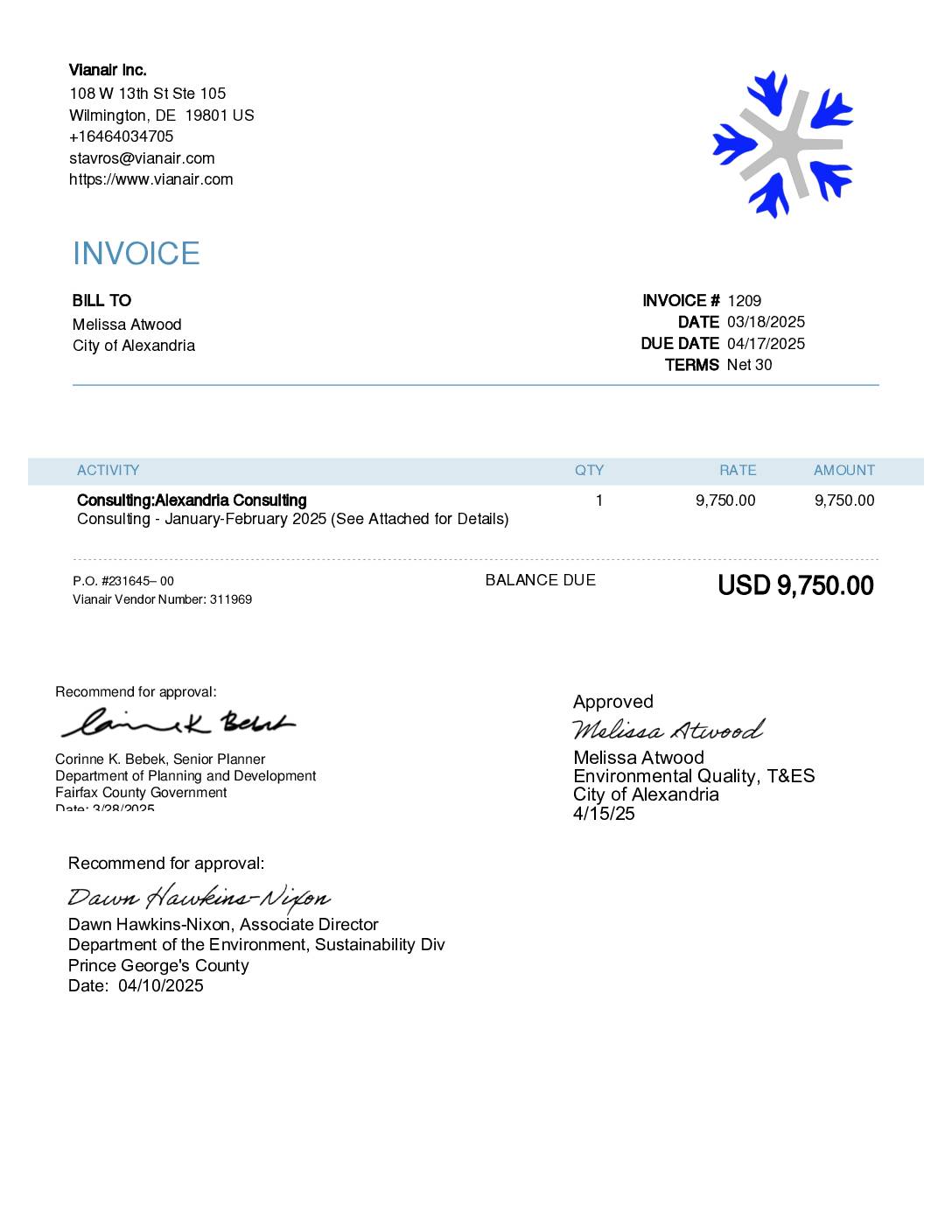
This document is an invoice and supporting monthly status report from Vianair Inc. to the City of Alexandria for aviation consulting services covering January–February 2025, totaling $9,750. The work included flight procedure reviews, public meeting presentations, steering committee participation, and software analysis related to the Alexandria (SoA) project. The invoice was recommended for approval by representatives from Fairfax County and Prince George's County and formally approved by the City of Alexandria on April 15, 2025. -
 2023-08-14
FAA Aviation Weather/Flight Track Map – Seattle-Tacoma Region
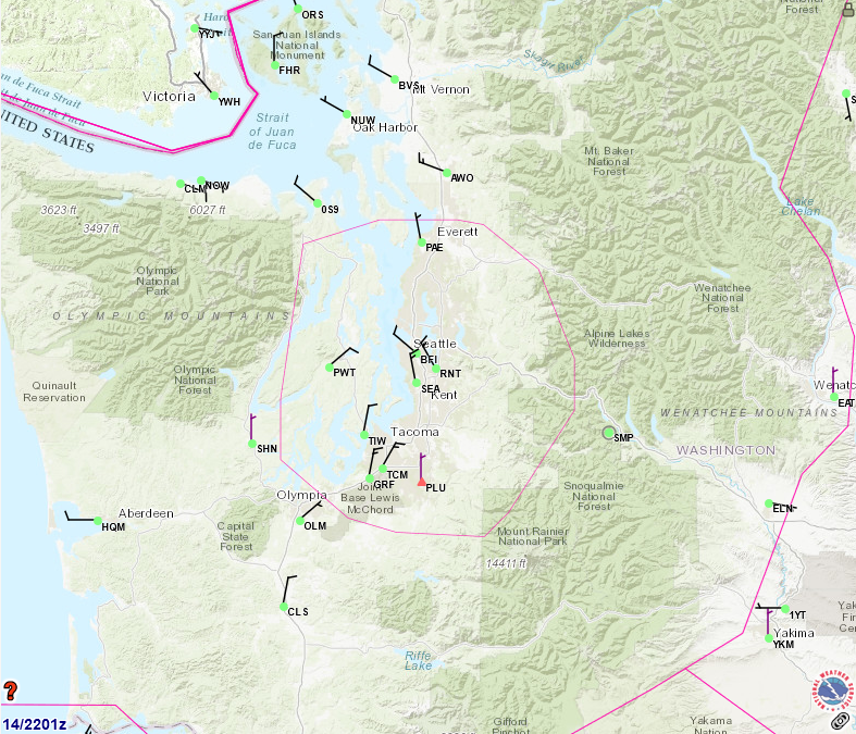
An FAA or aviation weather service map dated the 14th at 2201 Zulu, showing airports, airways, and airspace boundaries (including a pink ADIZ/TRACON boundary) across the Seattle-Tacoma metropolitan area and western Washington state. Visible airport identifiers include SEA (Seattle-Tacoma International), BFI (Boeing Field), PAE (Paine Field/Everett), RNT (Renton), TIW (Tacoma Narrows), OLM (Olympia), and numerous others, with a weather.gov watermark visible in the lower right. -
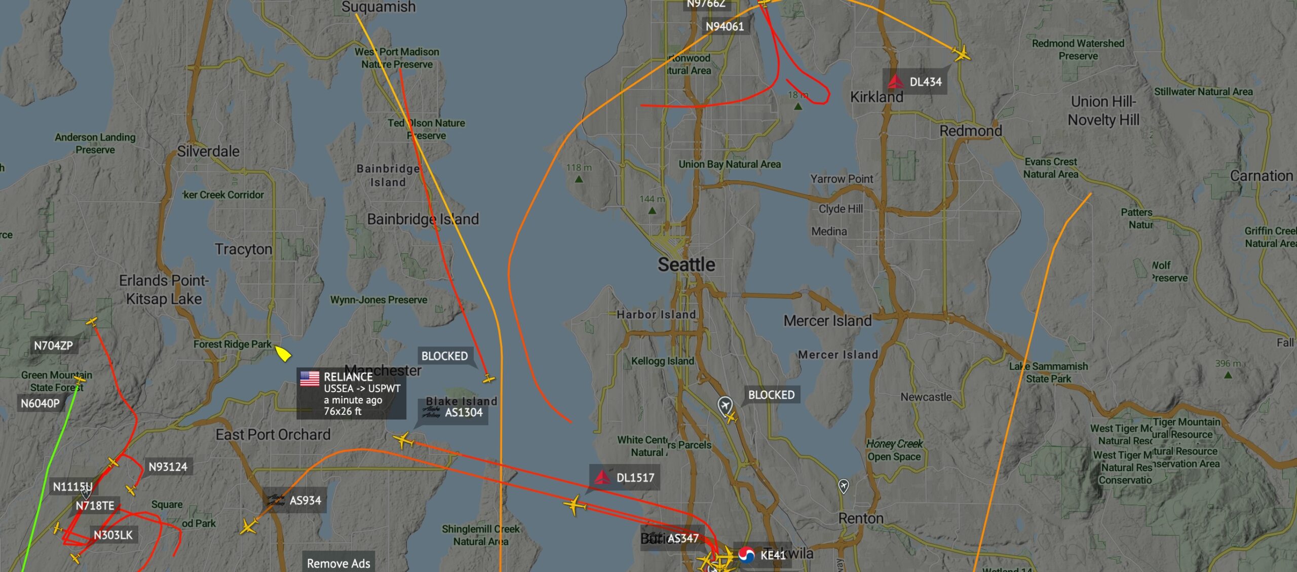
Flight Tracking Map of Seattle Area Aircraft and Blue Angels Flight Path Change
A real-time flight tracking map centered on the Seattle, Washington metropolitan area showing multiple aircraft in flight, including Alaska Airlines flights AS1304, AS934, and AS347; Delta Air Lines flights DL434, DL1517; Korean Air flight KE41; and several general aviation aircraft (N704ZP, N6040P, N1115U, N718TE, N303LK, N93124, N97662, N94061). A popup identifies a vessel named 'RELIANCE' routing USSEA to USPWT, dimensions 76x26 ft, observed approximately one minute prior to the screenshot. -
Flightradar24.com n249cb flight track
The difficulty for us is the fact that this was almost 2.5 hours of leaded gas expended simply for entertainment value. -
 2023-06-07
Highline Forum: Are arrivals lower now than they were a couple of years ago?
A Highline Forum presentation examining whether aircraft arrival numbers at Seattle-Tacoma International Airport have decreased compared to a few years earlier. The analysis uses one month of arrival flight track data from June 2013, June 2015, and June 2017 across Sea-Tac's three parallel runways (16L/34R, 16C/34C, and 16R/34L). June was chosen as a representative month because it typically features a balanced mix of north and south flow operations, Instrument Landing System (ILS) and visual approaches, and an average volume of aircraft traffic.