TagNoise Exposure Update(27)
-
 2026-08-30
Appendix G Comments and Responses
This document is Appendix G of the Seattle-Tacoma International Airport Part 150 Noise Study, compiling public comments and official responses gathered during the study's development. It covers a wide range of topics organized into three main areas: Part 150 regulations and noise exposure maps (including noise metrics, flight tracks, and FAA guidelines), current airport operations and community concerns (such as flight paths, nighttime operations, and the sound insulation program), and miscellaneous issues like health effects, air quality, and property values. Comments were collected through multiple channels including public open houses, workshops, the study website, and email. -
2026-08-30
Appendix G Comments and Responses
This document is Appendix G of the Seattle-Tacoma International Airport Part 150 Noise Study, compiling public comments and official responses gathered during the study's development. It covers a wide range of topics organized into three main areas: Part 150 regulations and noise exposure maps (including noise metrics, flight tracks, and FAA guidelines), current airport operations and community concerns (such as flight paths, nighttime operations, and the sound insulation program), and miscellaneous issues like health effects, air quality, and property values. Comments were collected through multiple channels including public open houses, workshops, the study website, and email. -
 2026-06-29
Appendix H Official Noise Exposure Maps
This document presents the official Noise Exposure Maps (NEMs) for Seattle-Tacoma International Airport (SEA), developed as part of the FAA Part 150 noise study. It includes maps showing 2022 existing noise conditions and projected 2032 future conditions, along with the flight tracks used in the Aviation Environmental Design Tool (AEDT) modeling for both north and south flow operations. The maps illustrate the geographic extent of aircraft noise impacts across surrounding communities, including Seattle, Burien, SeaTac, Tukwila, and Des Moines. -
2026-06-29
Appendix H Official Noise Exposure Maps
This document presents the official Noise Exposure Maps (NEMs) for Seattle-Tacoma International Airport (SEA), developed as part of the FAA Part 150 noise study. It includes maps showing 2022 existing noise conditions and projected 2032 future conditions, along with the flight tracks used in the Aviation Environmental Design Tool (AEDT) modeling for both north and south flow operations. The maps illustrate the geographic extent of aircraft noise impacts across surrounding communities, including Seattle, Burien, SeaTac, Tukwila, and Des Moines. -
 2026-06-20
Appendix H: Official Noise Exposure Maps — 2024 Part 150 Study
Appendix H of the Seattle-Tacoma International Airport (Sea-Tac Airport) Part 150 Study, containing official Noise Exposure Maps (NEMs) for 2022 Existing Conditions and 2032 Future Conditions, signed by Sarah Cox, Director of Aviation Environment & Sustainability, Port of Seattle, dated 06/20/26. Includes Aviation Environmental Design Tool (AEDT) flight tracks — North Flow and South Flow -
 2026-06-08
Noise Exposure Map Report: 14 CFR Part 150 Study
The Port of Seattle submitted this Noise Exposure Map (NEM) Report to the Federal Aviation Administration under 14 CFR Part 150, documenting aircraft noise levels around Seattle-Tacoma International Airport for 2022 (existing conditions) and 2032 (projected future conditions). The report was prepared by Environmental Science Associates and certified by the Port's Director of Aviation Environment and Sustainability on June 26, 2026, confirming that current airport operations remain consistent with the 2022 data. It includes documentation of public and agency consultation, noise contour maps showing areas exposed to DNL 65+ decibel levels, and supporting forecasts of aircraft activity through 2032. -
2026-06-08
Noise Exposure Map Report: 14 CFR Part 150 Study
The Port of Seattle submitted this Noise Exposure Map (NEM) Report to the Federal Aviation Administration under 14 CFR Part 150, documenting aircraft noise levels around Seattle-Tacoma International Airport for 2022 (existing conditions) and 2032 (projected future conditions). The report was prepared by Environmental Science Associates and certified by the Port's Director of Aviation Environment and Sustainability on June 26, 2026, confirming that current airport operations remain consistent with the 2022 data. It includes documentation of public and agency consultation, noise contour maps showing areas exposed to DNL 65+ decibel levels, and supporting forecasts of aircraft activity through 2032. -
Day-Night Average Sound Level Calculation
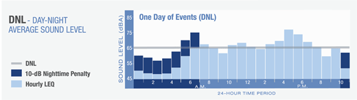
This diagram explains the DNL (Day-Night Average Sound Level) metric used in airport noise policy, showing a bar chart of hourly LEQ sound levels (in dBA) over a 24-hour period labeled 'One Day of Events (DNL).' It highlights the 10-dB nighttime penalty applied to noise events occurring during nighttime hours, which is a standard FAA methodology for calculating community noise exposure. -
 2025-08-11
Part 150 Study Technical Review Committee: Meeting #4 Agenda, August 11, 2025
This document is the agenda and attendance record for the fourth meeting of the Part 150 Study Technical Review Committee, held on August 11, 2025, at Seattle-Tacoma International Airport. The meeting covered updates on Phase 1 Noise Exposure Mapping, a kickoff for Phase 2 Noise Compatibility Program planning, and a review of the project schedule. Representatives from neighboring cities, airlines, King County, the FAA, and the Port of Seattle participated as members or liaisons. -
 2020-09-15
Letter to Ms. Hamer regarding GAO study 103933: Community impacts from NextGen noise
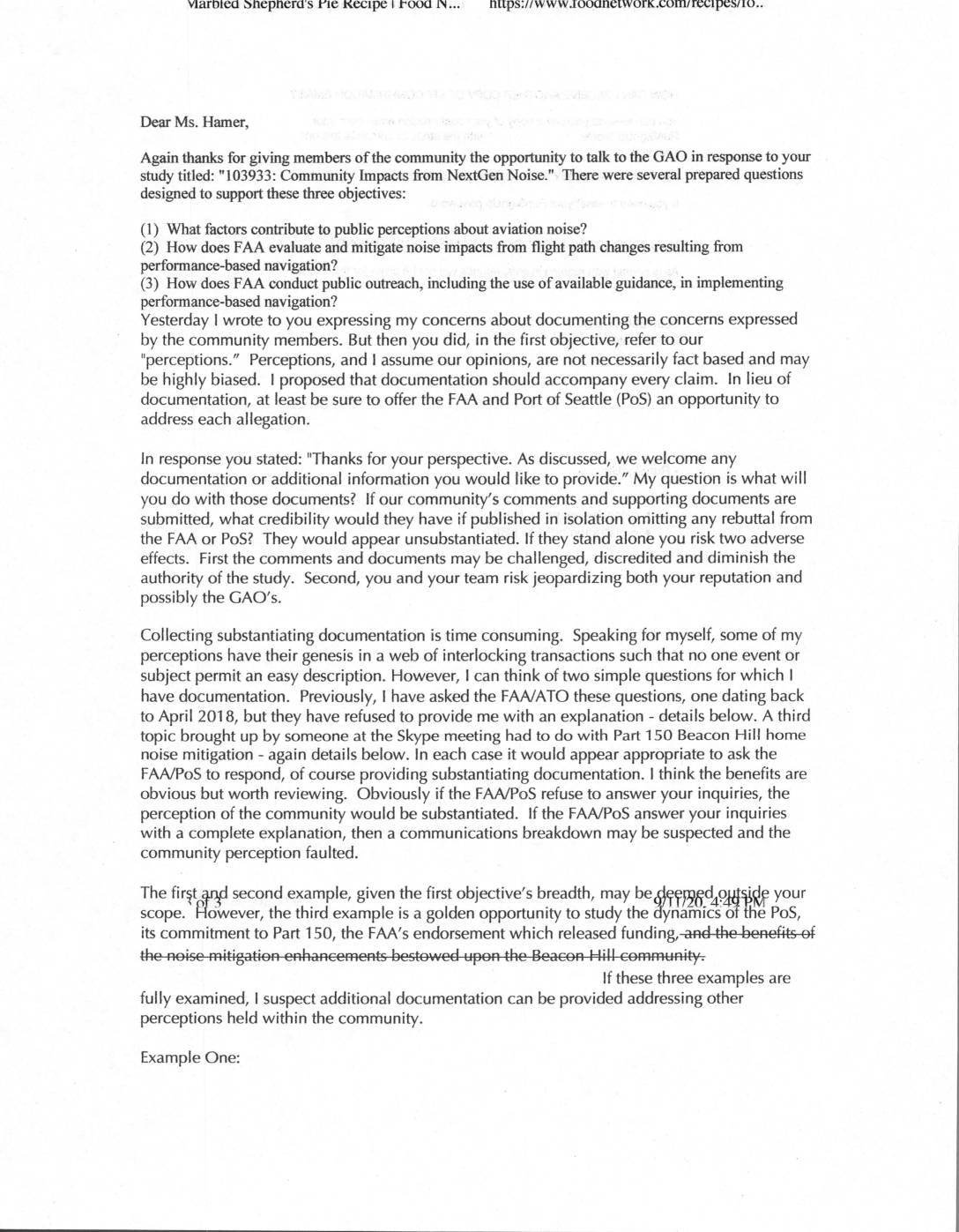
A community member wrote to a GAO researcher studying NextGen aviation noise impacts near Seattle-Tacoma International Airport, urging that community complaints be paired with responses from the FAA and Port of Seattle to ensure credibility. Key concerns raised include an outdated noise exposure map that has not been updated despite significant growth in air traffic, and the FAA's alleged refusal to answer questions submitted as far back as April 2018. The letter argues that without official rebuttals or supporting documentation, community perceptions risk appearing unsubstantiated and could undermine the integrity of the GAO study.