2025-10-28
★
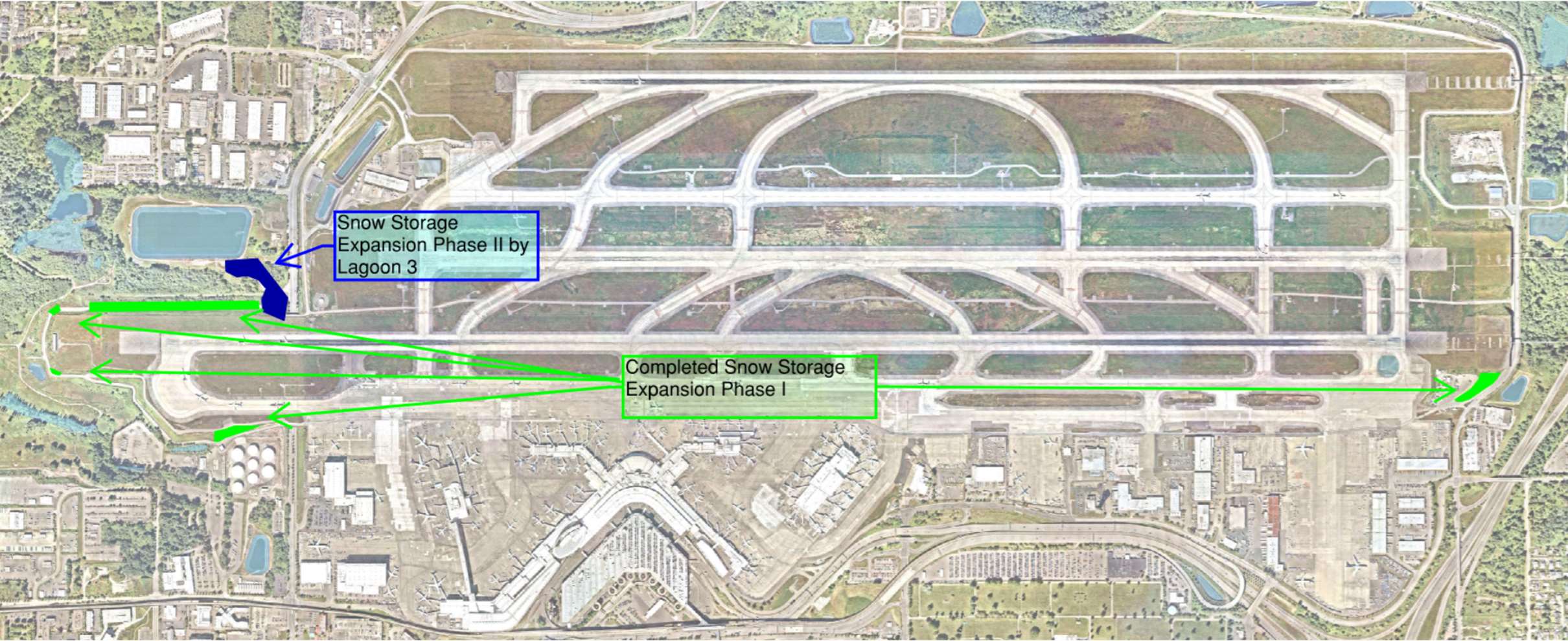
Aerial satellite map of O'Hare International Airport showing two annotated snow storage areas: 'Completed Snow Storage Expansion Phase I' along the south airfield and 'Snow Storage Expansion Phase II by Lagoon 3' on the west side, with green arrows indicating access routes between locations.
2026-07-31
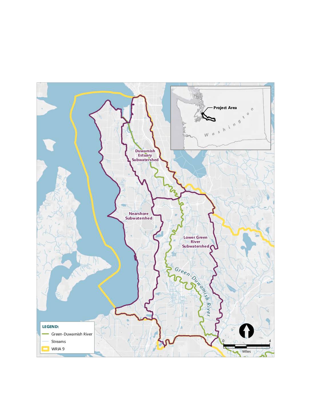
A map showing the mitigation bank service area within WRIA 9 (Water Resource Inventory Area 9), encompassing three subwatersheds: the Lower Green River Subwatershed, the Duwamish Estuary Subwatershed, and the Nearshore Subwatershed. The map displays the Green-Duwamish River and its associated streams in the greater Seattle/King County area of Washington State. An inset map shows
2026-07-31
A map showing potential mitigation sites and existing Port of Seattle habitat sites in the greater Seattle area, including Terminal 25, Terminal 117, and the Auburn Site. The map covers cities including Seattle, Burien, Tukwila, SeaTac, Des Moines, Federal Way, Kent, Renton, and Auburn. Sites are categorized by land use type including storage, vacant, and
A black-and-white site plan map labeled 'Figure 2. SEA-TAC INTERNATIONAL AIRPORT,' showing the airport's runway configuration, taxiways, terminal area, and surrounding road network. A north arrow is included in the lower left corner, orienting the map with runways running roughly east-west.
2026-07-04
It’s all about construction permits The Sustainable Airport Master Plan Near Term Projects Draft Environmental Impact Statement is a description of the effects of the largest expansion in airport history. But at bottom, it consists of thirty-one construction projects. What we find striking is the absence of detail on most of those projects. In most
This planning map, document number 6.6.5, is from the Sea-Tac Communities Plan sponsored by the Port of Seattle and King County. It depicts the North Reinforcement Area program application, showing grid-cell zones color-coded by noise mitigation category—including acquisition, purchase guarantee, cost-sharing insulation, and limited cost-sharing insulation—for the residential area surrounding Seattle-Tacoma International Airport, with landmarks such as Cedarhurst Elementary, Boulevard Park Elementary, Hilltop Elementary, Glacier High, and Sunset Junior High visible.
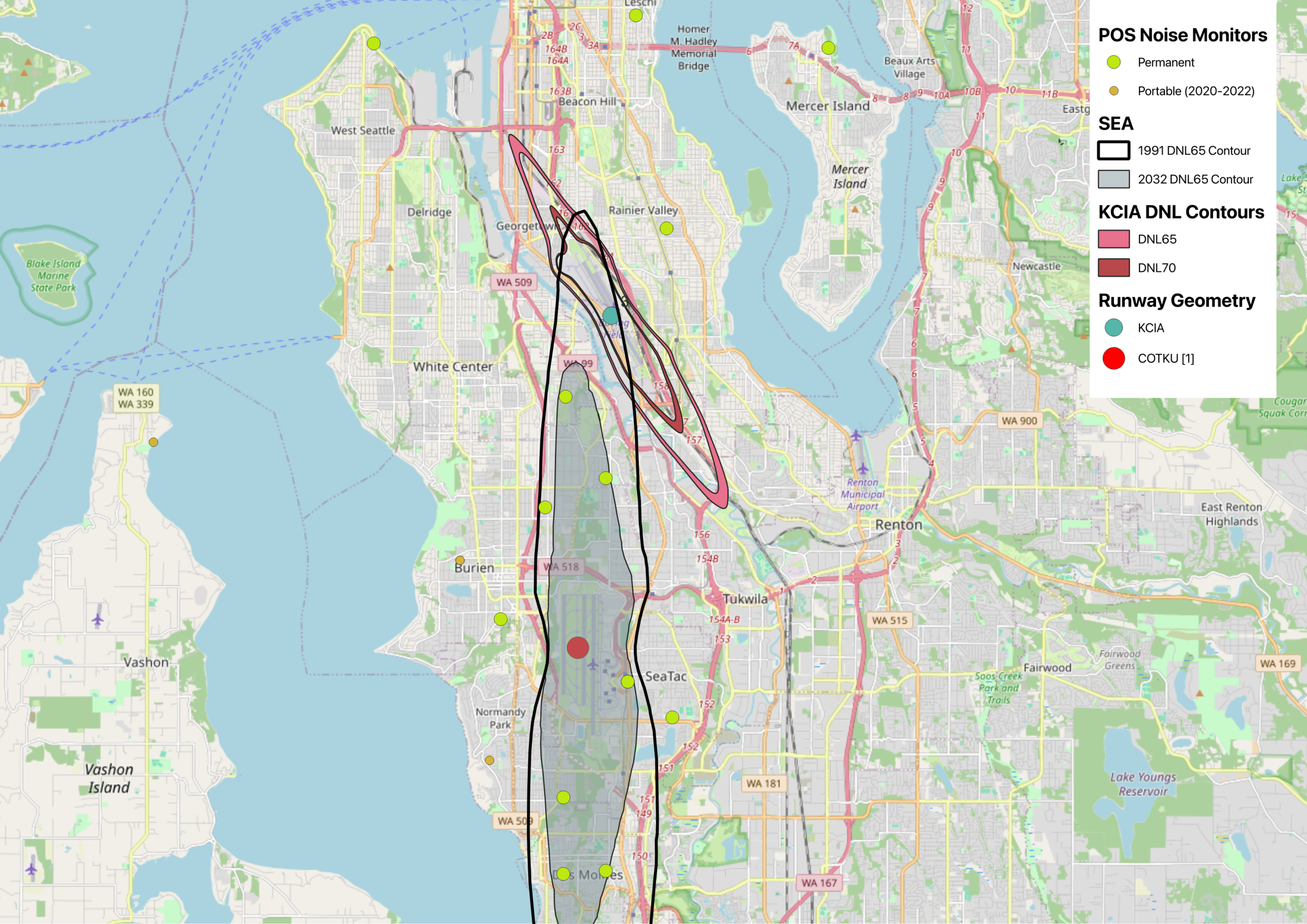
This map displays noise exposure contours for Seattle-Tacoma International Airport (SEA) comparing the 1991 and 2032 DNL65 projections, alongside KCIA DNL65 and DNL70 contours near Georgetown/South Seattle. It also shows POS (Port of Seattle) permanent and portable noise monitor locations (2020–2022) across the South Seattle, Burien, SeaTac, Tukwila, and Renton areas, with runway geometry markers for KCIA and COTKU [1].
2026-04-23
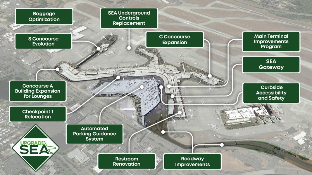
An aerial overview of Seattle-Tacoma International Airport annotated with labeled capital improvement projects under the 'Upgrade SEA' program, including C Concourse Expansion, S Concourse Evolution, Concourse A Building Expansion for Lounges, SEA Gateway, Main Terminal Improvements Program, Baggage Optimization, Checkpoint 1 Relocation, Automated Parking Guidance System, Restroom Renovation, Roadway Improvements, Curbside Accessibility and Safety, and SEA Underground Controls Replacement. The Upgrade SEA diamond logo is visible in the lower left corner.
2026-04-21
A 2018 Garmin-based aeronautical chart illustrating South Flow Noise Abatement Procedures at Seattle-Tacoma International Airport, showing the Initial Departure Corridor (green lines), Arrival Corridor (red lines), and a reference point north of the SR-520 bridge, with aircraft maintaining 5 nautical miles and 3,000 feet altitude constraints.
 2025-10-28
 2026-07-31
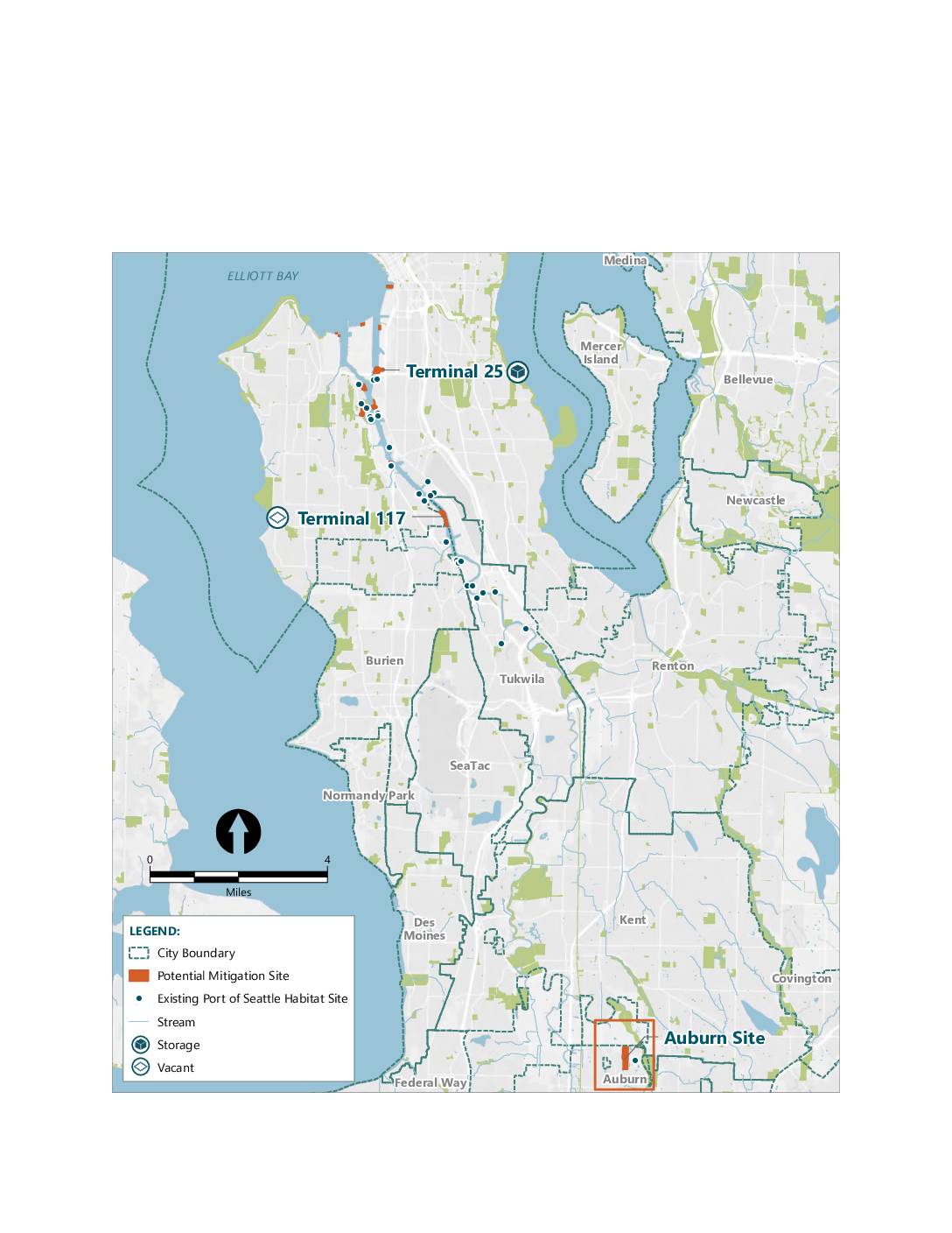 2026-07-31
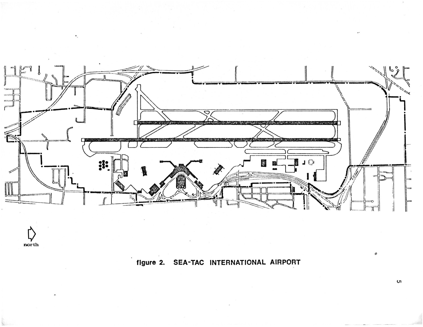
 2026-07-04
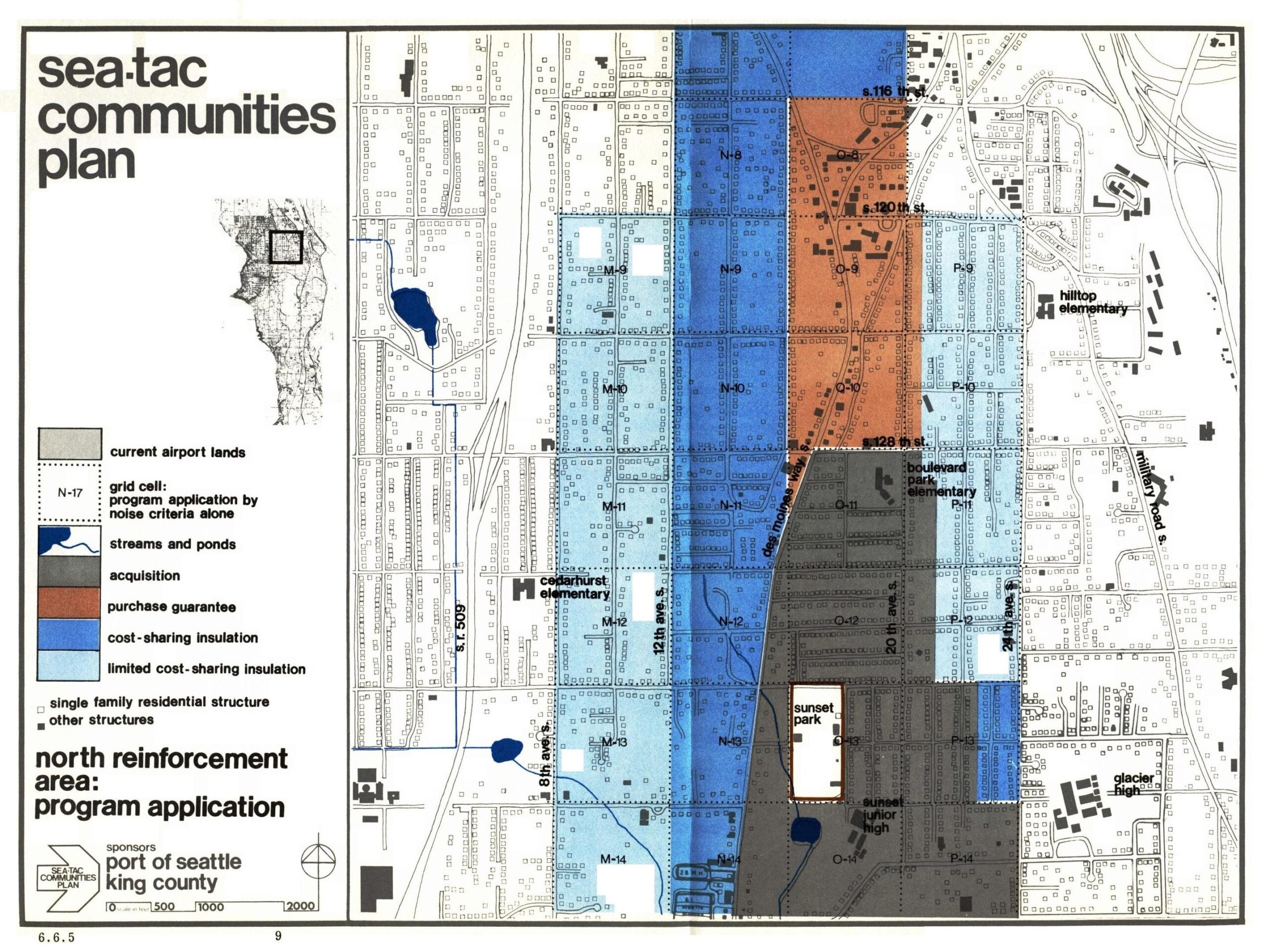
 2026-04-23
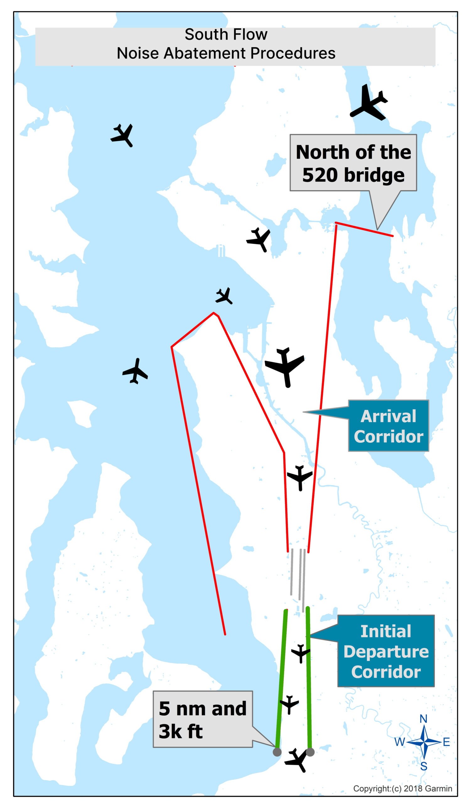 2026-04-21