Tagseatac(36)
-
 2026-01-06
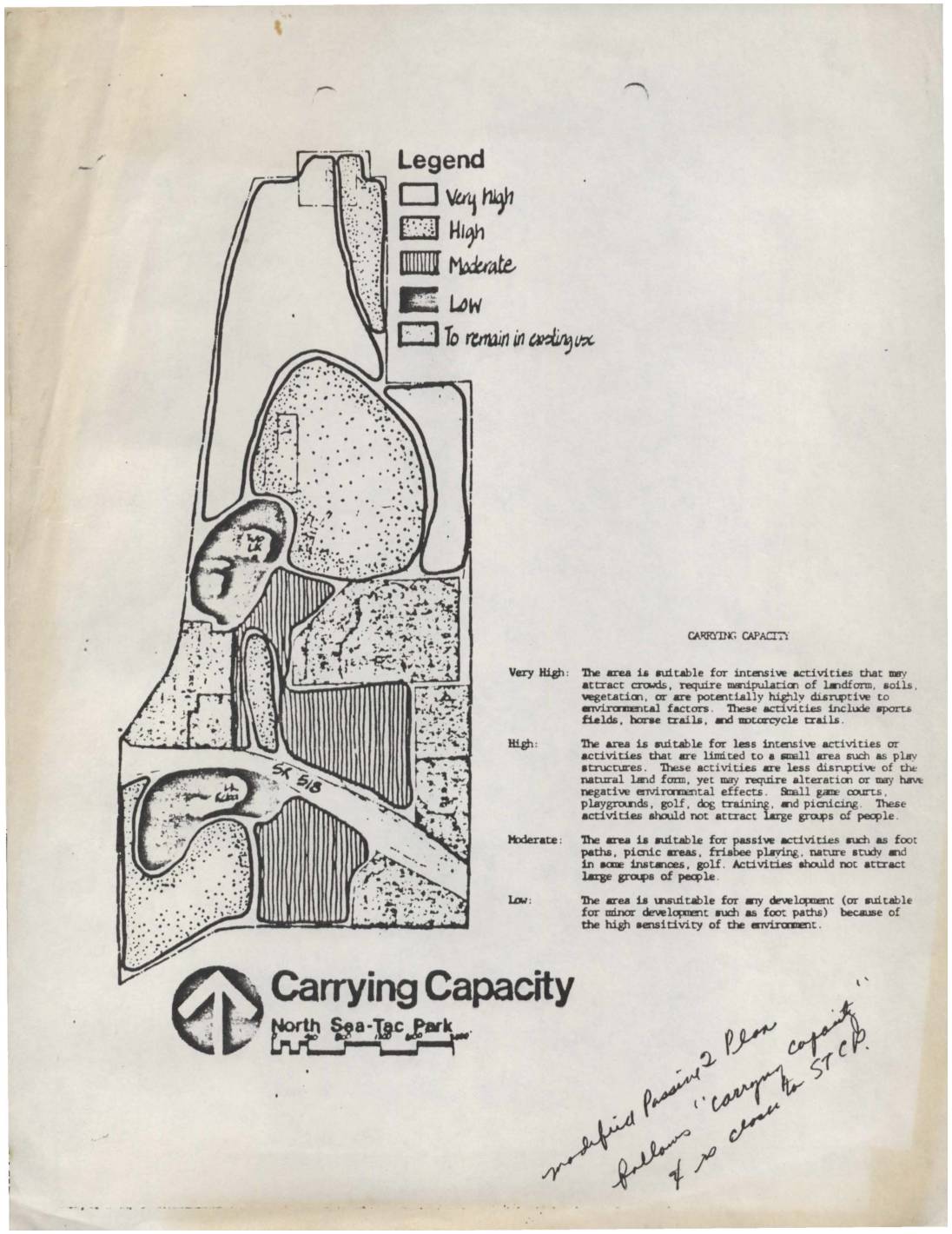
Carrying capacity map, North Sea-Tac Park
This document presents a Carrying Capacity map for North Sea-Tac Park, classifying land areas into four categories—Very High, High, Moderate, and Low—based on their suitability for various recreational activities. Very High areas can support intensive uses like sports fields and horse trails, while Low areas are too environmentally sensitive for most development. The map appears to be part of a passive recreational planning study examining how different zones of the park can be used without causing significant environmental harm. -
 2025-09-12
Legal Services Agreement Regarding Issues Regarding Port of Seattle’s Sustainable Airport Master Plan (SAMP)
★In September 2025, the City of SeaTac, Washington engaged the law firm Leech Tishman Nelson Hardiman to provide legal counsel regarding the Port of Seattle's Sustainable Airport Master Plan (SAMP), specifically in response to an anticipated Federal Aviation Administration (FAA) Finding of No Significant Impact (FONSI) and Record of Decision (ROD). The firm's work includes preparing legal analysis, submitting comments, and filing a Petition for Review in either the Ninth Circuit or D.C. Circuit Court of Appeals challenging the FAA's environmental findings once published in late 2025. The engagement is capped at $300,000 with an initial $10,000 retainer, and billing rates range from $300–$400 per hour for associates to $540 per hour for lead attorney Steven M. Taber. -
 2024-06-25
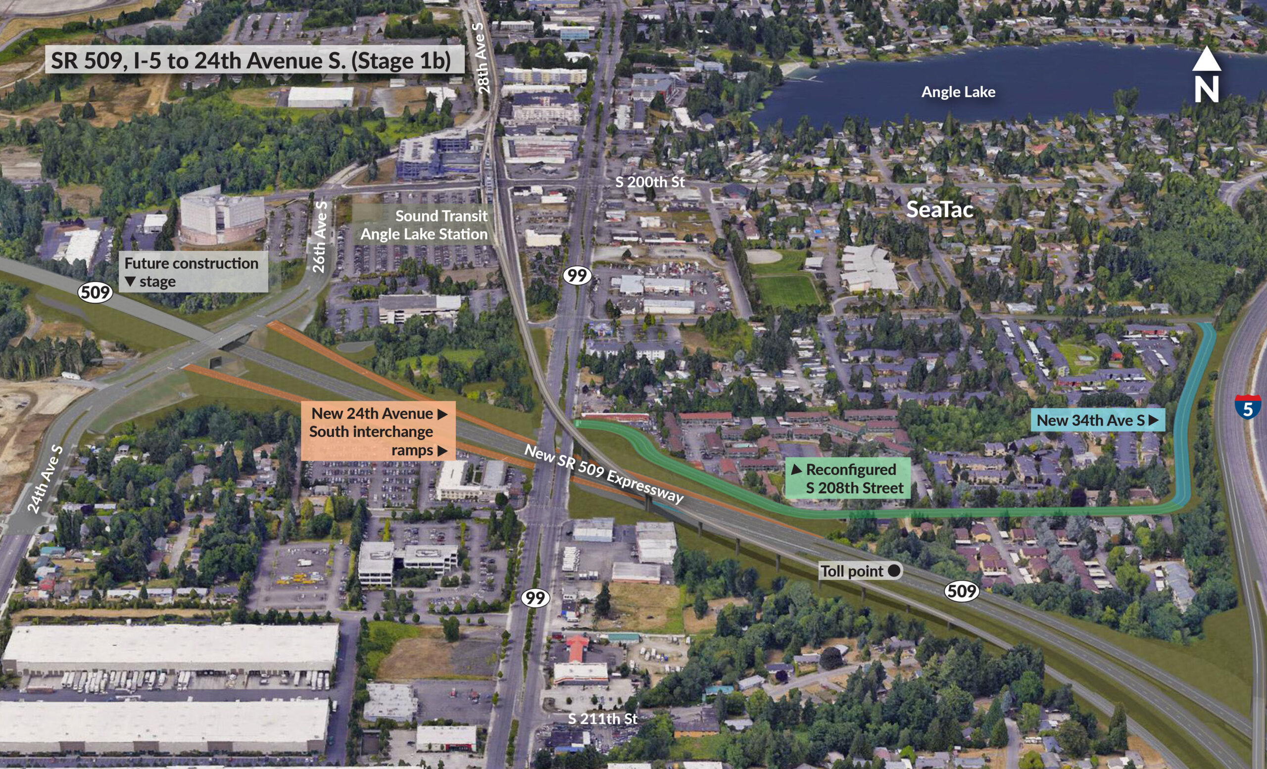
SR 509, I-5 to 24th Avenue S. (Stage 1b)
An aerial rendering depicting the SR 509 Expressway extension (Stage 1b) in SeaTac, Washington, showing planned infrastructure including a new 24th Avenue South interchange, new 34th Avenue S connection to I-5, a reconfigured S 208th Street, a toll point on SR 509, and proximity to the Sound Transit Angle Lake Station. The project corridor runs east-west connecting I-5 to existing SR 509 near Angle Lake. -
 2019-11-27
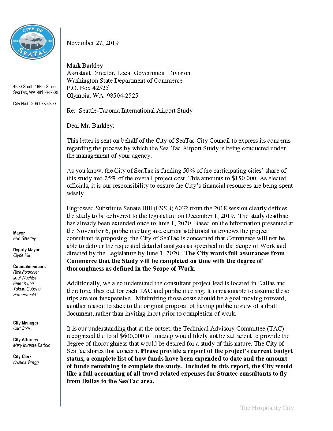
Letter from City of Sea-Tac Mayor Erin Sitterley to Mark Barkley Regarding Seattle-Tacoma International Airport Study
In a November 2019 letter to the Washington State Department of Commerce, SeaTac Mayor Erin Sitterley raised concerns about the management of the state-mandated Seattle-Tacoma International Airport Study, which SeaTac was funding to the tune of $150,000. The city questioned whether the study's consultant, Stantec, had strayed from the original technical scope of work, cited worries about monitoring stations placed outside the defined study area, and expressed doubt that the study could be completed on time and within budget. The letter demanded a full accounting of project expenditures—including consultant travel costs from Dallas—and requested that public input be limited until after a draft report was reviewed by the Technical Advisory Committee. -
SeaTac City Council meeting, city questions study of airport
Airport study questioned A letter, lengthily discussed by the Council Tuesday night, was signed by Mayor Erin Sitterley because the Council wants to “express its concerns regarding the process by which the Sea-Tac Airport Study is being conducted under the management” of the state Department of Commerce. Burien and Des Moines have not expressed that -
A Trump-Loving Mayor Is Running SeaTac, a Majority-Minority Town Full of Immigrants
A Trump-Loving Mayor Is Running SeaTac, a Majority-Minority Town Full of Immigrants by Rich Smith • Dec 28, 2018 at 3:09 pm Erin Sitterley, the new-ish Mayor of SeaTac. COURTESY THE CITY OF SEATAC The majority-minority airport town of SeaTac boasts a robust and growing immigrant population. But it’s currently being governed by a Trump-loving -
 2014-12-31
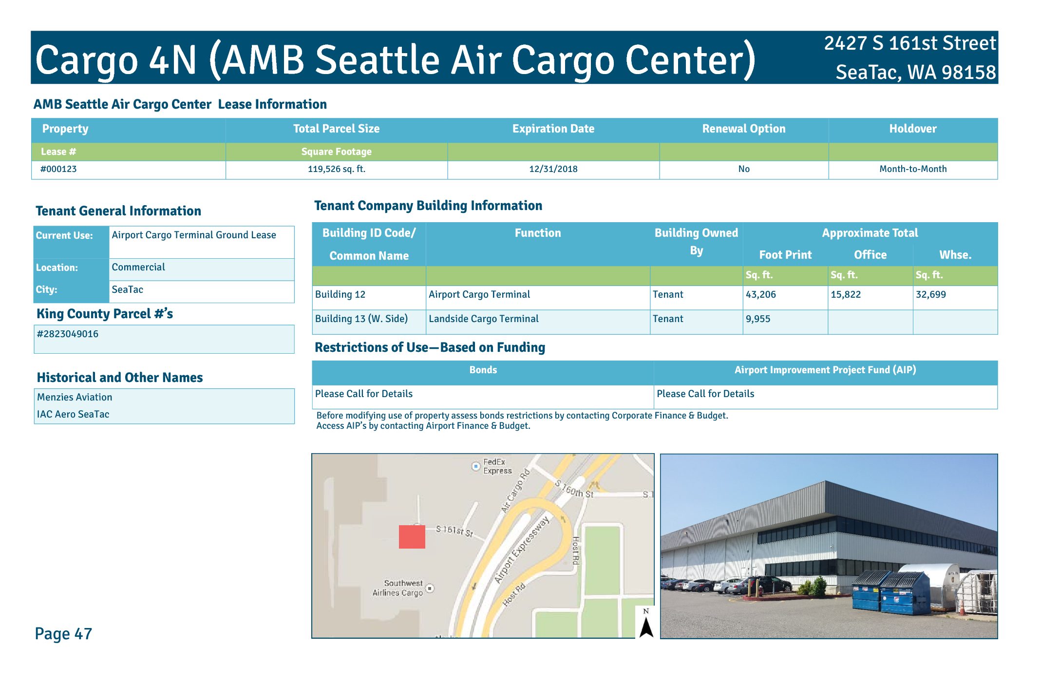
Cargo 4N (AMB Seattle Air Cargo Center) lease information
Cargo 4N, also known as the AMB Seattle Air Cargo Center, is a commercial air cargo facility located at 2427 S 161st Street in SeaTac, WA, operating under Port of Seattle Lease #000123 covering 119,526 square feet. The property includes two tenant-owned buildings: Building 12, an Airport Cargo Terminal with roughly 43,206 square feet, and Building 13 (West Side), a Landside Cargo Terminal of approximately 9,955 square feet. The lease, which expired on 12/31/2018 with no renewal option and a month-to-month holdover provision, was previously associated with Menzies Aviation and IAC Aero SeaTac. -
 2014-12-31
Cargo 4S Building (C4S) property information sheet
The Cargo 4S Building (C4S), located at 2380 S 166th Street in SeaTac, WA, is a Port of Seattle-owned airport cargo terminal totaling approximately 61,004 square feet, including 5,250 square feet of office space and 55,754 square feet of warehouse space. The property, historically known as the United Cargo Building, is leased to multiple tenants under individual lease agreements covering 46,298 square feet, with expiration dates and renewal options determined on a per-lease basis. Use of the property is subject to bond and Airport Improvement Project (AIP) funding restrictions, requiring coordination with Port of Seattle Corporate Finance & Budget and Airport Finance & Budget before any modifications. -
 2014-12-31
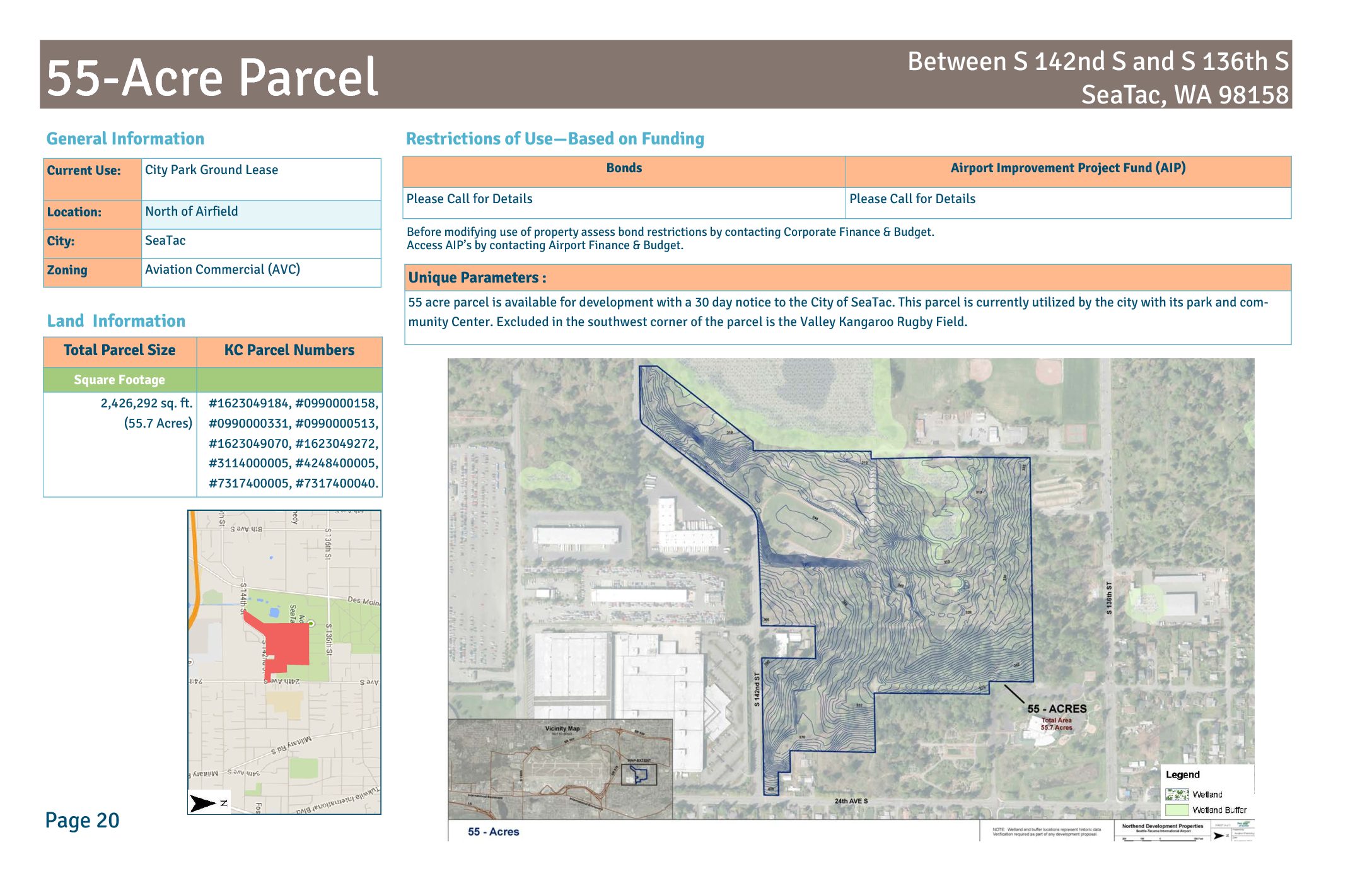
55-Acre parcel land information: Between S 142nd S and S 136th S, SeaTac, WA 98158
The Port of Seattle owns a 55-acre parcel (approximately 2.4 million sq. ft.) located north of Seattle-Tacoma International Airport's airfield, between S 136th St and S 142nd St in SeaTac, WA. Currently leased to the City of SeaTac as a park and community center, the land is zoned Aviation Commercial (AVC) and can be reclaimed for airport-related development with just 30 days' notice to the city. The parcel is subject to bond and Airport Improvement Program (AIP) funding restrictions that must be reviewed before any change in use. -
 2014-12-31
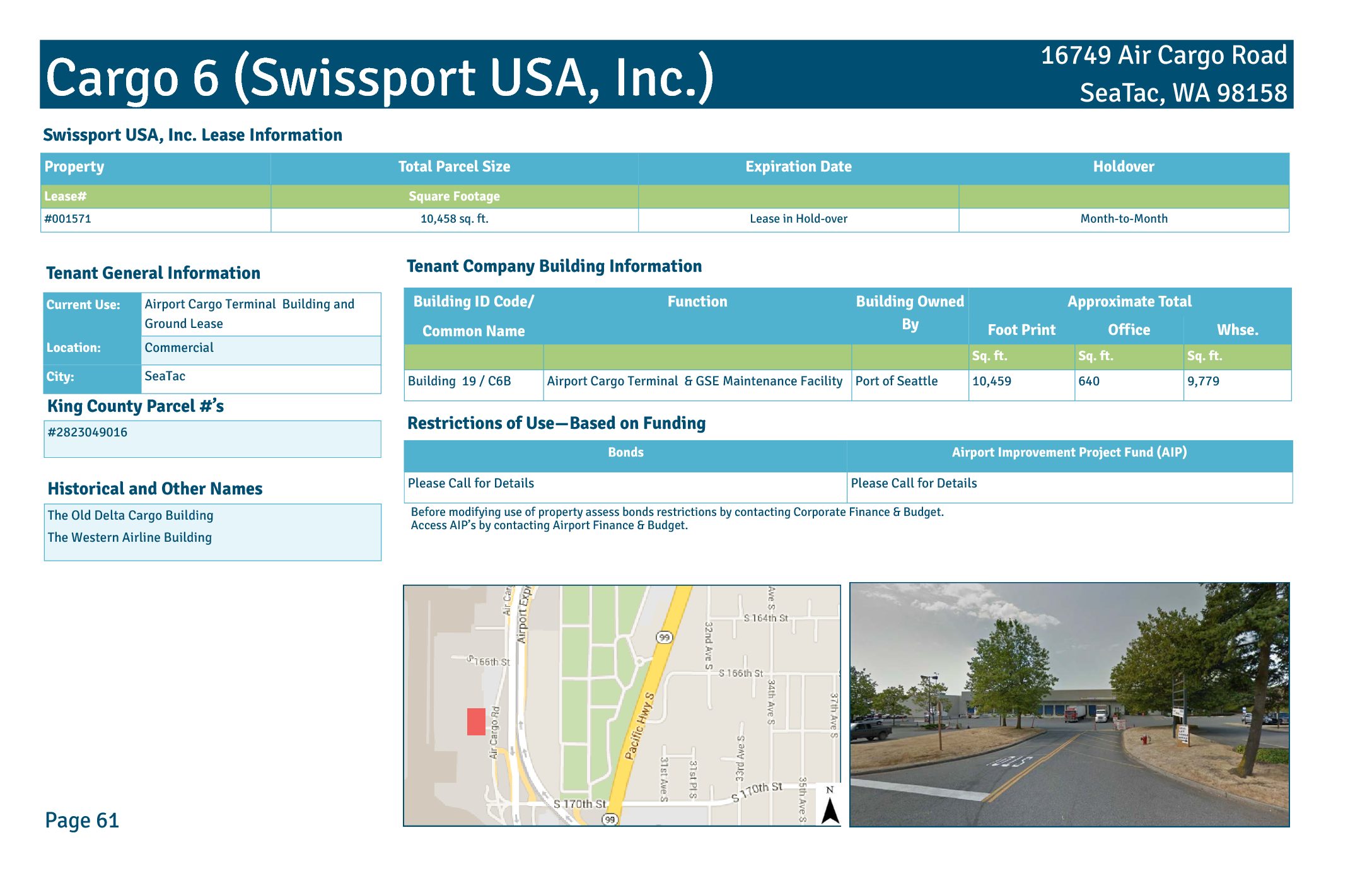
Cargo 6 (Swissport USA, Inc.) lease information
Cargo 6 is an airport cargo terminal and GSE maintenance facility at 16749 Air Cargo Road, SeaTac, WA 98158, leased by Swissport USA, Inc. under Lease #001571. The building (formerly known as the Old Delta Cargo Building and Western Airline Building) covers approximately 10,458 square feet, including 640 sq. ft. of office space and 9,779 sq. ft. of warehouse space, and is owned by the Port of Seattle. The lease is currently operating on a month-to-month holdover basis, with use restrictions tied to bond and Airport Improvement Project (AIP) funding requirements.