Tagnon-aviation transportation(43)
-
 2026-09-08
Night trains, not night planes
Social media graphic jointly published by Stay Grounded and Back-on-Track.eu (European network to promote cross-border night trains) for a September 13th campaign. The image promotes night trains as an alternative to night flights, featuring a crossed-out airplane and a modern passenger train, with the hashtag #RedLinesForAirports. Advocates for reducing aviation in favor of rail travel -
 2026-08-28
Chapter 7 Transportation Element
Chapter 7 of the City of SeaTac's Comprehensive Plan (Envision SeaTac 2044) outlines the city's Transportation Element, covering goals and policies for roadways, arterial streets, neighborhood streets, active transportation, transit, parking, and the airport. The element also addresses program financing, intergovernmental coordination, and includes maps of the pedestrian and bicycle networks, truck routes, and transit access. It serves as a planning framework guiding how SeaTac manages and improves its transportation system in alignment with state, regional, and county requirements. -
2026-08-28
Chapter 7 Transportation Element
Chapter 7 of the City of SeaTac's Comprehensive Plan (Envision SeaTac 2044) outlines the city's Transportation Element, covering goals and policies for roadways, arterial streets, neighborhood streets, active transportation, transit, parking, and the airport. The element also addresses program financing, intergovernmental coordination, and includes maps of the pedestrian and bicycle networks, truck routes, and transit access. It serves as a planning framework guiding how SeaTac manages and improves its transportation system in alignment with state, regional, and county requirements. -
 2026-08-28
Chapter 7 Transportation Background Report
This document is Chapter 7 of the City of SeaTac's Comprehensive Plan, serving as the Transportation Background Report. It references the 2024 Transportation Master Plan as its primary source, which inventories existing transportation systems, forecasts future travel demand, and identifies improvements needed to support population and employment growth through 2044. The Master Plan also outlines estimated project costs, anticipated revenues, and a financing and implementation strategy for the city's transportation network. -
2026-08-28
Chapter 7 Transportation Background Report
This document is Chapter 7 of the City of SeaTac's Comprehensive Plan, serving as the Transportation Background Report. It references the 2024 Transportation Master Plan as its primary source, which inventories existing transportation systems, forecasts future travel demand, and identifies improvements needed to support population and employment growth through 2044. The Master Plan also outlines estimated project costs, anticipated revenues, and a financing and implementation strategy for the city's transportation network. -
Sound Transit Airport Station Map
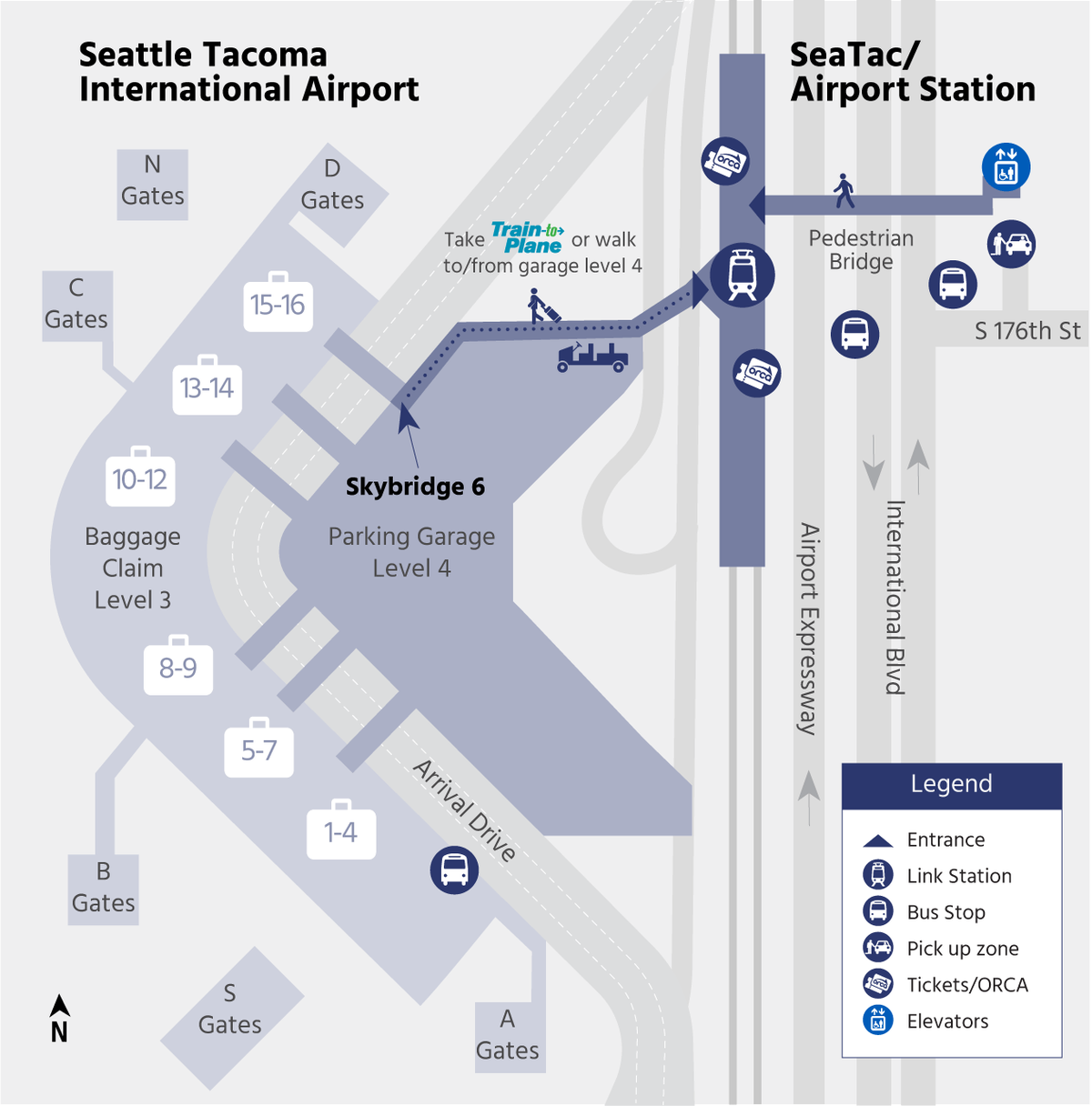
Official transit access map for Seattle-Tacoma International Airport showing the SeaTac/Airport Station connection via Skybridge 6 at Parking Garage Level 4. The map depicts the pedestrian route along S 176th Street and International Blvd, with marked locations for Link Station, bus stops, pick-up zones, ORCA ticket machines, and elevators. -
 2024-10-24
Overview of the 2025-2028 Regional Transportation Improvement Program
The 2025-2028 Regional Transportation Improvement Program (TIP), published by the Puget Sound Regional Council (PSRC) on October 24, 2024, outlines planned transportation projects and investments across the greater Puget Sound region for a four-year period. It covers project selection processes, funding plans, air quality requirements, and federal performance measures for roads, transit, ferries, and active transportation infrastructure. This document does not specifically address Sea-Tac Airport noise policy. -
 2024-09-07
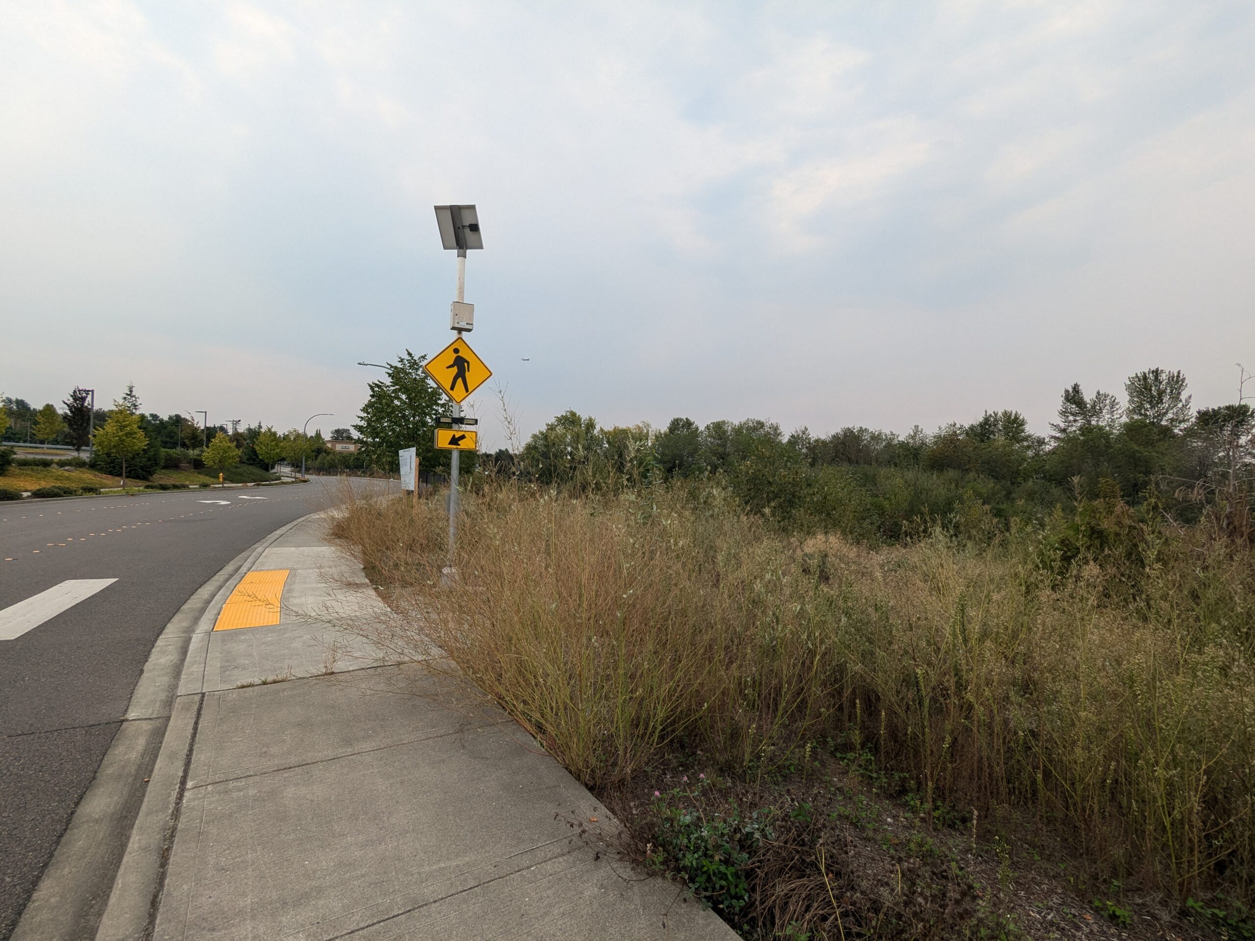
Pedestrian Crosswalk Signage Adjacent To Overgrown Vacant Lot
A solar-powered pedestrian crossing warning sign (MUTCD W11-2 standard yellow diamond) with a flashing beacon is mounted at a sidewalk curb cut featuring a yellow tactile warning pad. The surrounding area shows an unmaintained overgrown field with dry grasses alongside a curved roadway, consistent with undeveloped land near a major transportation corridor. -
 2024-09-05
Draft 2025-2028 regional transportation improvement program: Appendix A detailed project listings
This draft document from the Puget Sound Regional Council outlines the 2025-2028 Regional Transportation Improvement Program (TIP) for the greater Seattle-Tacoma region, listing federally, state, and locally funded transportation projects scheduled between 2025 and 2028. Projects are organized alphabetically by jurisdiction and include details on funding phases such as planning, design, construction, and equipment. The document was prepared as of September 5, 2024, with final updates expected by October 2024. -
 2024-05-13
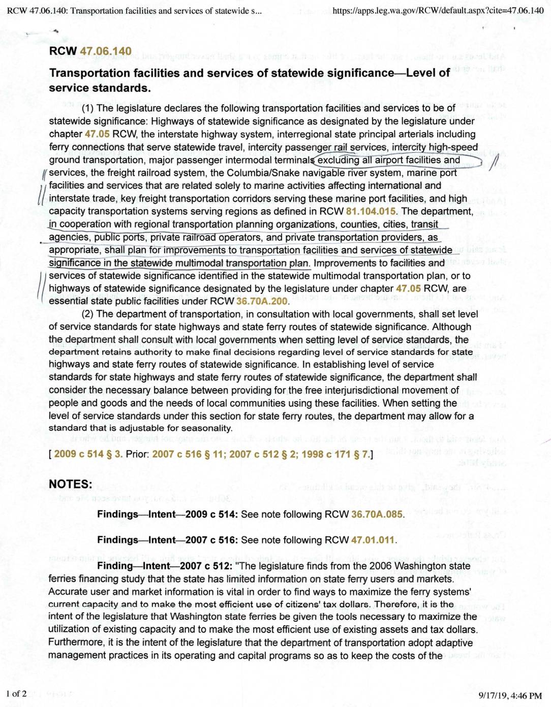
RCW 47.06.140: Transportation facilities and services of statewide significance—Level of service standards
RCW 47.06.140 defines transportation facilities and services of statewide significance in Washington State, including highways, the interstate system, ferry routes, freight railroads, and high-capacity transit systems, while explicitly excluding airport facilities and services from this designation. The law requires the Washington State Department of Transportation to set level of service standards for state highways and ferry routes, in consultation with local governments, while retaining final decision-making authority. Improvements to these statewide facilities are classified as essential state public facilities under RCW 36.70A.200.