TagBow Lake(13)
-
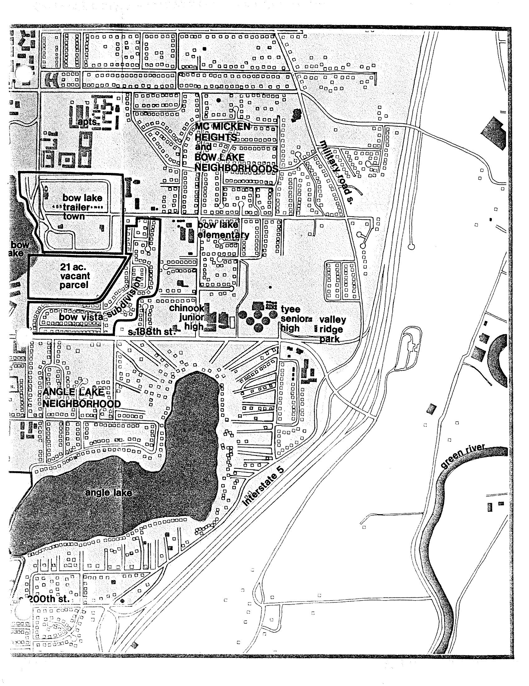
Sea-Tac Communities Plan Map: McMicken Heights and Bow Lake Neighborhoods
A neighborhood planning map depicting the McMicken Heights and Bow Lake neighborhoods near Sea-Tac Airport, showing Bow Lake, Angle Lake, Interstate 5, the Green River, and local landmarks including Bow Lake Elementary, Chinook Junior High, Tyee Senior High, and Valley Ridge Park. Also visible are Bow Lake Trailer Town, a 21-acre vacant parcel, Bow Vista Subdivision, and street references including S. 188th St. and 200th St. -
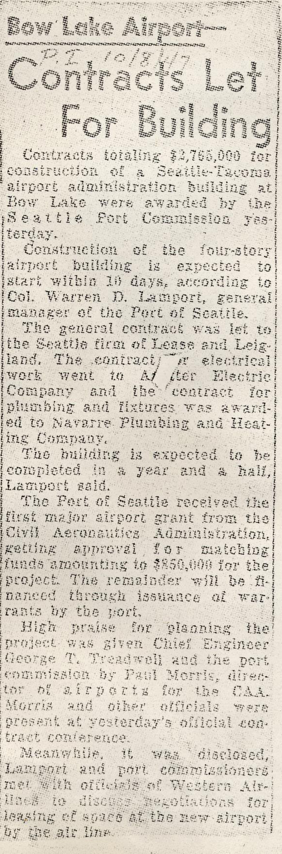
SeaTimes-1947-contracts let for bow lake airport-BD4D552785CD09871DD1EC6C22B2D375
A newspaper clipping (dated approximately 10/31/47 per handwritten notation) reporting that the Seattle Port Commission awarded contracts totaling $2,755,000 for construction of a Seattle-Tacoma airport administration building at Bow Lake, with the general contract going to Seattle firm Lease and Leigland. Col. Warren D. Lamport, general manager of the Port of Seattle, stated construction would begin within 10 days and be completed in a year and a half. -
Ray Bishop Scrapbook (Washington Digital Archives)
This scrapbook was assembled by Ray Bishop, Port of Seattle engineer involved in construction of Seattle-Tacoma (Sea-Tac) International Airport. The scrapbook includes photos documenting the construction from the initial grading work through expansion in the early 1960s and clippings documenting events at Sea-Tac through 1976. Bishop donated the scrapbook to the Port of Seattle in -
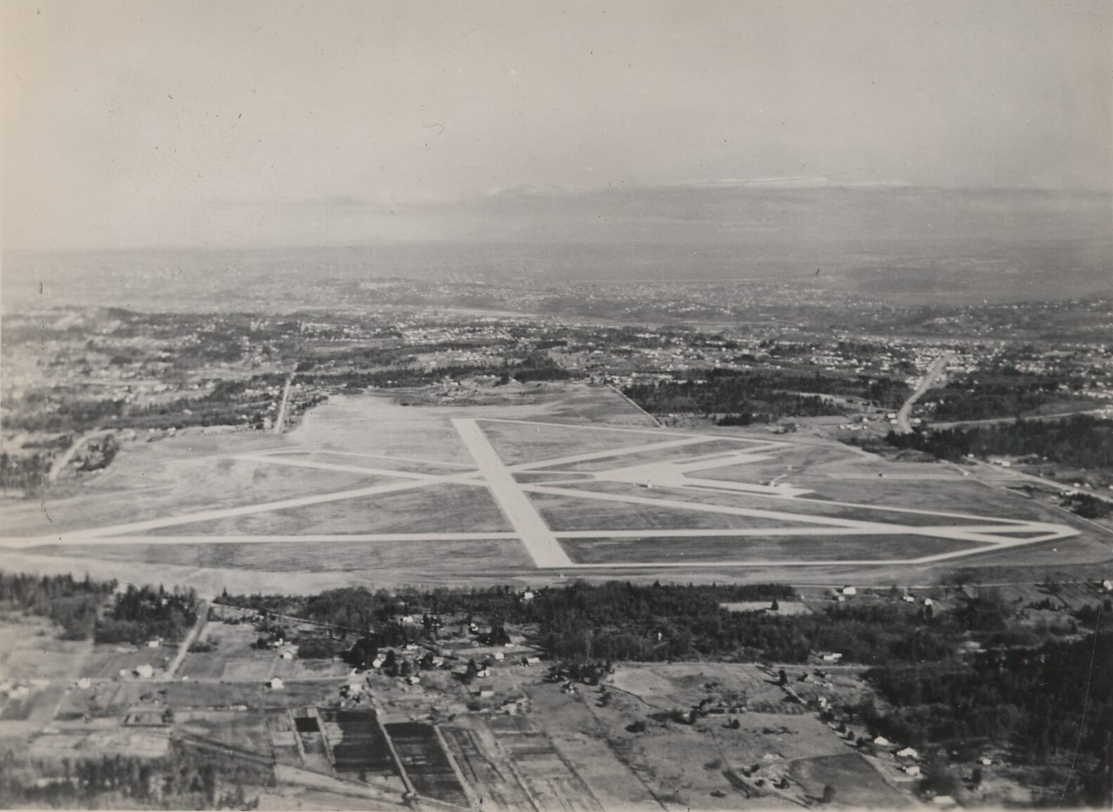
Bow Lake Airport Aerial View
Black-and-white aerial photograph showing a small to mid-sized airport with a triangular or star-pattern runway configuration and multiple taxiways. The surrounding area shows suburban residential development, wooded tracts, and agricultural parcels extending toward a distant urban area and mountains on the horizon. -
 2022-07-10
Sea-Tac Communities Plan: Chapter 3.1 Background
This document provides historical background on Seattle-Tacoma (Sea-Tac) Airport, tracing its origins to 1942 when the Civil Aeronautics Administration selected a site near Bow Lake and the Port of Seattle acquired the original 906 acres. As the jet age arrived and the airline industry expanded, the surrounding communities experienced rapid urbanization, bringing with it land use conflicts, traffic problems, pollution, and shortsighted commercial development. The Sea-Tac Communities Plan background chapter examines these challenges as context for developing more thoughtful, long-term planning policies for the airport region. -
Photos: What did Sea-Tac Airport look like in 1949? Think Stratocruisers and an old-timey diner.
Rarely seen photos from the Seattle Times archives show the earliest days of the airport. By Colin Diltz Seattle Times photo staff In 1942, Seattle’s Boeing Field and other airfields had been taken over by the Army to support the World War II effort. Commercial passenger flights were only being allowed temporarily. The region desperately -
 2002-05-01
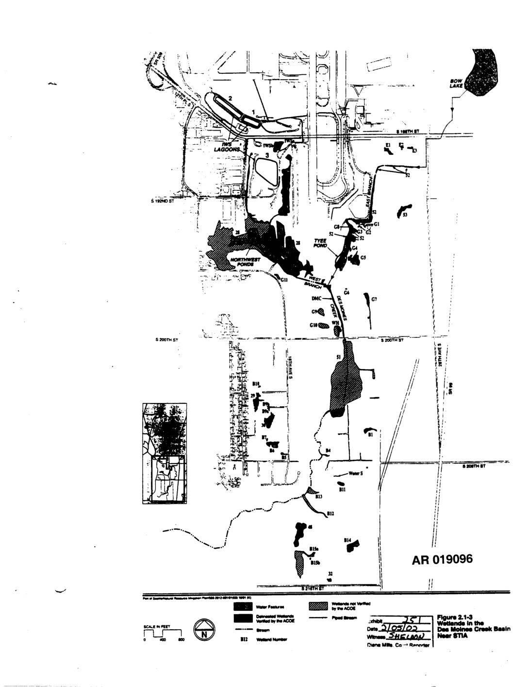
EXH AR019096: Figure 2.1-3 — Wetlands Des Moines Creek Basin Near STIA
This figure (2.1-3) is a map showing wetlands located in the Des Moines Creek Basin near Seattle-Tacoma International Airport (STIA). It identifies delineated wetlands verified by the Army Corps of Engineers (ACOE), water features, streams, and piped streams across the area, with individual wetlands labeled by alphanumeric codes. The map was submitted as part of a supplemental natural resources mitigation plan related to airport development activities in the region. -
 1962-02-01
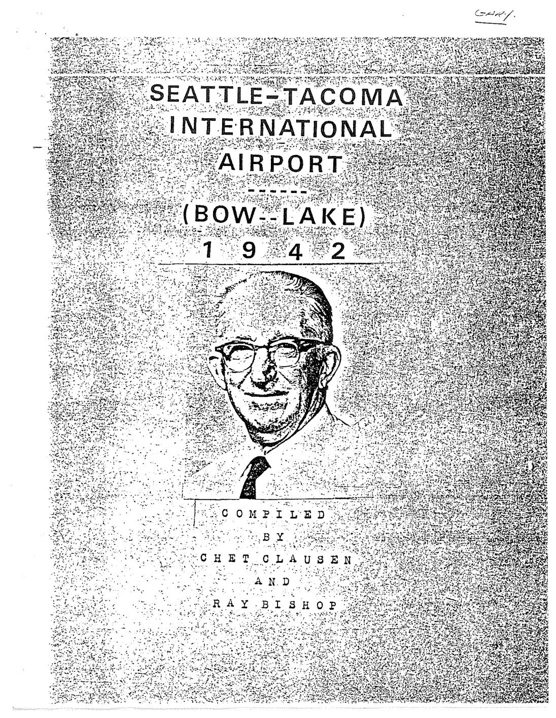
The history of Bow Lake Airport
This document chronicles the early history of Seattle-Tacoma International Airport (originally known as Bow Lake Airport), tracing its origins from 1942 when Seattle faced overcrowding at Boeing Field and growing demand for commercial air travel. Compiled by Port of Seattle engineers Chet Clausen and Ray Bishop, it details how the Seattle Chamber of Commerce began surveying new airport sites in 1941 and secured a $1 million federal grant from the Civil Aeronautics Administration — an offer that nearby Tacoma and Vancouver, Washington had previously forfeited by delaying their decisions. -
 1950-01-01
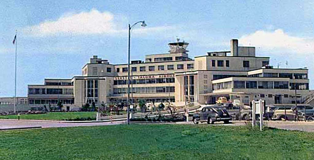
Sea Tac Airport Bow Lake ca 1950
A color photograph of the original Seattle-Tacoma Airport terminal building, with the name 'SEATTLE-TACOMA AIRPORT' visibly displayed on the facade. The image shows the Art Deco-style structure with its control tower, period automobiles in the foreground, and manicured grounds, consistent with the airport's early operational era following its 1949 opening. -
 1949-07-09
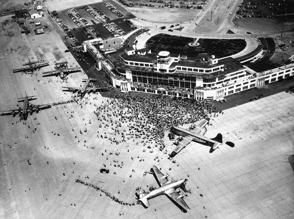
Bow Lake Airport dedication 07/09/1949
An aerial black-and-white photograph shows a large Art Deco-style airport terminal building surrounded by a massive crowd on the tarmac. Several large propeller-driven airliners are visible, with at least one appearing to bear 'NWA' (Northwest Airlines) livery, suggesting a mid-20th century dedication or airshow event.