TagSR509(120)
-

Puget Sound Gateway Program Phase 1 SR-509 Completion Project Environmental Re-Evaluation Map
Map from the Puget Sound Gateway Program Phase 1 SR-509 Completion Project Environmental Re-Evaluation (page 343 cropped). Shows 2003 FEIS Alternative C2 and Phase 1 Improvements along I-5 corridor between S 272nd St and S 188th St in King County, Washington, covering Federal Way, Des Moines, SeaTac, Burien, Kent, and Tukwila. Documents interchange configurations (Full -
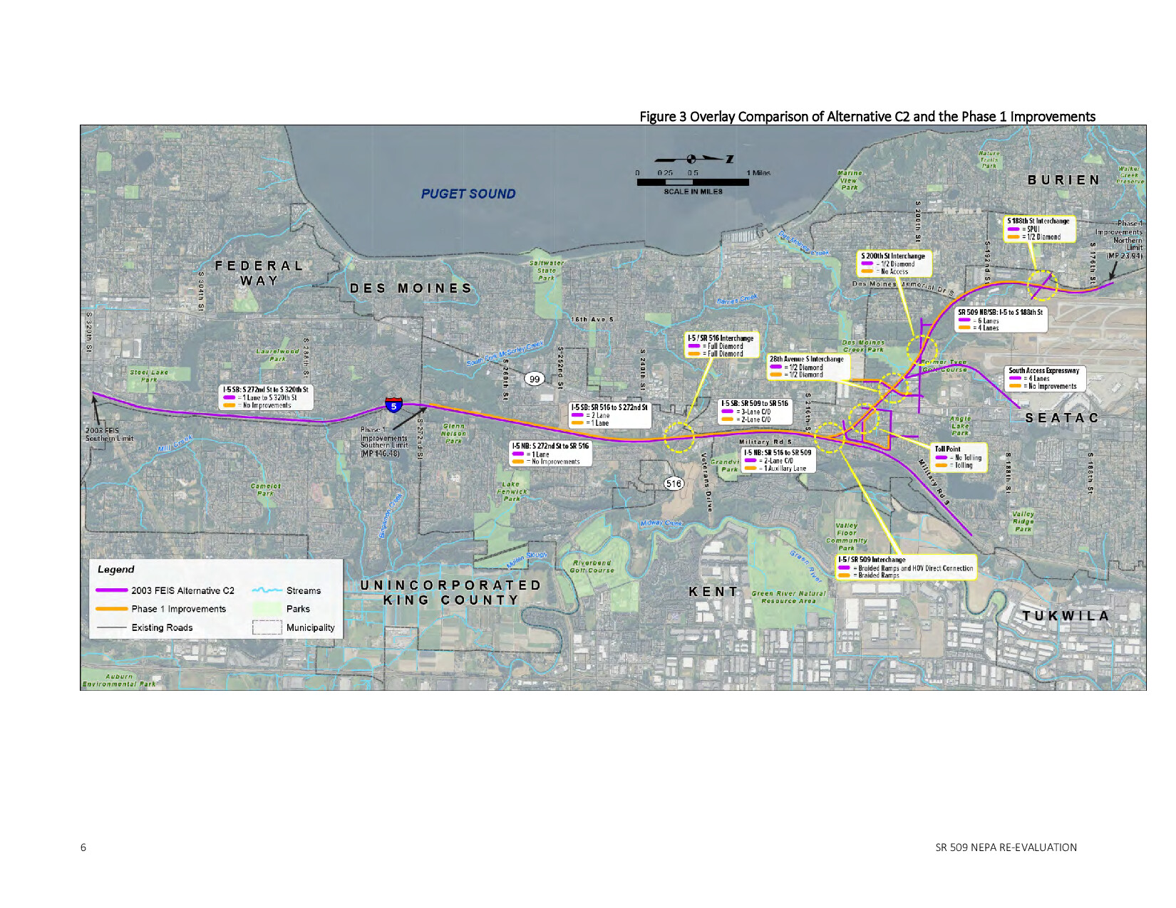
Puget sound gateway program – phase 1 of the sr 509 completion project environmental re evaluation page 343
This January 2018 environmental re-evaluation examines the potential impacts of Phase 1 of the SR 509 Completion Project, part of the Puget Sound Gateway Program, prepared for the Federal Highway Administration and Washington State Department of Transportation. The document assesses changed conditions and effects across multiple environmental categories—including noise, air quality, water quality, wetlands, and transportation—comparing the current project phase against the 2003 Final Environmental Impact Statement's preferred alternative. Notably, the noise section evaluates both operational and construction-phase sound impacts on surrounding communities, making it a relevant reference for research into transportation-related noise policy near Sea-Tac Airport. -
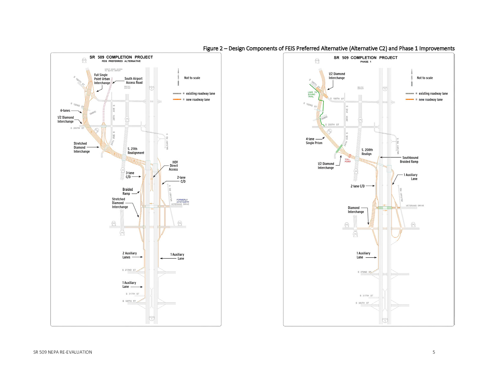
Puget sound gateway program – phase 1 of the sr 509 completion project environmental re evaluation page 342
This January 2018 environmental re-evaluation examines the potential impacts of Phase 1 of the SR 509 Completion Project, part of the Puget Sound Gateway Program, prepared for the Federal Highway Administration and Washington State Department of Transportation. The document assesses changed conditions and effects across multiple environmental categories—including noise, air quality, water quality, wetlands, and transportation—comparing the current project phase against the 2003 Final Environmental Impact Statement's preferred alternative. Notably, the noise section evaluates both operational and construction-phase sound impacts on surrounding communities, making it a relevant reference for research into transportation-related noise policy near Sea-Tac Airport. -
 2025-11-19
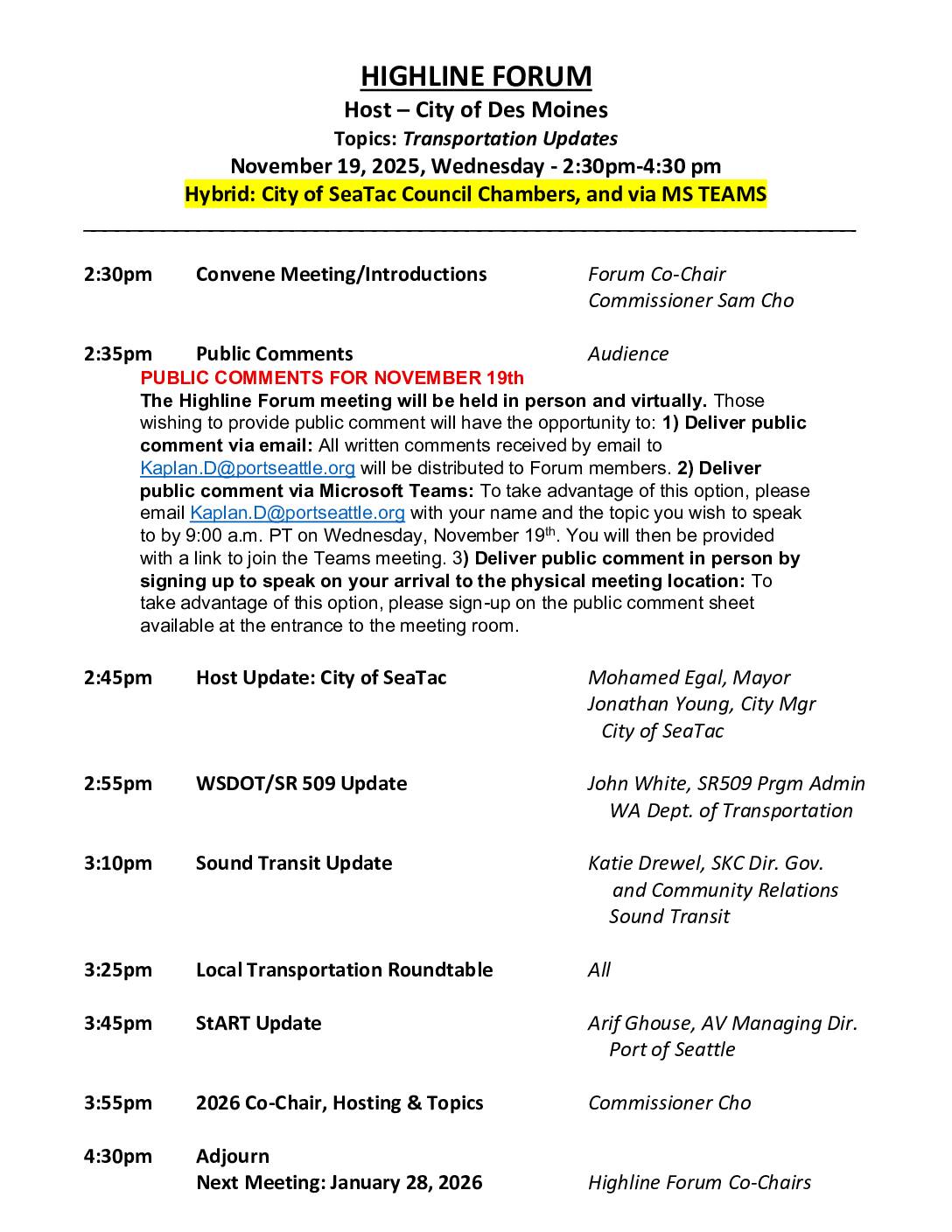
Highline Forum Agenda: November 19, 2025 — Transportation Updates
The Highline Forum held its November 19, 2025 meeting at the City of SeaTac Council Chambers, hosted by the City of Des Moines, with a focus on transportation updates including presentations from WSDOT on the SR 509 project, Sound Transit, and a StART update from the Port of Seattle. The forum, co-chaired by Port of Seattle Commissioner Sam Cho, also covered local transportation roundtable discussions and planning for 2026 co-chair roles and meeting schedules. The 2026 meeting calendar lists six bimonthly sessions, with the first scheduled for January 28, 2026 at Port of Seattle's SEA Airport facility. -
 2025-11-19
Puget Sound Gateway Program SR 509 Completion Project
WSDOT presentation on the Puget Sound Gateway Program, focusing on the SR 509 Completion Project. The program includes two projects (SR 167 and SR 509) to provide essential connections to the ports of Tacoma and Seattle, with various stages of construction progress. -
 2025-09-30
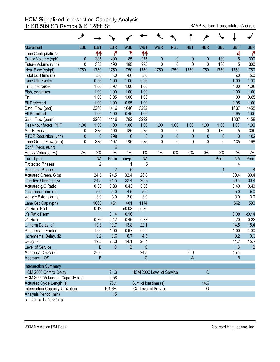
HCM Signalized Intersection Capacity Analysis: SR 509 SB Ramps, NB SR 509 Ramps, and Des Moines Way S at S 128th St — 2032 No Action PM Peak
This traffic engineering report analyzes three signalized intersections along S 128th Street near SR 509 in the Sea-Tac area under projected 2032 No Action conditions during the PM peak hour. The study finds that the SR 509 ramp intersections are operating well over capacity, with an Intersection Capacity Utilization of 104.6% and an ICU Level of Service G, while the Des Moines Way S intersection operates more acceptably at 63.3% ICU. Overall intersection control delays range from approximately 19 to 27 seconds, with most approaches functioning at Level of Service B or C. -
 2025-01-01
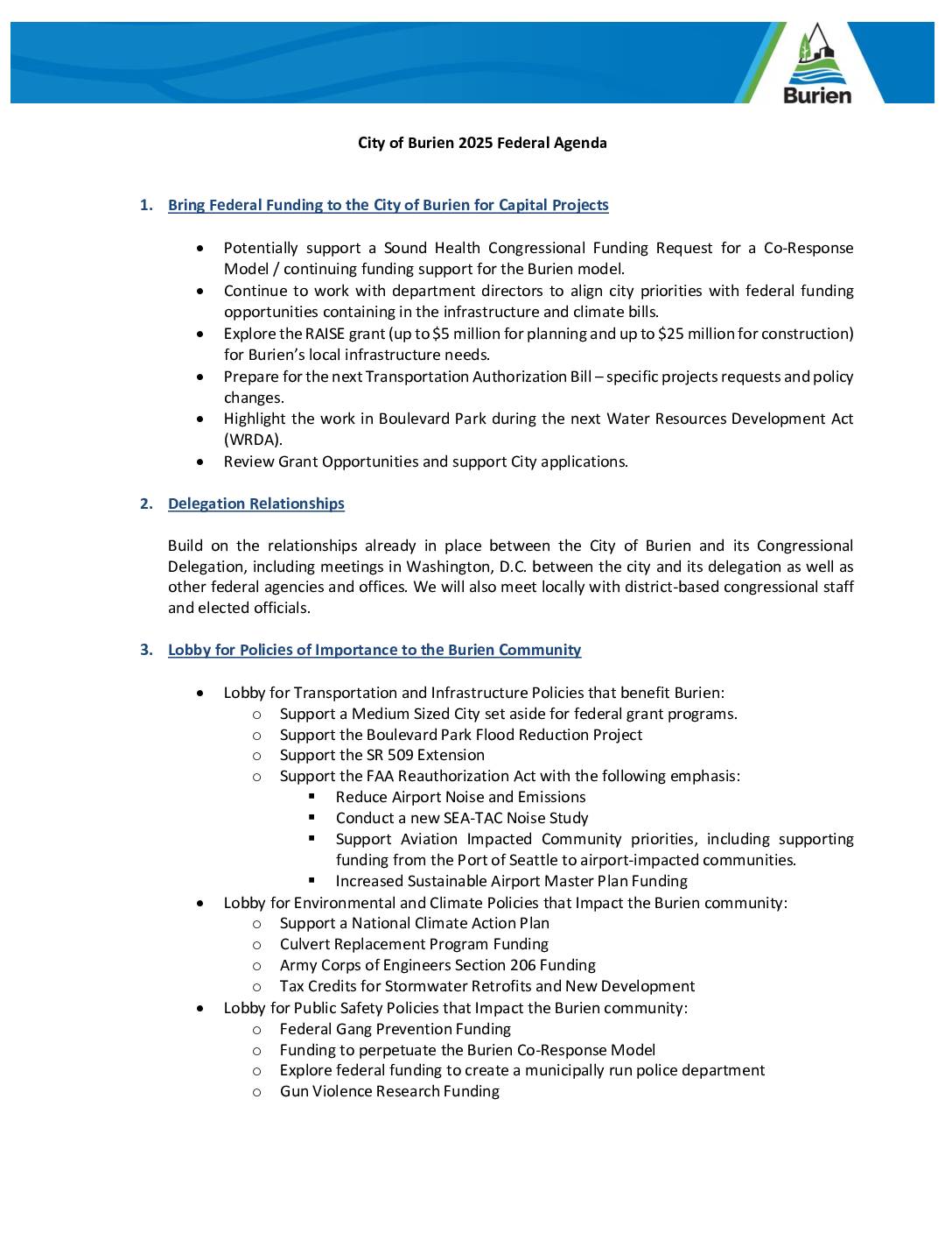
City of Burien 2025 Federal Agenda
The City of Burien's 2025 Federal Agenda outlines the city's lobbying priorities, including a strong focus on reducing the impact of Seattle-Tacoma International Airport on surrounding communities. Key airport-related goals include supporting the FAA Reauthorization Act to reduce airport noise and emissions, conducting a new SEA-TAC noise study, and securing funding from the Port of Seattle for airport-impacted communities. The agenda also addresses broader city priorities such as infrastructure funding, environmental initiatives, public safety, and housing policy. -
 2024-12-11
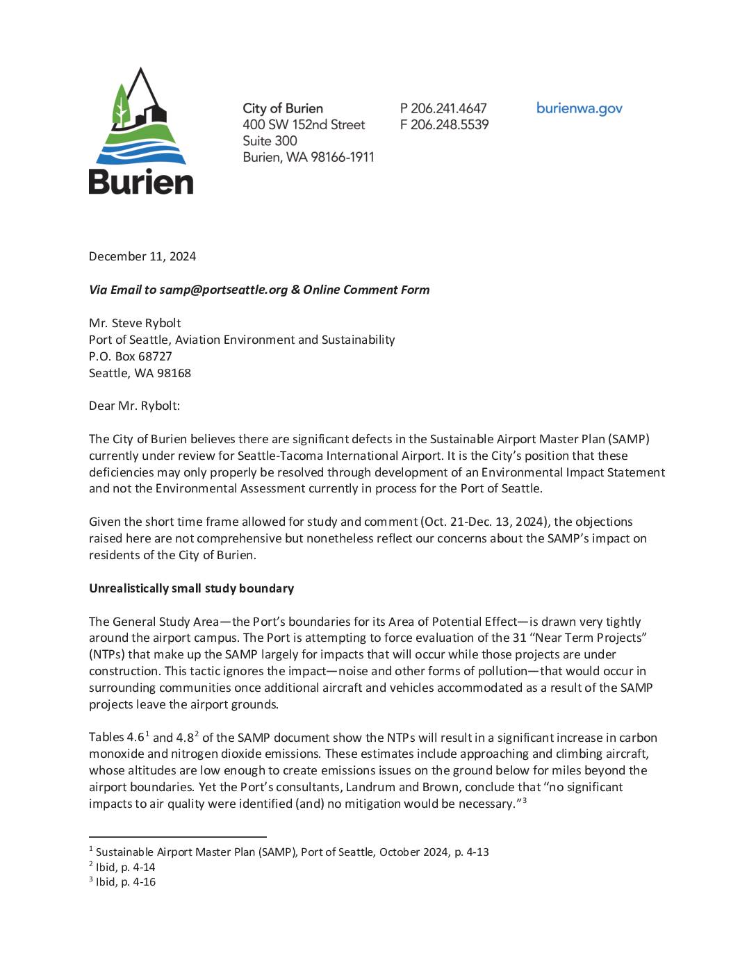
City of Burien Comment Letter on SAMP Draft Environmental Assessment
The City of Burien submitted formal comments in December 2024 arguing that the Port of Seattle's Sustainable Airport Master Plan (SAMP) for Sea-Tac International Airport contains serious flaws, including an unrealistically narrow study boundary that ignores noise and air pollution impacts on surrounding neighborhoods. The city contends that the plan fails to account for cumulative impacts such as the SR-509 highway extension, the 2008 opening of the airport's third runway, and emerging science on health risks from ultrafine particles and aircraft noise. Burien is calling for a full Environmental Impact Statement rather than the less rigorous Environmental Assessment currently underway. -
 2024-11-14
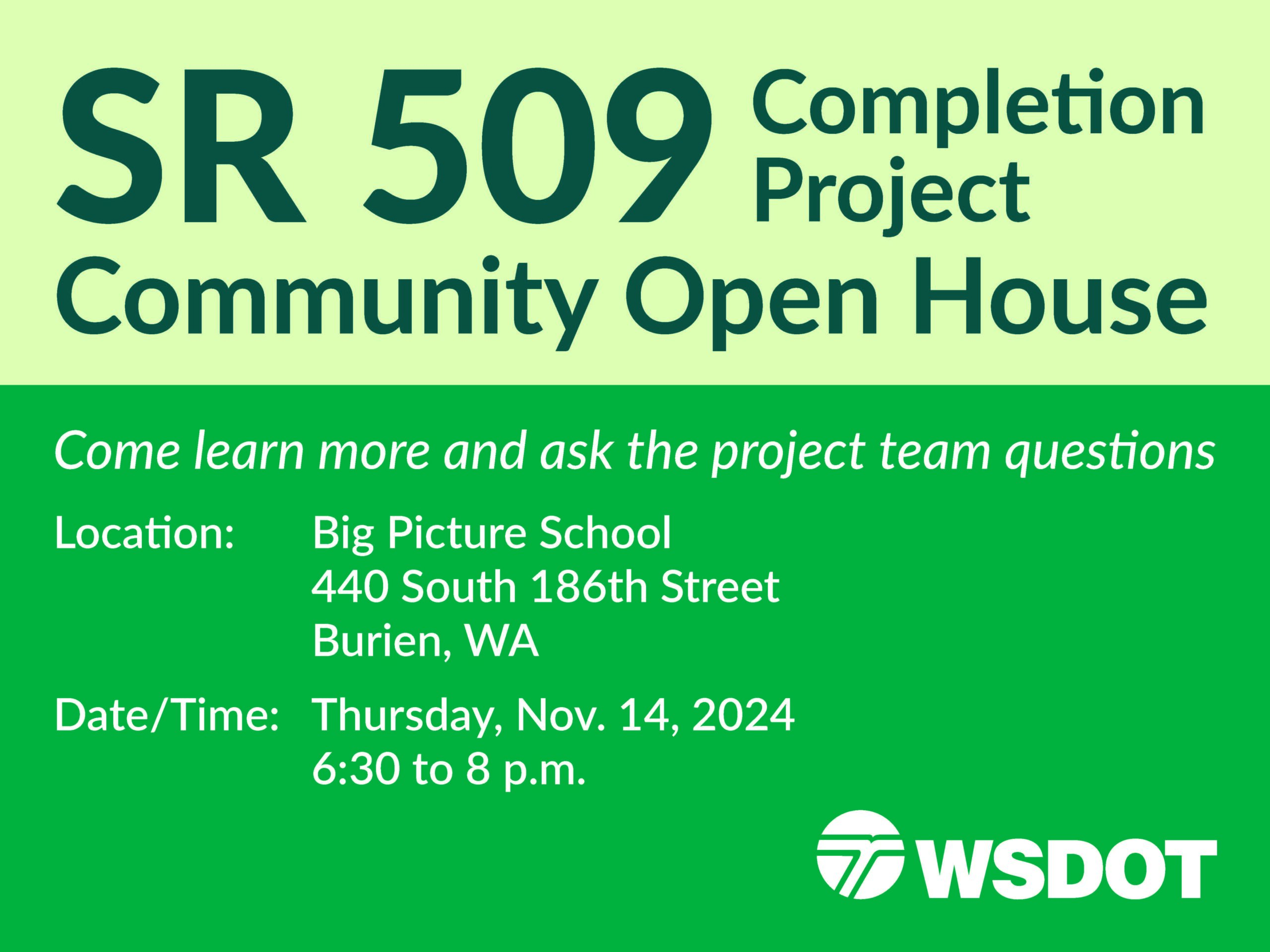
SR-509 Stage 2 Open House
WSDOT is hosting an open house on SR-509 Big Picture School 440 S 186th Street, Burien WA 98168 -
 2024-09-02
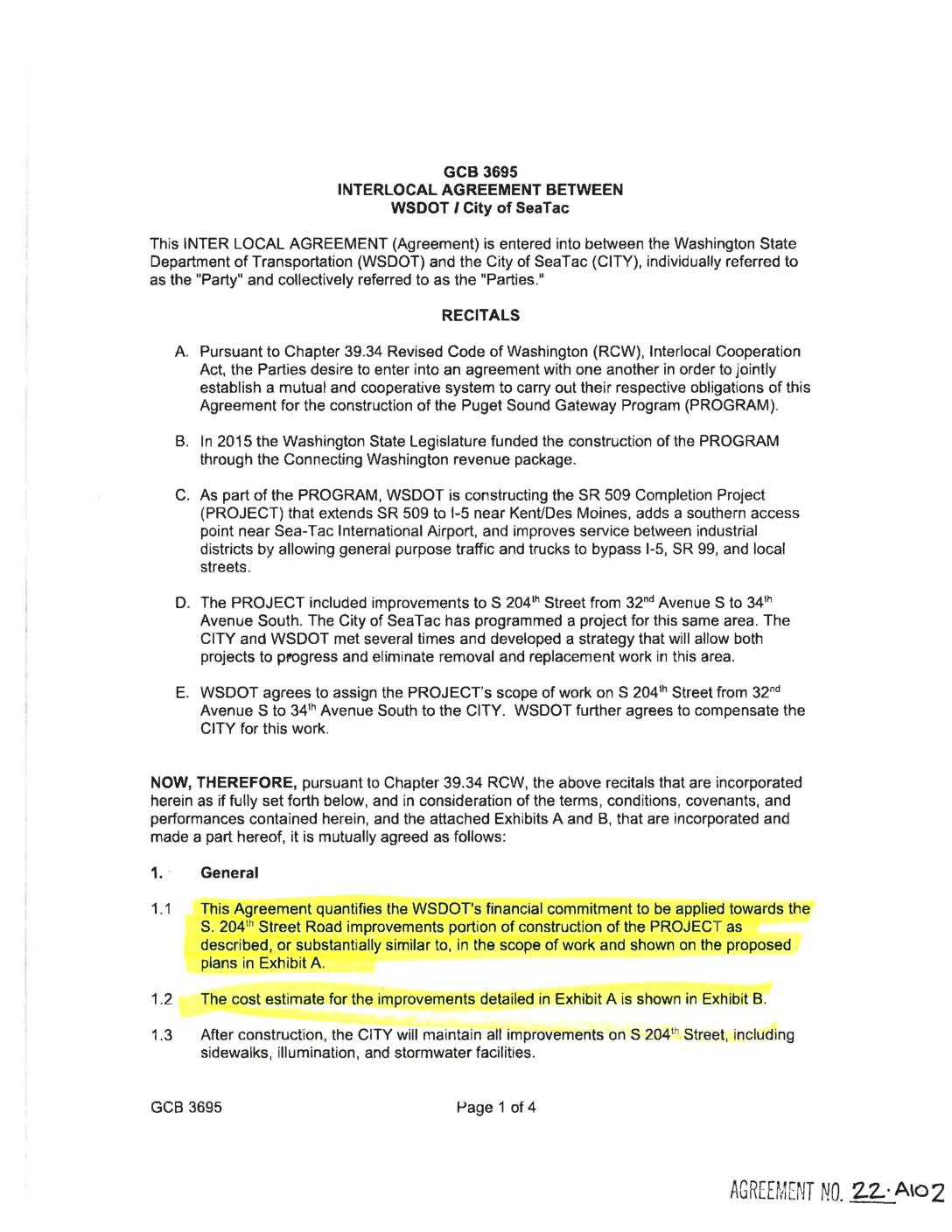
Interlocal agreement between WSDOT and City of SeaTac
This interlocal agreement between the Washington State Department of Transportation (WSDOT) and the City of SeaTac outlines a cooperative arrangement for road improvements on S. 204th Street between 32nd and 34th Avenues South, as part of the SR 509 Completion Project near Sea-Tac International Airport. WSDOT agreed to assign the construction work in that corridor to the City of SeaTac and reimburse the city up to $1,641,318 upon substantial completion. After construction, the City of SeaTac is responsible for maintaining all improvements, including sidewalks, lighting, and stormwater facilities.