TagAirport Layout Plans(31)
-
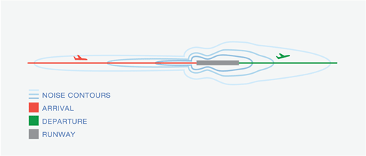
Aircraft Noise Contour Mapping
A diagram illustrating airport noise contours around a runway, with color-coded flight paths showing arrivals (red) and departures (green). The oval-shaped noise contour lines extend along both ends of the runway centerline, with greater extent on the departure end. -
 2026-01-06
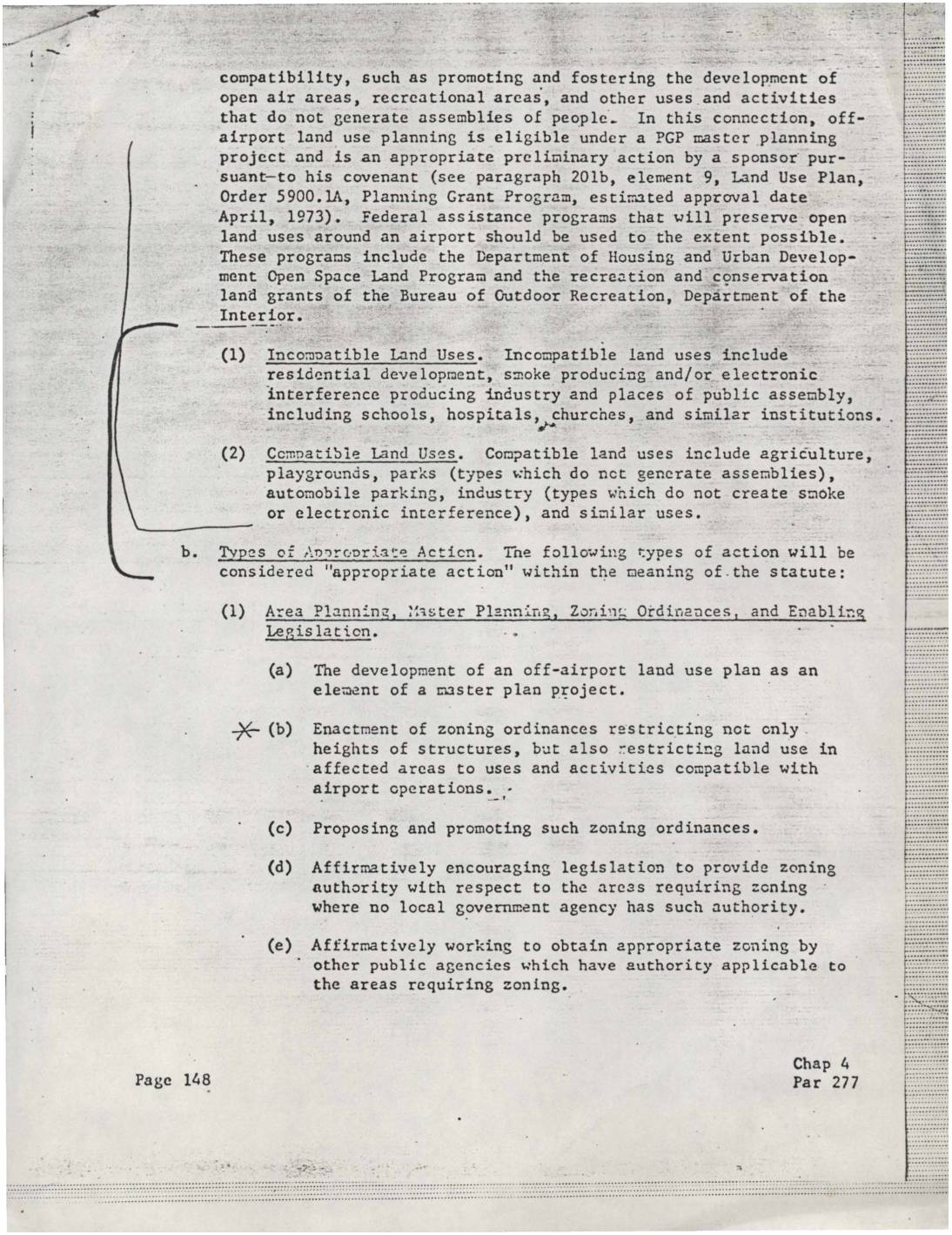
Airport land use compatibility: Incompatible and compatible land uses and types of appropriate action
This document outlines federal guidelines for managing land use around airports to minimize noise and safety conflicts. It distinguishes between incompatible land uses near airports—such as residential development, schools, hospitals, and churches—and compatible ones like agriculture, parks, and parking facilities. It also describes appropriate actions airport sponsors can take, including developing off-airport land use plans, enacting zoning ordinances, and working with local and regional authorities to restrict development in affected areas. -
 2026-01-06
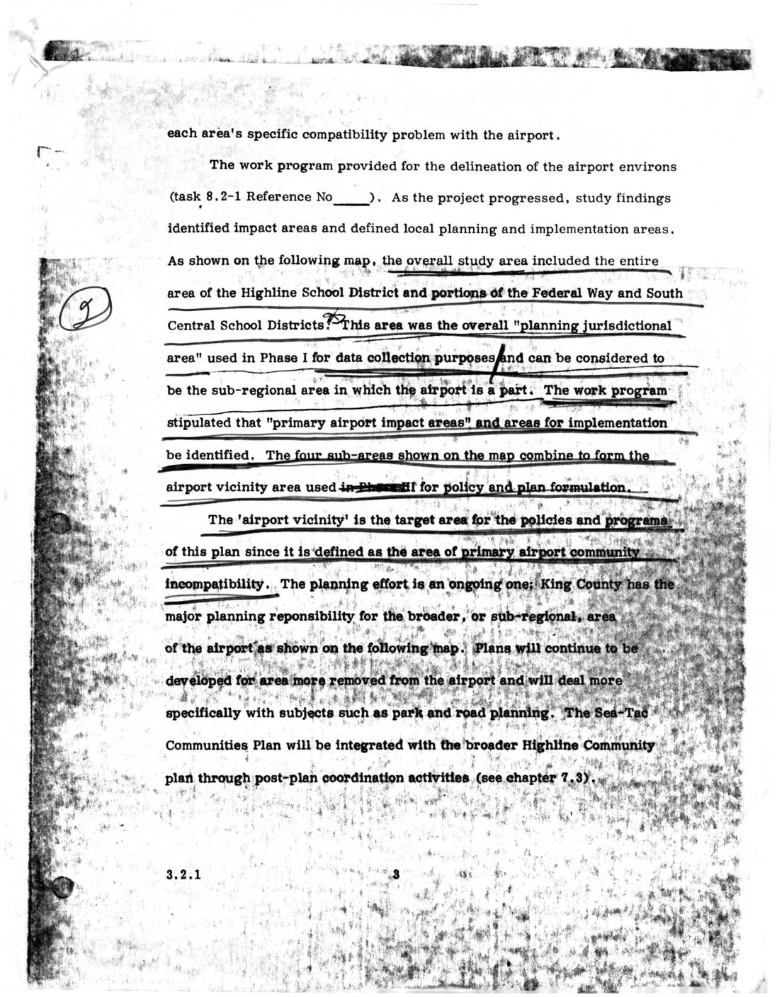
Sea-Tac Communities Plan: Airport Vicinity Area and Planning Jurisdictional Area (Section 3.2.1)
This document describes the planning study area surrounding Seattle-Tacoma (Sea-Tac) Airport, which encompassed the entire Highline School District and portions of the Federal Way and South Central School Districts. The study identified four sub-areas forming an 'airport vicinity' zone — defined as the area of primary airport-community incompatibility — to guide policy and land-use planning. King County holds major planning responsibility for the broader sub-regional area, with the Sea-Tac Communities Plan intended to integrate with the wider Highline Community Plan through post-plan coordination. -
 2025-11-14
NEPA Determination, Simple Categorical Exclusion for the Industrial Wastewater Treatment Plan Expansion Project at Seattle-Tacoma International Airport
The FAA has determined that Seattle-Tacoma International Airport's proposed expansion of its Industrial Wastewater Treatment Plant (IWTP) qualifies for a Simple Categorical Exclusion under the National Environmental Policy Act, meaning the project is not expected to have a significant impact on the environment. The project includes upgrades to the existing treatment plant infrastructure, construction of an aerated gravel bed, and updates to the adjacent Lagoon 3 site. This determination, issued November 14, 2025, clears the way for the required Airport Layout Plan update without the need for further environmental review. -
2025-11-14
NEPA Determination, Simple Categorical Exclusion for the Industrial Wastewater Treatment Plan Expansion Project at Seattle-Tacoma International Airport
The FAA has determined that Seattle-Tacoma International Airport's proposed expansion of its Industrial Wastewater Treatment Plant (IWTP) qualifies for a Simple Categorical Exclusion under the National Environmental Policy Act, meaning the project is not expected to have a significant impact on the environment. The project includes upgrades to the existing treatment plant infrastructure, construction of an aerated gravel bed, and updates to the adjacent Lagoon 3 site. This determination, issued November 14, 2025, clears the way for the required Airport Layout Plan update without the need for further environmental review. -
 2025-10-28
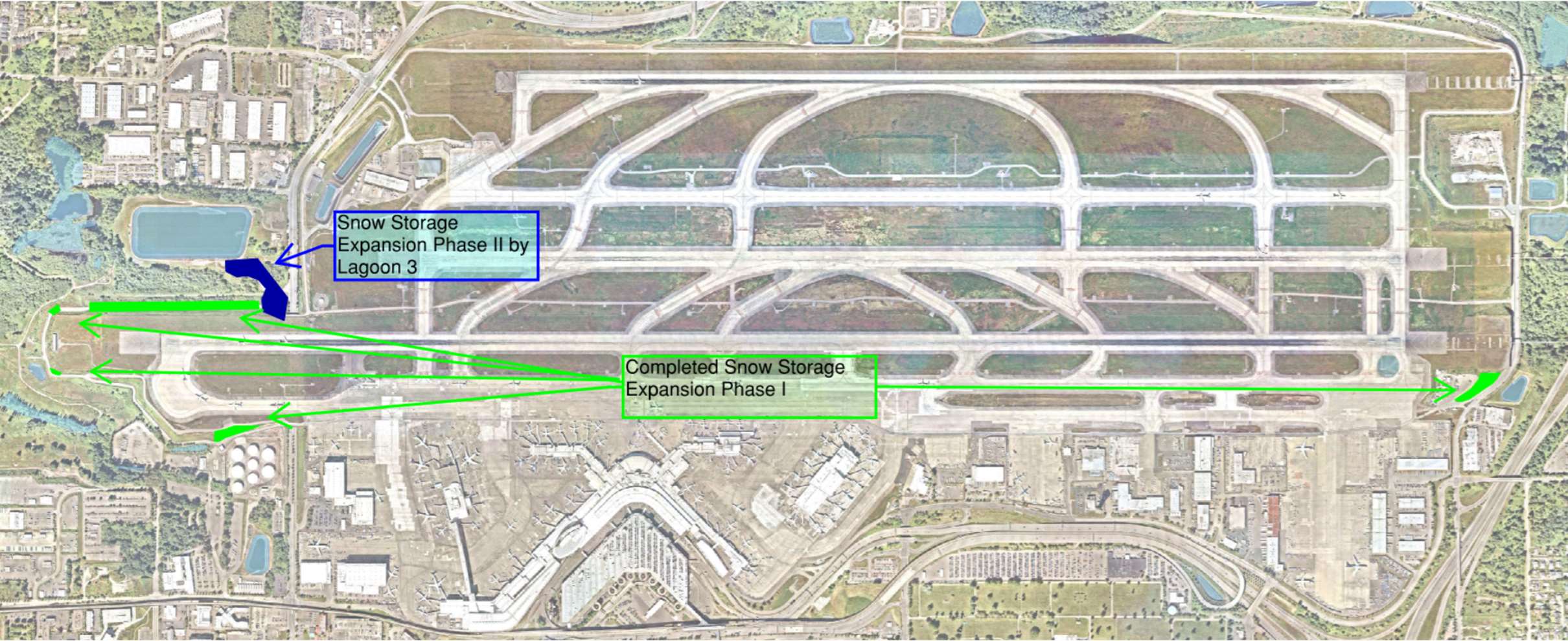
Sea-Tac Airport Airport Snow Storage Expansion Diagram
★Aerial satellite map of showing two annotated snow storage areas: 'Completed Snow Storage Expansion Phase I' along the south airfield and 'Snow Storage Expansion Phase II by Lagoon 3' on the west side, with green arrows indicating access routes between locations. -
 2024-10-23
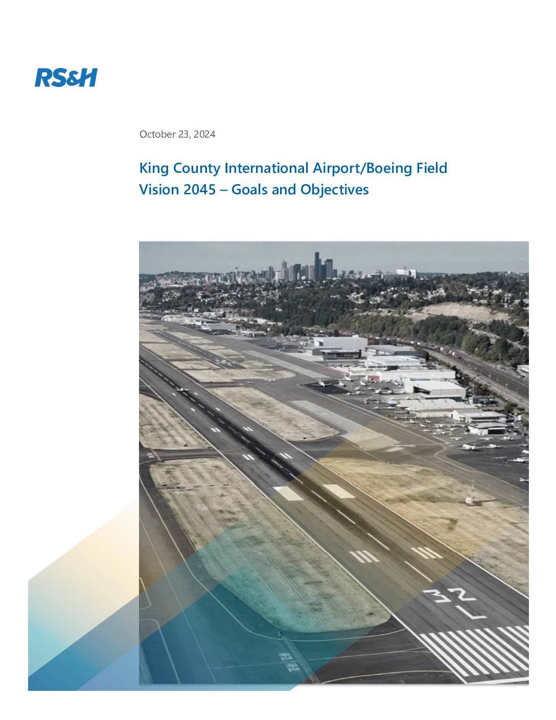
King County International Airport/Boeing Field Vision 2045 – Goals and Objectives
A planning document outlining the goals and objectives for King County International Airport/Boeing Field’s Vision 2045 plan. The document establishes seven key goals including safety, efficiency, environmental stewardship, fiscal sustainability, land management, communication, and resilience, with detailed considerations for both airport operations and community impacts. -
 2024-10-08
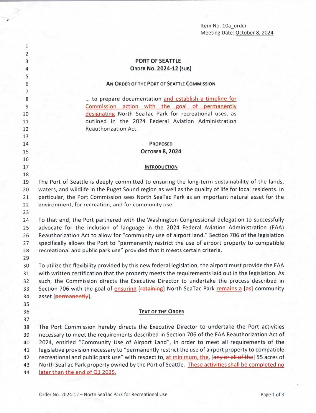
Port of Seattle Order No. 2024-12 – North SeaTac Park for Recreational Use
The Port of Seattle Commission issued Order No. 2024-12 in October 2024, directing its Executive Director to take the steps necessary under Section 706 of the 2024 FAA Reauthorization Act to permanently designate the 55-acre North SeaTac Park for recreational and public park use. The order requires the development of legally binding frameworks, a preferred protection methodology reported to the Commission by Q2 2025, and at least $150,000 in the 2025 budget for park improvements in partnership with the City of SeaTac. This action aims to ensure the park remains a permanent community and ecological asset, shielded from future aeronautical or commercial redevelopment. -
 2024-06-25
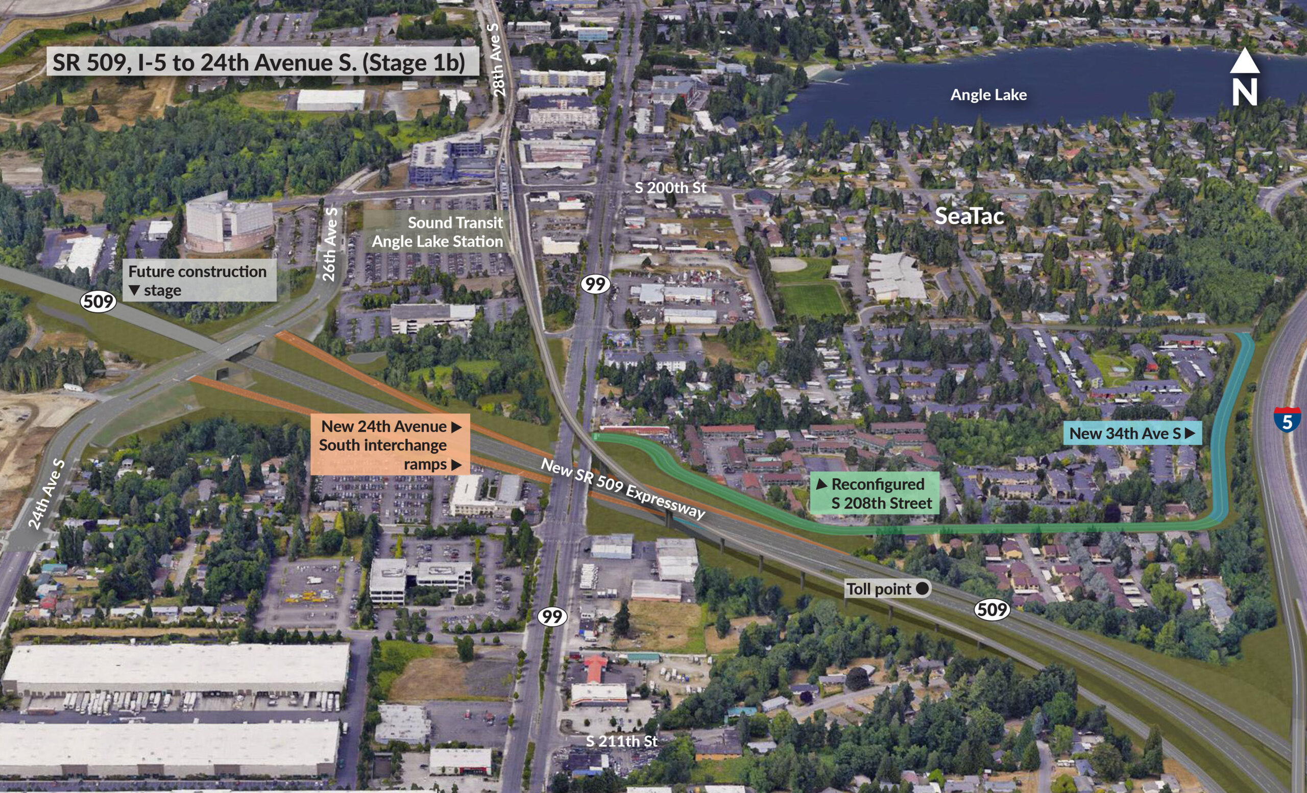
SR 509, I-5 to 24th Avenue S. (Stage 1b)
An aerial rendering depicting the SR 509 Expressway extension (Stage 1b) in SeaTac, Washington, showing planned infrastructure including a new 24th Avenue South interchange, new 34th Avenue S connection to I-5, a reconfigured S 208th Street, a toll point on SR 509, and proximity to the Sound Transit Angle Lake Station. The project corridor runs east-west connecting I-5 to existing SR 509 near Angle Lake. -
 2023-08-22
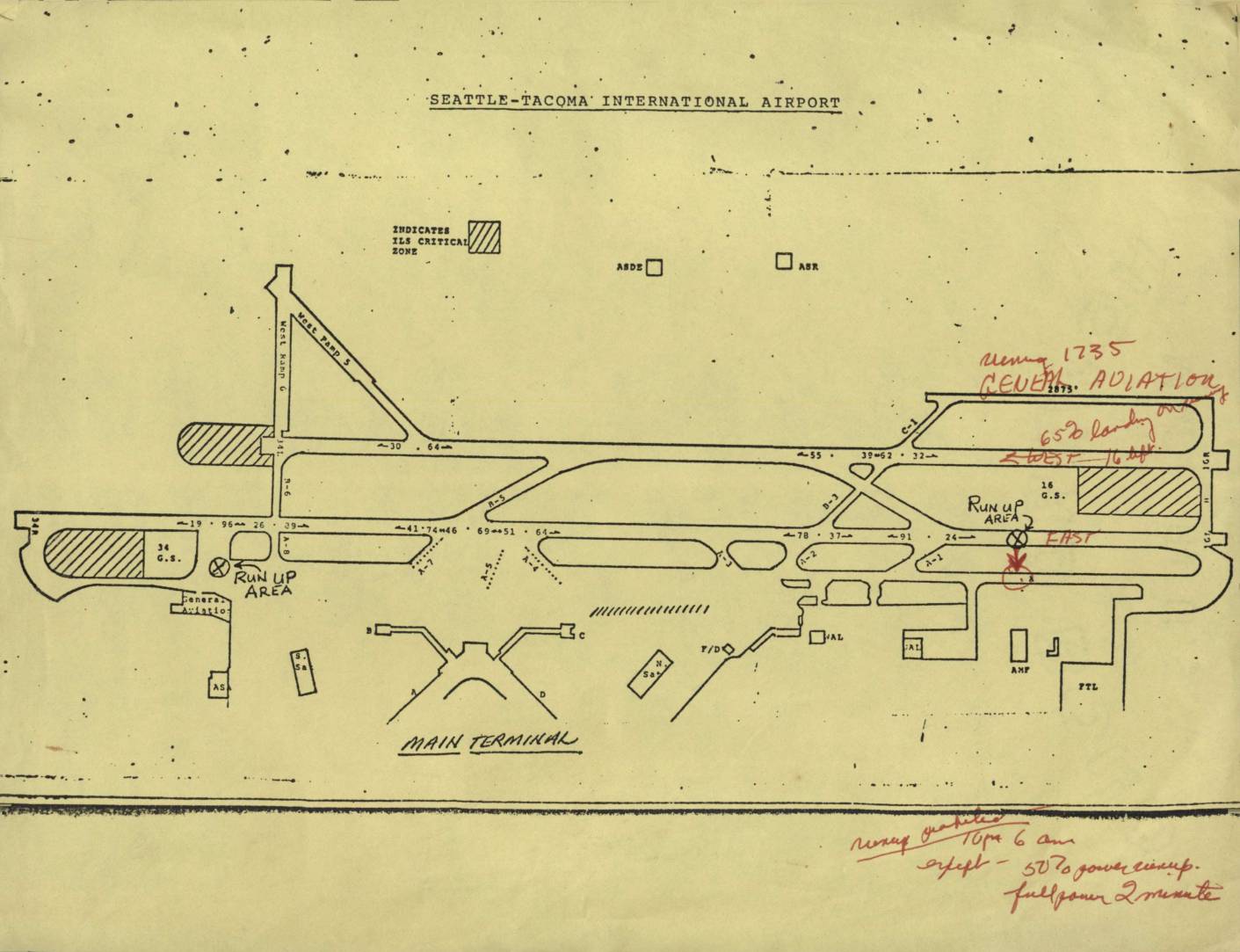
Seattle-Tacoma International Airport map
This document is an airport diagram of Seattle-Tacoma International Airport showing runways, taxiways, run-up areas, and terminal facilities. Handwritten annotations in red ink reference noise abatement procedures, including a note about 'General Aviation' operations and restrictions on runways, specifying limits such as '650 landings' and directions (East/West). Additional handwritten notes at the bottom outline runway use prohibitions from 10 PM to 6 AM, with exceptions for 50% power run-ups and full-power checks limited to 2 minutes.