TagLand Use(178)
-
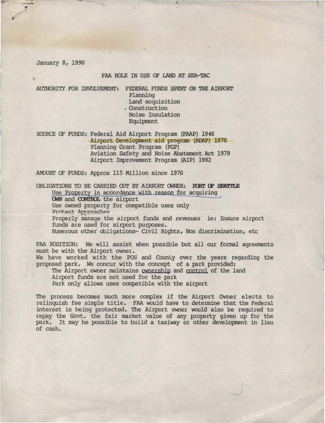 1990-01-08
FAA role in use of land at Sea-Tac
★A January 1990 FAA briefing document outlines the agency's role in land use at Seattle-Tacoma International Airport, explaining that federal involvement stems from approximately $115 million in federal funds spent on the airport since 1970 for planning, land acquisition, construction, and noise insulation. The FAA supported the concept of a park on airport land, provided the Port of Seattle maintained ownership and control, airport funds were not used for the park, and only compatible uses were allowed. The document also details Sea-Tac's noise mitigation efforts, including over $50 million in federal grants to acquire roughly 750 noise-impacted land parcels and more than $7 million to insulate 323 homes near the airport. -
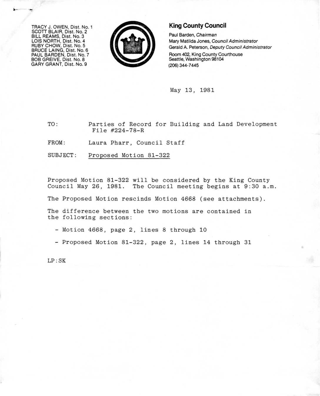
224-78-R Motion King County Council (Boeing HQ Rezone)
★ 32Proposal to move Boeing headquarters to west side of airport noise buffer property from Sea-Tac Communities Plan -
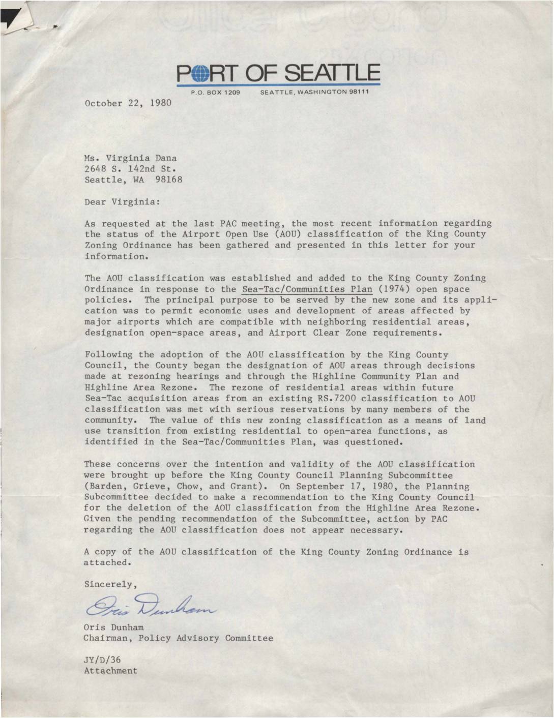 1980-10-22
Letter from Oris Dunham Airport Open Use (AOU) Classification Status Update
★Letter from Port of Seattle Policy Advisory Committee Chairman Oris Dunham to Virginia Dana providing status update on the Airport Open Use (AOU) classification in King County Zoning Ordinance. The letter explains the AOU classification’s purpose for economic development near airports and community concerns that led to a recommendation for deletion from the Highline Area -
 2026-07-15
FAA Approval of Noise Compatibility Program 14 CFR Part 150 Dane County Regional Airport, Madison, Wisconsin
Department of Transportation Federal Aviation Administration Federal Aviation Administration, DOT. Notice. The Federal Aviation Administration (FAA) announces its findings on the noise compatibility program submitted by the Dane County for Dane County Regional Airport (MSN). On December 21, 2023, the FAA determined that the noise exposure maps (NEMs) submitted by Dane County were in -
 2026-07-14
Community open house: Burien, Des Moines, and SeaTac demand equity for airport-impacted communities
Presentation boards from a community open house hosted by Burien, Des Moines, and SeaTac focused on equity concerns related to the Sustainable Airport Master Plan (SAMP). The materials highlight deficiencies in the Draft Environmental Impact Statement (DEIS), including inadequate analysis of hazardous materials impacts and land use compatibility. The boards identify specific technical deficiencies such -
2026-07-14
Community open house: Burien, Des Moines, and SeaTac demand equity for airport-impacted communities
Presentation boards from a community open house hosted by Burien, Des Moines, and SeaTac focused on equity concerns related to the Sustainable Airport Master Plan (SAMP). The materials highlight deficiencies in the Draft Environmental Impact Statement (DEIS), including inadequate analysis of hazardous materials impacts and land use compatibility. The boards identify specific technical deficiencies such -
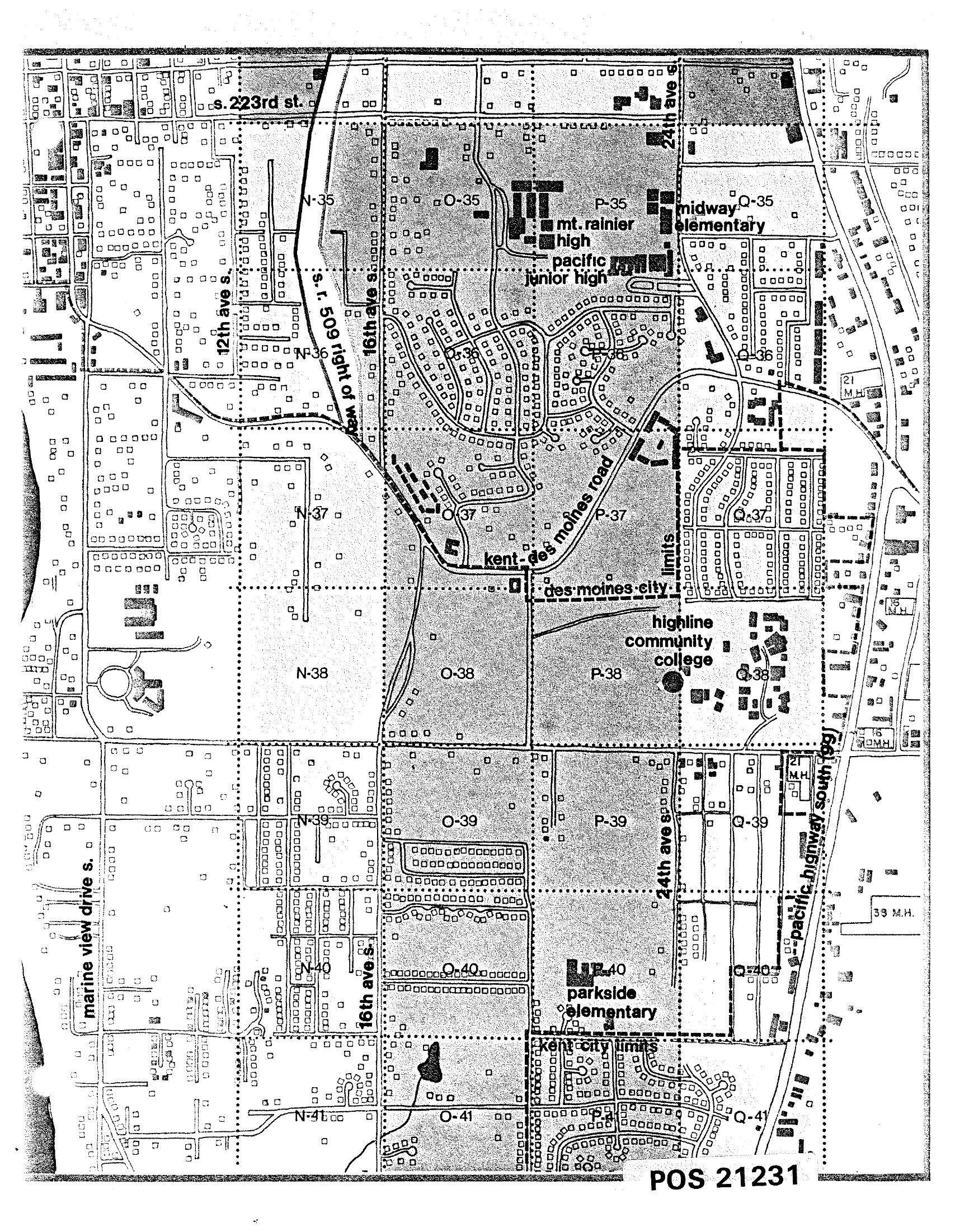
STCP Zoning and Land Use Map — Des Moines and Kent Area
A black-and-white planning grid map (document reference POS 21231) showing residential and institutional land use in the Des Moines/Kent area south of Seattle, including landmarks such as Mt. Rainier High School, Pacific Junior High, Midway Elementary, Parkside Elementary, and Highline Community College. Major roads visible include S. 223rd St., 16th Ave. S., 24th Ave. S., Kent-Des Moines Road, and Pacific Highway South, with Des Moines city limits and Kent city limits marked. -
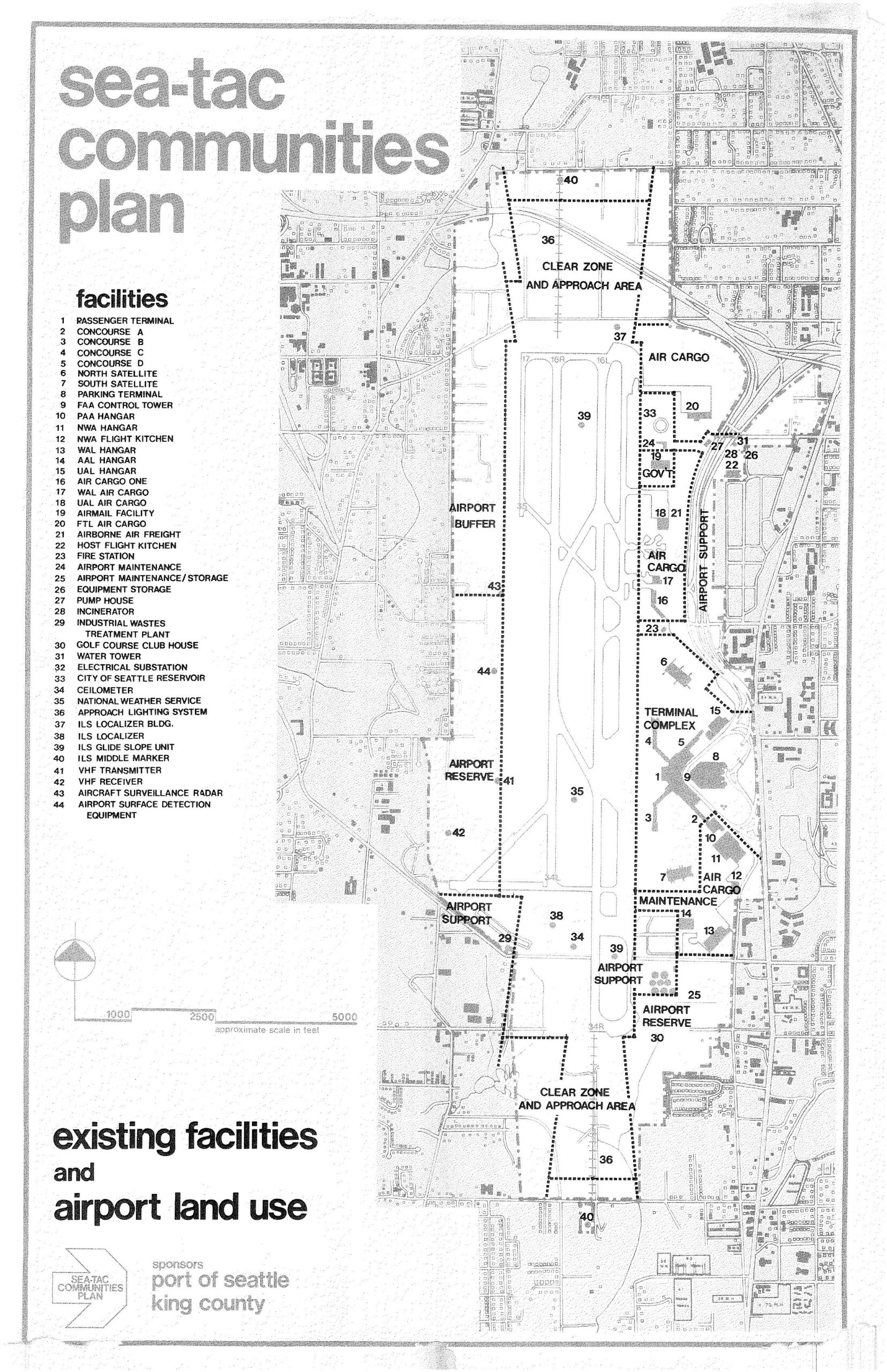
Sea-Tac Communities Plan: Existing Facilities and Airport Land Use Map
A detailed land-use map from the Sea-Tac Communities Plan, sponsored by the Port of Seattle and King County, showing existing facilities and airport land use zones at Seattle-Tacoma International Airport. The map identifies 44 numbered facilities including the passenger terminal, concourses, hangars, air cargo areas, ILS navigation equipment, clear zones, and approach areas, with zones labeled for Terminal Complex, Airport Support, Airport Reserve, and Airport Buffer. -
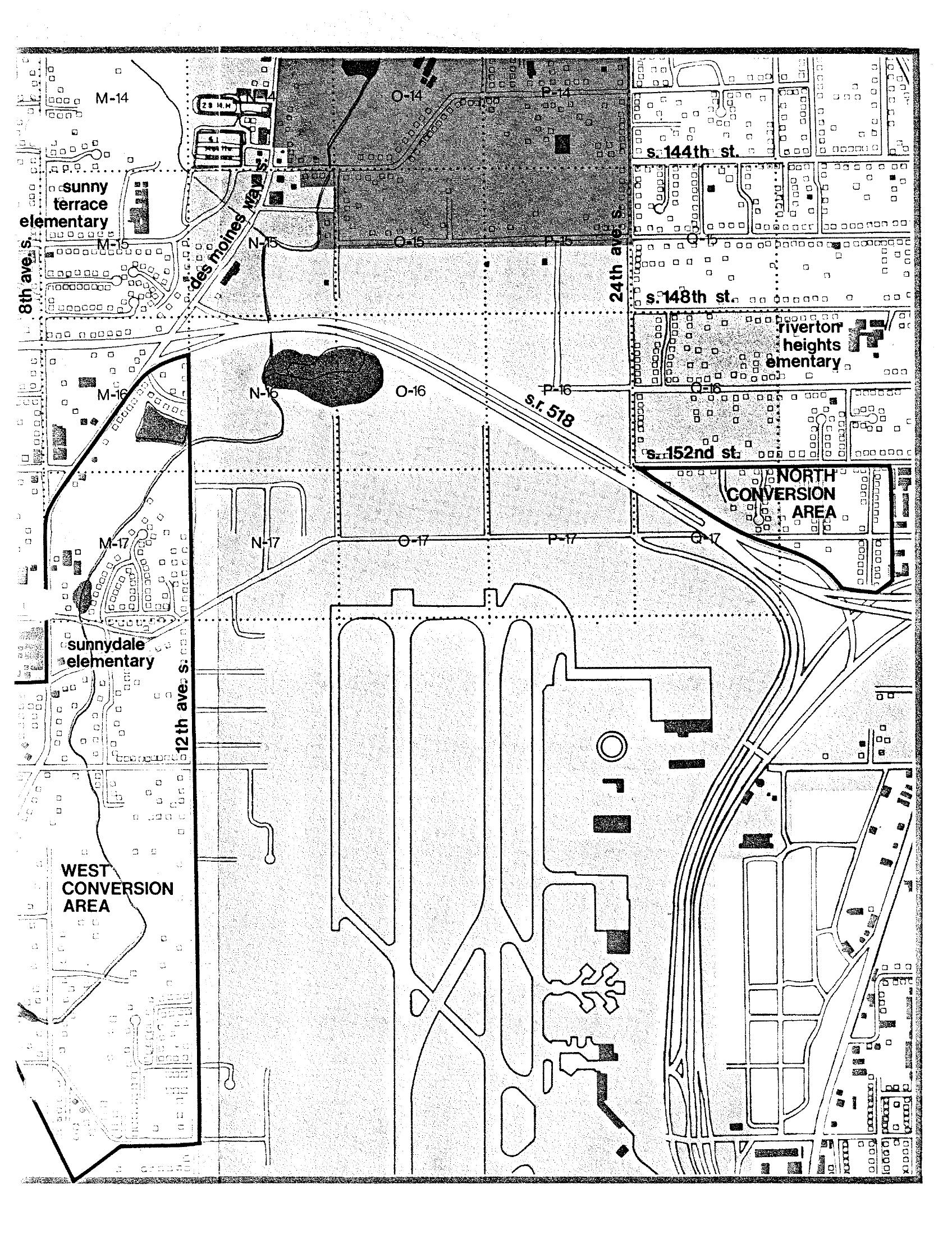
STCP Area Map: North and West Conversion Areas Near Sea-Tac Airport
A planning grid map of the area surrounding Seattle-Tacoma International Airport, showing labeled grid cells (M through Q, rows 14–17), street names including S. 144th St., S. 148th St., S. 152nd St., 8th Ave. S., 12th Ave. S., and 24th Ave. S., State Route 518, and Des Moines Way. The map identifies 'North Conversion Area' and 'West Conversion Area,' along with nearby elementary schools (Sunny Terrace, Riverton Heights, Sunnydale), consistent with noise impact and land-use conversion planning documents for the Sea-Tac Airport noise policy archive. -
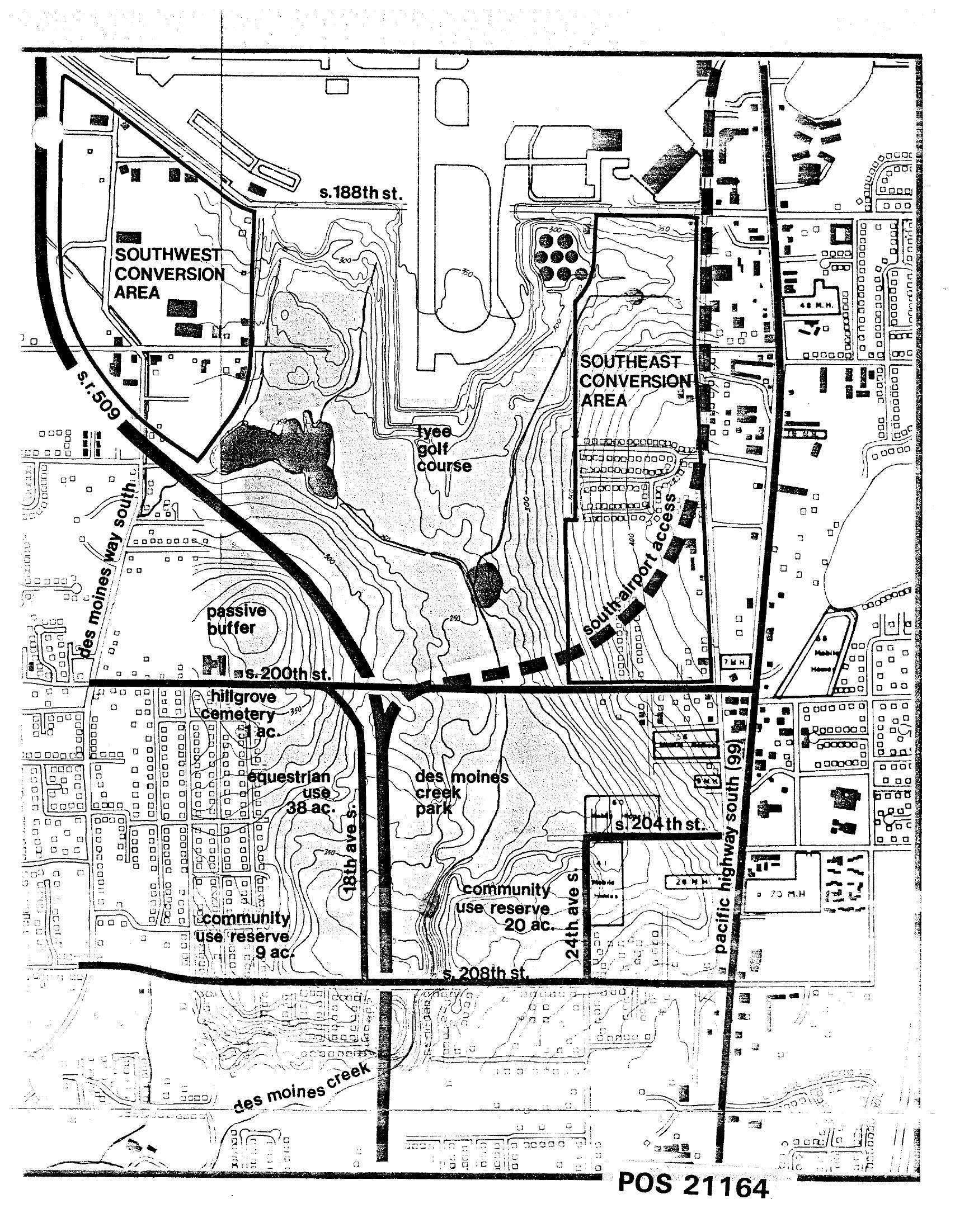
Sea-Tac Communities Plan Area Map — Land Use Planning Zones
Map labeled POS 21164 depicting land use planning zones around Seattle-Tacoma International Airport, including the Southwest Conversion Area, Southeast Conversion Area, Tyee Golf Course, Hillgrove Cemetery, Des Moines Creek Park, passive buffer zones, equestrian use areas, and community use reserves. Key roads shown include S.R. 509, Des Moines Way South, Pacific Highway South (99), and streets S. 188th, S. 200th, S. 204th, and S. 208th.