TagSea-Tac Communities Plan(215)
-
 2026-07-15
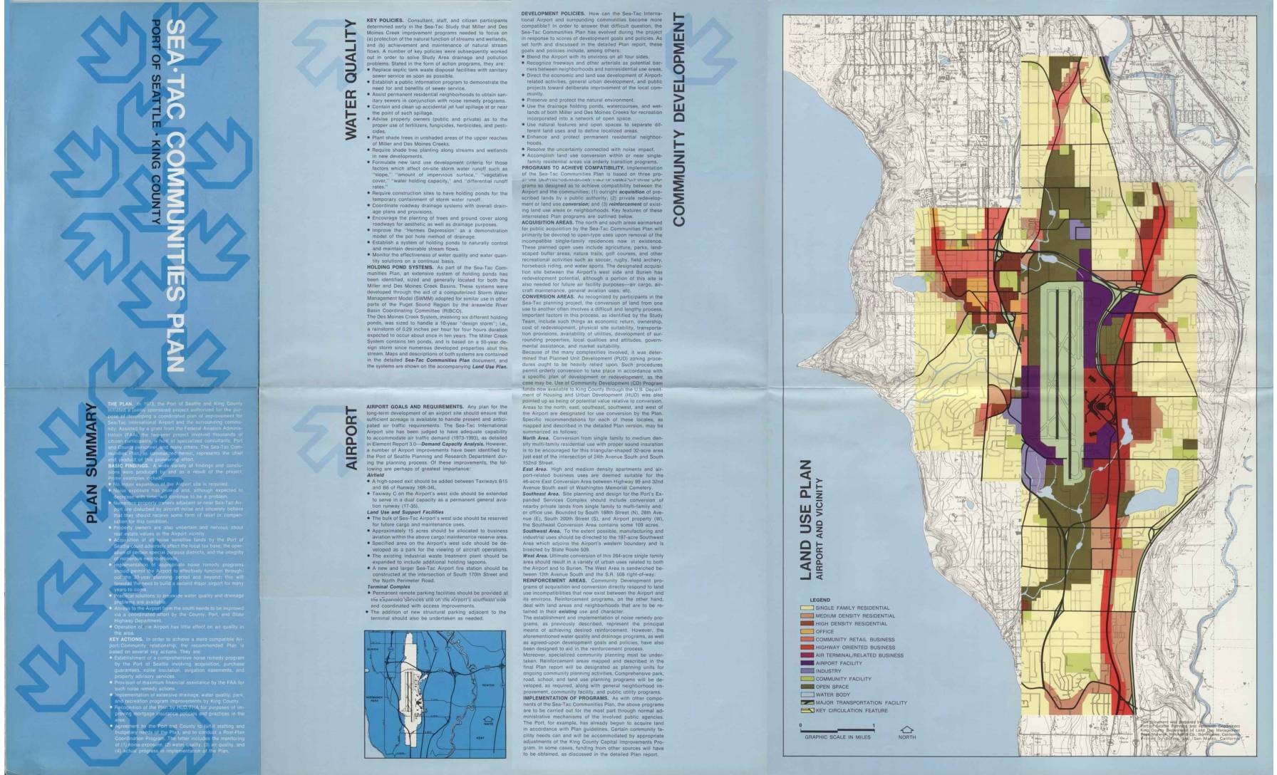
Sea-Tac Communities Plan: Plan Summary Brochure
The Sea-Tac Communities Plan, jointly developed by the Port of Seattle and King County beginning in 1973, outlines strategies to improve compatibility between Sea-Tac International Airport and surrounding neighborhoods, with a focus on aircraft noise remedies, water quality improvements, and land use conversion. The plan identifies specific areas for outright property acquisition, purchase guarantees, and noise insulation programs affecting thousands of homes north and south of the airport. It also establishes policies for drainage management, community development, and long-term airport facility improvements to accommodate projected air traffic growth through 1993. -
 2026-07-15
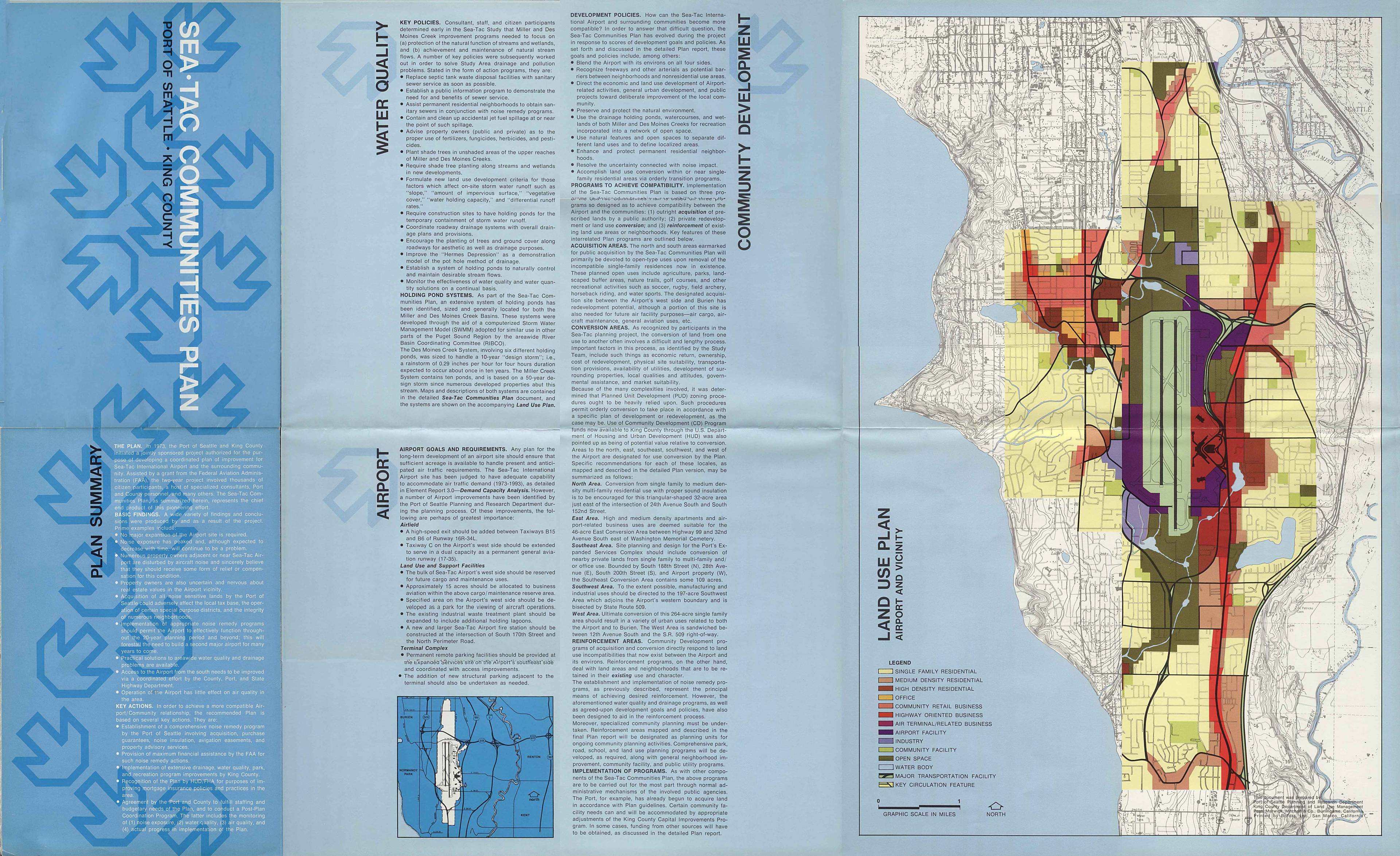
Sea-Tac Communities Plan: Water quality, airport, and community development
The Sea-Tac Communities Plan outlines strategies to improve compatibility between Seattle-Tacoma International Airport and surrounding neighborhoods, focusing on water quality, drainage, and land use. Key programs include public acquisition of noise-impacted residential areas for open space and recreation, conversion of single-family zones to higher-density or commercial uses, and reinforcement of existing neighborhoods through noise remedy and infrastructure improvements. The plan also addresses environmental concerns such as stream protection, holding pond systems for stormwater management, and pollution control near Miller and Des Moines Creeks. -
 2026-07-15
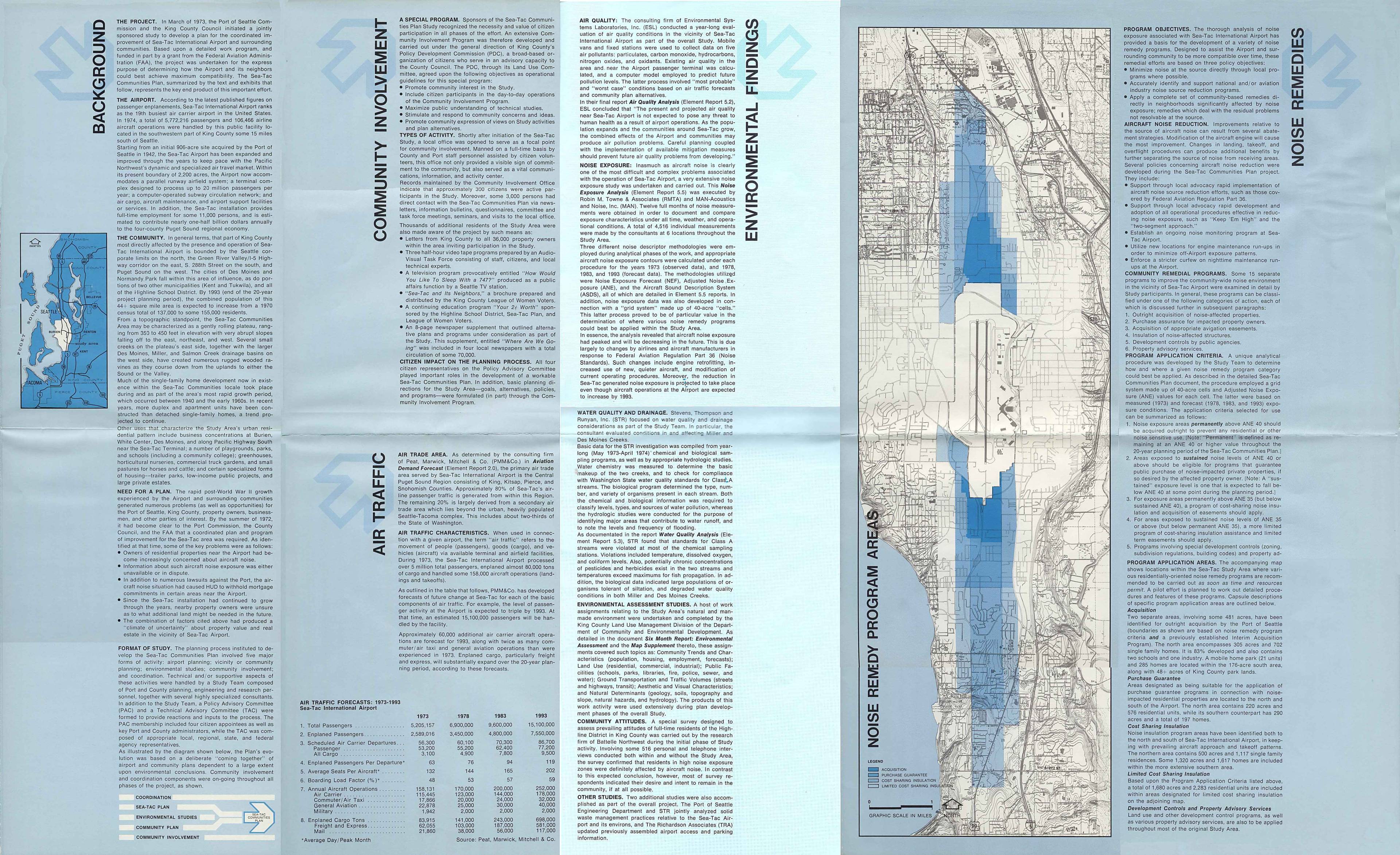
Sea-Tac Communities Plan background and environmental findings
This document summarizes the Sea-Tac Communities Plan, a 1973 joint study by the Port of Seattle and King County to improve compatibility between Sea-Tac International Airport and its surrounding neighborhoods. The plan examined aircraft noise exposure, air and water quality, and community growth, finding that noise levels were expected to decrease over time due to quieter aircraft technology despite rising flight operations. It proposed a range of noise remedy programs—including property acquisition, purchase guarantees, and insulation assistance—affecting thousands of homes in areas north and south of the airport. -
 2026-07-14
Sea-Tac Communities Plan: Map Supplement to Sixth Month Report — Community Trends and Characteristics, Land Use, Ground Transportation and Traffic, Aesthetic and Visual Characteristics, Natural Determinants
This document is a map supplement to the sixth-month element report for the Sea-Tac Communities Plan, a planning study sponsored by the Port of Seattle and King County and partially funded by a federal FAA grant. It covers five key topics—community trends and characteristics, land use, ground transportation and traffic, aesthetic and visual characteristics, and natural determinants—for the communities surrounding Seattle-Tacoma International Airport. The supplement includes 1970 census tract maps of the Sea-Tac area and an errata note correcting a data classification error for Census Tract 272 related to public assistance recipients. -
 2026-07-13
Sea-Tac Communities Plan: Part 1 — Overview of the Plan (Working Draft)
This working draft of the Sea-Tac Communities Plan, produced jointly by the Port of Seattle and King County, outlines a planning framework for communities surrounding Seattle-Tacoma International Airport. The document, reviewed in summary form around 1975, addresses land use and policy considerations for neighborhoods affected by airport operations and noise. It represents an early collaborative effort to balance airport growth with the needs of surrounding residential communities. -
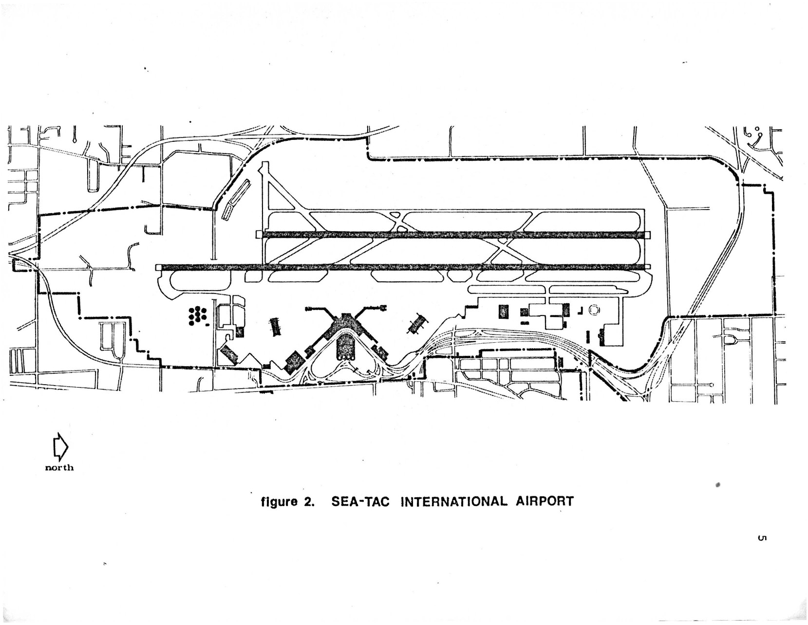
Second Runway Aerial Line Drawing – Planning for the airport and its environs: The Sea-Tac success story page 9
A black-and-white site plan map labeled 'Figure 2. SEA-TAC INTERNATIONAL AIRPORT,' showing the airport's runway configuration, taxiways, terminal area, and surrounding road network. A north arrow is included in the lower left corner, orienting the map with runways running roughly east-west. -
 2026-07-10
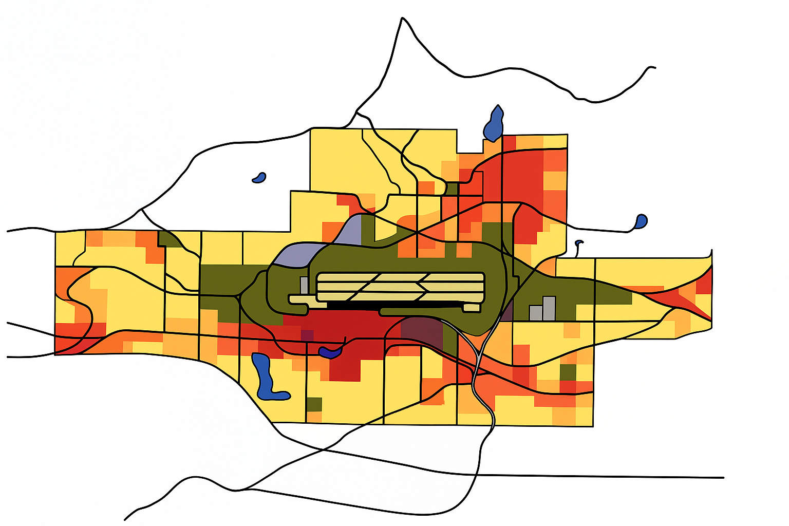
Sea-Tac Communities Plan – Planning Maps
The Sea-Tac Communities Plan really was a plan. Because Sea-Tac Airport was sited in a growing area, the Second Runway expansion presented huge challenges. Sea-Tac became the ‘alpha-tester’ for many FAA initiatives. The question they were trying to answer was: how can any major airport function in harmony with its surroundings? One idea, which the -
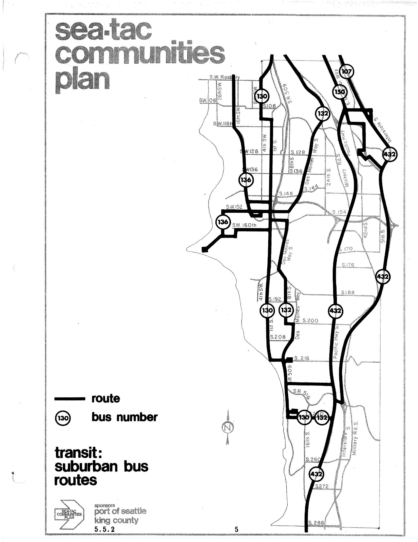
STCP Suburban Bus Routes Transit Map — Routes 107, 130, 132, 136, and 432
A transit map from the Sea-Tac Communities Plan (document section 5.5.2) showing suburban bus routes 107, 130, 132, 136, 432, and others in the Sea-Tac area. The plan was sponsored by the Port of Seattle and King County. -
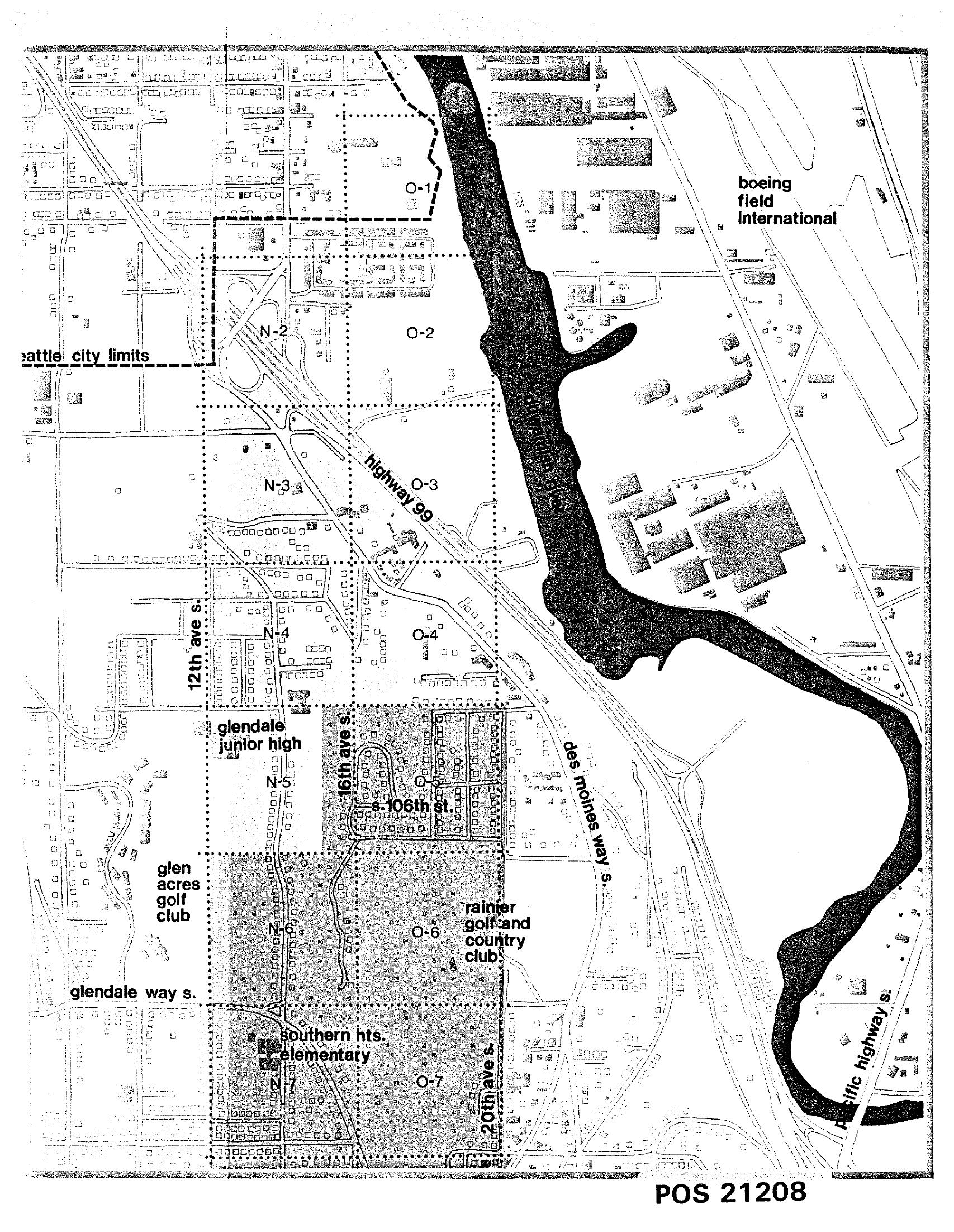
Sea-Tac Communities Plan Noise Study Zones Map (POS 21208)
Planning map labeled POS 21208 showing noise study zones (N-1 through N-7 and O-1 through O-7) in the area south of Seattle city limits along Highway 99 and 16th Ave S, bounded by Boeing Field/King County International Airport to the north and featuring landmarks including Glendale Junior High, Glen Acres Golf Club, Rainier Golf and Country Club, Southern Heights Elementary, and the Duwamish River. The map appears to be part of a Sea-Tac Airport or regional airport noise impact planning study. -
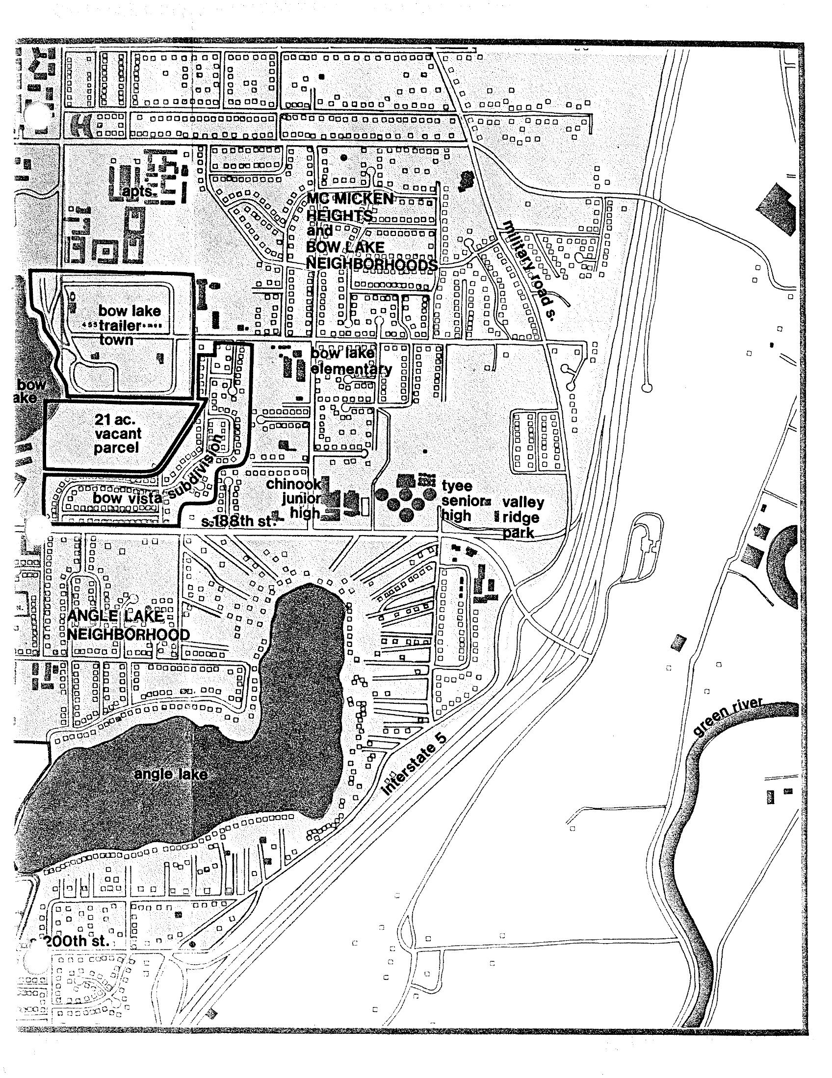
Sea-Tac Communities Plan Map: McMicken Heights and Bow Lake Neighborhoods
A neighborhood planning map depicting the McMicken Heights and Bow Lake neighborhoods near Sea-Tac Airport, showing Bow Lake, Angle Lake, Interstate 5, the Green River, and local landmarks including Bow Lake Elementary, Chinook Junior High, Tyee Senior High, and Valley Ridge Park. Also visible are Bow Lake Trailer Town, a 21-acre vacant parcel, Bow Vista Subdivision, and street references including S. 188th St. and 200th St.