Category : Resources
-
2025-06-01 15:06
Port Packages mapped
Structures with Port of Seattle avigation easements Background When the Port of Seattle conducted their initial Part 150 Study in 1985, there were at least 11,000 structures inside the eligible boundary area. Since then, it has conducted four more, including the current one. Since then, the boundary, and the structures included within those boundaries, have -
 2025-05-17 00:57
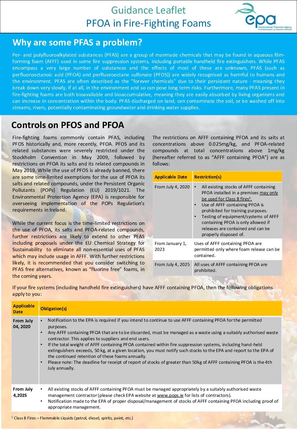
PFOA in Fire-Fighting Foams
EPA guidance leaflet explaining the problems with PFAS chemicals in fire-fighting foams, including PFOA and PFOS, which are harmful persistent chemicals. Details restrictions and controls on PFOA-containing AFFF (Aqueous Film Forming Foam) with timeline from 2020-2025 for phasing out use. -
2025-04-19 12:36
Contact Your Electeds
Local, Port of Seattle, County, State and Federal May 5-9 is filing week for candidates running for office in November. Here are all the King County candidates who have filed. City Councils Burien: council@burienwa.gov Position #1, #3, #5, and #7 are up for election this November. Des Moines: citycouncil@desmoineswa.gov Position #1, #3, #5, and #7 -
 2025-03-21 13:21
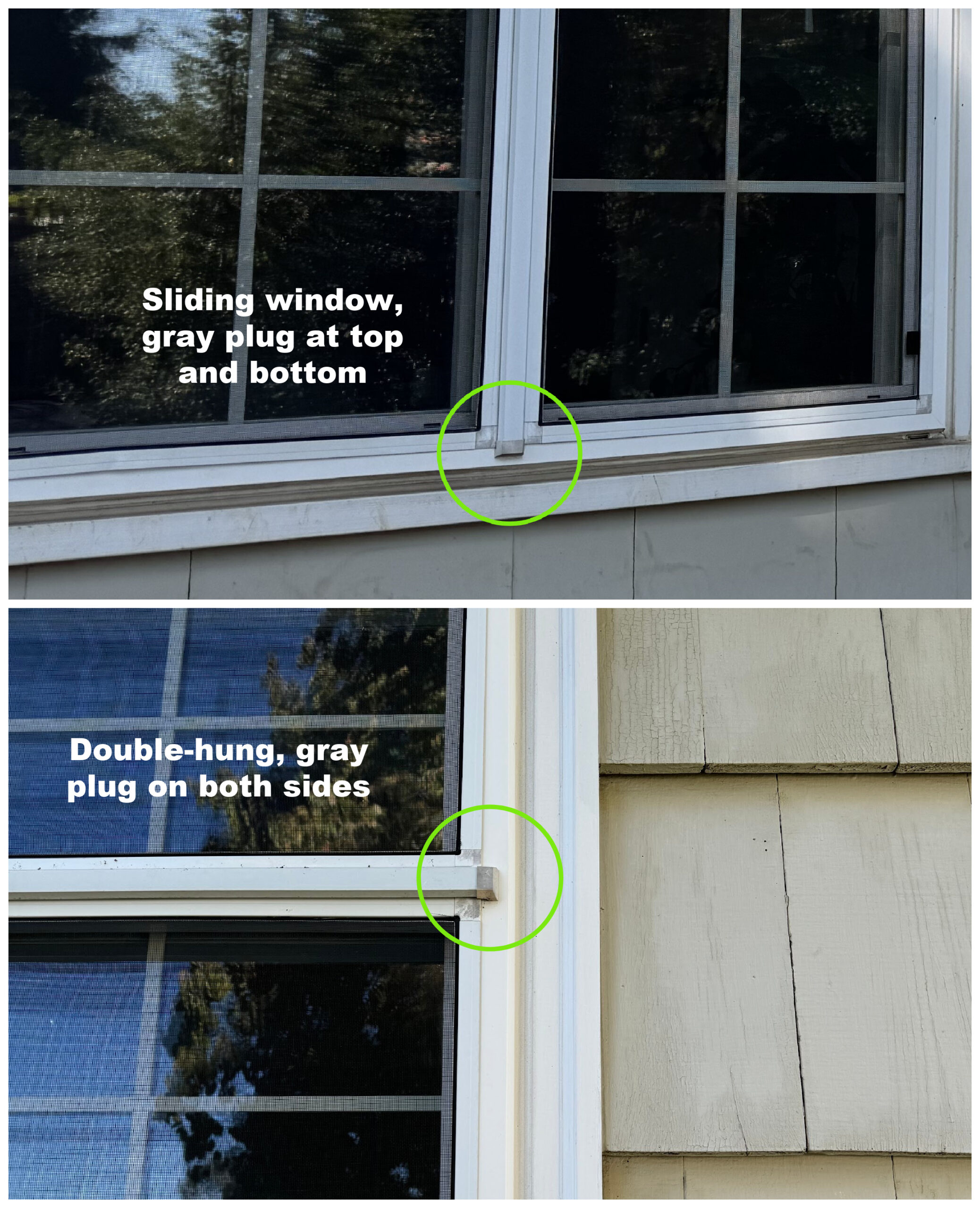
Window Types – Sliding and Double-Hung Window Features
Comparison image showing two types of windows with their distinctive features. The top image shows a sliding window with gray plugs at top and bottom, while the bottom image shows a double-hung window with gray plugs on both sides. Both images highlight the location of the plugs with green circles. -
2025-03-03 22:56
Asbestos Northwest
30620 Pacific Hwy S Suite 103 Federal Way, WA, 98003 253-941-4343 Mold Testing Bulk Building Materials and Tape Lifts : Bulk Nonviable Fungal Identification Air Quality Samples: Air sampling and Fungal Spore Identification We are now offering testing for fungal identification, which can help in identifying hazardous types of mold. Bulk samples may be tape -
 2025-02-14 13:29
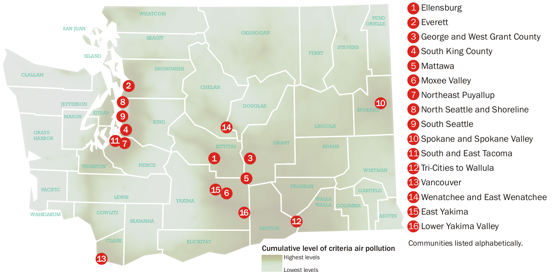
Washington State Air Pollution Map – Airport Communities
Map of Washington State showing cumulative levels of criteria air pollution with numbered markers indicating 16 airport-impacted communities. The map uses green shading to represent pollution levels from highest to lowest, with communities like Ellensburg, Everett, South King County, and others marked with red numbered circles. -
2024-12-29 00:34
Sea-Tac Airport Airlines and Destinations
-
 2024-08-13 12:11
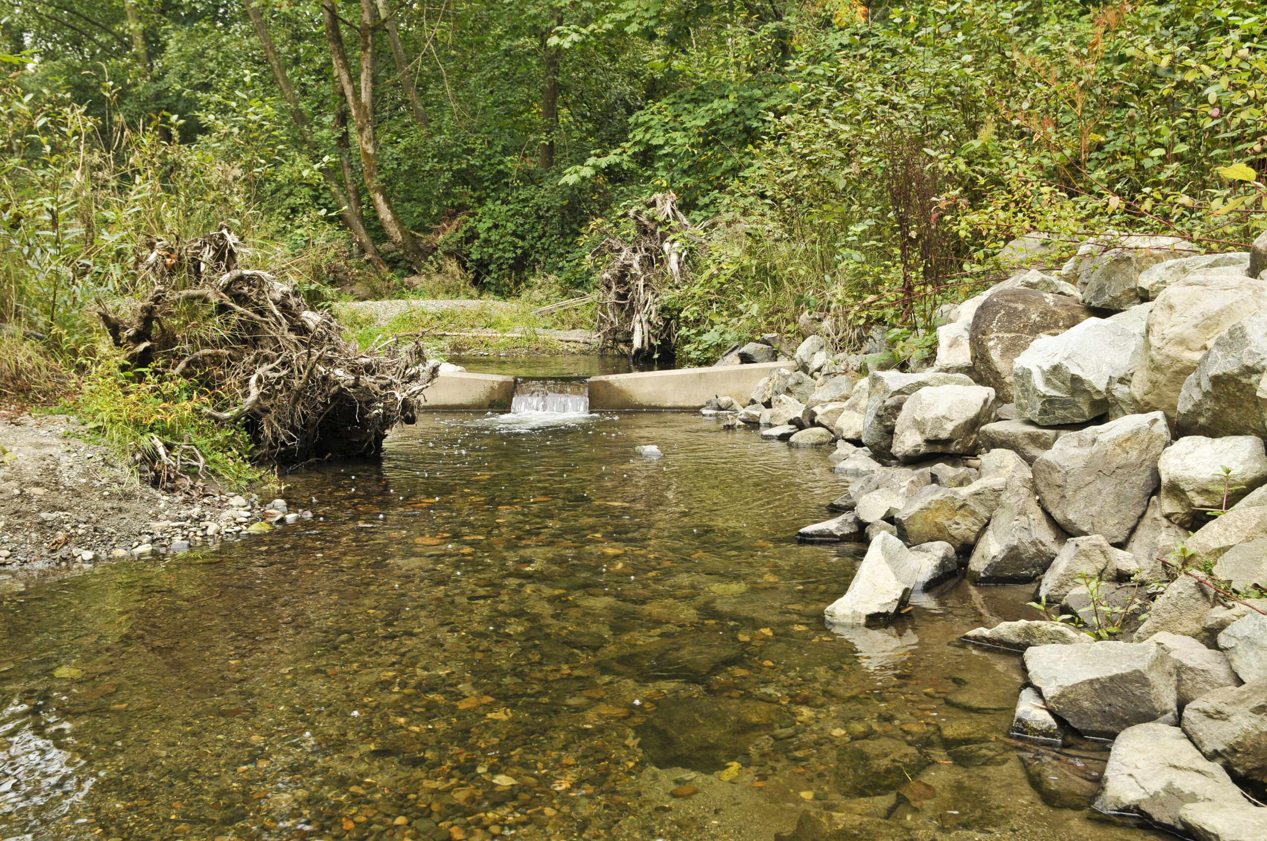
Stream or Creek with Water Control Structure
Image shows a natural stream or creek flowing through a wooded area with a concrete water control structure or small dam. Large rocks line the banks and fallen logs are visible along the edges. The clear water flows over the concrete structure creating a small waterfall effect. -
 2024-07-29 12:58
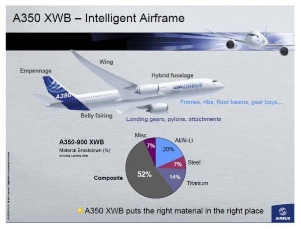
A350 XWB – Intelligent Airframe
Technical diagram showing the Airbus A350 XWB aircraft with material composition breakdown. The chart displays that the aircraft is composed of 52% composite materials, 20% aluminum/lithium, 14% titanium, 7% steel, and 7% miscellaneous materials, highlighting the strategic placement of different materials throughout the airframe. -
 2024-06-25 23:37
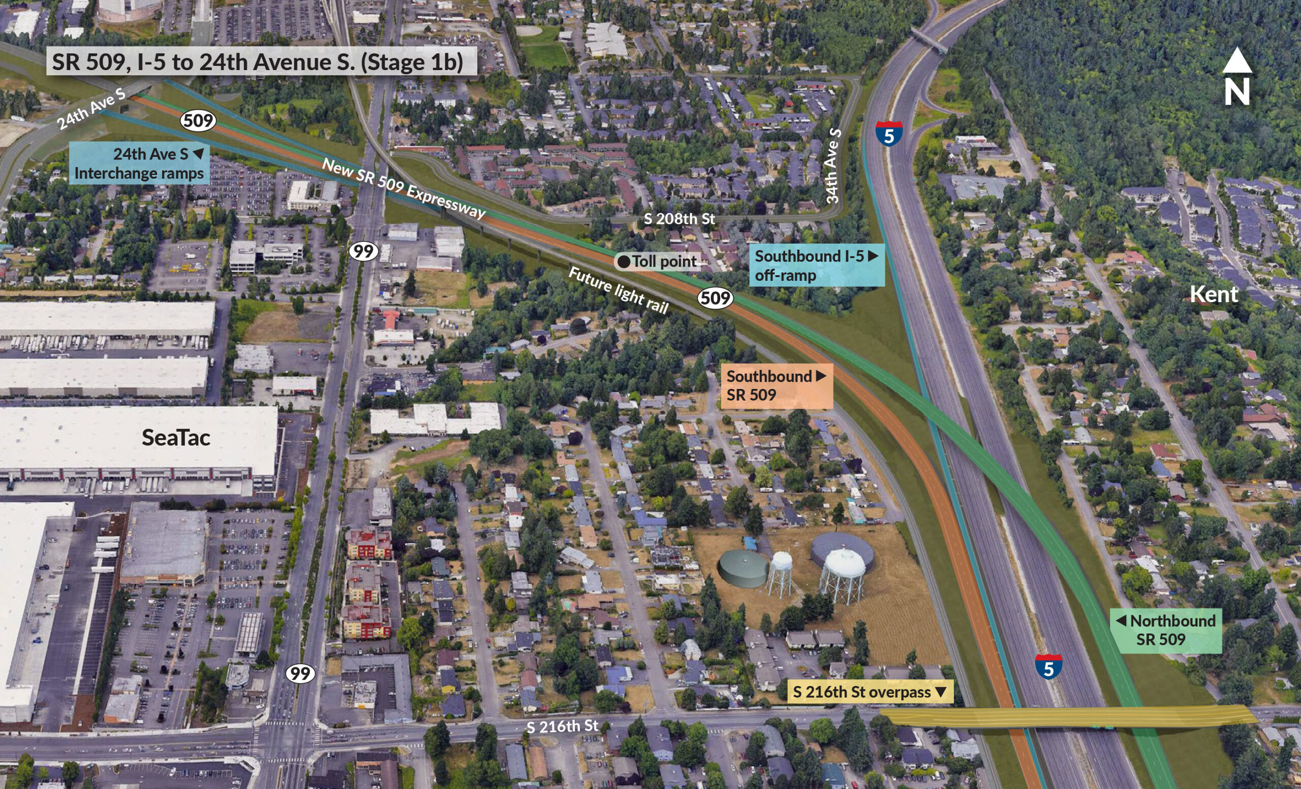
SR 509, I-5 to 24th Avenue S. (Stage 1b)
Aerial view map showing the SR 509 expressway construction project from I-5 to 24th Avenue S, including interchange ramps, toll points, and future light rail connections. The map displays the Kent area with various residential neighborhoods and commercial facilities including SeaTac airport vicinity.