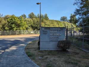
It’s an FAA acronym. Terminal Radar Approach Control. And if you live in any of the areas considered for a Second Airport, including Enumclaw or Pierce and Thurston Counties, keep reading.
TRACONs are FAA facilities that house air traffic controllers who guide aircraft approaching and departing airports generally within a 30- to 50-mile radius up to 10,000 feet, as well as aircraft that may be flying over that airspace.

Once an aircraft that is landing is within six miles of Sea-Tac Airport and below 3,500 feet, TRACON controllers hand the aircraft off to air traffic controllers in the airport tower.
When a departing aircraft leaves the TRACON’s range of control, TRACON controllers hand responsibility for the aircraft off to controllers at FAA En Route Centers who guide the aircraft at higher altitudes while it is en route to the next airport.
In other words, while TRACON controllers do not handle landings and takeoffs. Instead, they are responsible for the safe separation of aircraft flying in the busy areas surrounding airports to about 15,000 feet.
And the En Route Centers are in control after that–when the captain calls out “We’ve reached our cruising altitude of 37,000 feet and I’ve turned off the Seatbelt Sign.”
Co-Location

The TRACON which covers Sea-Tac Airport (S46) lives at Sea-Tac Airport. Our TRACON actually manages all airports in Puget Sound. This practice is common in the biz and is known as co-location, but the location is actually irrelevant because TRACON controllers do not rely on sight to manage flights–strictly computers/radar.
Why it matters
As operations increase, the TRACON becomes more important to communities further away, in particular the areas under consideration for a ‘second airport‘. NextGen concentrates flights within the six miles or so from the tower at Sea-Tac. However, aircraft don’t magically appear out of nowhere. The TRACON area includes all the areas under consideration for a Second Airport because those spots are along the main ‘highways’ that aircraft flow through on their way to Sea-Tac.
The railroad in the sky
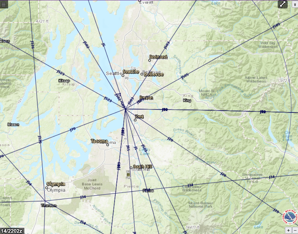
The FAA often uses the analogy of a ‘railroad in the sky’ and that is not just a metaphor. There are main highways that all jets traverse going across America. Here are those main paths within 50 miles of KSEA.

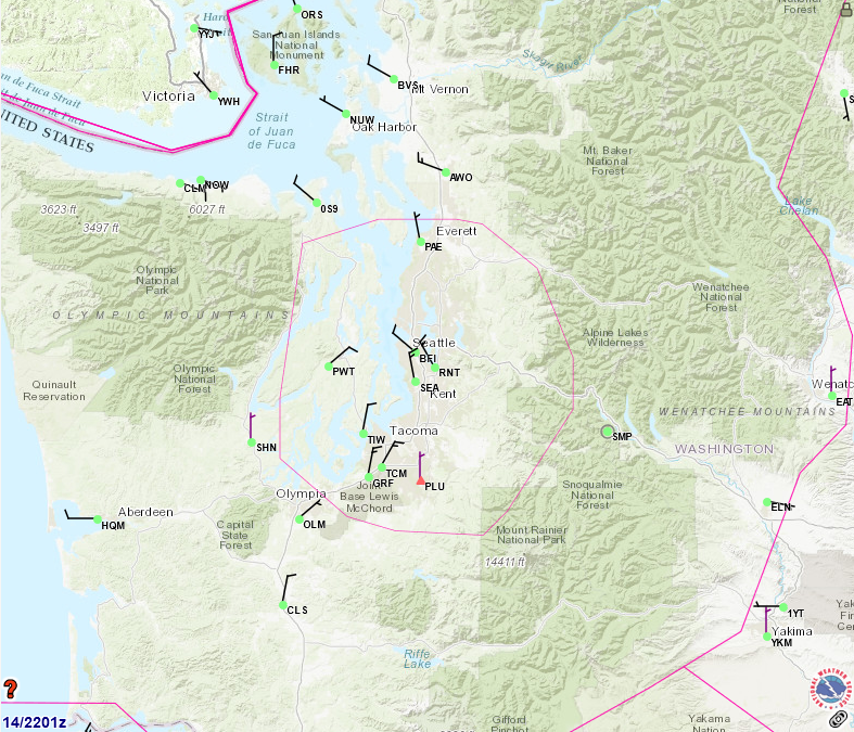
And here is (sort of) our TRACON area and the airports it controls, represented by the red ring.

As you can see, because of geography or planning or efficiency (or a combination of all three), flights do tend to begin concentrating into ‘highways’ long before they get to that six mile point we associate with a particular airport.
Dispersion
The FAA recognizes this and consciously attempts to develop a process called dispersion, meaning attempts to distribute flights in the TRACON area so as to spread the pain around in an equitable manner. But this is not automatic. After all, it makes more work for everybody to make this happen.
So the FAA relies on the public to weigh in on how best to do that, otherwise, the FAA will simply do what is the safest and most efficient–which is almost always those straight lines.
Section 175 of the 2018 FAA Reauthorization discusses what communities within that TRACON space can do to advocate for themselves on this. And what this comes down to is that even if you are outside tower control, you must be part of an ongoing discussion of flight paths.
Put directly, even if you live in Enumclaw or Thurston or Pierce Counties and think you’re out of the woods now because you didn’t get a second airport? Think again. And as it stands now, if you’re not part of these Section 175 discussions, you’re not even at the table.
And that is another reason why we encourage all areas that feed into Sea-Tac Airport to work with us, together, on equitable long-term solutions.