TagSea-Tac Airport(1855)
-
 2000-06-12
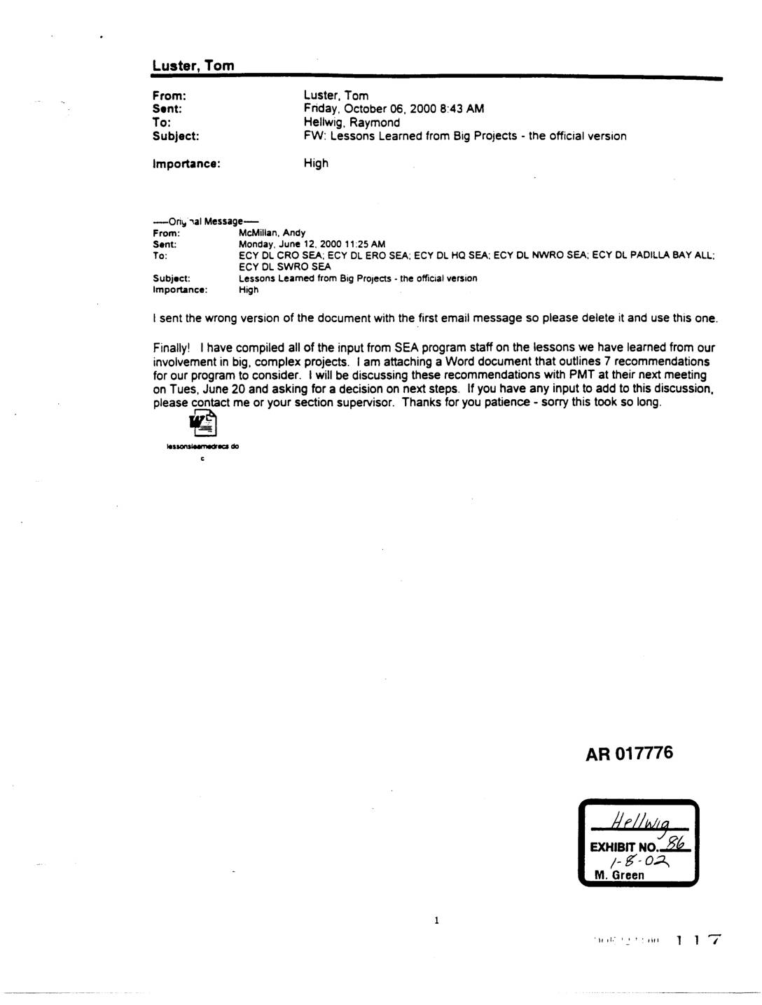
EXH AR017776: Lessons Learned from “Big” Projects — Recommendations for SEA Program
Email from Andy McMillan (SEA program) dated June 12, 2000, forwarded by Tom Luster to Raymond Hellwig on October 6, 2000, transmitting the official version of a Word document titled “Lessons Learned from Big Projects: Recommendations for SEA Program.” The attached document outlines 7 recommendations developed from SEA program staff experiences with large, complex projects -
 2000-06-01
EXH AR044681: Biological Assessment — Master Plan Update Improvements, STIA
Biological Assessment prepared by Parametrix, Inc. for the Federal Aviation Administration and Port Of Seattle regarding reinitiation and initiation of Section 7 ESA consultation for Seattle-Tacoma International Airport Master Plan Update Improvements. Covers ESA-listed species managed by USFWS and NMFS including Chinook salmon, bull trout, and essential fish habitat (EFH). Analyzes hydrologic systems including Miller -
 2000-06-01
EXH AR045252: Subsurface Conditions Data Report, West MSE Wall, Third Runway Embankment, Sea-Tac Airport
Hart Crowser draft subsurface conditions data report (project J-4978.21) prepared for Port Of Seattle and HNTB, June 2000, covering the West MSE (Mechanically Stabilized Earth) Wall for the Third Runway Embankment at Sea-Tac International Airport. Report includes generalized geologic conditions, subsurface soil conditions, consolidation test results, CU and UU triaxial compression test results, hydrogeologic conditions, -
 2000-06-01
EXH AR045402: Preliminary Stability and Settlement Analyses — Subgrade Improvements, MSE Wall Support, Third Runway Project
Hart Crowser report (J-4978-22) prepared for HNTB, June 2000, analyzing preliminary stability and settlement for subgrade improvements supporting Mechanically Stabilized Earth (MSE) walls at the Sea-Tac Airport Third Runway Project. Covers three MSE wall locations — North Safety Area, West MSE Wall, South MSE Wall — with analysis of subgrade improvement alternatives including overexcavation and -
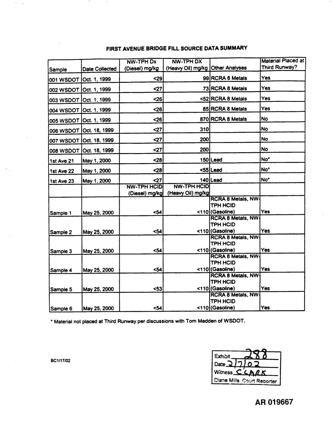 2000-05-25
EXH 288: First Avenue Bridge Fill Source Data Summary
This document summarizes soil contamination test results for fill material taken from the First Avenue Bridge site, collected between October 1999 and May 2000. Samples were tested for petroleum hydrocarbons (diesel and heavy oil ranges) as well as RCRA 8 metals and other contaminants, with results indicating varying levels of heavy oil detected across samples. The table notes which soil samples were ultimately placed at the Third Runway construction site at Sea-Tac Airport, with several samples excluded due to contamination concerns. -
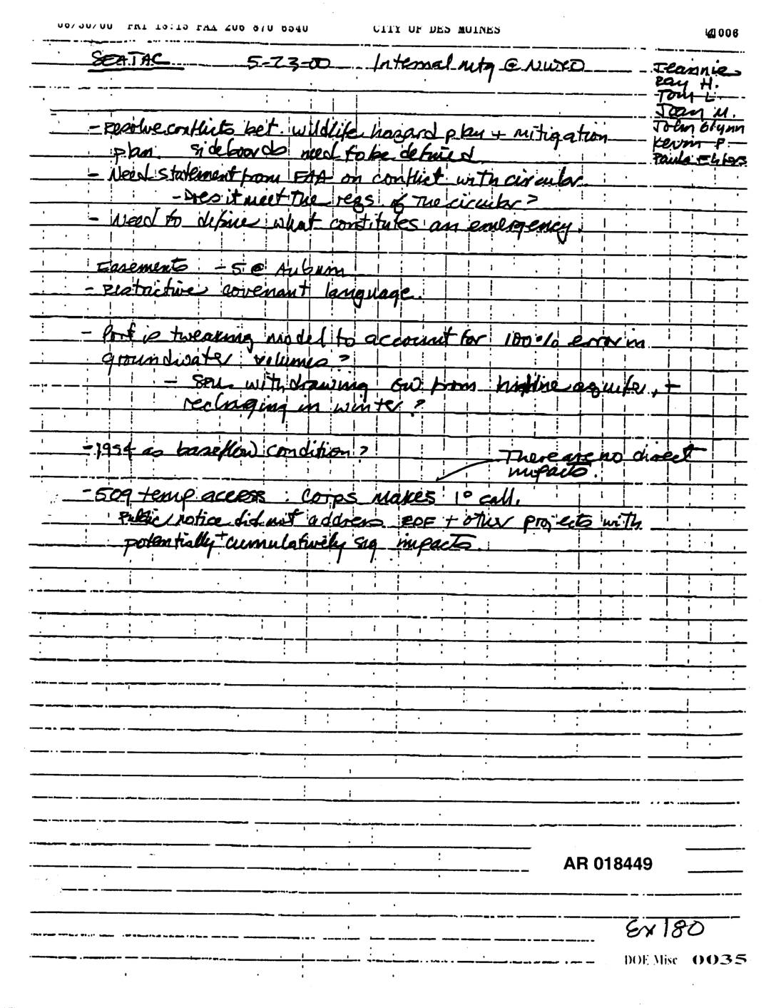 2000-05-23
EXH AR018449: Sea-Tac Internal Meeting Notes — Wildlife Hazard Plan, Easements, Groundwater Model, Cumulative Impacts
Handwritten notes from a SeaTac internal meeting on 5-23-00 (AR 018449, Exhibit 180), attended by Jeannie, Ray H., Tom L., Joan M., John Glynn, Kevin P., and Paula Chlos. Topics include resolving conflicts between wildlife hazard plan and mitigation plan, sideboard definitions needed; need for ETA statement on conflict with circular and whether it meets -
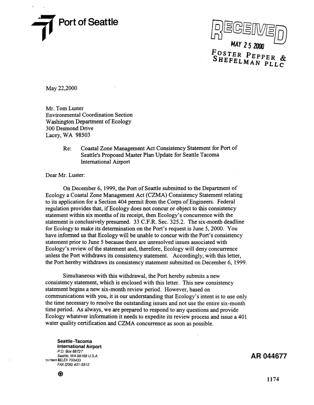 2000-05-22
EXH AR044677: Port Of Seattle Letter Withdrawing and Resubmitting CZMA Consistency Statement for Sea-Tac Airport Third Runway
Letter dated May 22, 2000 from Elizabeth Leavitt, Manager of Aviation Environmental Programs at Port Of Seattle, to Tom Luster at Washington Department of Ecology (Environmental Coordination Section), withdrawing the December 6, 1999 CZMA Consistency Statement and simultaneously submitting a new one to reset the six-month review period under 33 C.F.R. Sec. 325.2. The withdrawal -
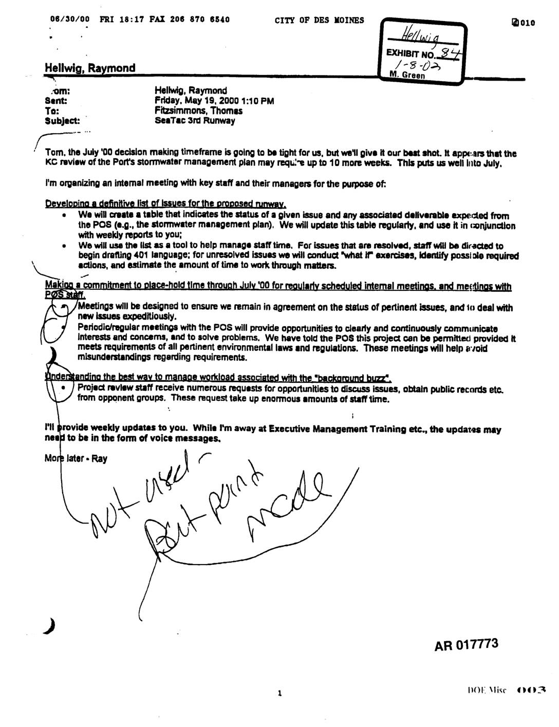 2000-05-19
EXH AR017773: Internal Email — Sea-Tac Third Runway Decision-Making Timeline and Workload Management
Email from Raymond Hellwig to Thomas Fitzsimmons dated May 19, 2000, regarding the SeaTac Third Runway permitting process and July 2000 decision-making timeframe. Discusses King County review of Port Of Seattle stormwater management plan requiring up to 10 more weeks, internal staff meetings to develop a definitive issues list, drafting 401 language for resolved issues, -
 2000-05-12
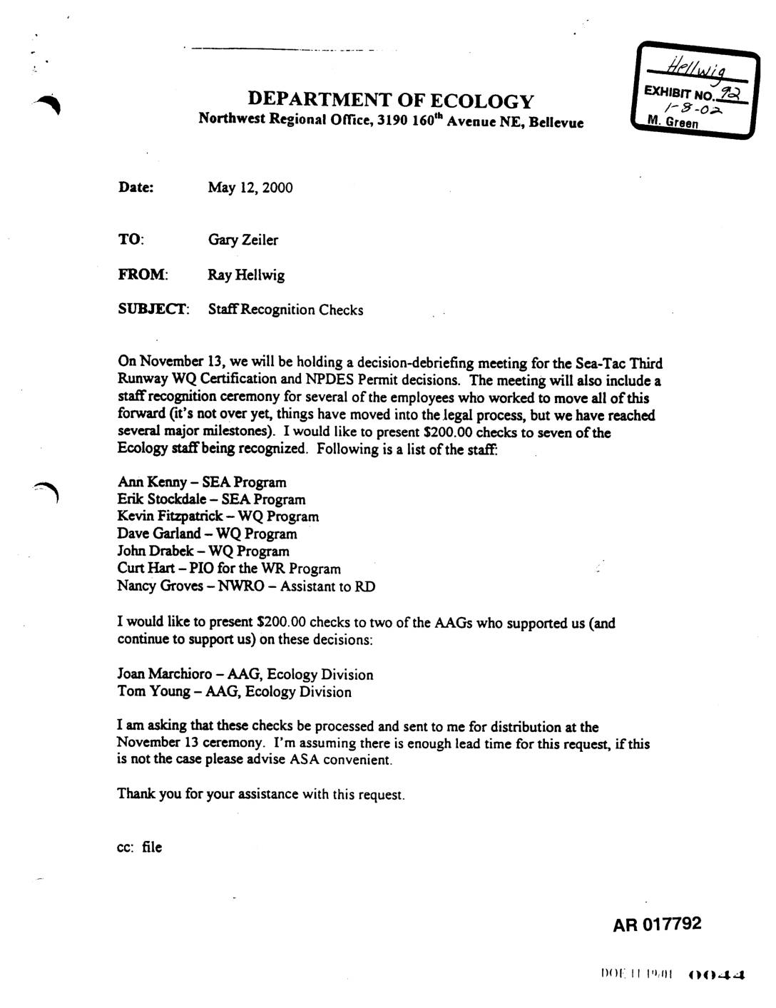
EXH AR017792: Ecology Staff Recognition Checks — Sea-Tac Third Runway WQ Certification and NPDES Permit
Memo dated May 12, 2000 from Ray Hellwig (Northwest Regional Office, Department of Ecology) to Gary Zeiler requesting $200.00 recognition checks for seven Ecology staff and two AAGs (Joan Marchioro and Tom Young, Ecology Division) involved in the Sea-Tac Third Runway Water Quality Certification and NPDES Permit decisions. Staff recognized include Ann Kenny, Erik Stockdale -
 2000-05-01
EXH AR044473: Stormwater Whole Effluent Toxicity (WET) Testing at STIA Final Report
Final report prepared by Scott Tobiason, Aviation Environmental Programs, Port Of Seattle, documenting Stormwater Whole Effluent Toxicity (WET) testing at Seattle-Tacoma International Airport (STIA), May 2000. AR 044473. Covers WET testing background, sampling methods, STIA storm drainage subbasins, source-tracing of SDN1 outfall, chelation testing, synthetic runoff WET test results, field investigations, and NPDES stormwater discharge