Notes
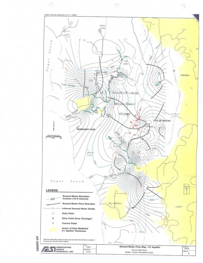
Ground Water Flow Map for the C1 Aquifer prepared by Associated Earth Sciences, Inc. (project no. 8V07019, figure 7) as part of a Ground Water Study at Seattle-Tacoma International Airport, dated 12/02/99. The map covers the Sea-Tac Airport area including Normandy Park, City of SeaTac, Tukwila, Des Moines, and surrounding Puget Sound shorelines. Shows ground water elevation contours at 10 ft intervals (ranging from approximately 150 to 400 ft), ground water flow direction arrows, inferred ground water divides, data points including Ecology data points, control points, and areas of zero modelled C1 Aquifer thickness (shown in yellow). Notable features include Arbor Lake, Tub Lake, Lake Burien, Bow Lake, Angle Lake, Arrow Lake, Miller Creek, and Des Moines Creek. AR number 026984.