TagSea-Tac Airport(1835)
-
 2014-12-31
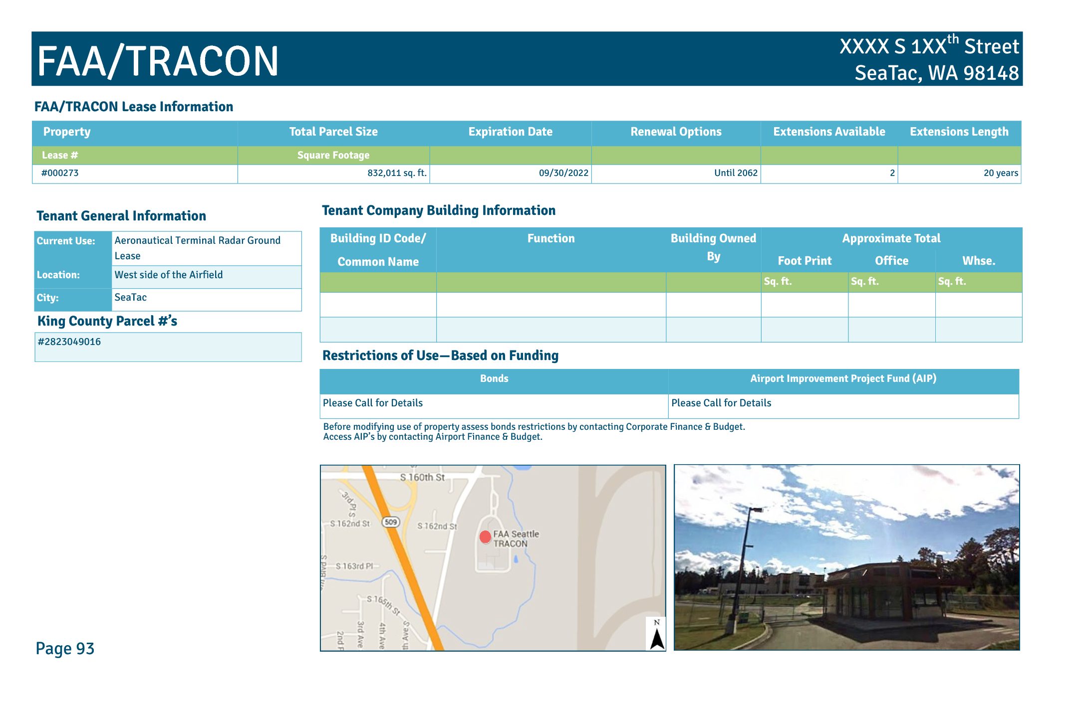
FAA/TRACON lease information
This document describes a Port of Seattle ground lease (Lease #000273) with the FAA/TRACON facility located on the west side of the airfield in SeaTac, Washington. The lease covers approximately 832,011 square feet, was set to expire on September 30, 2022, and includes two renewal options extending until 2062, each for a period of 20 years. The facility serves an aeronautical terminal radar function and is subject to bond and Airport Improvement Project (AIP) funding restrictions that require coordination with Airport Finance & Budget before any changes in property use. -
 2014-12-09
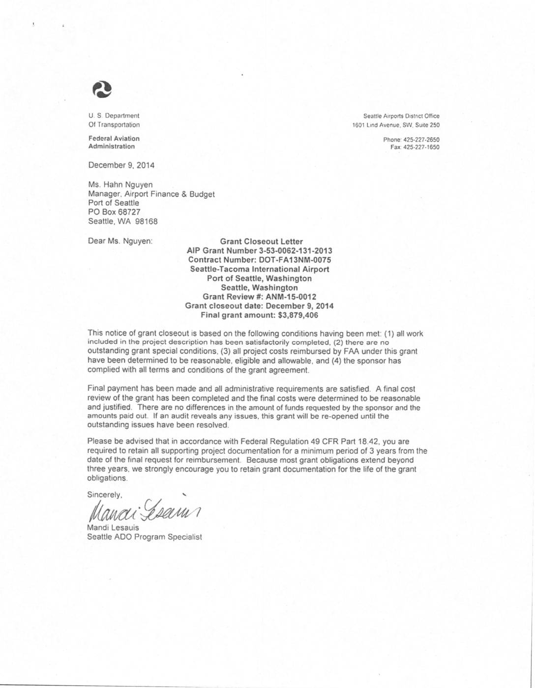
Grant closeout letter: AIP grant number 3-53-0062-131-2013
The Federal Aviation Administration (FAA) issued a grant to the Port of Seattle to fund noise mitigation work at Olympic Elementary School near Seattle-Tacoma International Airport, with a maximum federal contribution of $3.9 million covering 80% of allowable project costs. The grant (AIP Grant Number 3-53-0062-131-2013) was formally closed out on December 9, 2014, with a final paid amount of $3,879,406 after all work was confirmed satisfactorily completed and costs verified as reasonable and eligible. The Port of Seattle is required to retain all supporting project documentation for a minimum of three years from the final reimbursement request, in accordance with Federal Regulation 49 CFR Part 18.42. -
 2014-12-02
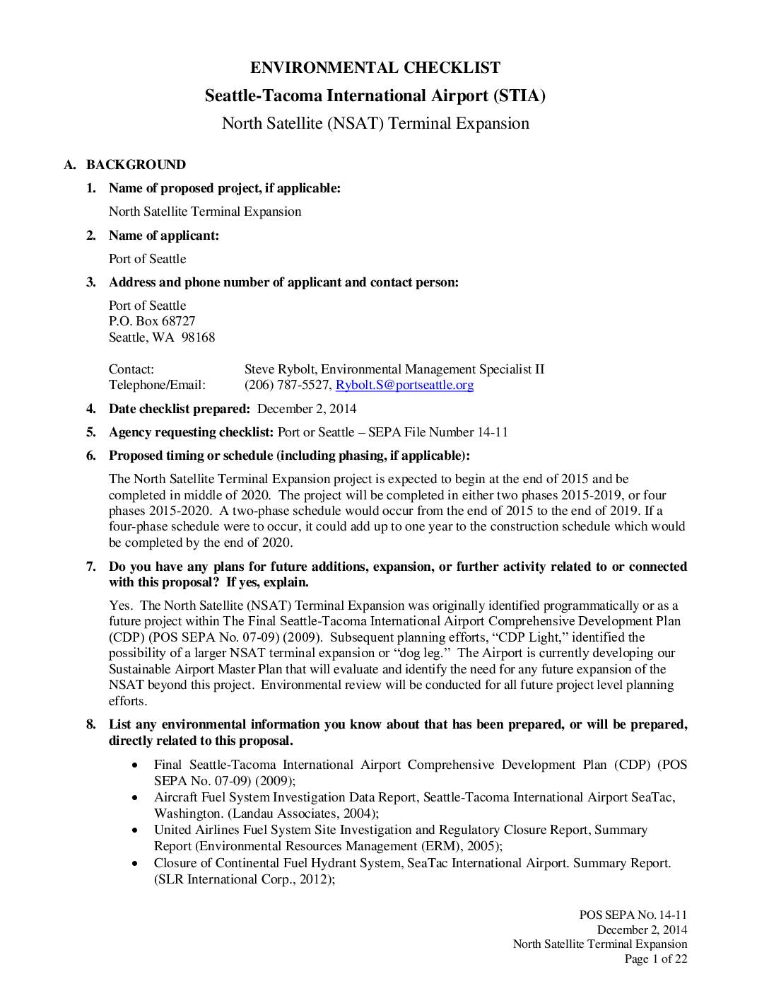
SEPA Environmental checklist: Seattle-Tacoma International Airport (STIA) North Satellite (NSAT) Terminal Expansion
This SEPA environmental checklist prepared by the Port of Seattle covers the proposed renovation and expansion of the North Satellite Terminal at Seattle-Tacoma International Airport. The project would expand the terminal footprint from 91,500 to 154,500 square feet, adding eight new airplane gates for a total of twenty contact gates. Construction was planned in two -
 2014-10-13
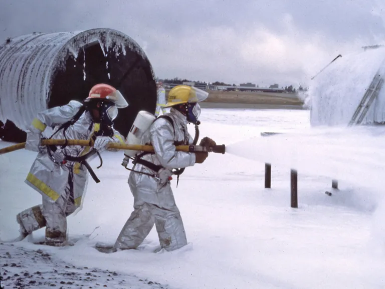
Firefighter PFAS training exercise October 13, 2014
Two firefighters in silver proximity suits and yellow helmets operate a hose line deploying fire-suppression foam across a tarmac area. A large cylindrical aircraft fuselage mockup is visible in the background, consistent with an Aircraft Rescue and Firefighting (ARFF) training exercise at an airport facility. -
 2014-06-25
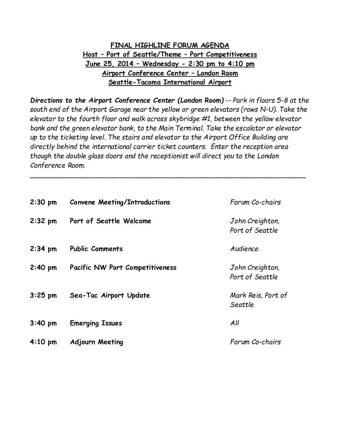
Highline Forum Agenda: Port Competitiveness — June 25, 2014
The Highline Forum held a meeting on June 25, 2014, at the Seattle-Tacoma International Airport Conference Center, hosted by the Port of Seattle with a theme of Port Competitiveness. The agenda included a welcome and presentation on Pacific Northwest Port Competitiveness by Port of Seattle Commissioner John Creighton, followed by a Sea-Tac Airport update from Mark Reis. The two-hour session also included time for public comments and a discussion of emerging issues. -
 2014-06-13
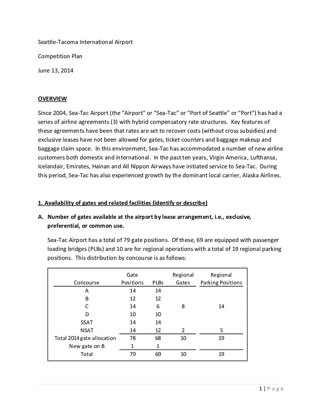
Seattle-Tacoma International Airport competition plan June 13, 2014
Seattle-Tacoma International Airport's 2014 Competition Plan outlines how the airport manages its 79 gate positions across six concourses, with 65 gates preferentially leased by airlines and 14 controlled as common-use gates by the Port of Seattle. The plan describes policies ensuring fair access for new and existing carriers, prohibiting exclusive gate leases, and setting rates to recover costs without cross-subsidies. It also details gate monitoring procedures and expansion plans for the North Satellite terminal to accommodate growing demand from carriers such as Alaska Airlines and Delta. -
 2014-05-01
Air Cargo Market Assessment: Seattle-Tacoma International Airport
This May 2014 technical report, prepared by Leigh Fisher and Webber Air Cargo, Inc. for the Port of Seattle, assesses the air cargo market at Seattle-Tacoma International Airport (Sea-Tac). It examines industry trends, carrier market shares, competing gateways, international trade flows, and the airport's cargo facilities and handling service providers. The report concludes with an outlook and recommendations to support future cargo growth at Sea-Tac. -
2014-02-25
Policy And Procedures Concerning The Use Of Airport Revenue; Proceed from Taxes on Aviation Fuel
Policy And Procedures Concerning The Use Of Airport Revenue; Proceed from Taxes on Aviation Fuel Created by the Federal Aviation Administration Port of Seattle Posted by the Federal Aviation Administration on Feb 25, 2014 The Port of Seattle, owner and operator of Seattle – Tacoma International Airport (“Sea-Tac”), agrees that proceeds generated from taxes on -
 2013-12-05
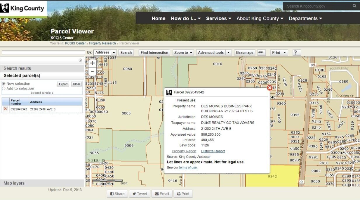
King County Parcel Viewer – Des Moines Business Park Parcel 0922049342
King County GIS Parcel Viewer screenshot dated December 5, 2013, showing parcel 0922049342 at 21202 24th Ave S, Des Moines, WA, identified as Des Moines Business Park Building 4A. The parcel, held by Duke Realty Co, has an appraised value of $56,260,300 and a lot area of 490,456 square feet, located within the Sea-Tac Airport vicinity under levy code 1126. -
 2013-10-23
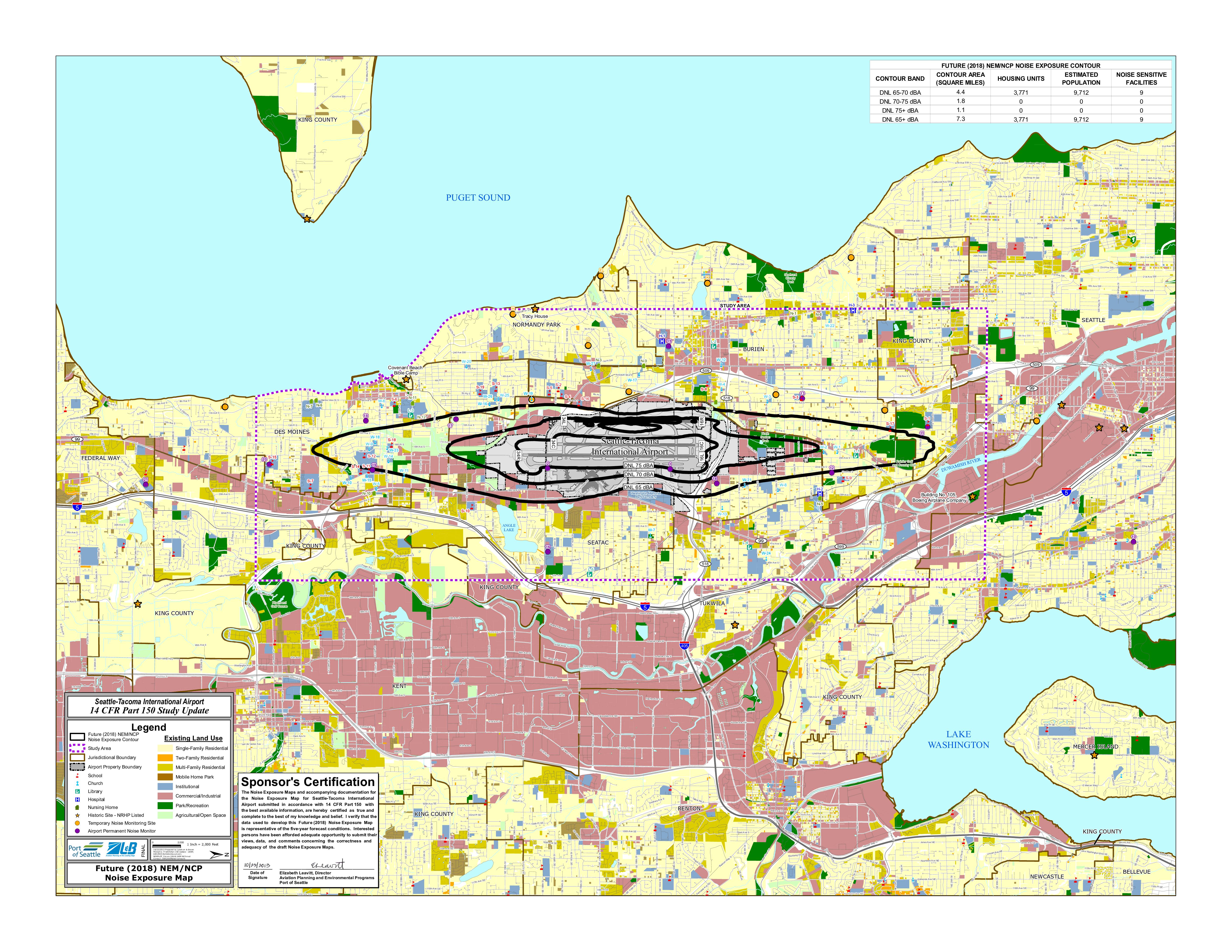
Future (2018) NEM/NCP Noise Exposure Map: Seattle-Tacoma International Airport 14 CFR Part 150 Study Update
This map, prepared by Landrum & Brown for the Port of Seattle's 14 CFR Part 150 Study Update, shows projected aircraft noise exposure around Seattle-Tacoma International Airport for the year 2018. It illustrates three noise contour zones (DNL 65, 70, and 75 dBA), with the total area above DNL 65 dBA covering approximately 7.3 square miles and affecting an estimated 3,771 housing units and 9,712 residents. The map also identifies noise-sensitive land uses such as schools, churches, hospitals, and libraries within the affected area, and was certified by the Port of Seattle's Director of Aviation Planning and Environmental Programs.