TagMap(375)
-
 1981-01-01
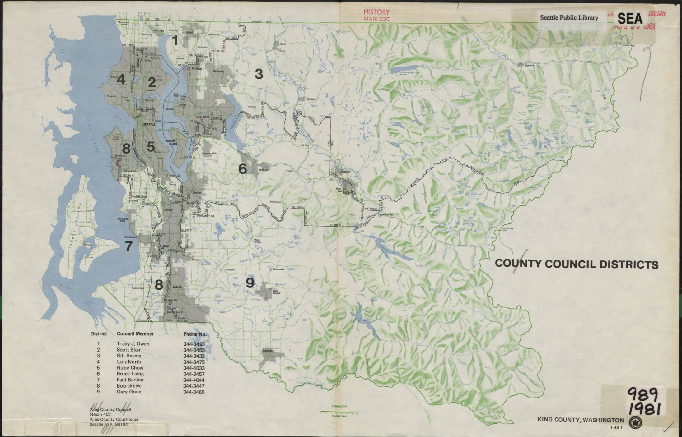
King County Council Districts Map, 1981
This 1981 King County, Washington map depicts the nine County Council Districts, listing each district's representative and contact phone number. Council members included Tracy J. Owen, Scott Blair, Bill Reams, Lois North, Ruby Chow, Bruce Laing, Paul Barden, Bob Greive, and Gary Grant. The map was produced by the King County Council and archived by the Seattle Public Library as a historical state document. -
 1981-01-01
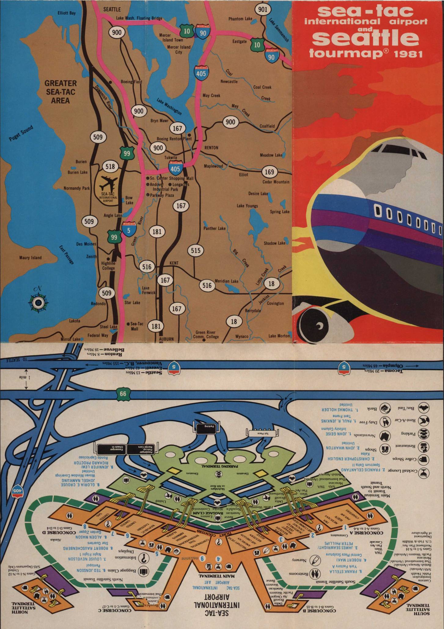
Sea-Tac International Airport and Seattle tourmap 1981
This 1981 Sea-Tac International Airport and Seattle Tourmap provides a comprehensive guide for air travelers, featuring detailed maps of the Greater Sea-Tac area, a terminal layout showing concourses, gates, and passenger services, and a visitor's map of downtown Seattle. The document includes practical airport information such as emergency phone numbers, baggage claim procedures, parking details, and descriptions of on-site amenities including restaurants, a satellite transit system, and chaplain services. While primarily a travel and navigation guide, it offers a snapshot of the airport's physical layout and operational environment during the early 1980s. -
 1980-08-01
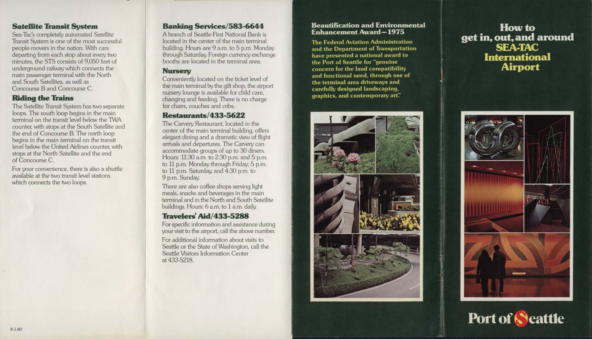
How to Get In, Out, and Around Sea-Tac International Airport
This circa-1980 visitor guide for Seattle-Tacoma (Sea-Tac) International Airport describes the layout and services available to travelers, including the automated Satellite Transit System—an underground railway connecting the main terminal to the North and South Satellites and Concourses B and C. The brochure covers amenities such as banking, dining, a nursery lounge, and Travelers' Aid, and includes a terminal map showing airline gate assignments and ground transportation options. It also notes that the Port of Seattle received a 1975 Federal Aviation Administration award for its attention to land compatibility, landscaping, and contemporary art throughout the airport. -
 1980-02-20
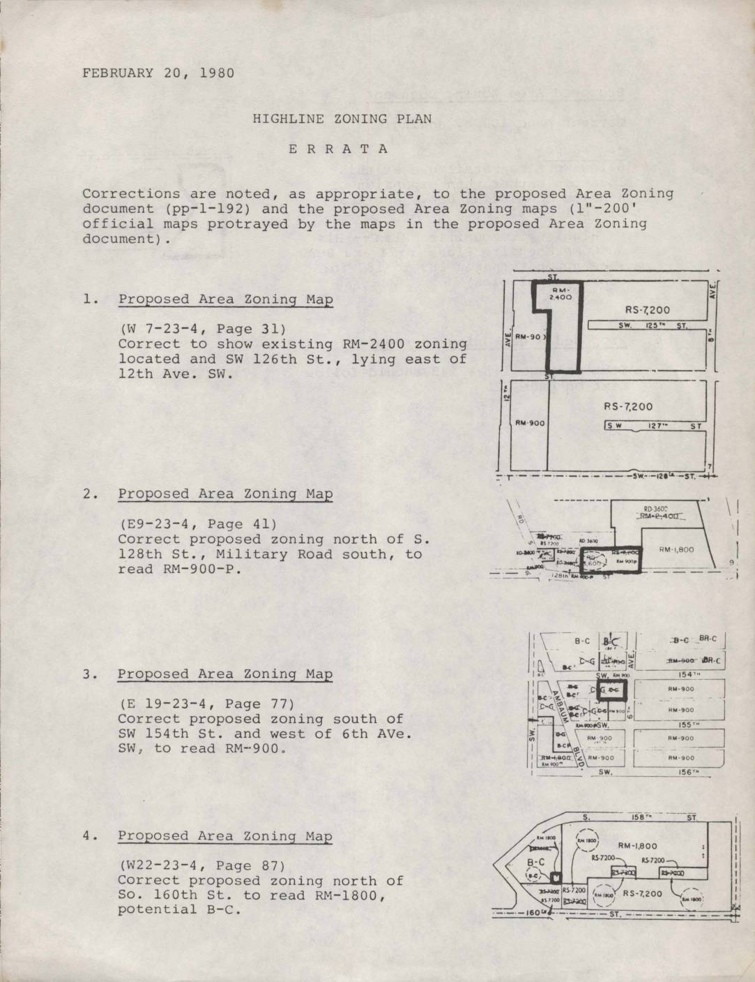
Highline Zoning Plan Errata
This February 20, 1980 errata document lists official corrections to the Highline Zoning Plan, a proposed area zoning document and accompanying maps covering communities in the Highline area near Seattle. The corrections update specific zoning designations on several map sections, such as changing certain parcels to residential multi-family (RM) or business-commercial (B-C) classifications, and fix a text sequencing error in the zoning document. These adjustments reflect policy decisions aimed at guiding land use—including residential density and commercial development—in neighborhoods in the vicinity of what is now Sea-Tac Airport. -
 1979-07-10
North Clear Zone Advisory Committee membership list (July 10, 1979)
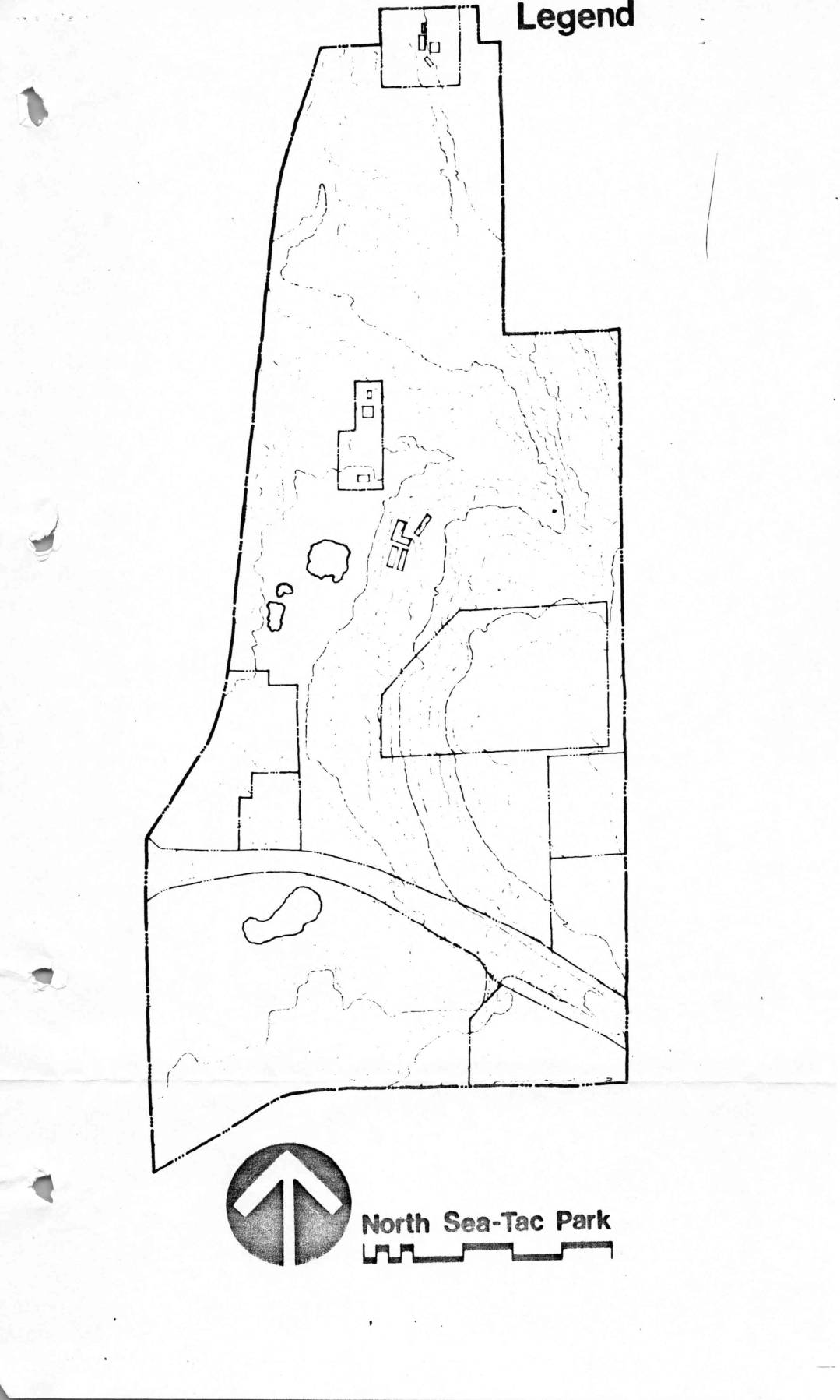
This document contains planning materials for North Sea-Tac Park from around 1979, including a base map of the park and four alternative development concept plans ranging from fully passive (nature-focused) to fully active (sports and recreation facilities). It also includes a roster of the North Clear Zone Advisory Committee, dated July 10, 1979, listing approximately 40 community members with their addresses, phone numbers, and areas of recreational interest such as golf, baseball, trails, and general planning. The materials reflect community input efforts related to land use and park development in the airport noise impact zone near Seattle-Tacoma International Airport. -
 1979-02-01
Zoning Map: North Sea-Tac Park Area, February 1979
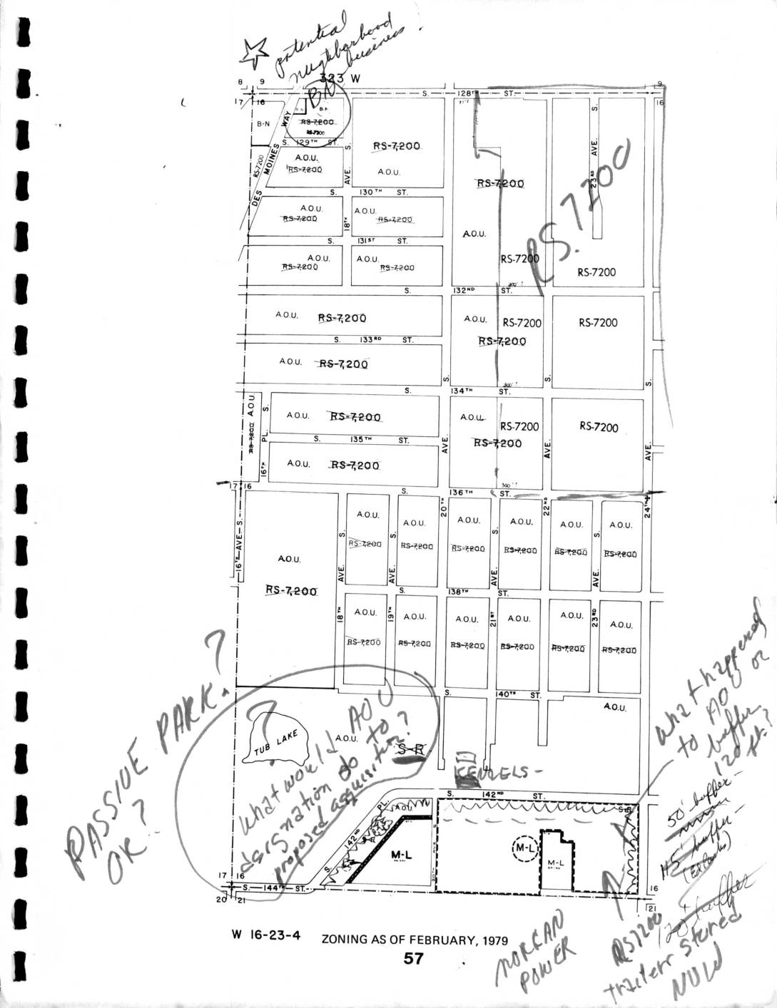
This is a zoning map dated February 1979 for section W 16-23-4, showing land use designations—primarily RS-7200 (single-family residential) and A.O.U. (Airport Operations Use) zones—in the area south of S. 128th Street near Seattle-Tacoma Airport. Handwritten annotations raise questions about passive park designations, proposed AOC/AOU classifications near Tub Lake, buffer distances (50-foot and 45-foot buffers are noted), and the status of an RS-7200 trailer storage site. The notes suggest an active policy review regarding how airport-related zoning categories and noise buffers should be applied to residential and transitional parcels in this neighborhood. -
 1979-01-01
Noise Monitoring System Site Locations Map
Figure 3 shows the locations of noise monitoring system sites around the Seattle-Tacoma Airport area, covering communities from Seattle in the north to Woodmont Beach and Poverty Bay in the south, including Burien, Normandy Park, and Des Moines along Puget Sound. The map displays numbered monitoring stations positioned throughout the region to measure aircraft noise impacts on surrounding neighborhoods. This figure was likely part of an environmental or noise impact study related to Sea-Tac Airport operations. -
 1978-08-28
FAA Noise Density Guidelines North Sea-Tac Park
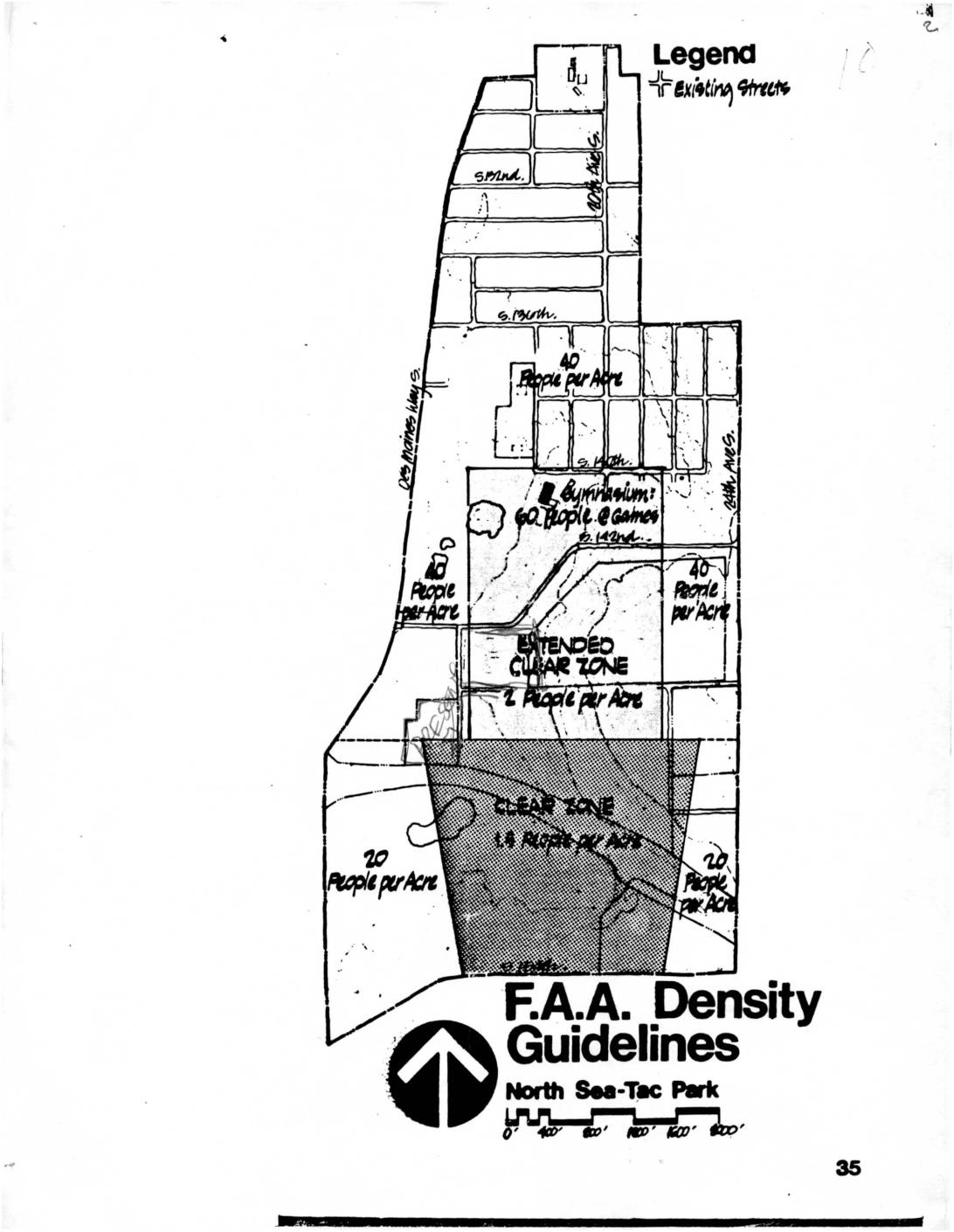
This document presents F.A.A. Density Guidelines for North Sea-Tac Park, a neighborhood near Seattle-Tacoma International Airport. It maps out population density limits across different zones, ranging from 1.5 people per acre in the Clear Zone closest to the airport, to 2 people per acre in the Extended Clear Zone, up to 20-40 people per acre in areas farther from the runway. The guidelines reflect FAA safety and noise policy restrictions that limit how many residents can live in areas most directly affected by airport flight paths. -
 1978-01-01
Sea-Tac International Airport Terminal Area Plan — Land-Use Map from the Sea-Tac Communities Plan (1978)
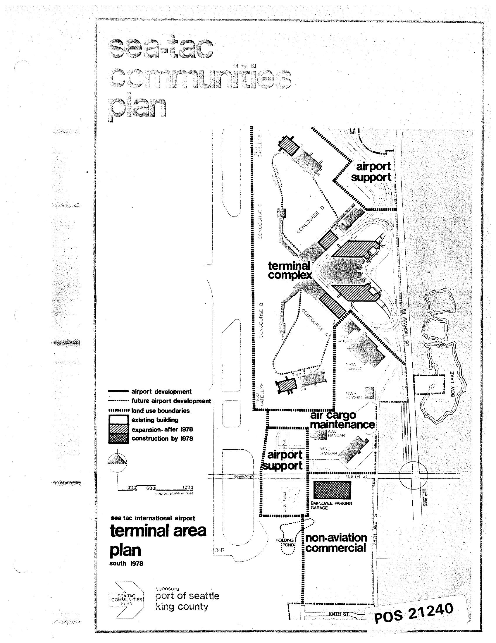
A land-use map from the Sea-Tac Communities Plan showing the Sea-Tac International Airport terminal area as of south 1978, sponsored by the Port of Seattle and King County. The map identifies zones including the terminal complex, airport support, air cargo maintenance, and non-aviation commercial areas, with a legend distinguishing existing buildings, expansions after 1978, and construction by 1978. Document reference number POS 21240. -
 1978-01-01
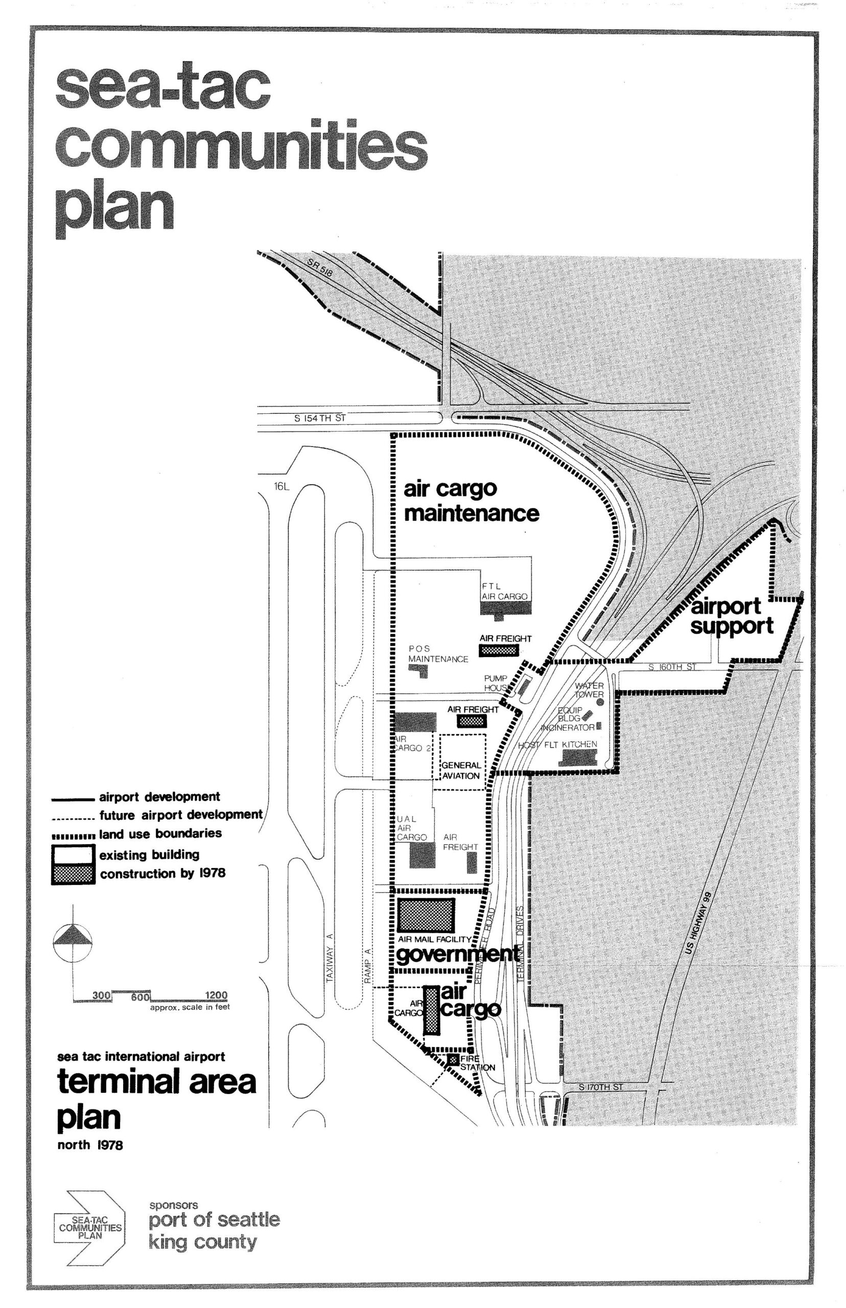
Sea-Tac International Airport North Terminal Area Plan Map, 1978
A land-use planning map from the Sea-Tac Communities Plan showing the north terminal area of Sea-Tac International Airport as of 1978, delineating zones for air cargo maintenance, airport support, government, and general aviation facilities, with existing buildings and planned construction indicated. The plan was sponsored by the Port of Seattle and King County, and shows key roadways including S 154th St, S 160th St, S 170th St, and US Highway 99.