TagMap(375)
-
 1976-06-16
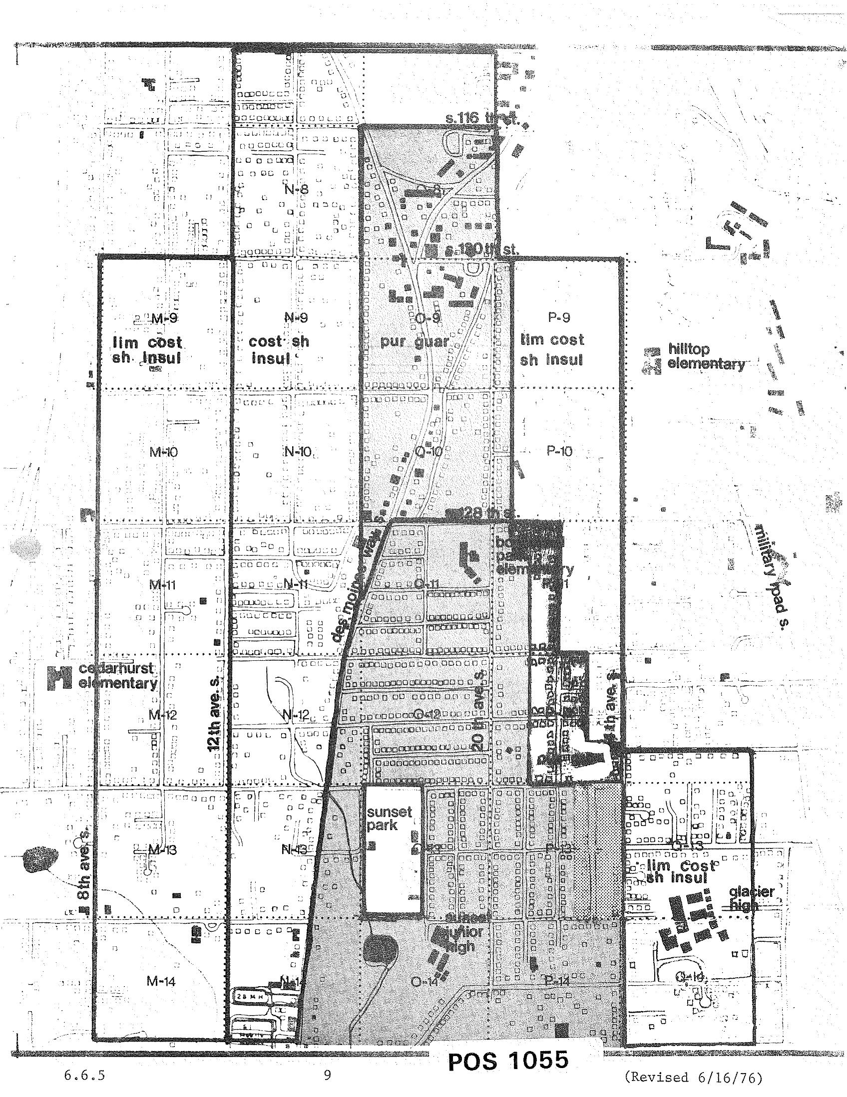
STCP Land Use and Noise Impact Zoning Grid Map, Revised June 16, 1976
A zoning/noise-impact grid map labeled 'POS 1055,' revised June 16, 1976, showing land-use designations (e.g., 'lim cost sh insul,' 'cost sh insul,' 'pur guar') in lettered and numbered grid cells around the Sea-Tac Airport corridor. Named landmarks visible include Cedarhurst Elementary, Hilltop Elementary, Bow Lake Elementary, Glacier High, Sunset Park, Sunset Junior High, 12th Ave S., 8th Ave S., Military Road S., and streets S. 116th, S. 120th, and S. 128th. -
 1976-06-16
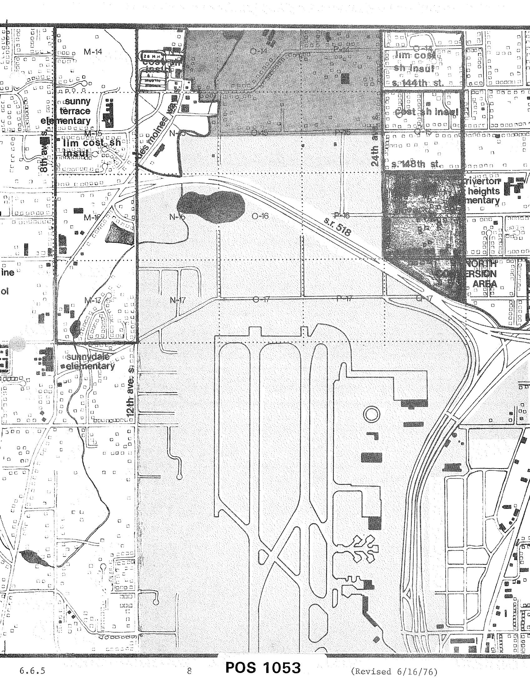
POS 1053 Zoning and Land Use Map — Sea-Tac Airport Area (Revised June 16, 1976)
A planning or zoning map labeled 'POS 1053' (revised June 16, 1976, document section 6.6.5) showing the area surrounding Seattle-Tacoma International Airport, including grid sections M, N, O, and P in rows 14–17, S.R. 518, 24th Avenue, 148th Street, 144th Street, 12th Avenue S., and nearby landmarks such as Sunny Terrace Elementary, Sunnydale Elementary, and Riverton Heights Elementary, with a designated 'North Conversion Area' visible in the upper right. -
 1975-05-27
Part 6 – chapter 6.7 map supplement
Chapter 6.7 map supplement from the Sea-Tac Communities Plan showing proposed land use plans for the airport and surrounding vicinity. The document contains color-coded maps displaying various land use categories including residential, commercial, industrial, and airport facilities. -
 1975-04-22
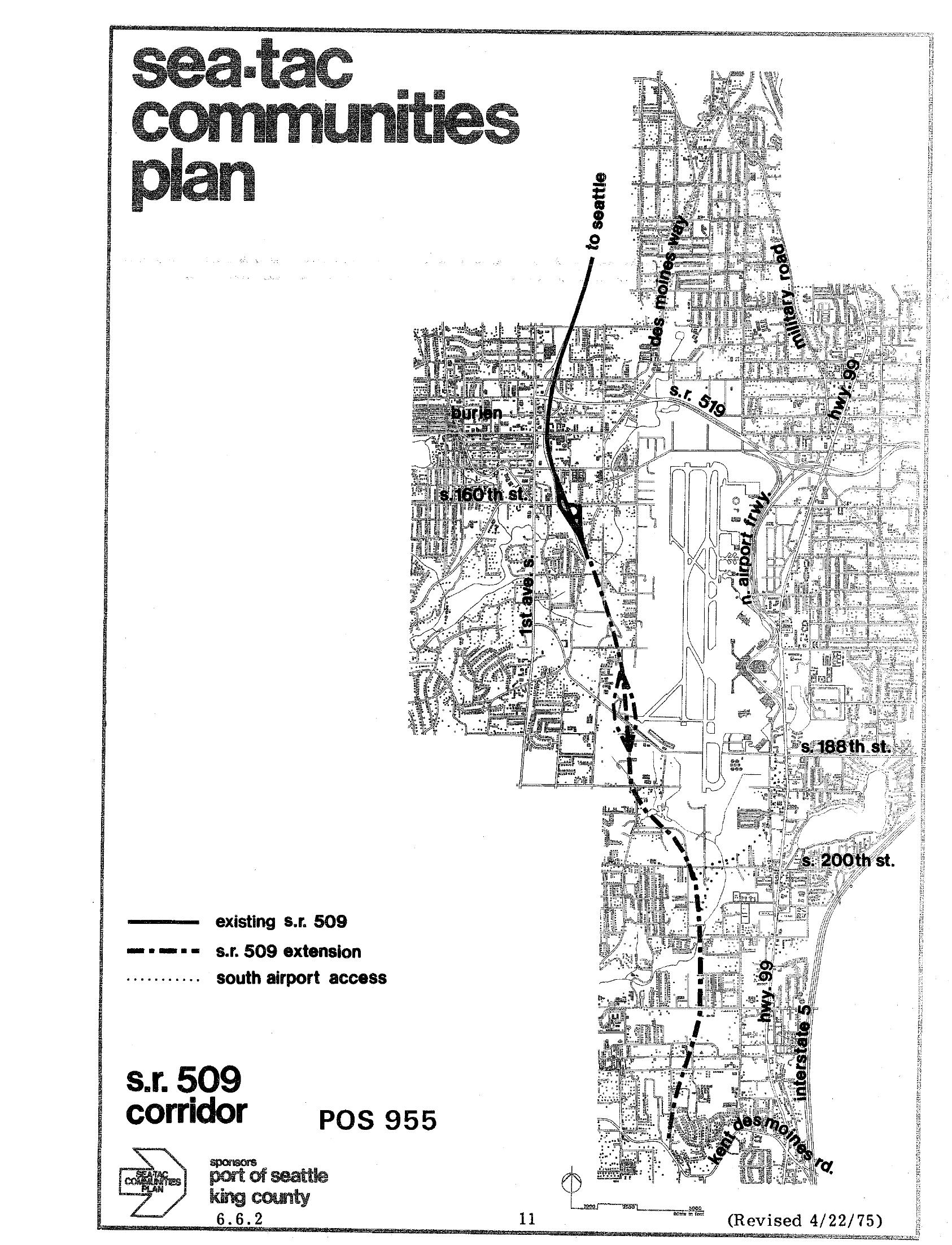
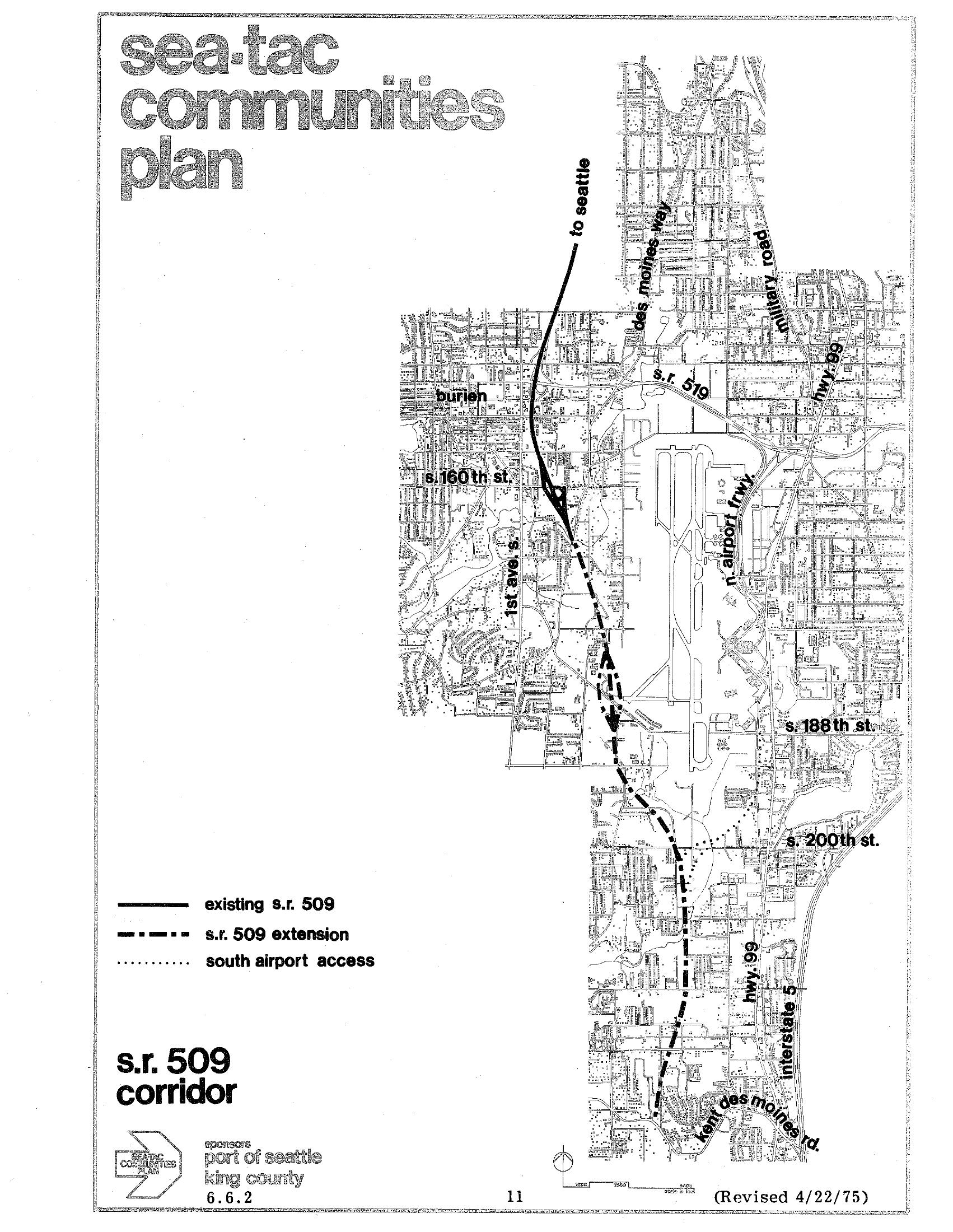
SR 509 Corridor Planning Map — Sea-Tac Communities Plan (POS 955), April 1975
A planning map from the Sea-Tac Communities Plan (POS 955), sponsored by the Port of Seattle and King County, showing the existing S.R. 509 alignment, the proposed S.R. 509 extension, and the south airport access route in the vicinity of Seattle-Tacoma International Airport. The document is dated revised 4/22/75 and is identified as page 11, section 6.6.2. -
 1975-04-22
STCP SR 509 Corridor Planning Map — Sea-Tac/Burien Area, April 1975
A planning map from the Sea-Tac Communities Plan (document section 6.6.2) depicting the S.R. 509 corridor, showing the existing S.R. 509 route, proposed S.R. 509 extension, and south airport access roads in the SeaTac/Burien area of King County, Washington. The map is sponsored by the Port of Seattle and King County, revised April 22, 1975, and identifies key roads including Des Moines Way, Military Road, Highway 99, and Interstate 5. -
 1975-04-22
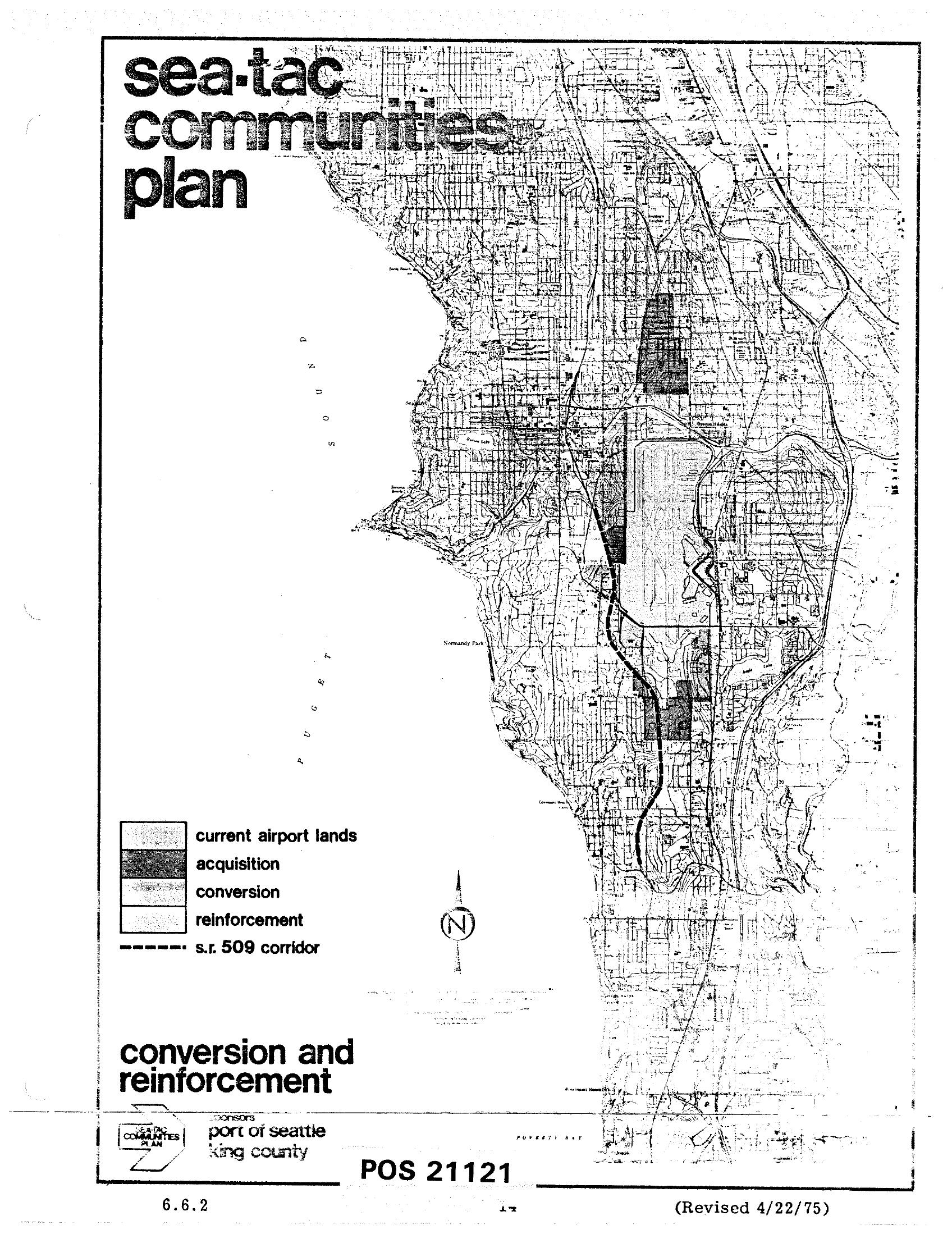
Sea-Tac Communities Plan Map 6.6.2 — Conversion and Reinforcement Areas (April 1975)
This is map sheet 6.6.2 (POS 21121, revised April 22, 1975) from the Sea-Tac Communities Plan, sponsored by the Port of Seattle and King County. It shows the area around Seattle-Tacoma International Airport with land-use designations including current airport lands, acquisition zones, conversion areas, reinforcement areas, and the proposed S.R. 509 corridor, overlaid on a street grid map extending from Puget Sound eastward. -
 1975-04-22
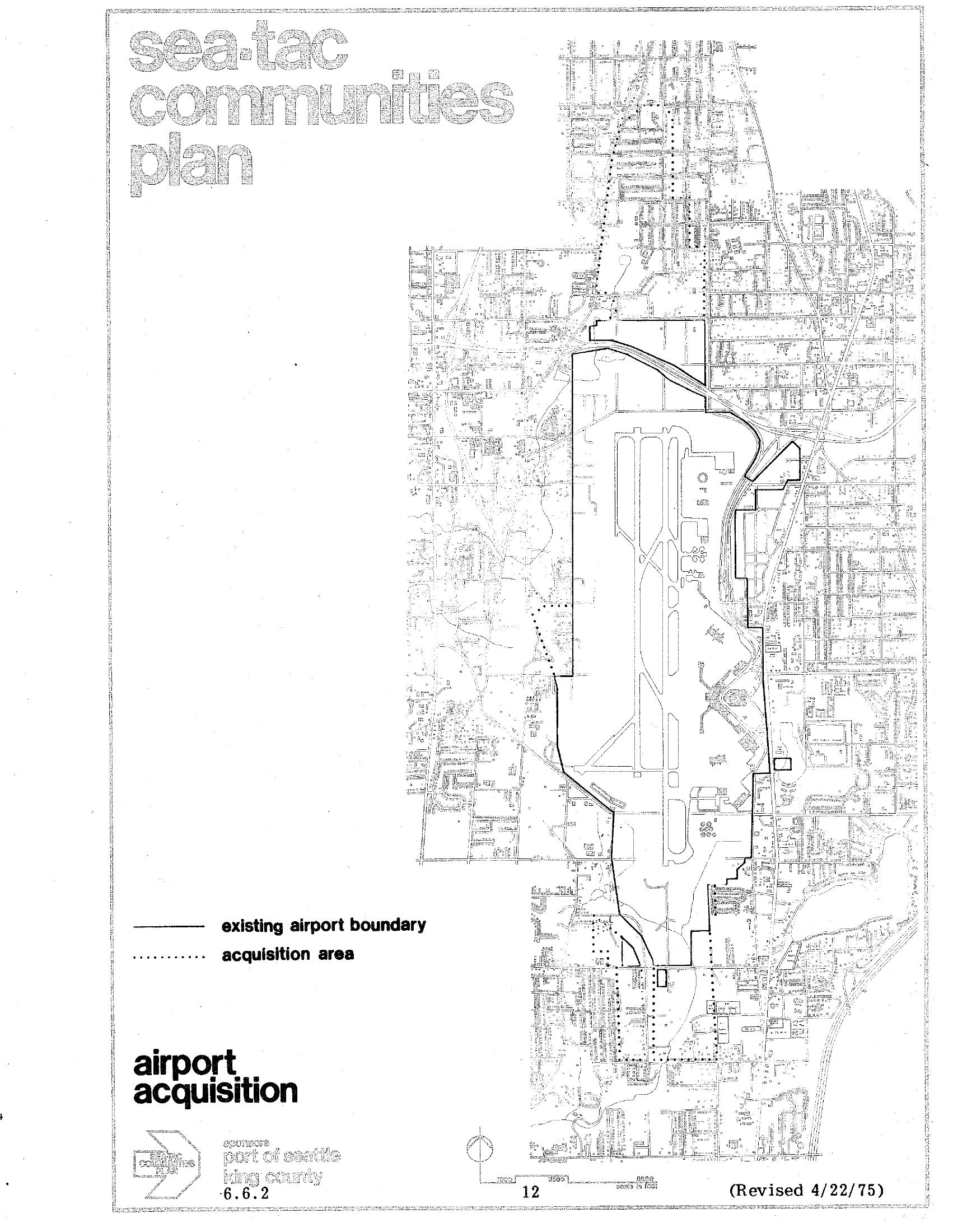
Sea-Tac Communities Plan Airport Acquisition Map (Plate 6.6.2), April 1975
Map plate 6.6.2 from the Sea-Tac Communities Plan, revised April 22, 1975, showing the existing Seattle-Tacoma International Airport boundary (solid line) and the proposed acquisition area (dotted line). The document is sponsored by the Port of Seattle and King County and is labeled 'airport acquisition,' page 12. -
 1975-04-22
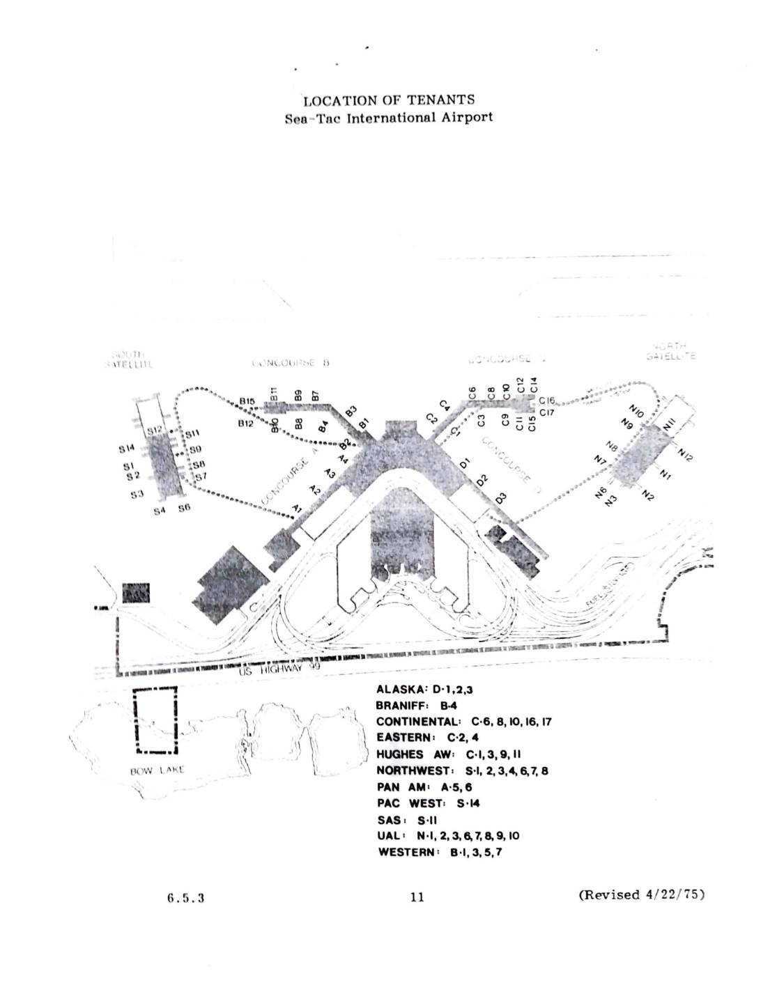
Location of tenants: Sea-Tac International Airport
This 1975 document shows the location of airline tenants at Sea-Tac International Airport, mapping gate assignments across the airport's concourses and satellite terminals. Airlines listed include Alaska, Braniff, Continental, Eastern, Hughes Airwest, Northwest, Pan Am, Pacific West, SAS, United Air Lines, and Western. The map identifies each carrier's specific gate numbers within Concourses B and C, the North and South Satellites, and other terminal areas. -
 1975-01-01
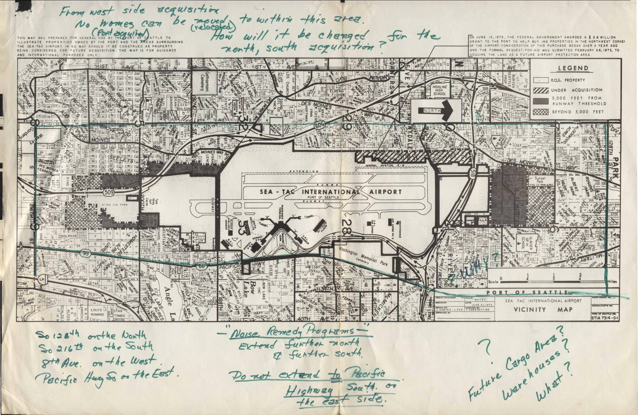
Sea-Tac International Airport Map with Handwritten Notes
Vicinity Map of Sea-Tac International Airport and surrounding areas including runways, terminals, and nearby communities from the Sea-Tac Communities Plan committee. The map contains extensive handwritten annotations and notes from Virginia Dana concerning relocation, warehouses and HB1328. -
 1974-01-01
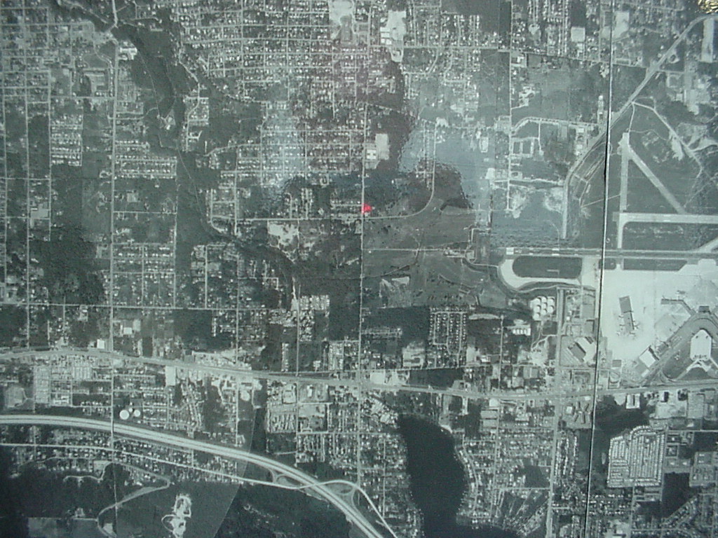
1974 Aerial Photograph of Sea-Tac Airport and Surrounding Urban Grid
Black-and-white aerial photograph showing a densely developed urban grid with what appears to be an airport facility with runways visible in the upper-right quadrant. A small red marker is visible near the center of the image, possibly indicating a reference point on the map.