TagMap(375)
-
 1999-09-16
EXH AR042985: Fax Transmittal and Map — Proposed Groundwater Level Monitoring Well Network, STIA Groundwater Study
Fax transmittal dated 9/16/99 from John Strunk of Associated Earth Sciences, Inc. (Bainbridge Island, WA) to Roger Nye at Ecology, transmitting a map showing proposed well locations for measuring groundwater levels at Seattle-Tacoma International Airport (STIA). The attached map titled ‘Proposed Groundwater Level Monitoring Well Network, STIA Groundwater Study’ (September 16th, 1999) shows on-site and -
 1999-08-12
EXH AR043187: Conceptual Flow Model Boundary Presentation — STIA Ground Water Study
Conceptual Flow Model Boundary Presentation for the Seattle-Tacoma International Airport (STIA) Ground Water Study, prepared by Associated Earth Sciences, Inc. and S.S. Papadopulos and Associates, Inc. for Port Of Seattle. Document AR043187 includes a Project Area Map (Figure 1, dated 08/03/99) showing the data collection boundary, Airport Operations and Maintenance Area (AOMA), wellhead protection delineation -
 1999-05-01
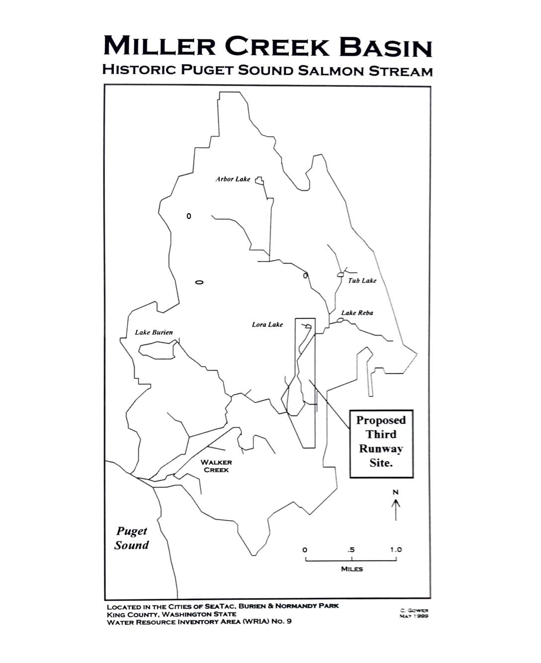
Miller Creek Basin: Historic Puget Sound Salmon Stream — Basin Map with Proposed Third Runway Site
This 1999 document by C. Gower describes the Miller Creek Basin, a historic Puget Sound salmon stream located in the cities of SeaTac, Burien, and Normandy Park in King County, Washington (Water Resource Inventory Area No. 9). The basin includes several lakes — Arbor, Tub, Reba, Lora, and Burien — and drains into Puget Sound via Miller Creek and Walker Creek. The map highlights the proposed Third Runway site at Sea-Tac Airport within the watershed, raising concerns about potential environmental impacts to this salmon-bearing stream system. -
 1999-01-01
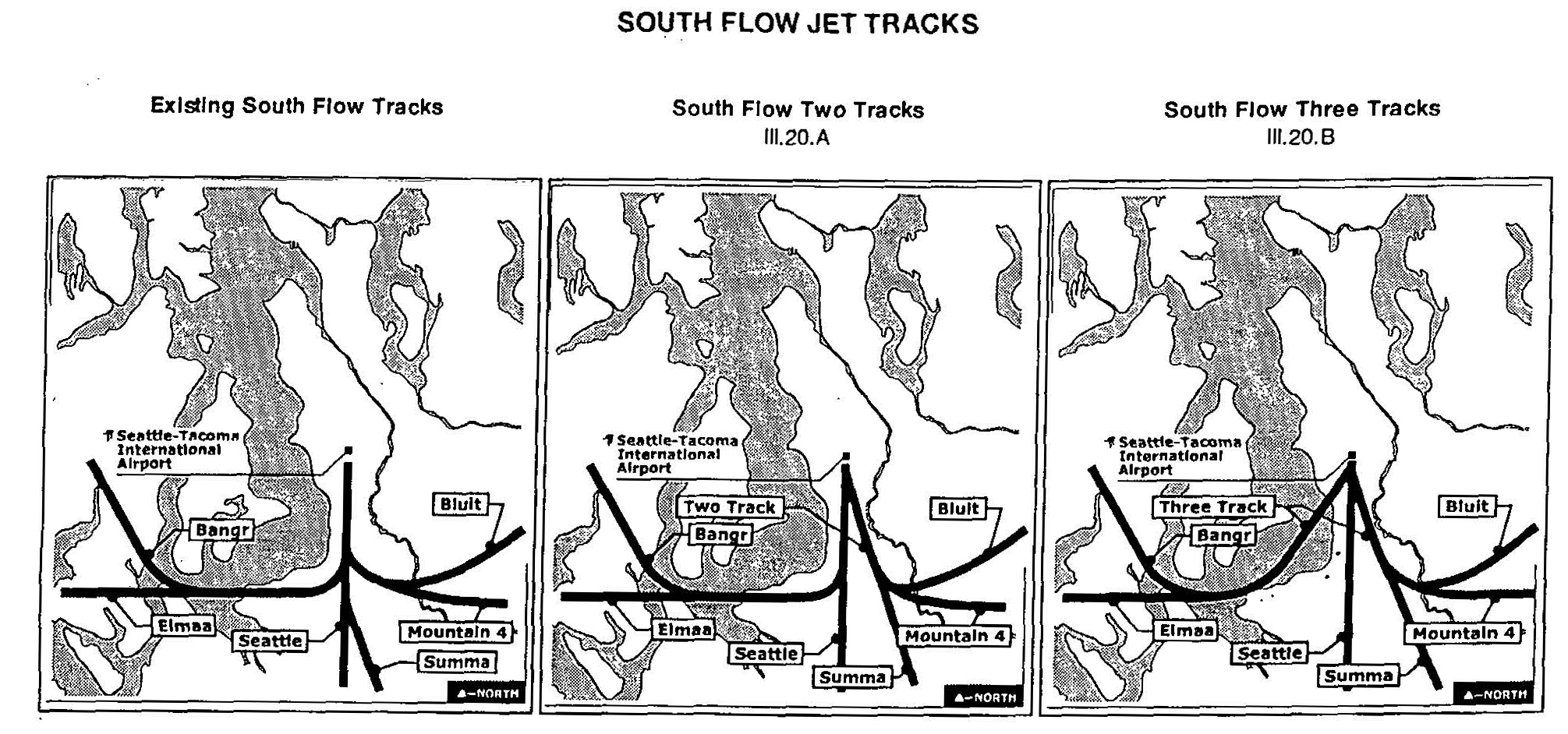
Resolution No. 882 Expressing the Council’s Preference for the South Flow Flight Track, 1999
Three maps comparing existing and proposed south flow jet departure tracks at Seattle-Tacoma International Airport, showing waypoints including Bangr, Bluit, Elmaa, Seattle, Summa, and Mountain 4. The proposed alternatives are labeled 'South Flow Two Tracks' (III.20.A) and 'South Flow Three Tracks' (III.20.B), consistent with an environmental or noise impact study for Sea-Tac Airport. -
 1998-08-01
Part 150 Noise Monitoring Locations: Seattle-Tacoma International Airport
This document maps the Part 150 Noise Monitoring Locations surrounding Seattle-Tacoma International Airport, as prepared by the Port of Seattle in August 1998. It identifies dozens of measurement sites categorized as permanent, semi-permanent, or temporary, spread across communities north and south of the airport including Burien, Des Moines, Normandy Park, Mercer Island, and as far north as the University District. Each site is listed with its specific street address or intersection, providing a detailed geographic record of how aircraft noise was tracked across the wider Seattle-Tacoma region. -
 1998-06-01
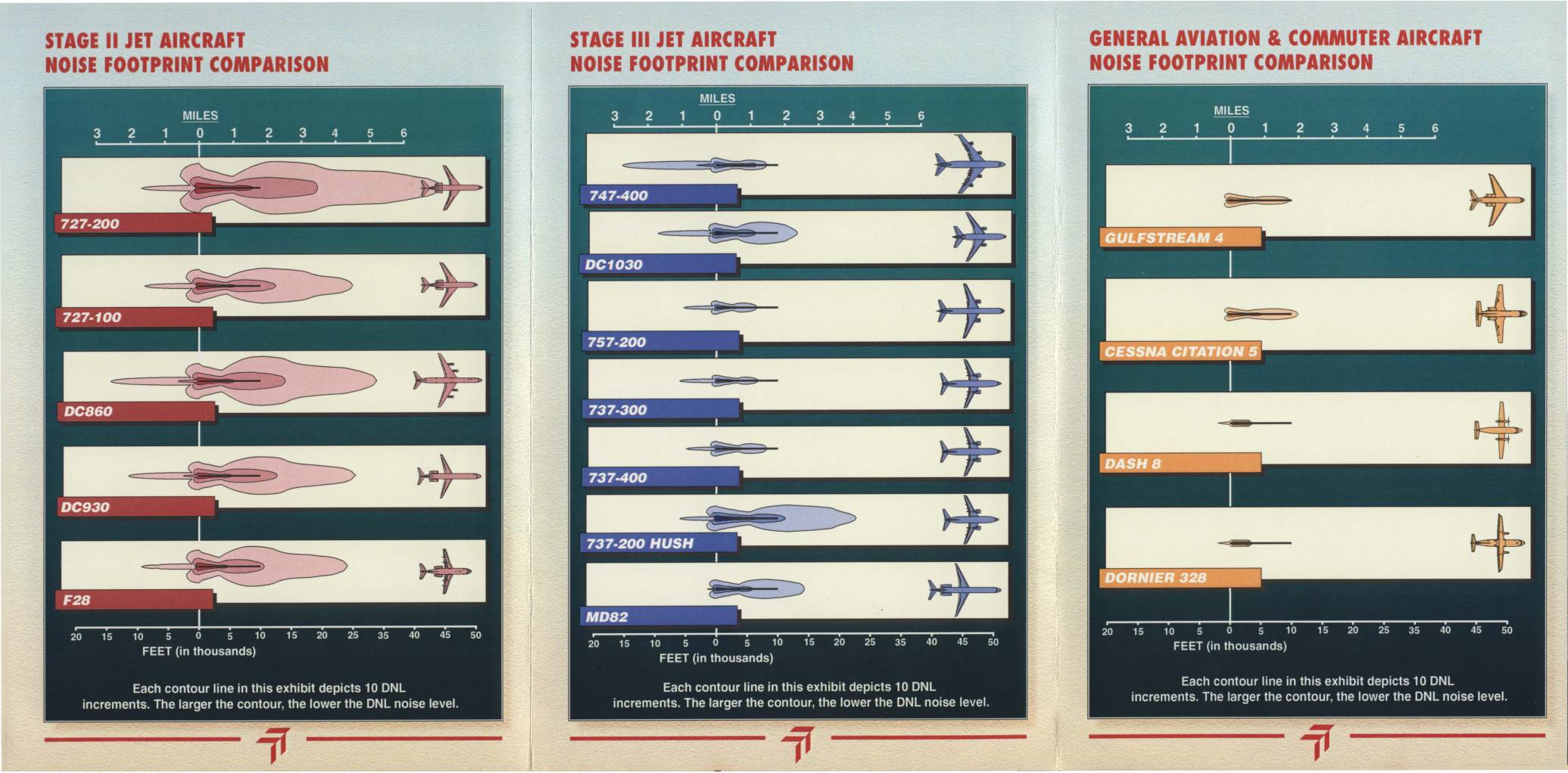
Sea-Tac International Airport: Commercial Aircraft Noise Footprint Comparison
This Sea-Tac International Airport brochure, prepared by the Port of Seattle in Summer 1998, compares the noise footprints of Stage II jets, Stage III jets, and general aviation/commuter aircraft to help residents understand the noise impacts of different aircraft types. It explains that Stage III aircraft are significantly quieter than Stage II aircraft, and that replacing older Stage II planes with newer Stage III models would meaningfully reduce noise levels in surrounding communities. The document also defines key noise measurement terminology, including DNL (Day-Night Average Sound Level), and notes that nighttime flights carry a 10-decibel penalty in noise accounting. -
 1998-06-01
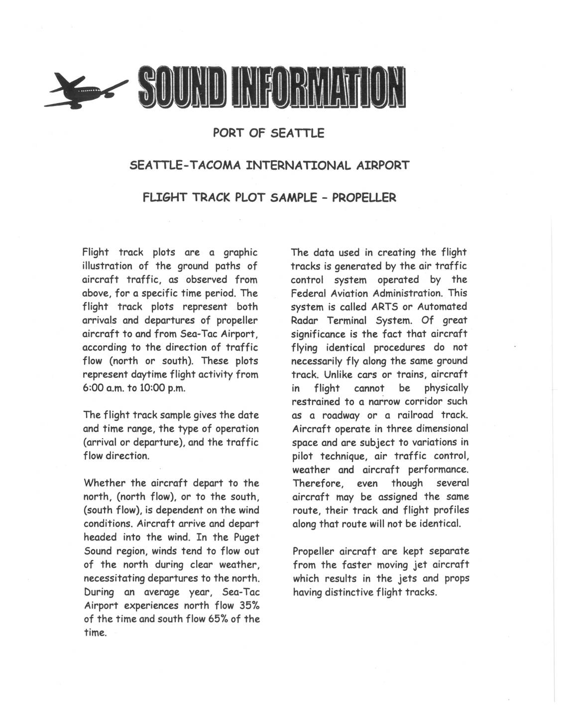
Port Of Seattle Sea-Tac Propeller Aircraft Flight Track Patterns
This Port of Seattle document explains flight track plots for propeller aircraft at Seattle-Tacoma International Airport, showing the ground paths of arrivals and departures during daytime hours (6 a.m. to 10 p.m.) for both north and south traffic flows. Aircraft flight paths vary due to pilot technique, weather, and air traffic control, meaning planes assigned the same route will not follow identical tracks. On average, Sea-Tac experiences south flow conditions 65% of the year and north flow 35%, with propeller aircraft kept on separate tracks from faster jet aircraft. -
 1997-10-01
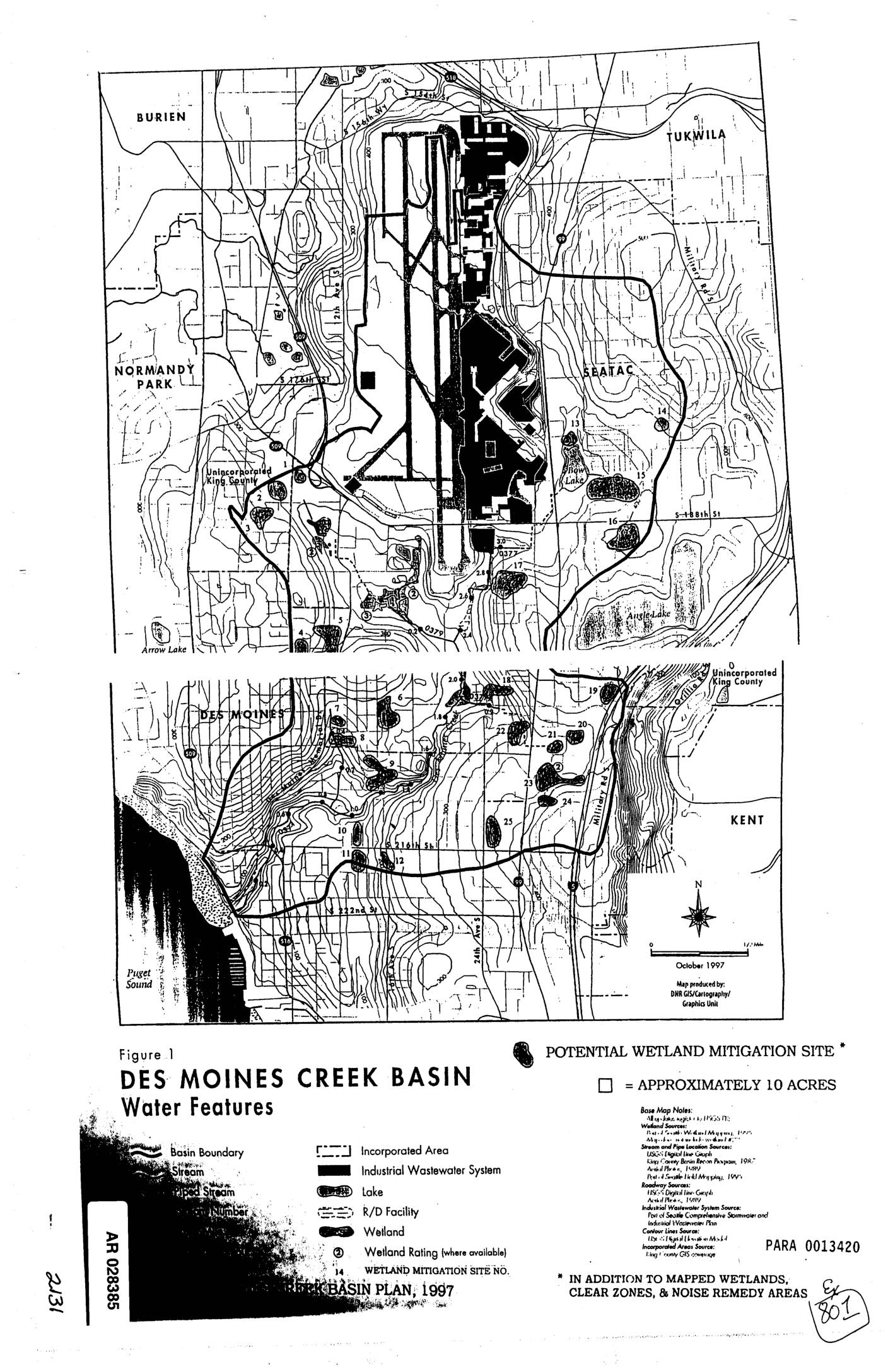
EXH AR028385: Des Moines Creek Basin Water Features Map — Potential Wetland Mitigation Sites
Figure 1 from the Des Moines Creek Basin Plan (1997), a map produced by DNR GIS/Cartography/Graphics Unit showing water features and potential wetland mitigation sites in the Des Moines Creek Basin. Covers areas including Burien, Normandy Park, SeaTac, Tukwila, Des Moines, Kent, and unincorporated King County. Map legend identifies basin boundary, streams, piped streams, wetlands, -
 1997-06-01
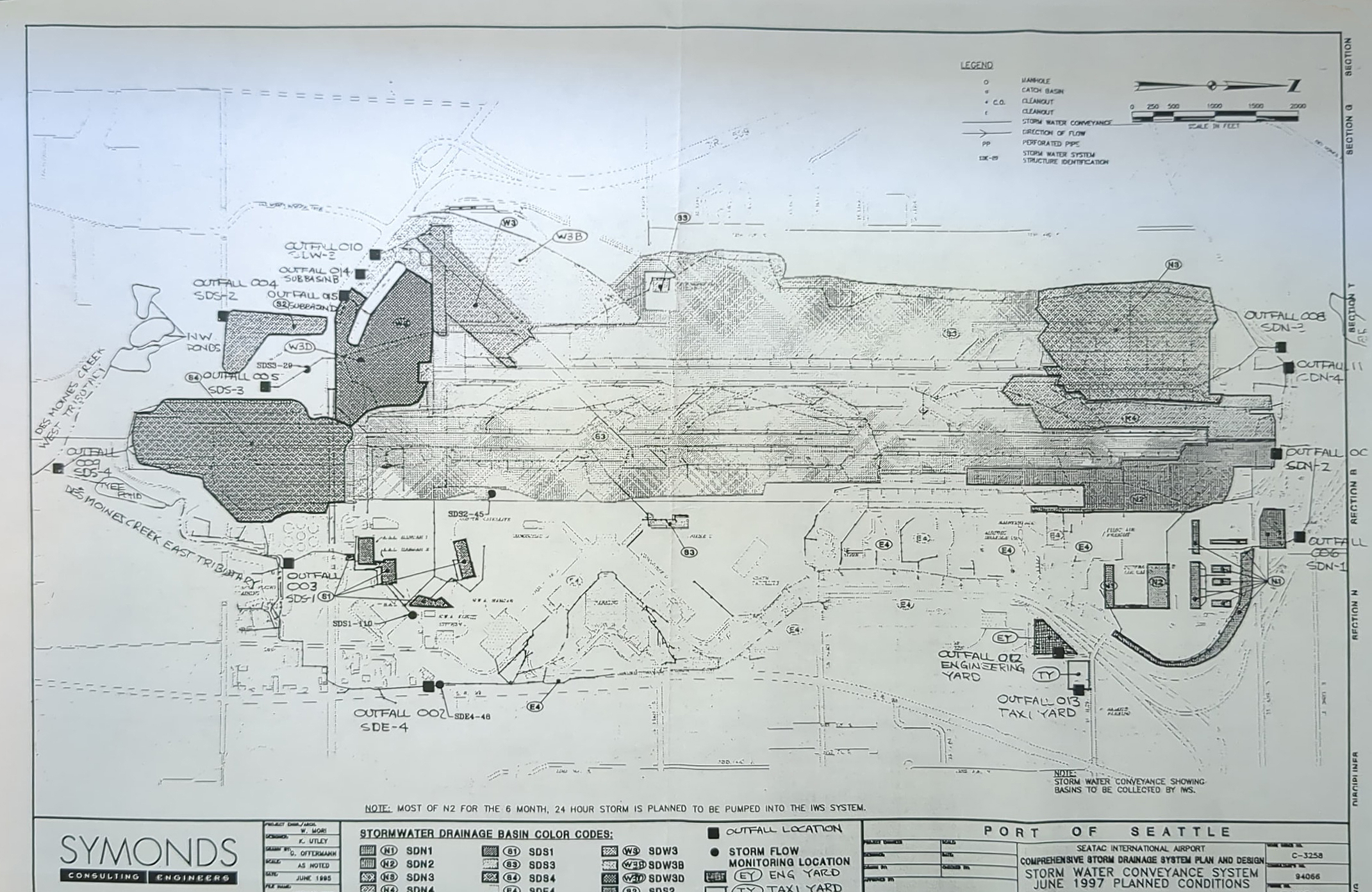
Symonds Stormwater System June 1997
Engineering drawing prepared by Symonds Consulting Engineers for the Port of Seattle, titled 'Comprehensive Storm Drainage System Plan and Design – Storm Water Conveyance System, June 1997 Planned Conditions' (Drawing No. C-3258, Project No. 94066). The plan depicts SeaTac International Airport's stormwater drainage basins, outfall locations (Outfalls 002–016), storm flow monitoring locations, and drainage connections to Des Moines Creek and its east tributary. -
 1994-01-01
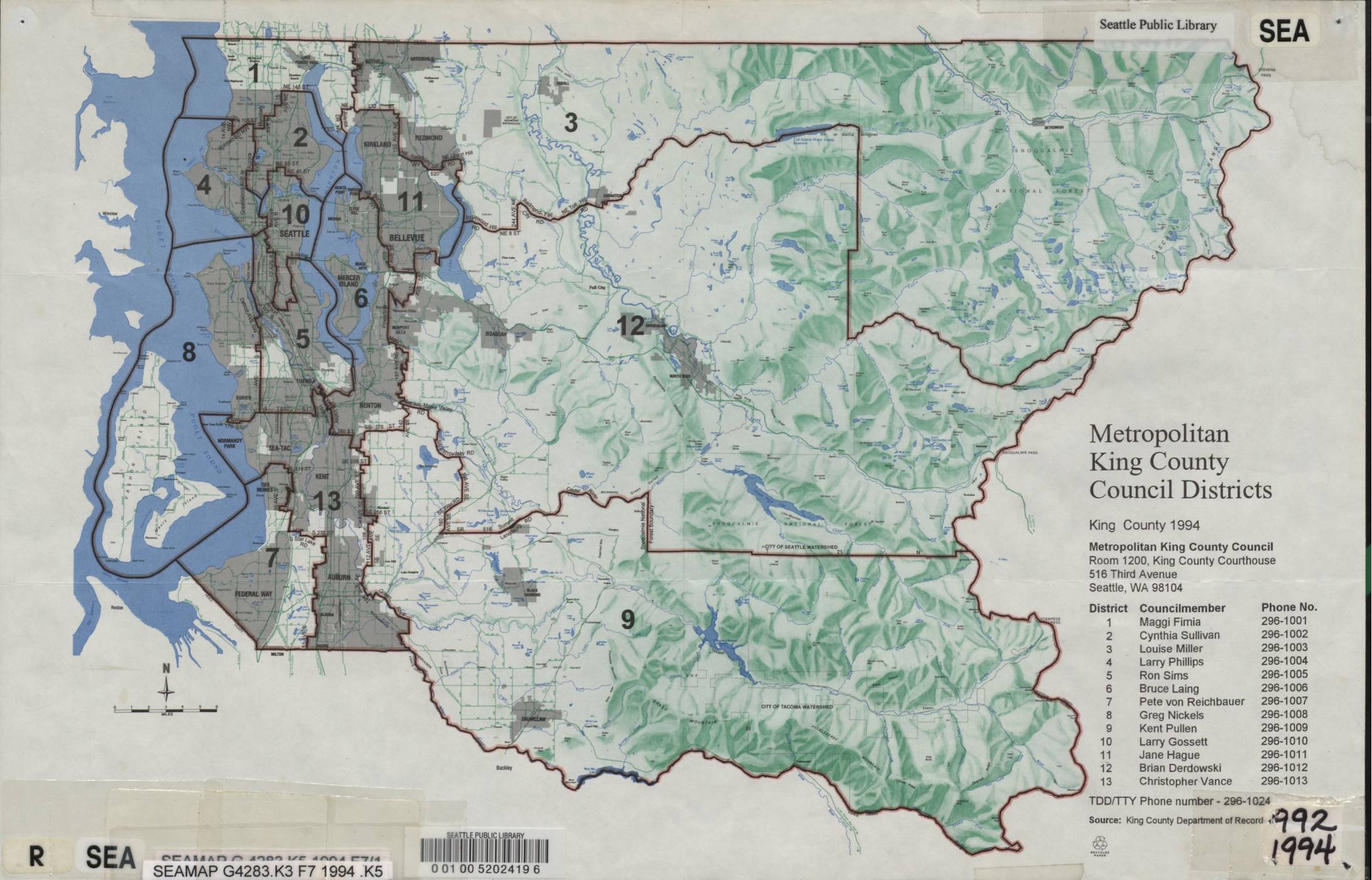
Metropolitan King County Council Districts Map, King County 1994
This 1994 map from the Seattle Public Library shows the Metropolitan King County Council Districts, dividing King County, Washington into 13 districts. It lists each district's elected councilmember and contact phone number, with the council headquartered at Room 1200, King County Courthouse, 516 Third Avenue, Seattle. While primarily a political boundary reference document, it provides geographic and governance context for the King County region surrounding Sea-Tac Airport.