TagMap(375)
-
 1978-01-01
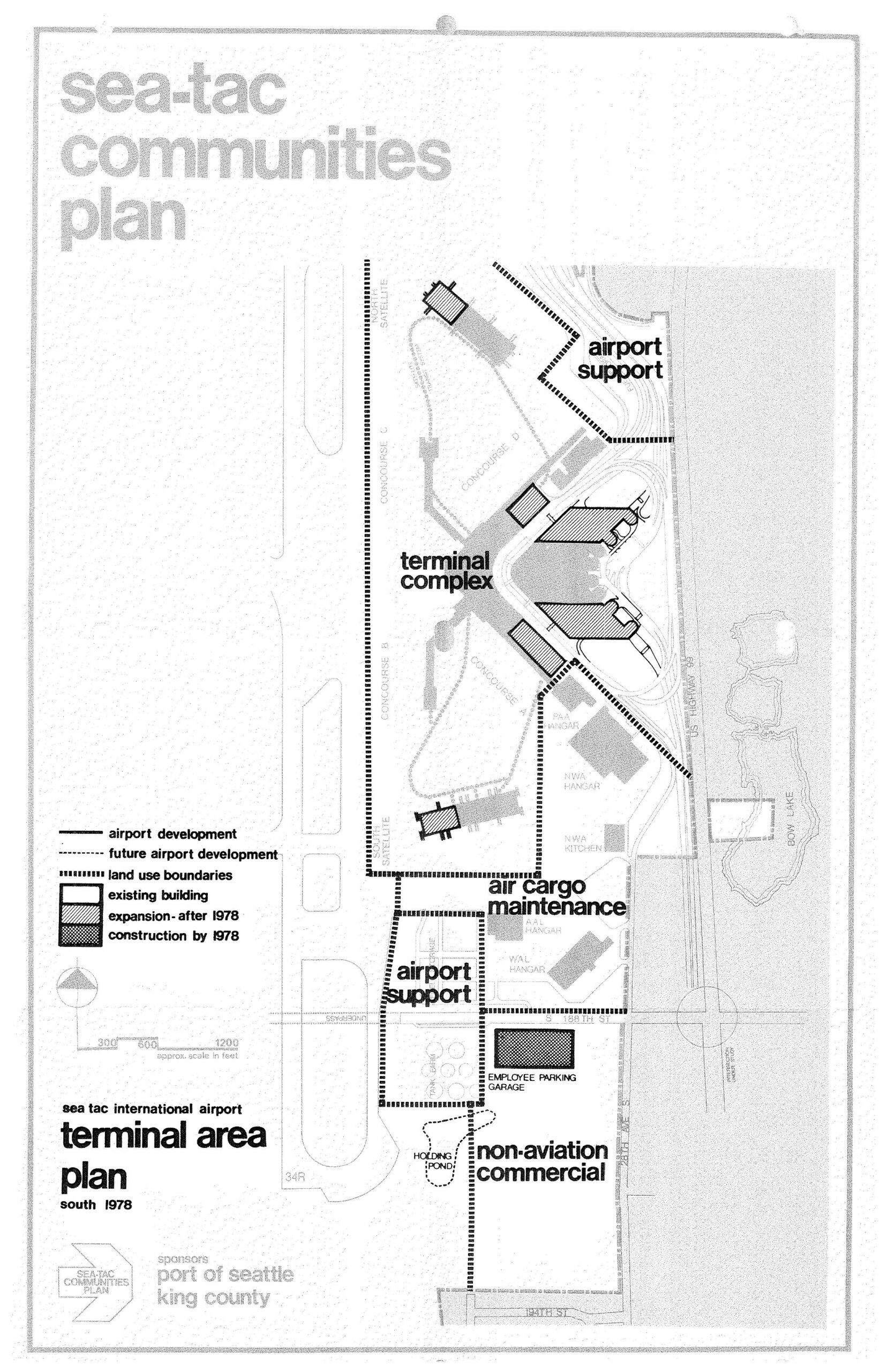
Sea-Tac International Airport Terminal Area Plan South — STCP, 1978
A planning map from the Sea-Tac Communities Plan, sponsored by the Port of Seattle and King County, depicting the Sea-Tac International Airport terminal area as of 1978. The map identifies land use zones including the terminal complex, airport support areas, air cargo maintenance, non-aviation commercial, and an employee parking garage, with a legend distinguishing existing buildings, post-1978 expansions, and construction completed by 1978. -
 1978-01-01
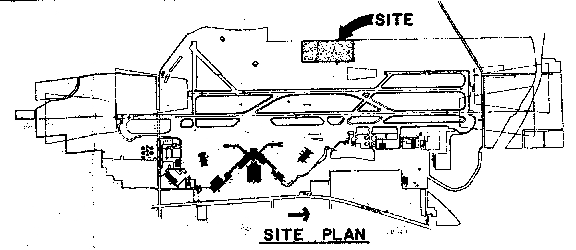
Boeing Headquarters Proposal Map
A site plan diagram of Seattle-Tacoma International Airport, with an arrow and label identifying a specific 'SITE' location in the northern portion of the airport property. The plan shows runway configurations, taxiways, terminal areas, and surrounding land uses. -
 1978-01-01
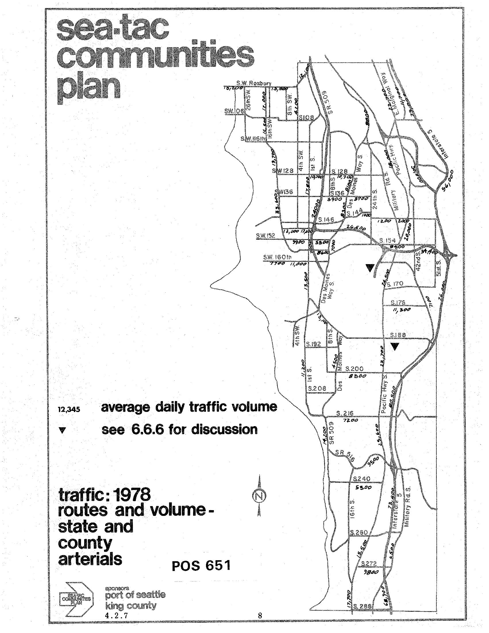
STCP 1978 Traffic Routes and Volumes: State and County Arterials
A traffic map from the Sea-Tac Communities Plan (document reference POS 651, section 4.2.7) showing 1978 average daily traffic volumes on state and county arterials in the Sea-Tac area. The map was sponsored by the Port of Seattle and King County, and displays traffic counts on major roads including SR 509, Pacific Highway S, Military Road, and various numbered streets (SW 128th through S 272nd). -
 1977-01-01
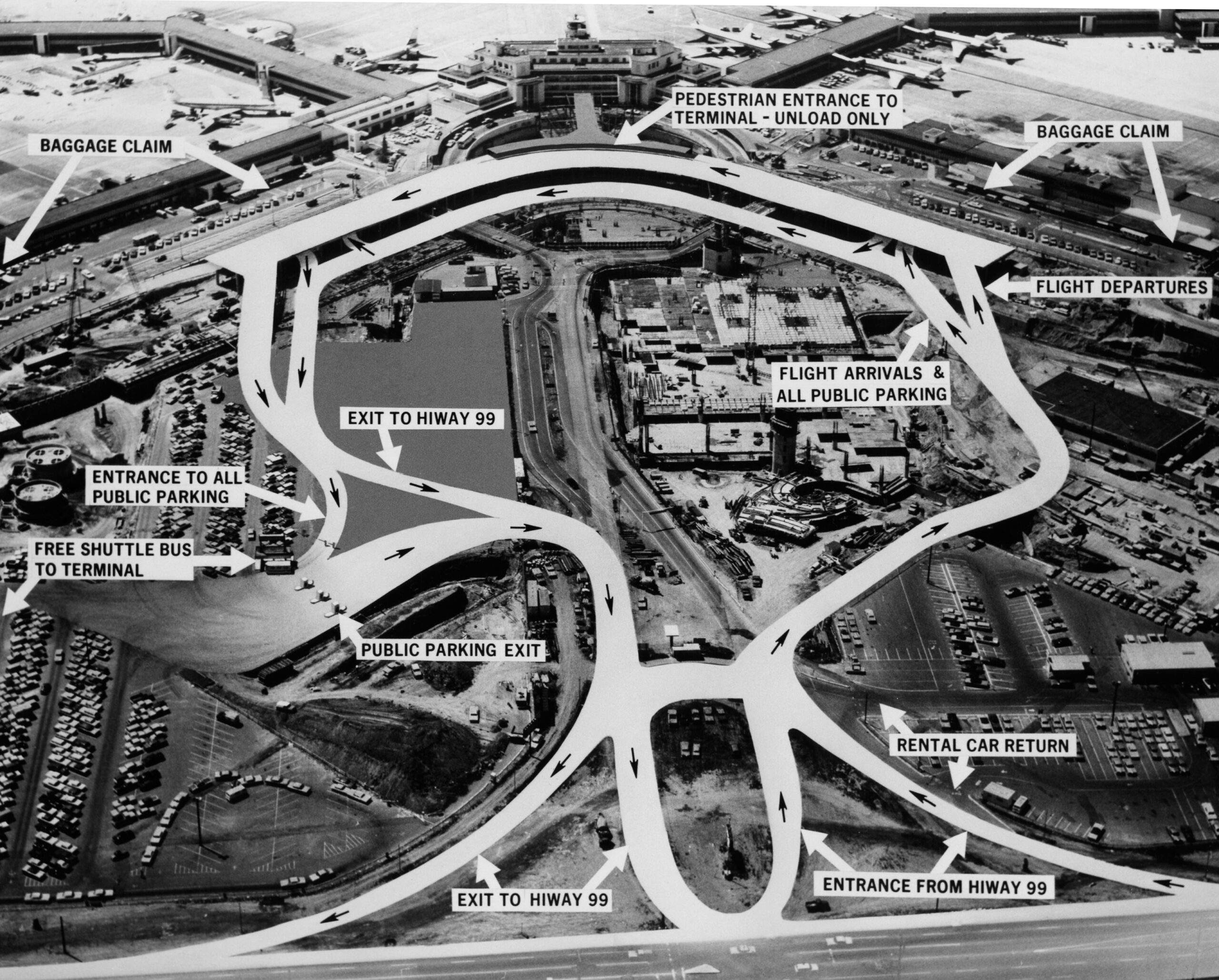
Sea-Tac access road patterns
An annotated aerial photograph of Seattle-Tacoma International Airport showing vehicular traffic flow patterns, with labeled destinations including Baggage Claim, Flight Arrivals, Flight Departures, Rental Car Return, Public Parking entrances and exits, and connections to Highway 99. A free shuttle bus service to the terminal from public parking lots is also indicated. -
 1976-07-01
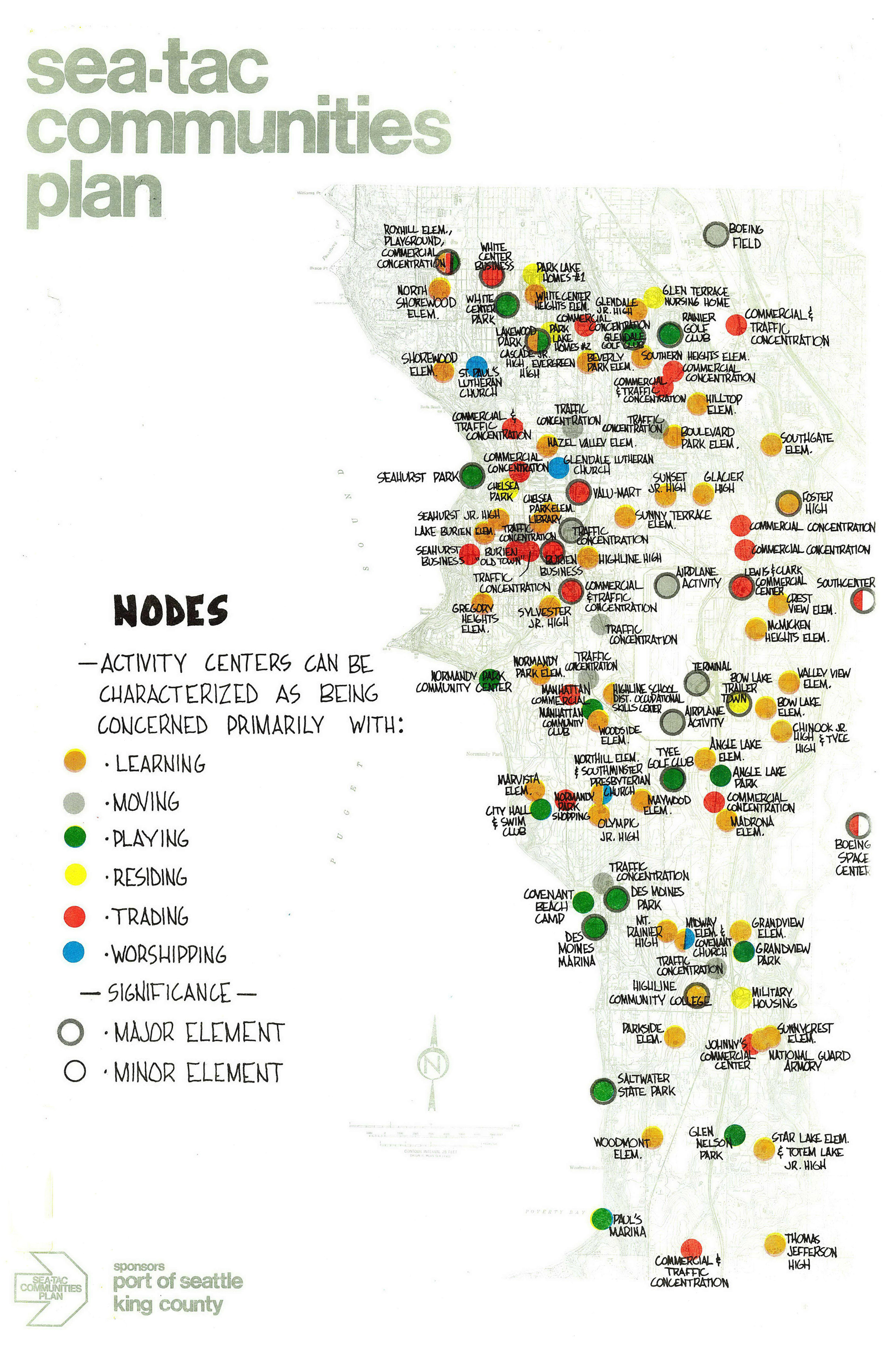
Sea-Tac Communities Plan: Nodes map
A community planning map produced for the Sea-Tac Communities Plan, sponsored by the Port of Seattle and King County, showing activity-center nodes across the Sea-Tac area classified by function (learning, moving, playing, residing, trading, worshipping) and significance (major or minor element). Named locations include schools, parks, commercial concentrations, traffic concentrations, Boeing Field, and Boeing Space Center, among others. -
 1976-06-16
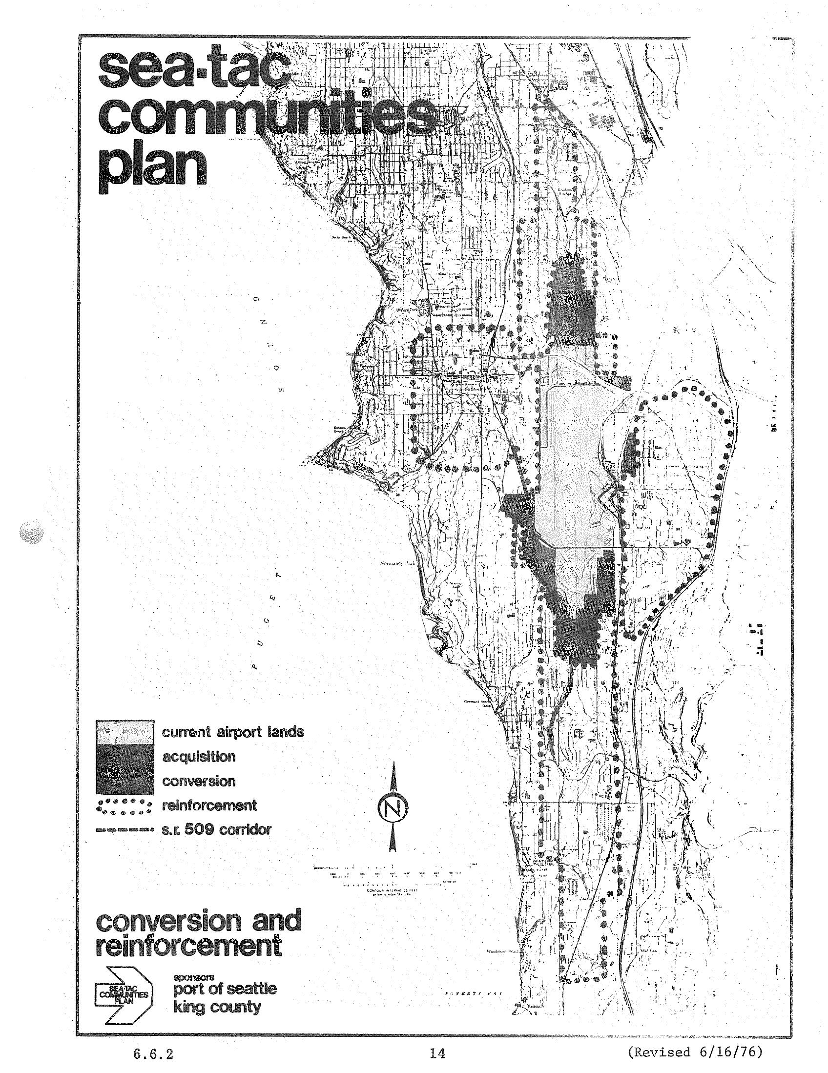
Sea-Tac Communities Plan Land Use Map — Conversion and Reinforcement Areas (1976)
A planning map from the Sea-Tac Communities Plan (page 14, revised June 16, 1976), sponsored by the Port of Seattle and King County, depicting current airport lands, acquisition zones, conversion areas, reinforcement areas (dotted pattern), and the S.R. 509 corridor in the Sea-Tac region along Puget Sound. The map illustrates land use strategies for communities affected by Seattle-Tacoma International Airport noise and expansion. -
 1976-06-16
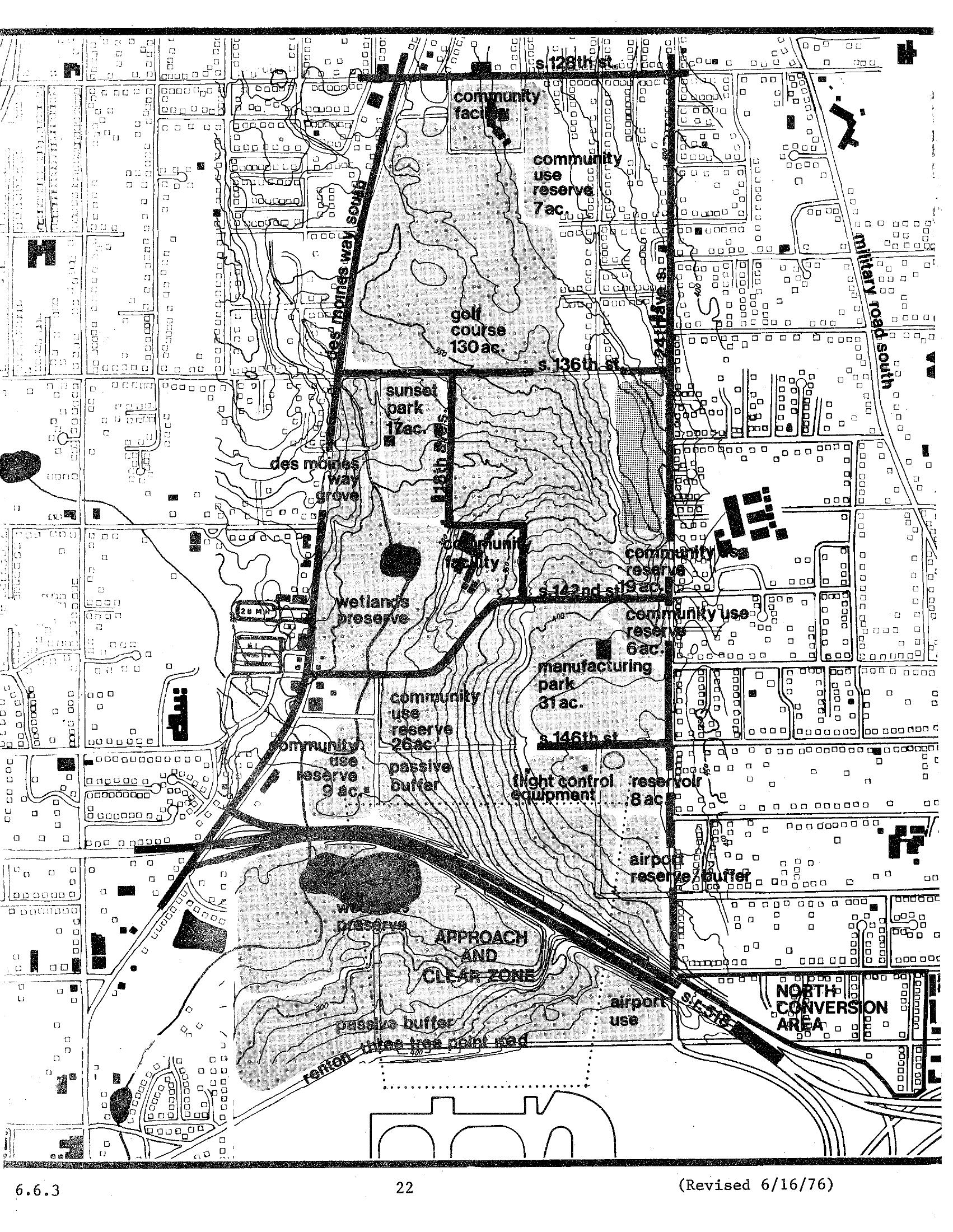
Sea-Tac Communities Plan Chapter 6, Page 22 — North Subarea Land Use Map (1976)
A detailed planning map (page 22, revised June 16, 1976) showing land use designations around Seattle-Tacoma International Airport, including a golf course (130 ac.), wetlands preserve, manufacturing park (31 ac.), community use reserves, sunset park (17 ac.), approach and clear zone, and airport reserve/buffer areas bounded by S. 128th St. to the north and the Renton–Three Tree Point Road to the south along Military Road South. -
 1976-06-16
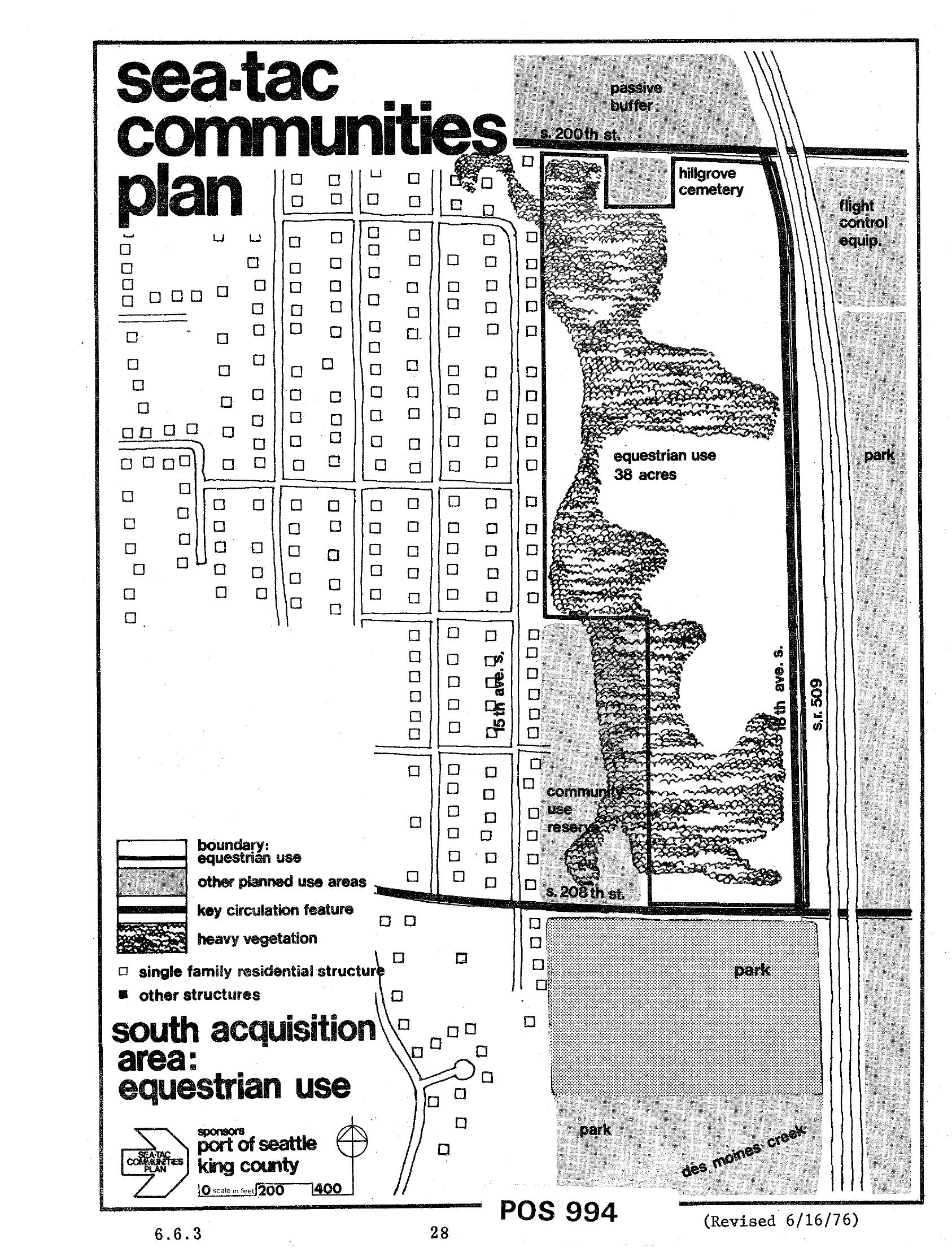
Sea-Tac Communities Plan South Acquisition Area Equestrian Zone Map, June 1976
A planning map labeled 'Sea-Tac Communities Plan' showing the south acquisition area designated for equestrian use, featuring a 38-acre equestrian zone, Hillgrove Cemetery, a community use reserve, and adjacent park areas near Des Moines Creek. The document is numbered POS 994, revised June 16, 1976, sponsored by the Port of Seattle and King County, and catalogued as page 28, section 6.6.3. -
 1976-06-16
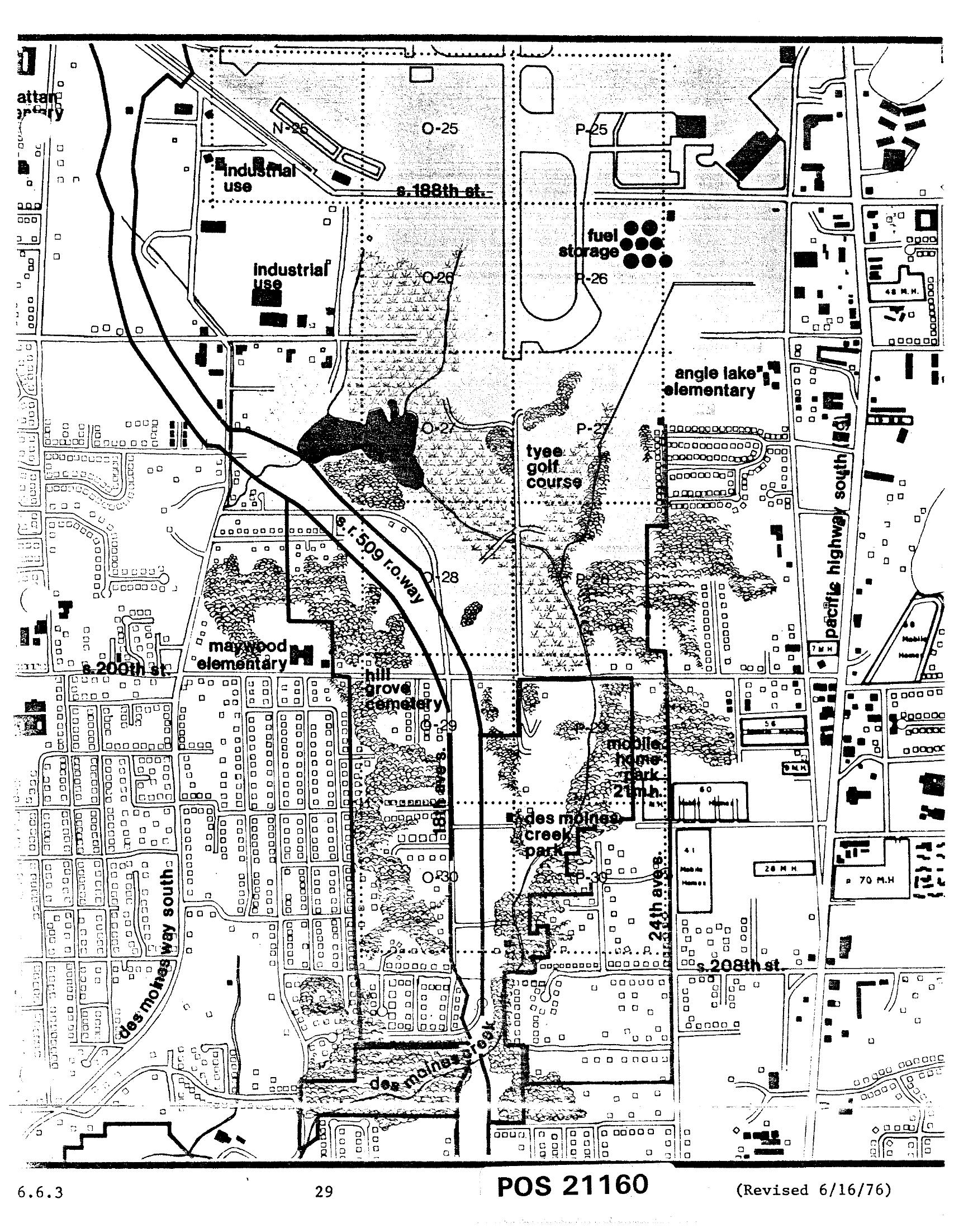
Sea-Tac Comprehensive Plan Land Use Zoning Map — Des Moines Area, Chapter 6, Page 29 (June 1976)
This is document POS 21160, revised June 16, 1976, a detailed land use map (page 29, section 6.6.3) showing the area surrounding Seattle-Tacoma International Airport. Visible features include industrial use zones, fuel storage areas, Tyee Golf Course, Angle Lake Elementary, Maywood Elementary, Hill Grove Cemetery, Des Moines Creek Park, a mobile home park, S. 188th St., S. 200th St., S. 208th St., Pacific Highway South, Des Moines Way South, and the S.R. 509 right-of-way corridor. -
 1976-06-16
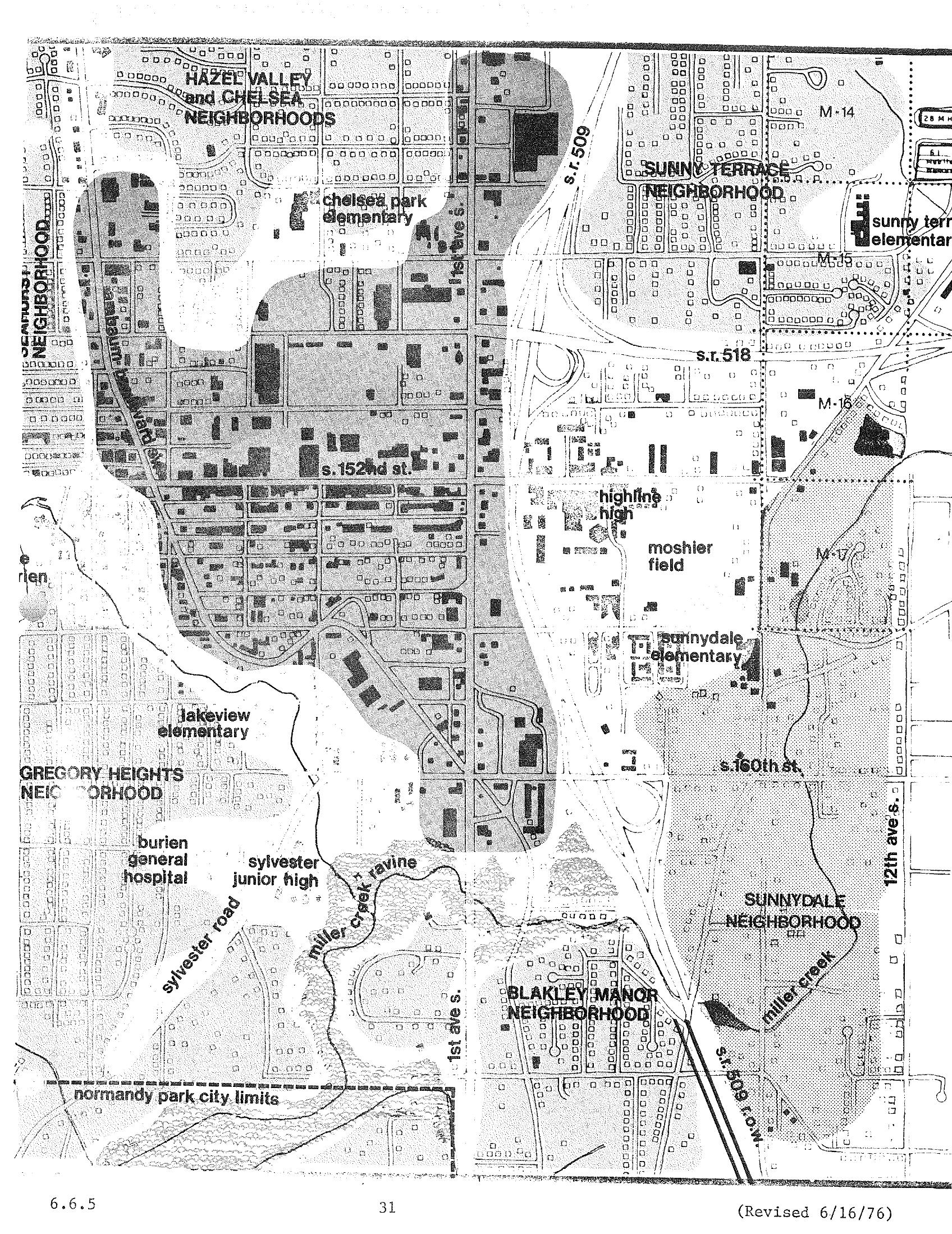
Burien/Sea-Tac Neighborhood Boundaries and Schools Map — STCP Chapter 6, Page 31 (Revised June 1976)
A planning map dated revised 6/16/76 (page 31, section 6.6.5) showing neighborhoods and landmarks in the Burien/Sea-Tac area of Washington State, including Hazel Valley, Chelsea, Sunny Terrace, Gregory Heights, Sunnydale, and Blakley Manor neighborhoods, along with schools (Chelsea Park Elementary, Lakeview Elementary, Highline High, Sunnydale Elementary), Burien General Hospital, Sylvester Junior High, Moshier Field, and major roads including S.R. 509, S.R. 518, and 1st Ave S. The map appears to be part of a noise or land-use study related to Sea-Tac Airport.