TagMap(375)
-
 2023-08-22
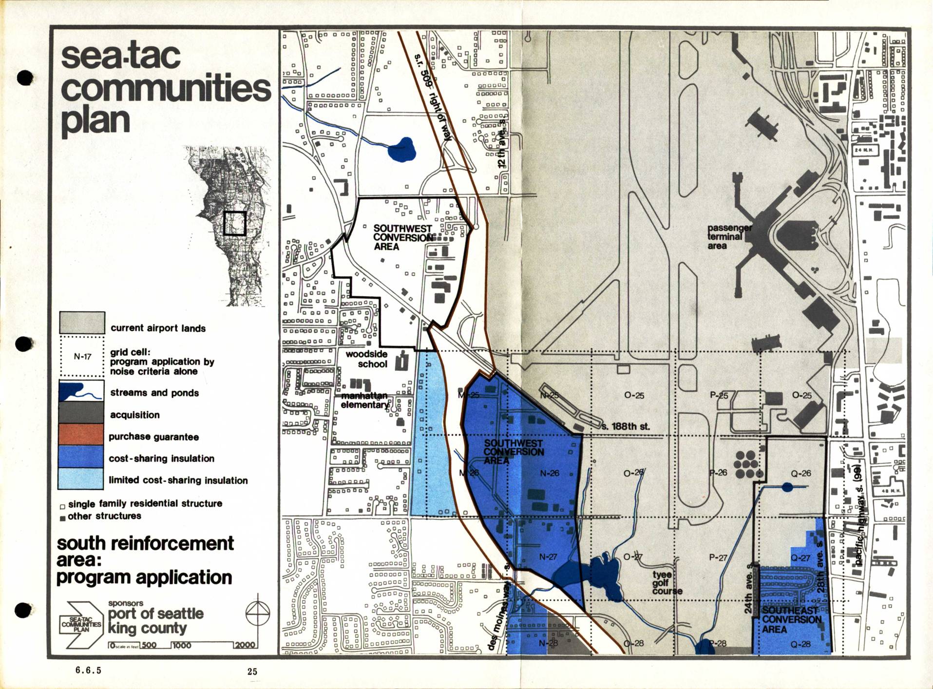
Sea-Tac Communities Plan: South Reinforcement Area Program Application (Section 6.6.5)
The Sea-Tac Communities Plan, sponsored by the Port of Seattle and King County, maps out noise mitigation programs for residential and other structures in communities surrounding Seattle-Tacoma International Airport. The plan designates specific zones for different types of assistance, including property acquisition, purchase guarantees, cost-sharing insulation, and limited cost-sharing insulation, with a focus on the South Reinforcement Area. Grid cells are identified by noise criteria to determine which program applies to each affected neighborhood, covering areas such as the Southwest and Southeast Conversion Areas near the airport's passenger terminal. -
 2023-08-22
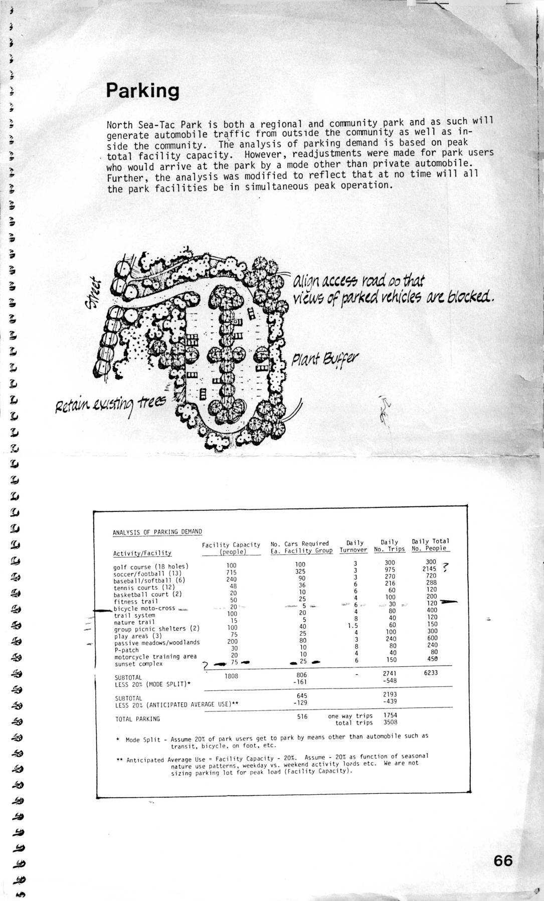
Parking analysis for North Sea-Tac Park
This document covers planning considerations for North Sea-Tac Park, including an analysis of parking demand across various recreational facilities such as golf courses, sports fields, and trail systems, estimating a total parking need of 516 spaces based on adjusted peak usage. It also addresses air support facility requirements near Sea-Tac Airport, describing clear zone and extended clear zone boundaries where land use is restricted to prevent hazards to aircraft. Within these clear zones, tall buildings, smoke-producing facilities, bird-attracting features, and large gatherings of people are prohibited to minimize risk to approaching and departing aircraft. -
 2023-08-14
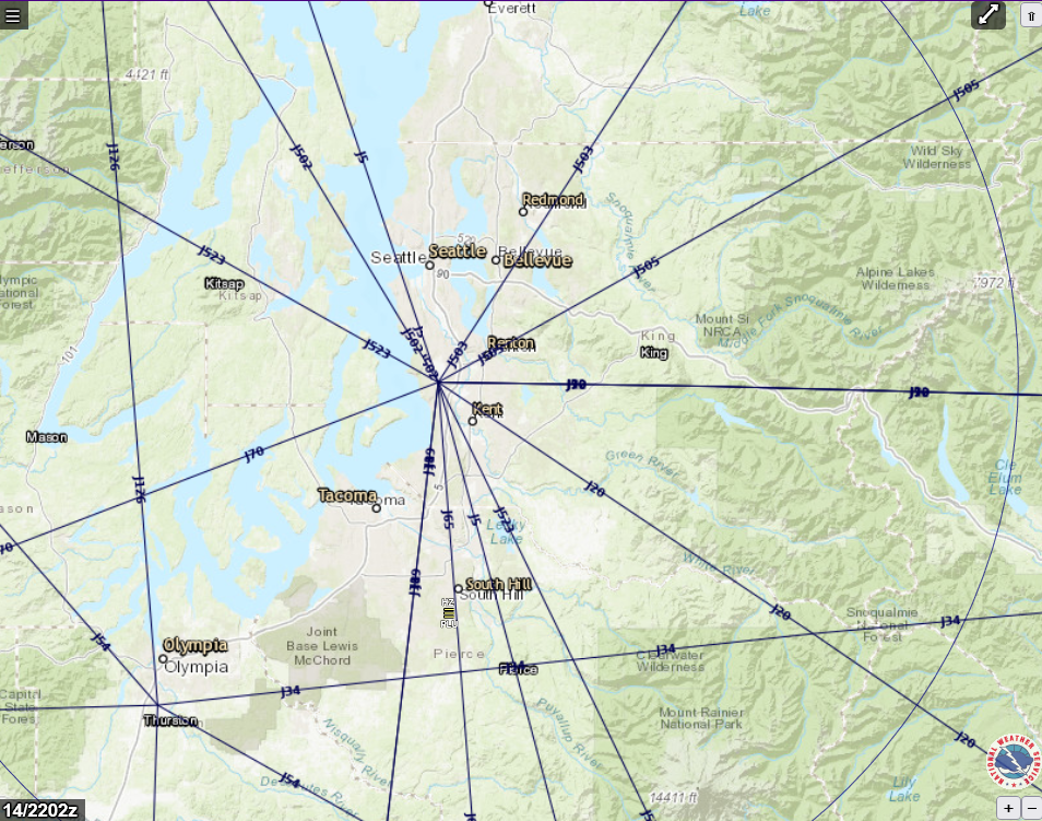
FAA Jet Route Chart Centered on Seattle-Tacoma Area – 14/2202z
A National Weather Service (NWS)-branded interactive aviation map showing FAA high-altitude jet routes (J-routes) radiating from a central fix near Seattle-Tacoma International Airport (Sea-Tac), with surrounding cities including Seattle, Bellevue, Renton, Kent, Tacoma, and Olympia visible. The map is timestamped 14/2202z and displays multiple labeled jet airways (J20, J34, J90, J523, etc.) overlaid on a terrain basemap of the greater Puget Sound region. -
 2023-08-14
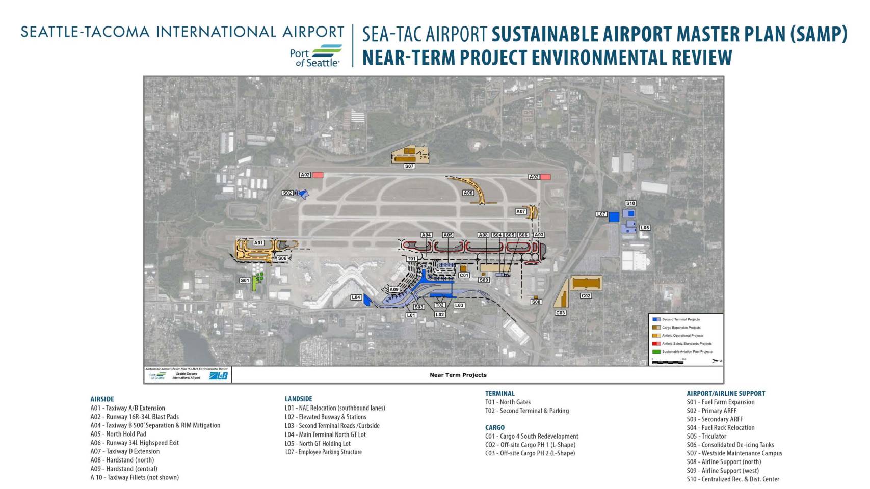
Sea-Tac Airport Sustainable Airport Master Plan (SAMP): Near-Term Project Environmental Review Map
The Sea-Tac Airport Sustainable Airport Master Plan (SAMP) Near-Term Project Environmental Review outlines a comprehensive set of planned improvements at Seattle-Tacoma International Airport, covering airside, landside, terminal, cargo, and airport support facilities. Key projects include taxiway and runway upgrades, a new second terminal with associated roads and parking, cargo facility expansions, and sustainability initiatives such as sustainable aviation fuel infrastructure and consolidated de-icing tanks. These near-term projects are intended to enhance airport capacity, safety, and operational efficiency while supporting the airport's long-term growth strategy. -
 2023-08-09
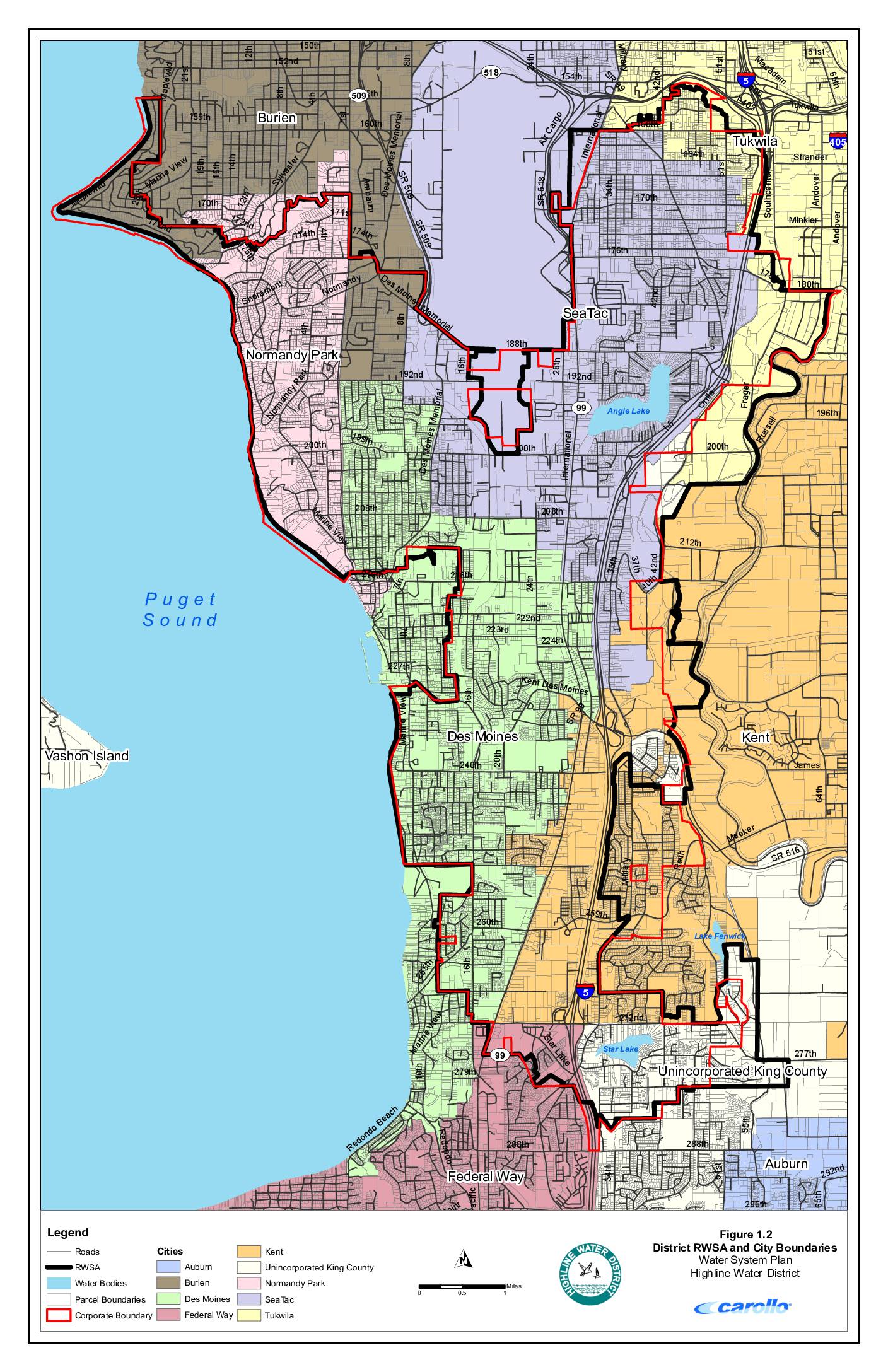
District RWSA and city boundaries – Water System Plan, Highline Water District
This map from Highline Water District's Water System Plan shows the district's Regional Water Service Area (RWSA) and surrounding city boundaries in the communities near Sea-Tac Airport, including Burien, Normandy Park, Des Moines, SeaTac, Tukwila, Kent, Federal Way, and unincorporated King County. The document depicts roads, water bodies such as Angle Lake, Lake Fenwick, and Star Lake, and parcel boundaries across the service area along the eastern shore of Puget Sound. While primarily a water infrastructure planning document, it provides detailed geographic context for the municipalities and neighborhoods in the Sea-Tac Airport vicinity. -
 2023-08-09
Water system facilities and pressure zones
This document is a water system facilities and pressure zones map for the Highline Water District, covering communities including SeaTac, Des Moines, Burien, Normandy Park, and Federal Way in the greater Seattle area. It shows the locations of water mains, pump stations, storage facilities, wells, water treatment plants, and pressure-reducing valves (PRVs) across more than a dozen distinct pressure zones. The map is part of the district's Water System Plan and was produced by engineering firm Carollo. -
 2023-08-09
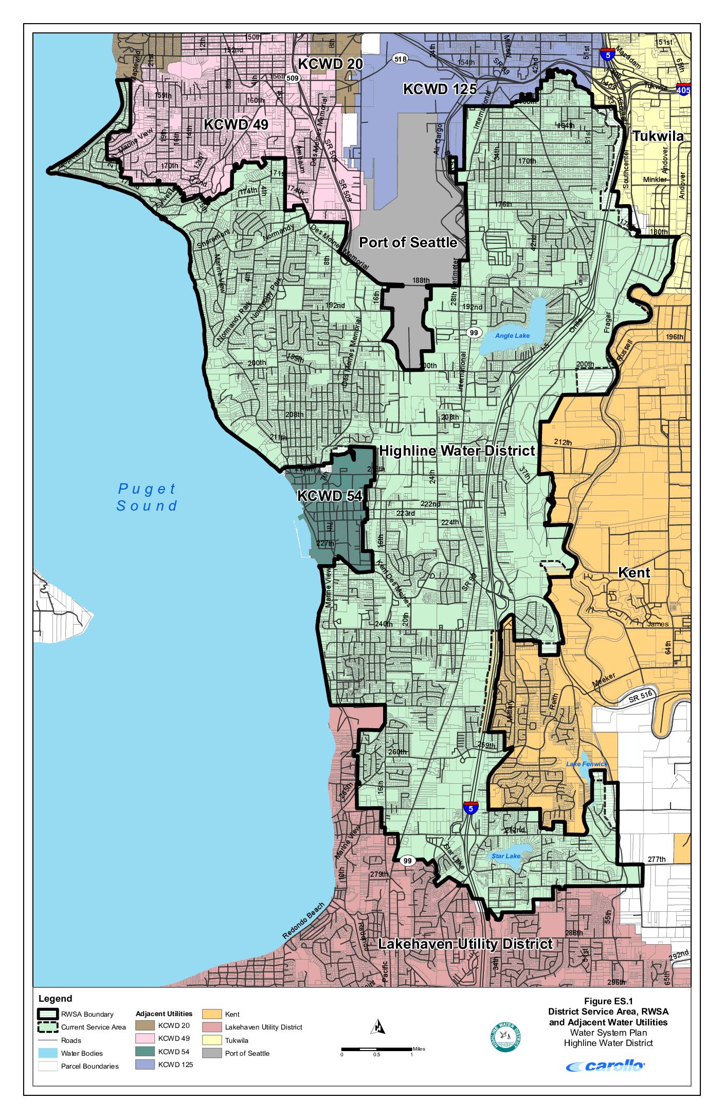
District service area, RWSA and adjacent water utilities – Highline Water District water system plan
This map from Highline Water District's Water System Plan shows the district's service area and surrounding water utilities in the communities south of Seattle, including areas near Sea-Tac Airport. It identifies neighboring providers such as the Port of Seattle, KCWD 20, KCWD 49, KCWD 54, KCWD 125, Tukwila, Kent, and Lakehaven Utility District, along with key landmarks like Angle Lake, Star Lake, and Lake Fenwick. The map delineates the Regional Water Service Area (RWSA) boundary and current service areas relative to major roads and Interstate 5. -
 2023-08-08
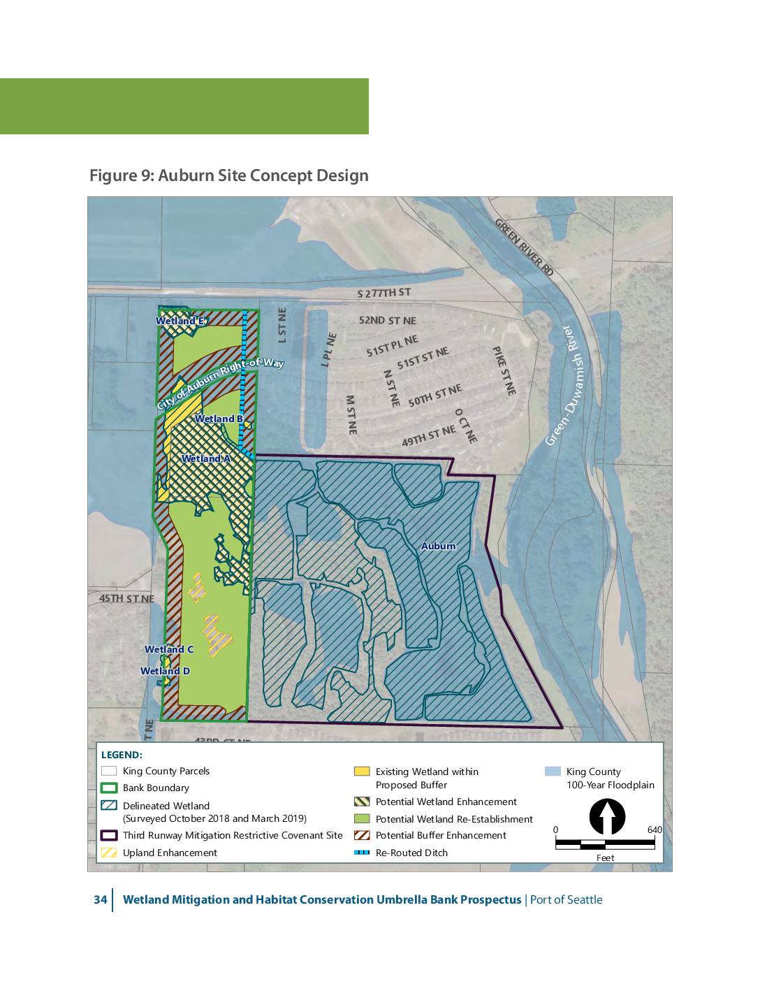
Auburn Wetlands site concept design
This map presents the concept design for the Auburn wetland mitigation site as part of the Port of Seattle’s Wetland Mitigation and Habitat Conservation Umbrella Bank Prospectus. The figure shows five delineated wetlands (A through E) along the Green-Duwamish River, with proposed enhancements including wetland re-establishment, buffer enhancement, upland enhancement, and re-routed ditches. The site -
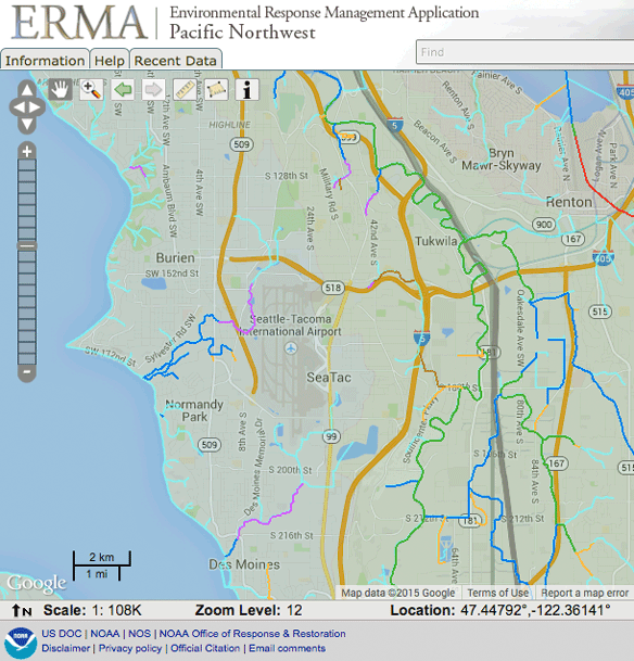
ERMA Sea-Tac Salmon Streams
A screenshot from NOAA's Environmental Response Management Application (ERMA) Pacific Northwest interface, showing a Google-based map centered on the Seattle-Tacoma International Airport (SeaTac) area at zoom level 12, scale 1:108K, at coordinates 47.44792°N, 122.36141°W. Surrounding communities visible include Burien, Tukwila, Renton, Normandy Park, and Des Moines, with overlaid environmental or response-related boundary layers in multiple colors. -
 2023-07-16
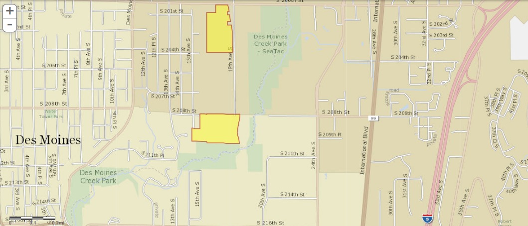
King County GIS Parcel Map: Property Ownership Near Des Moines Creek Park and Sea-Tac Airport Noise Zone
A street map showing the Des Moines and SeaTac area of Washington State, with two parcels highlighted in yellow/orange near Des Moines Creek Park and along 18th Ave S between approximately S 201st St and S 208th St. The map shows International Blvd (SR-99) and Interstate 5 to the east, in an area relevant to Sea-Tac Airport noise impact zones.