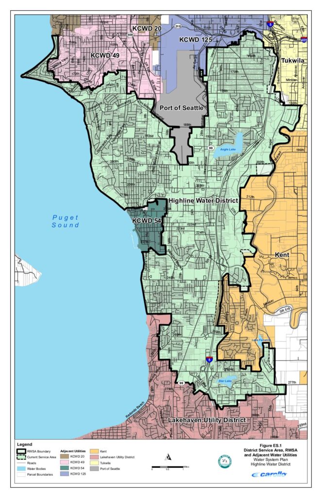
This map from Highline Water District's Water System Plan shows the district's service area and surrounding water utilities in the communities south of Seattle, including areas near Sea-Tac Airport. It identifies neighboring providers such as the Port of Seattle, KCWD 20, KCWD 49, KCWD 54, KCWD 125, Tukwila, Kent, and Lakehaven Utility District, along with key landmarks like Angle Lake, Star Lake, and Lake Fenwick. The map delineates the Regional Water Service Area (RWSA) boundary and current service areas relative to major roads and Interstate 5.Open full document
Notes
This map shows the Highline Water District’s service area, retail water service area (RWSA) boundary, and adjacent water utilities in the south King County region near Sea-Tac Airport. It displays neighboring utilities including KCWD 20, KCWD 49, KCWD 54, KCWD 125, Kent, Lakehaven Utility District, Tukwila, and Port of Seattle. The map also shows major roads, water bodies including Puget Sound, Angle Lake, Lake Fenwick, and Star Lake, along with parcel boundaries.