TagMap(375)
-
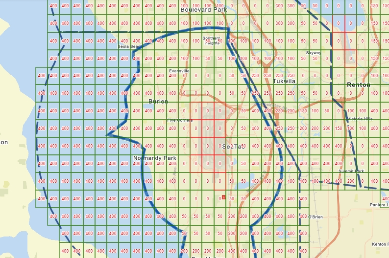
FAA UAS Facility Map – Sea-Tac Airport Maximum Altitude Grid (July 2025)
A GIS-style grid map overlaid on the south Seattle/Sea-Tac region showing noise exposure values (0, 50, 100, 200, 250, 300, 400 units) across cells covering communities including Burien, Tukwila, Renton, Normandy Park, and SeaTac. A dashed blue boundary line delineates what appears to be a noise impact or study area boundary around Seattle-Tacoma International Airport. -
 2025-02-26
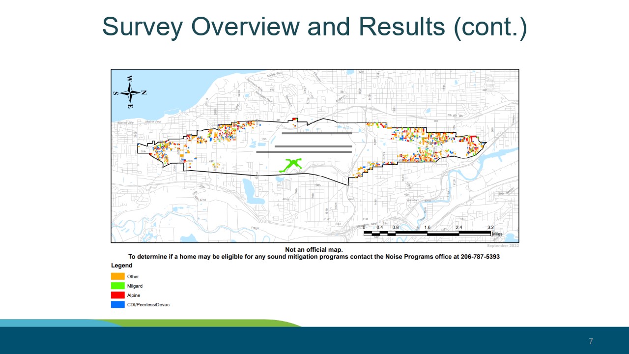
StART SIRRPP Update — Sound Mitigation Contractor Map by Property (September 2022) — Slide 7
Slide 7 from a Sea-Tac Airport presentation titled 'Survey Overview and Results (cont.)' showing a geographic map of properties around Seattle-Tacoma International Airport color-coded by sound mitigation contractor (Other, Milgard, Alpine, CDI/Peerless/Devac). The map is dated September 2022 and includes a note directing homeowners to contact the Noise Programs office at 206-787-5393 to determine eligibility for sound mitigation programs. -
 2025-01-01
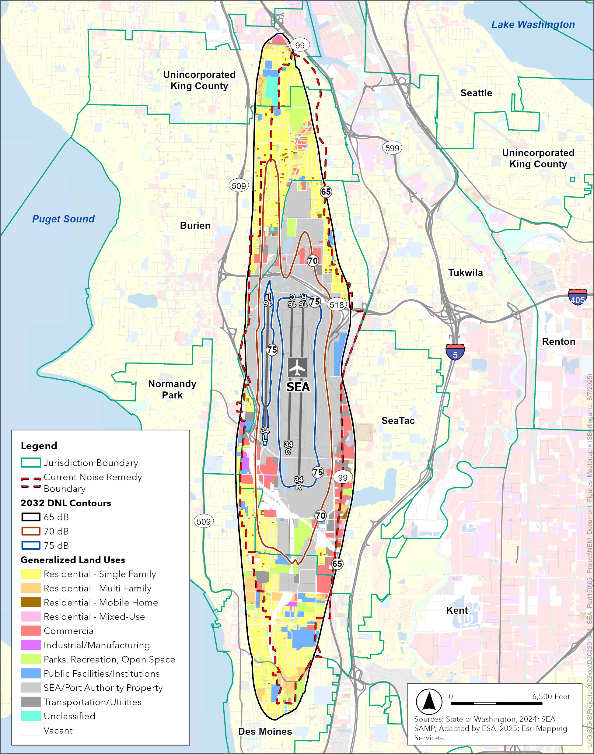
2032 DNL Noise Contours with Existing Land Use and Noise Remedy Boundary — Sea-Tac Airport
This GIS map depicts the 2032 Day-Night Average Sound Level (DNL) noise contours (65, 70, and 75 dB) for Seattle-Tacoma International Airport (SEA), overlaid with generalized land use classifications and the current Noise Remedy Boundary. Sourced from the State of Washington (2024) and SEA SAMP, adapted by ESA in 2025, the map covers surrounding jurisdictions including Burien, SeaTac, Tukwila, Normandy Park, Des Moines, and unincorporated King County. -
 2024-11-12
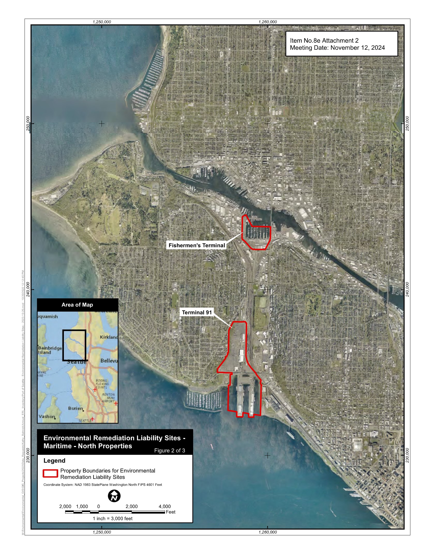
Environmental Remediation Liability Sites — Fishermen’s Terminal and Terminal 91 Property Boundaries Map (Page 131, November 12, 2024 RM Packet)
This is Figure 2 of 3 from Item No. 8e Attachment 2, dated November 12, 2024, showing property boundaries (outlined in red) for environmental remediation liability sites at Fishermen's Terminal and Terminal 91 in Seattle's north maritime area. The map uses NAD 1983 StatePlane Washington North FIPS 4601 Feet coordinate system at a scale of 1 inch = 3,000 feet. -
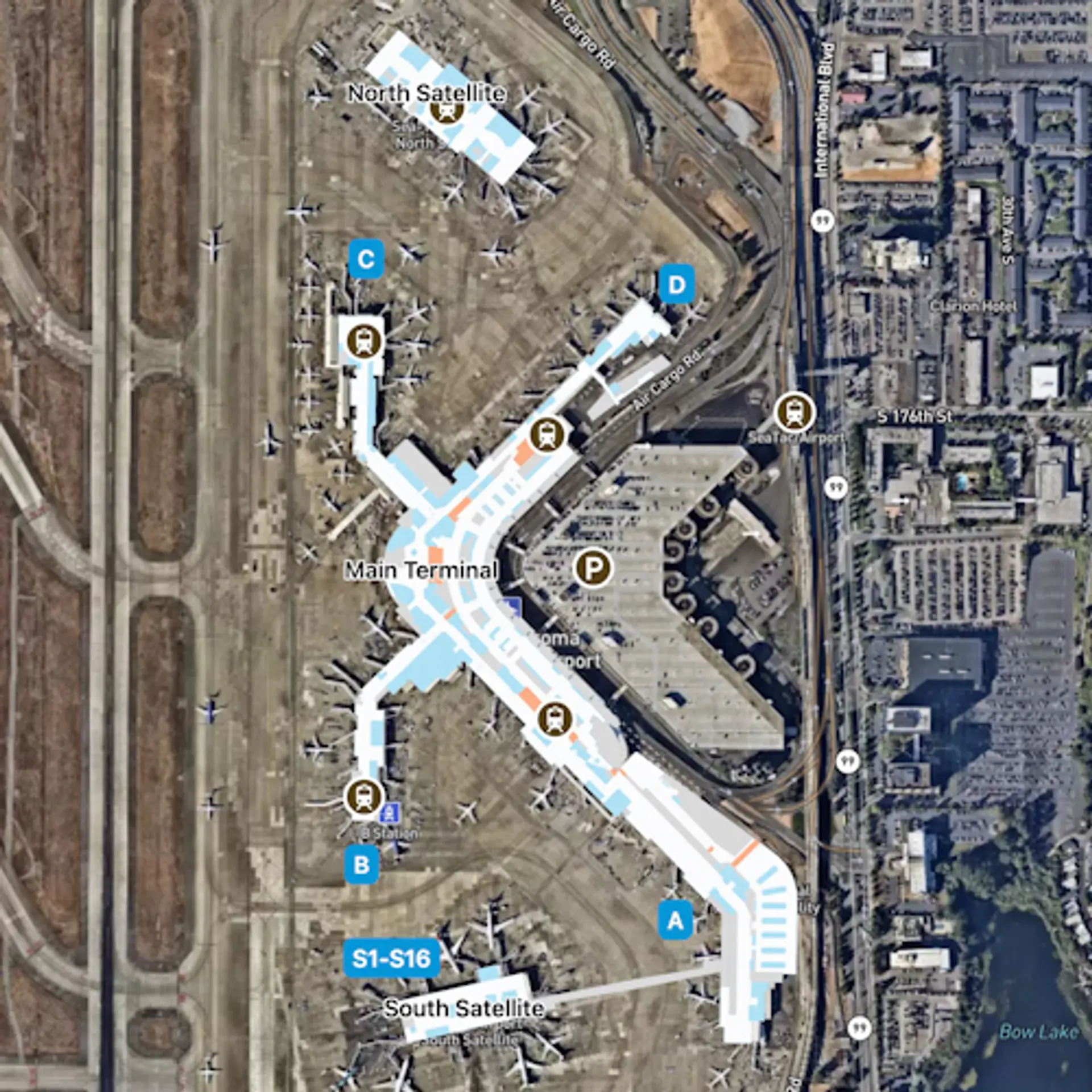
Seattle-Tacoma-SEA-Overview Map
Aerial satellite map of Seattle-Tacoma International Airport (SEA/Sea-Tac) showing the Main Terminal, North Satellite, South Satellite (gates S1–S16), concourses labeled A, B, C, and D, the SeaTac Airport Link light rail station, and parking structures. The map highlights airside pedestrian connector routes in blue and orange overlaid on the satellite imagery. -
 2024-10-01
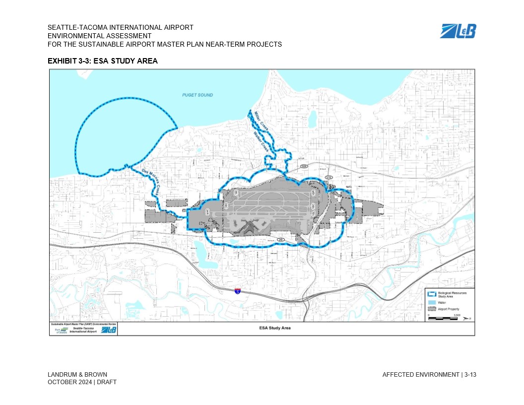
SAMP Exhibit 3-3 Area of Potential Effects (APE) Water
Exhibit 3-3 from the Seattle-Tacoma International Airport Environmental Assessment for the Sustainable Airport Master Plan (SAMP) Near-Term Projects, prepared by Landrum & Brown, dated October 2024 (Draft). The map depicts the Biological Resources ESA Study Area boundary (shown in blue dashed line) surrounding the airport property, extending to Puget Sound to the west and encompassing nearby waterways including Miller Creek and Walker Creek. -
 2024-09-05
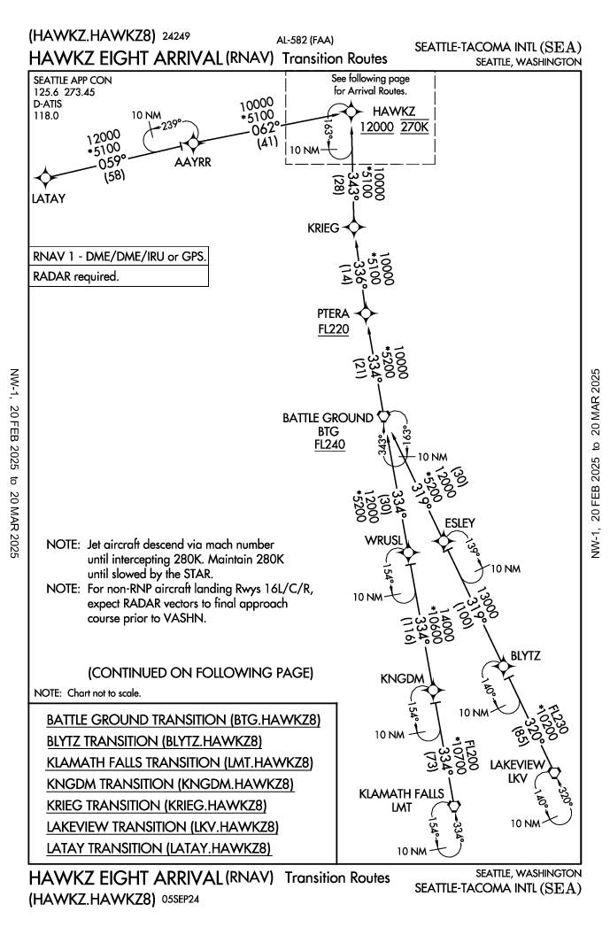
HAWKZ Eight Arrival (RNAV) — Transition Routes, Seattle-Tacoma International Airport
The HAWKZ Eight Arrival (HAWKZ8) is a standard terminal arrival route (STAR) used to guide aircraft into Seattle-Tacoma International Airport (SEA) from multiple directions, including transitions from waypoints such as Battle Ground, Klamath Falls, and Lakeview. The procedure requires RNAV 1 capability (DME/DME/IRU or GPS) and radar, and directs jet aircraft to descend via Mach number until intercepting 280 knots. Aircraft follow a series of waypoints and altitude restrictions, ultimately converging at the HAWKZ fix at 12,000 feet and 270 knots before continuing to the airport. -
 2024-07-13
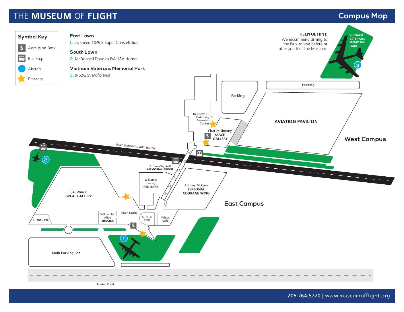
The Museum of Flight Campus Map
This is a campus map for the Museum of Flight in Seattle, showing the layout of its East and West campuses along East Marginal Way South adjacent to Boeing Field. The map identifies key buildings and galleries, outdoor aircraft displays including a B-52G Stratofortress, F/A-18A Hornet, and Lockheed Super Constellation, as well as parking areas, bus stops, and entrance points. It does not contain information related to Sea-Tac Airport noise policy. -
 2024-07-13
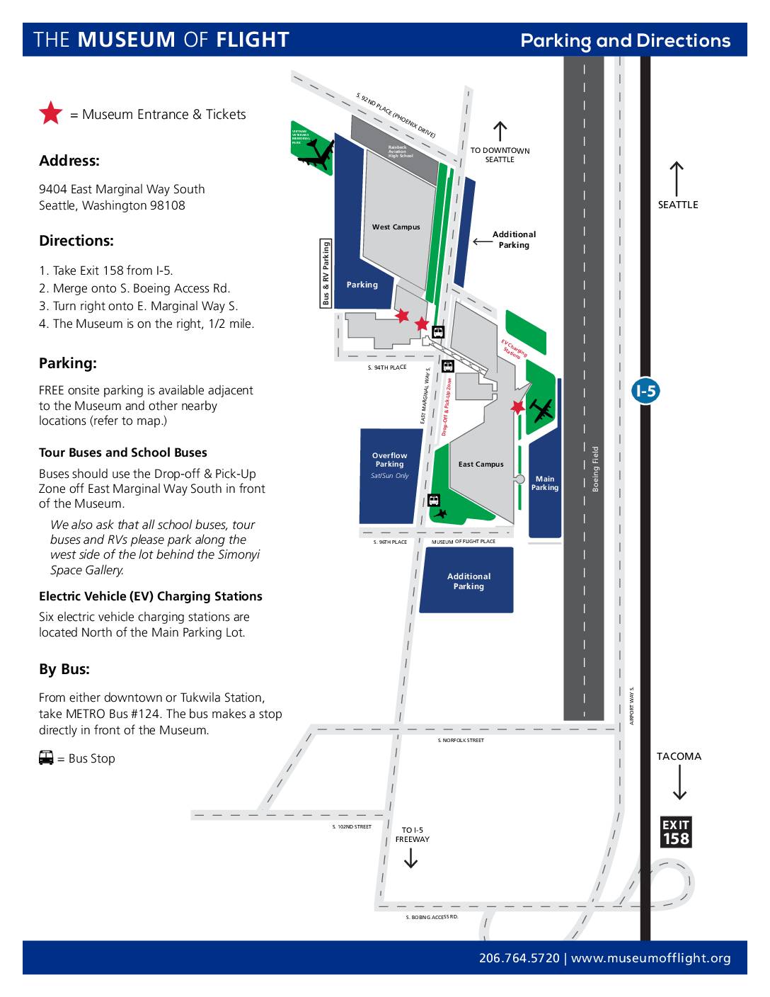
Boeing Museum of Flight General Parking Directions
A parking and directions guide for the Boeing Museum of Flight in Seattle, Washington. The document includes driving directions from I-5, public transit options via METRO Bus #124, and information about free onsite parking, bus/RV parking, and electric vehicle charging stations. A detailed map illustrates the campus layout including main, overflow, and additional parking areas. -
 2024-05-13
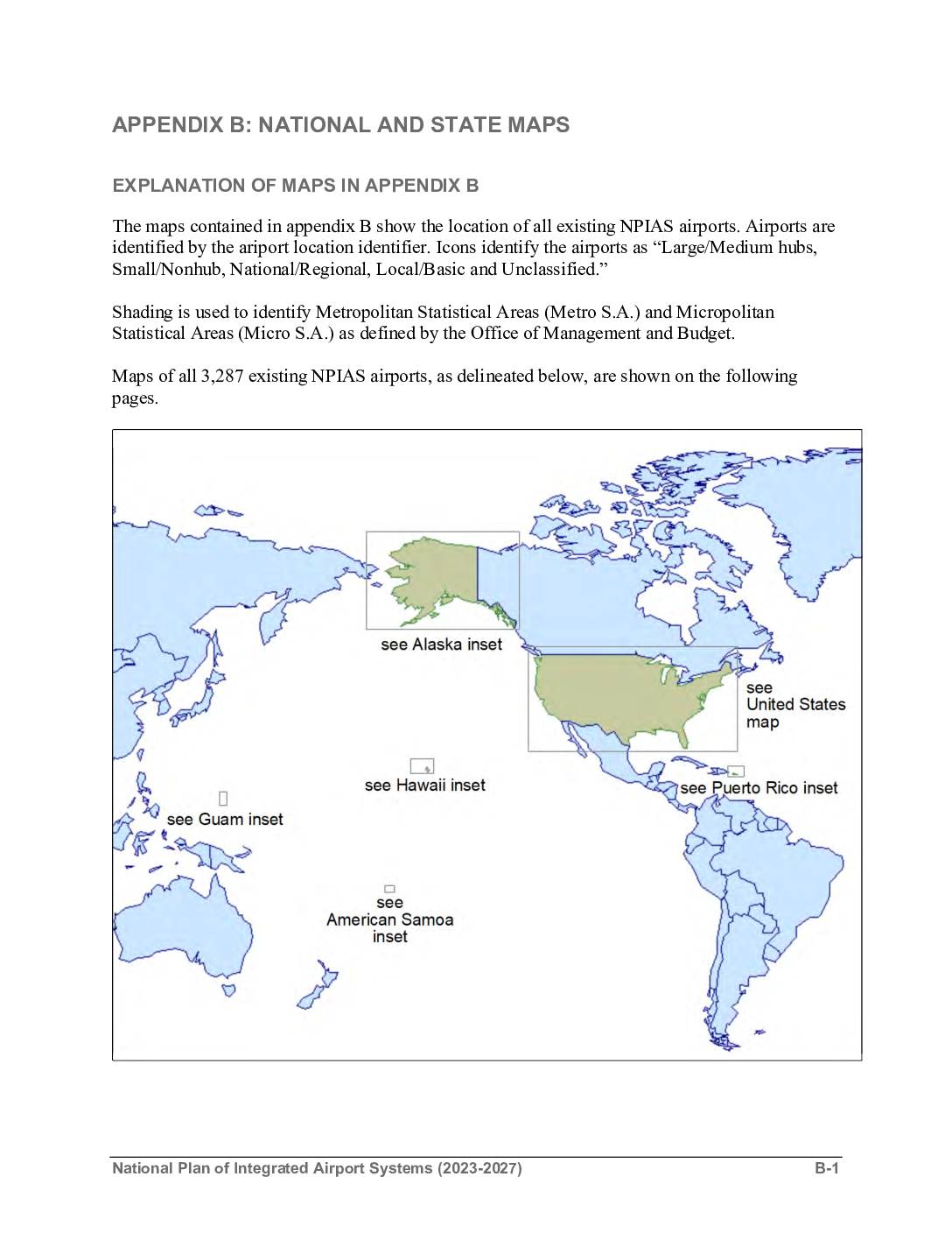
National Plan of Integrated Airport Systems (2023-2027): Appendix B – National and state maps
Appendix B of the National Plan of Integrated Airport Systems (NPIAS) 2023-2027 provides national and state maps showing the locations of all 3,287 existing NPIAS airports across the United States and its territories, including Alaska, Hawaii, Puerto Rico, Guam, and American Samoa. Airports are categorized by type — Large/Medium hub, Small/Nonhub, National/Regional, Local/Basic, and Unclassified — and displayed alongside Metropolitan and Micropolitan Statistical Areas. Note that this document covers the broader national airport system and does not contain specific noise policy information related to Sea-Tac Airport.