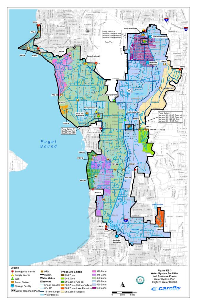
This document is a water system facilities and pressure zones map for the Highline Water District, covering communities including SeaTac, Des Moines, Burien, Normandy Park, and Federal Way in the greater Seattle area. It shows the locations of water mains, pump stations, storage facilities, wells, water treatment plants, and pressure-reducing valves (PRVs) across more than a dozen distinct pressure zones. The map is part of the district's Water System Plan and was produced by engineering firm Carollo.Open full document
Notes
A detailed map of the Highline Water District’s water system facilities and pressure zones in the south King County area. The map displays water mains by pipe diameter, pressure reducing valves (PRVs), pump stations, storage facilities, water treatment plants, wells, and interties across multiple pressure zones ranging from 295 to 600 psi. Service area covers cities including Des Moines, SeaTac, Normandy Park, Burien, Federal Way, Kent, Tukwila, and Auburn.