TagMap(375)
-
 2024-04-05
Deciphering the FAA’s wildly complex aviation maps
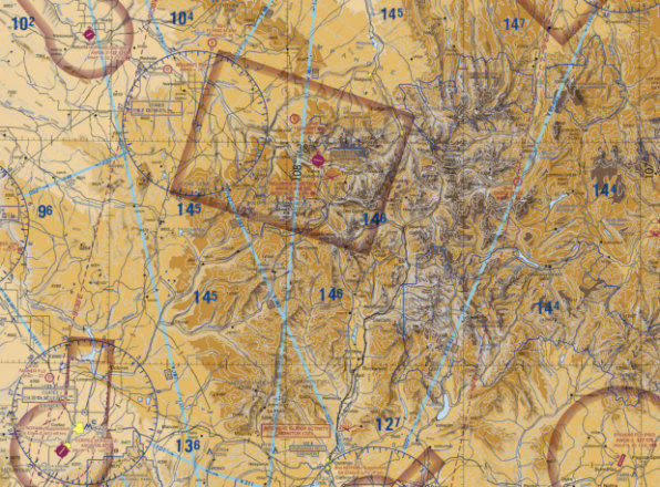
Among all of the visual information published by the U.S. government, there may be no product with a higher information density than the Federal Aviation Administration’s (FAA) aviation maps. Intended for pilots, the FAA publishes free detailed maps of the entire U.S. airspace, and detailed maps of airports and their surroundings and updates them frequently. The density -
 2024-02-22
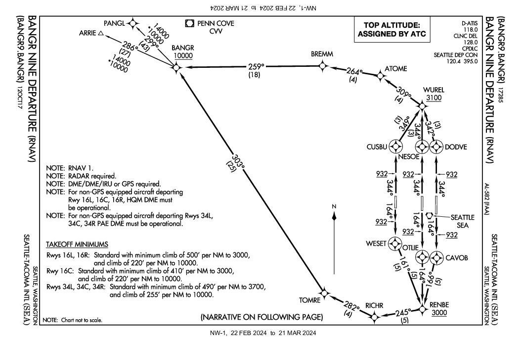
BANGR Nine Departure (RNAV) — Seattle-Tacoma International Airport (SEA)
The BANGR Nine Departure is a standardized instrument departure procedure (SID) for pilots flying out of Seattle-Tacoma International Airport (SEA), directing aircraft on specific headings and altitudes depending on which runway they use. Aircraft departing on northbound runways (34L, 34C, 34R) climb to at least 932 feet before routing through waypoints like CUSBU, NESOE, or DODVE, crossing WUREL at or above 3,100 feet, while southbound runway departures (16L, 16C, 16R) follow similar climb profiles through waypoints like CAVOB, OTLIE, or WESET, crossing RENBE at or above 3,000 feet. All routes converge at the BANGR waypoint, which must be crossed at or above 10,000 feet, with specific minimum climb gradients established to manage aircraft noise and terrain clearance in the surrounding communities. -
 2023-12-07
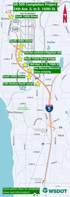
SR 509 Completion Project: 24th Ave. S. to S. 160th St.
The SR 509 Completion Project extends State Route 509 from 24th Avenue South to South 160th Street near Sea-Tac Airport, adding new interchanges, roundabouts, and connections to southbound I-5 and toward Seattle. Key features include a new interchange at South 188th Street with a shared-use path and Lake to Sound Trail access, as well as a South 160th Street interchange with noise walls to protect nearby residents. The project also includes wetland mitigation sites and infrastructure improvements along the Des Moines Memorial Drive corridor. -
 2023-11-07
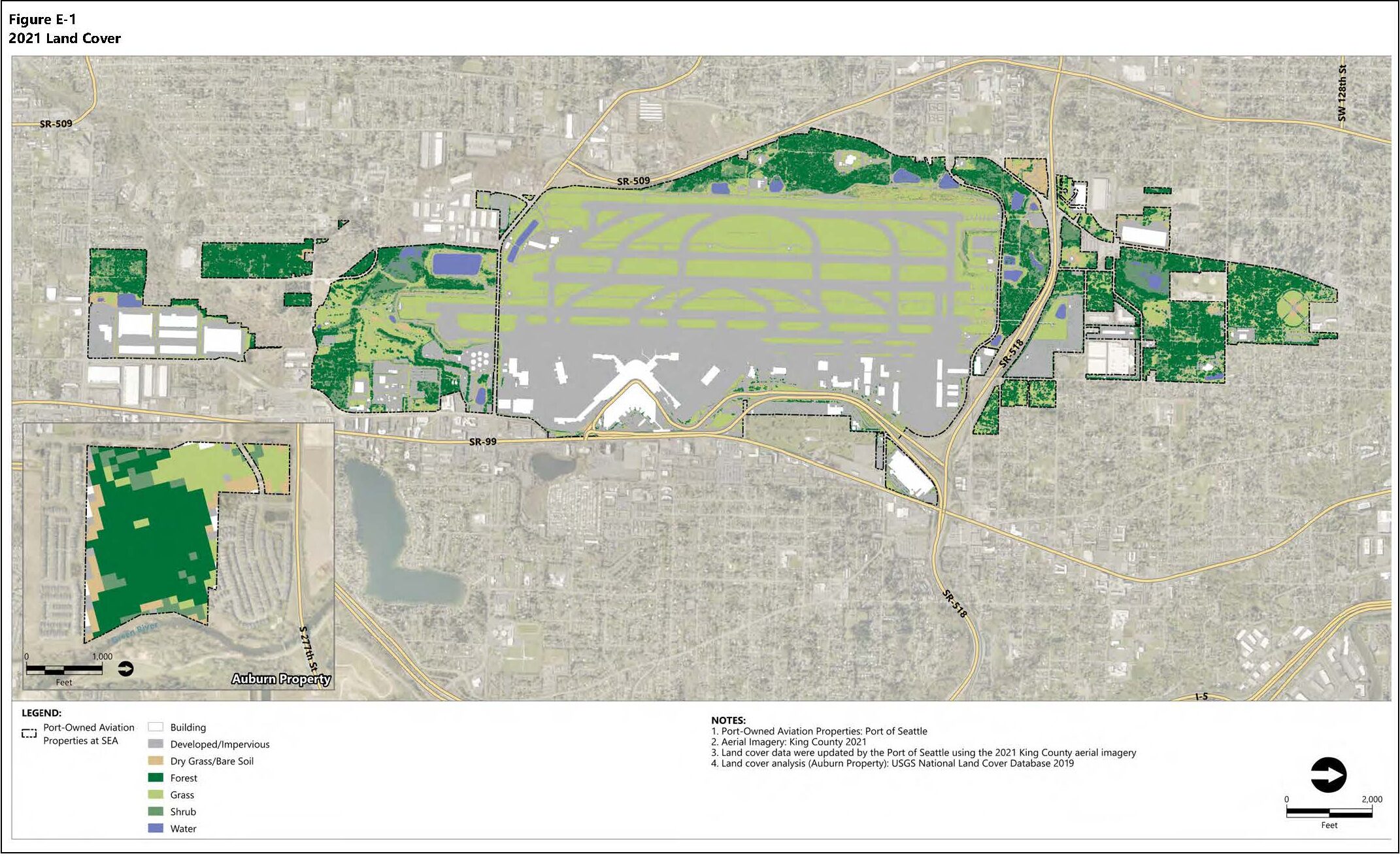
Port Of Seattle 2021 Land Cover Classifications Map — Sea-Tac Airport Aviation Properties
Figure E-1 from a Port of Seattle document depicting 2021 land cover classifications for Port-owned aviation properties at Seattle-Tacoma International Airport (SEA) and an Auburn Property inset. Land cover categories include forest, grass, shrub, water, developed/impervious surfaces, and buildings, based on 2021 King County aerial imagery and USGS National Land Cover Database 2019. -
 2023-08-28
Location Map: King County, WA (File No. 985481)
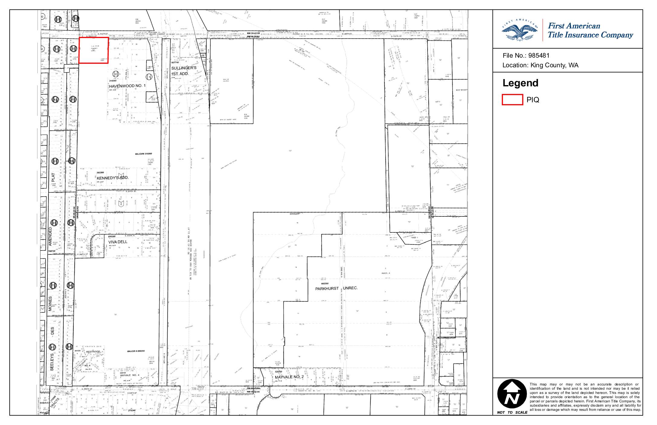
This is a parcel map prepared by First American Title Insurance Company for File No. 985481, identifying land located in King County, Washington. The map provides a general geographic orientation of one or more parcels in the area, encompassing subdivisions such as Havenwood No. 1, Kennedy's Addition, Viva Dell, and Mayvale No. 2. The document is not intended to serve as a legal survey and carries an express disclaimer of liability for any reliance on its contents. -
 2023-08-22
Seattle-Tacoma International Airport map
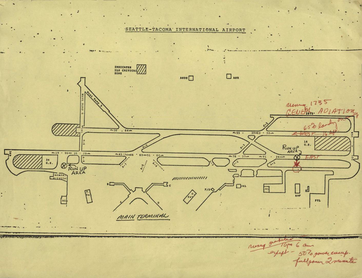
This document is an airport diagram of Seattle-Tacoma International Airport showing runways, taxiways, run-up areas, and terminal facilities. Handwritten annotations in red ink reference noise abatement procedures, including a note about 'General Aviation' operations and restrictions on runways, specifying limits such as '650 landings' and directions (East/West). Additional handwritten notes at the bottom outline runway use prohibitions from 10 PM to 6 AM, with exceptions for 50% power run-ups and full-power checks limited to 2 minutes. -
 2023-08-22
Seattle-Tacoma International Airport Planning Area Boundary Map
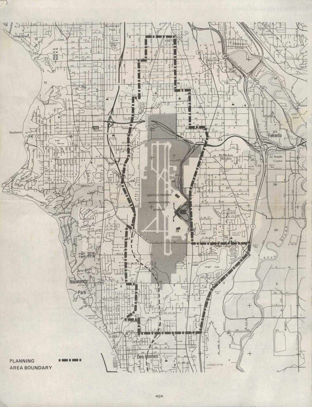
This map depicts the planning area boundary surrounding Seattle-Tacoma International Airport and its neighboring communities, including Burien, Normandy Park, Des Moines, Tukwila, and Riverton. The shaded region highlights the airport's footprint and immediate environs, while the dashed boundary line delineates the study area used for airport-related land use and noise planning purposes. The document appears to be part of an environmental or community planning effort assessing the impact of Sea-Tac Airport on surrounding residential and commercial areas. -
 2023-08-22
F.A.A. density guidelines: North Sea-Tac Park
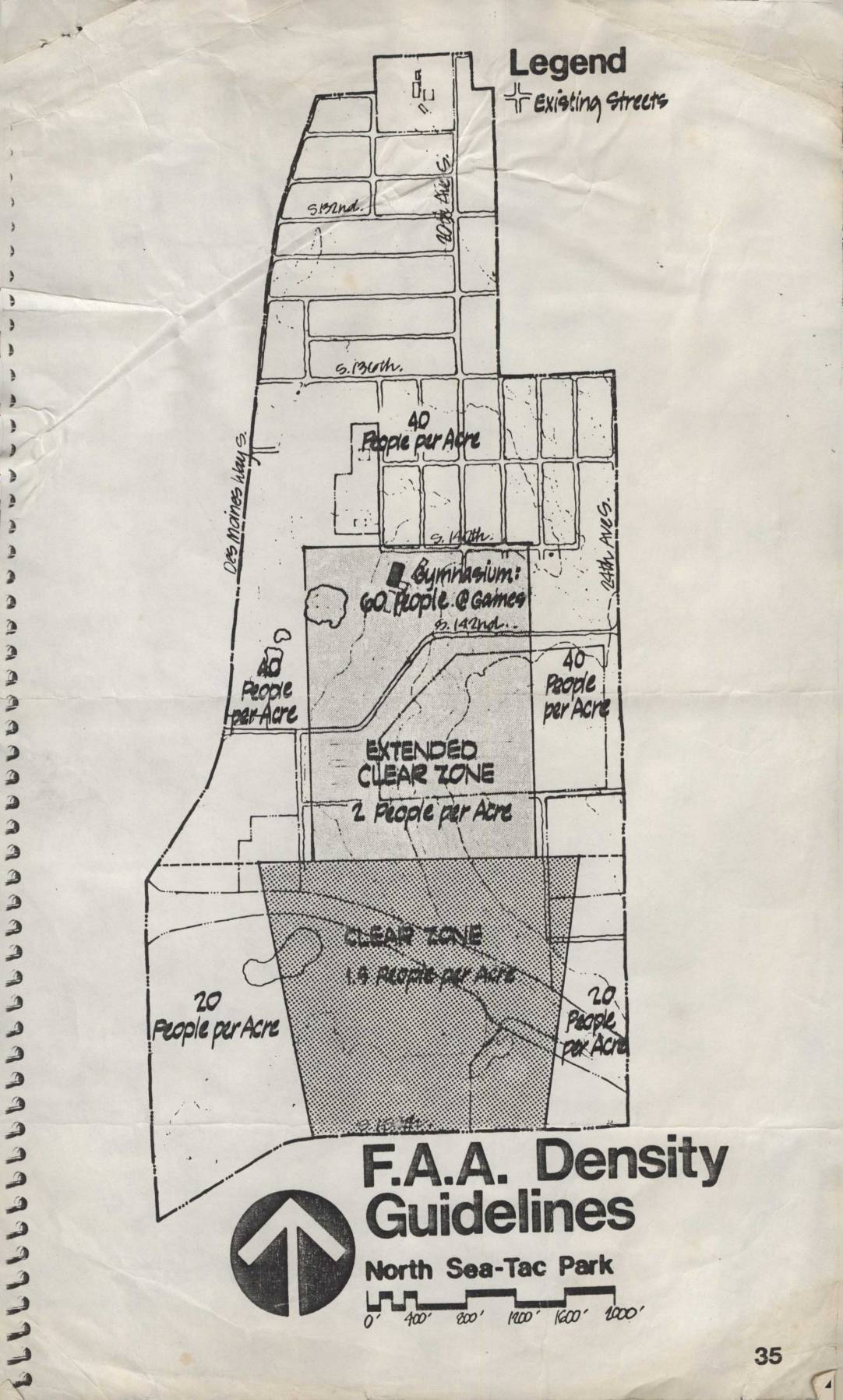
This document presents FAA density guidelines for the North Sea-Tac Park area near Seattle-Tacoma International Airport, showing recommended population limits per acre across different zones. Areas closest to the runway are designated as a 'Clear Zone' allowing only 1.5 people per acre, while an 'Extended Clear Zone' permits 2 people per acre, and surrounding residential areas are limited to 20–40 people per acre. A gymnasium on the map is noted as accommodating 60 people during games, illustrating how the guidelines account for concentrated gatherings near airport flight paths. -
 2023-08-22
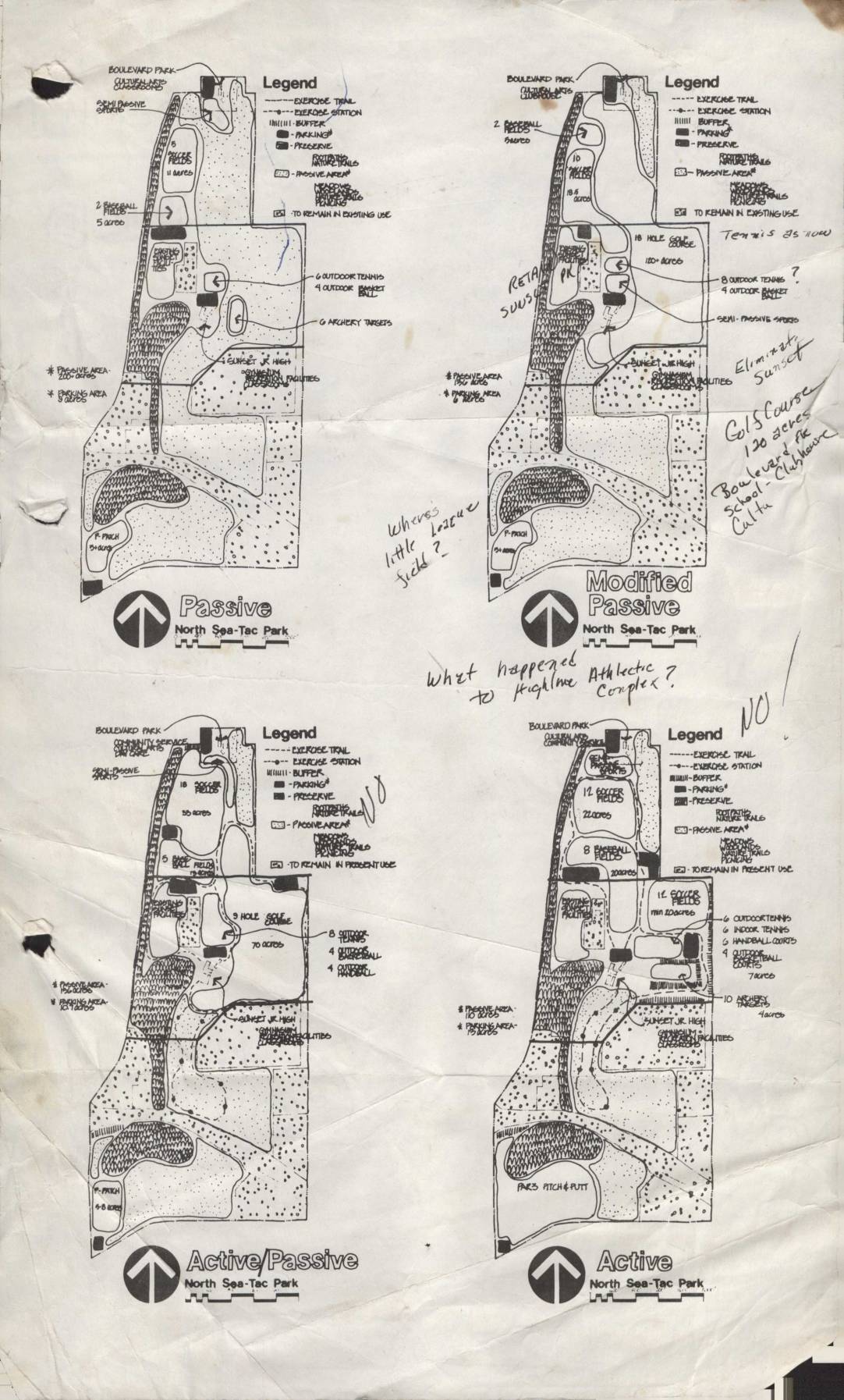
North Sea-Tac Park planning maps: Passive, modified passive, active/passive, and active options
This document presents four conceptual land-use plans for North Sea-Tac Park, ranging from 'Passive' to 'Active' configurations, each showing different proposed recreational facilities such as tennis courts, golf courses, archery targets, baseball fields, and exercise trails. Handwritten annotations question the fate of certain features, including the Highline Athletic Complex and a 'little league field,' and note that a golf course of approximately 120 acres was considered in connection with Boulevard School and Club Moore. The plans appear to be early planning documents exploring how the park land could be developed or preserved under varying levels of recreational activity. -
 2023-08-22
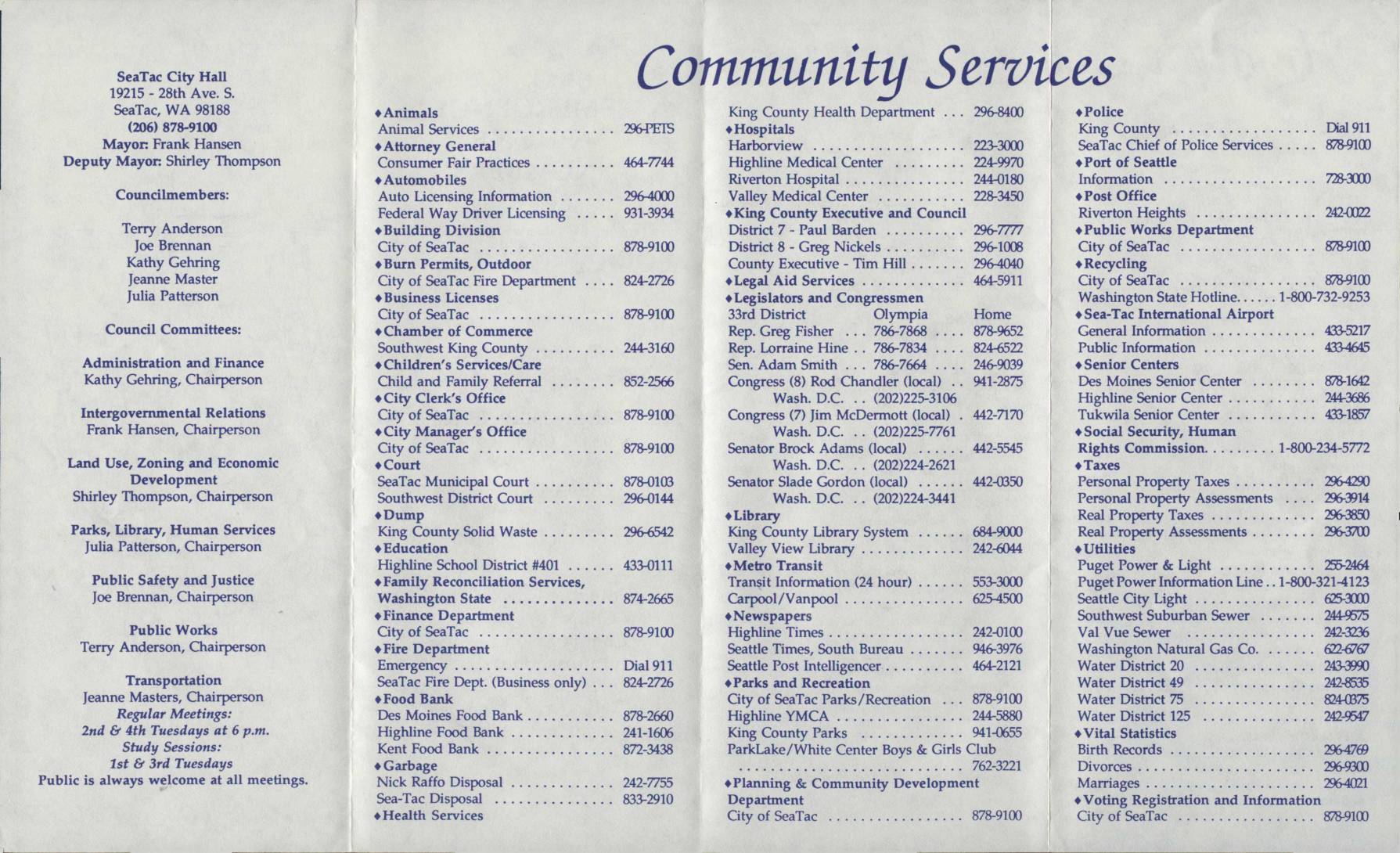
City of SeaTac community services guide
This City of SeaTac community services guide provides residents with a comprehensive directory of local phone numbers and resources, including city government offices, emergency services, schools, utilities, and elected representatives. It lists contact information for the SeaTac City Hall, Highline School District, Sea-Tac International Airport public information lines, and various county and state agencies serving the SeaTac area. The guide also includes a street map of the City of SeaTac and emergency numbers for fire, police, and crisis services.