TagSea-Tac Airport(1835)
-
 2018-01-01
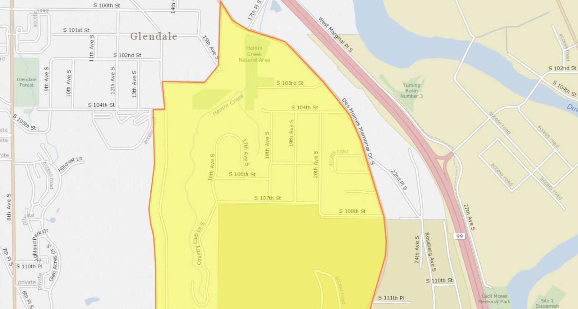
DNL65 Boundary Map (2018)
This document contains a series of maps outlining a highlighted geographic zone spanning several Seattle-area neighborhoods, including Glendale, Southern Heights, Boulevard Park, and North SeaTac. The yellow-shaded areas, bordered in red, appear to delineate a specific study or policy boundary likely related to Sea-Tac Airport noise impact zones. Streets and landmarks such as Hamm Creek Natural Area, Des Moines Memorial Drive, and Southern Heights Park are visible within and around the designated boundary. -
 2018-01-01
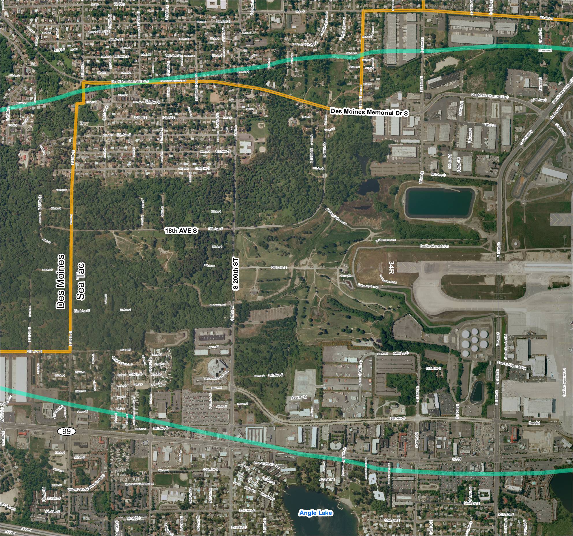
Grid 2 (2018): Aerial Map of Des Moines / Sea-Tac Area
This document is an aerial map showing the area surrounding Seattle-Tacoma (Sea-Tac) Airport, covering the cities of Des Moines and SeaTac in Washington State. It highlights key roads and boundaries, including Des Moines Memorial Drive S, S 200th Street, 18th Avenue S, and SR 99, with colored overlays likely indicating noise-impact or study zones near the airport. Runway 34R and Angle Lake are visible landmarks, with the map appearing to delineate jurisdictional or noise-contour boundaries relevant to airport planning and policy. -
 2018-01-01
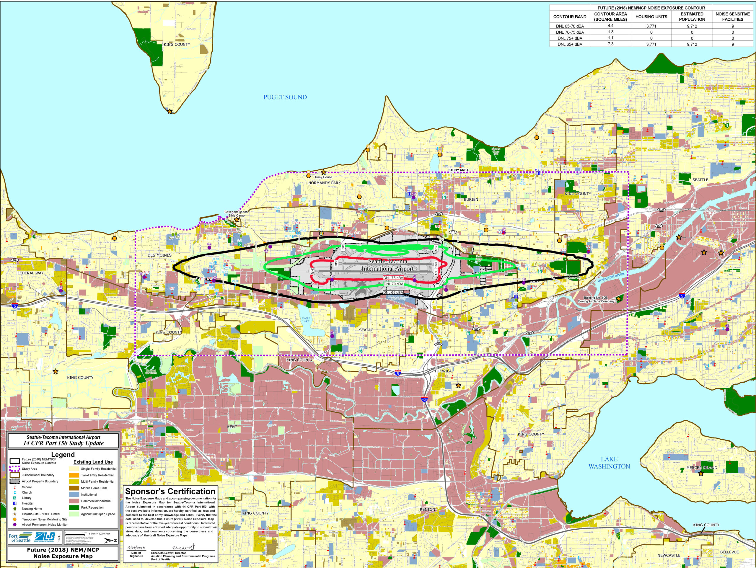
Part 150 2013 Noise Exposure Map NEM PLOT Future 2018
This is the Future (2018) Noise Exposure Map (NEM/NCP) for Seattle-Tacoma International Airport, produced as part of a 14 CFR Part 150 Study Update by the Port of Seattle. The map displays DNL noise contour bands (65–70, 70–75, and 75+ dBA) overlaid on surrounding land uses, with a data table showing the DNL 65–70 dBA contour covering 4.4 square miles and affecting an estimated 9,712 people; it includes a Sponsor's Certification signed by Elizabeth Leavitt, Director of Aviation Planning and Environmental Programs for the Port of Seattle. -
 2018-01-01
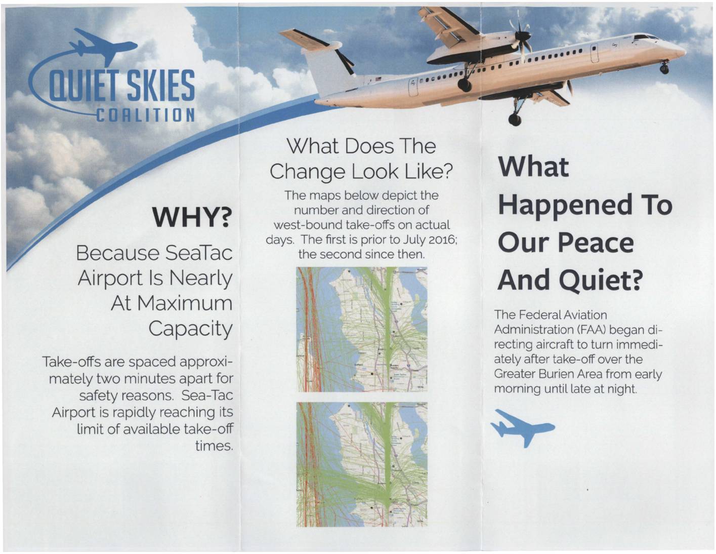
Quiet Skies Coalition: What Happened to Our Peace and Quiet?
The Quiet Skies Coalition is a community group opposing increased aircraft noise over the Greater Burien area near Seattle-Tacoma (Sea-Tac) Airport. Since July 2016, the FAA began directing westbound flights to turn immediately after takeoff over residential neighborhoods, a change driven by Sea-Tac nearing its maximum capacity with takeoffs spaced roughly two minutes apart. The coalition urges residents to contact the FAA and Port of Seattle to object, and welcomes financial contributions to support their advocacy efforts. -
 2018-01-01
Sea-Tac Airport economic impact
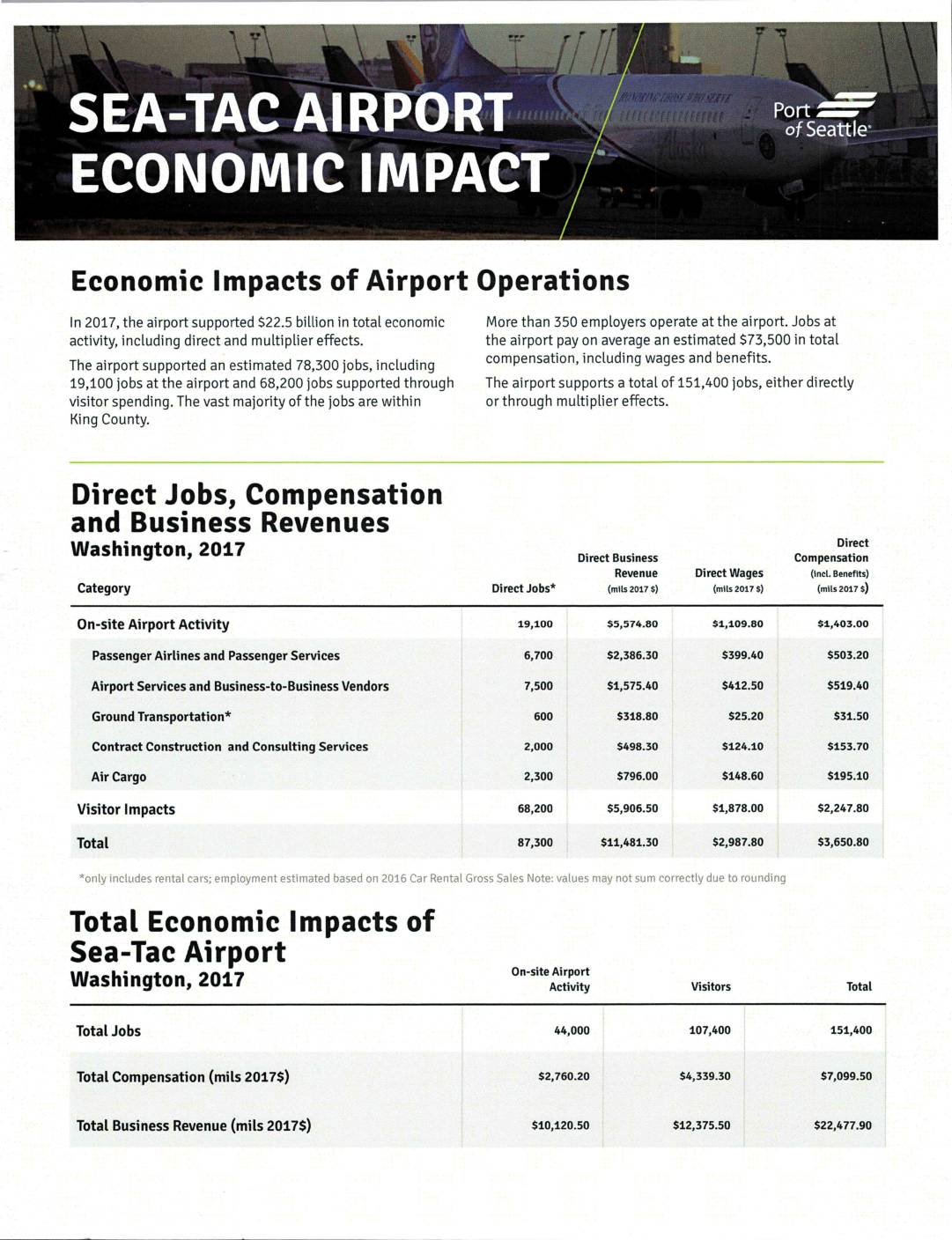
A 2017 economic impact report from the Port of Seattle shows that Seattle-Tacoma International Airport supported $22.5 billion in total economic activity and approximately 151,400 jobs across the region, including direct employment and multiplier effects. More than 350 employers operate at the airport, with on-site jobs averaging $73,500 in total compensation, and the surrounding communities of King and Pierce counties benefiting significantly from visitor spending and airport-related business revenues. -
 2018-01-01
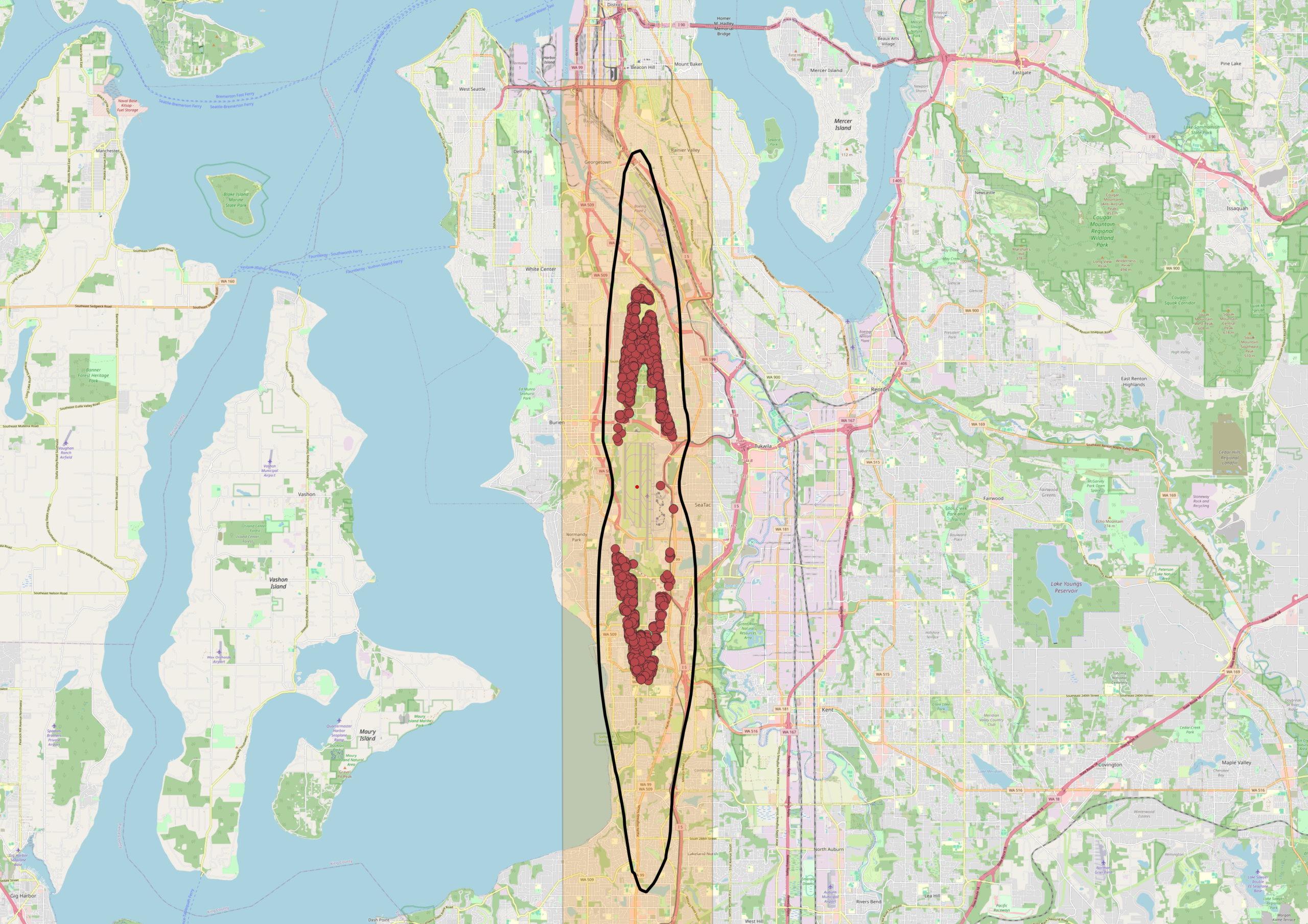
Sea-Tac Airport DNL 65 Noise Contour Map with 2018 Noise Complaints — Burien, White Center, and Tukwila
An OpenStreetMap-based map of the Seattle–Tacoma area showing Sea-Tac Airport's flight corridor, marked with a highlighted orange corridor zone and a black oval outline indicating the primary noise impact area. Red dot clusters represent noise complaints or flight track incidents concentrated over the Burien, White Center, and Tukwila neighborhoods south of Seattle, with a secondary cluster further south near Federal Way. -
 2017-12-18
Plans for Expanding SeaTac Leave Me Scratching My Head – Travel Codex
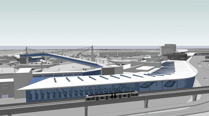
Plans for Expanding SeaTac Leave Me Scratching My Head by Scott MackenzieLast updated December 18, 2017 I’m not an airport manager, architect, or anyone qualified to determine the best way to build an airport. But some of the plans for expanding Seattle’s airport strike me as especially odd. The problem is the port authority believes passenger -
 2017-12-11
FAA/Industry’s own data exposes ‘Greener Skies’ as an environmental fraud
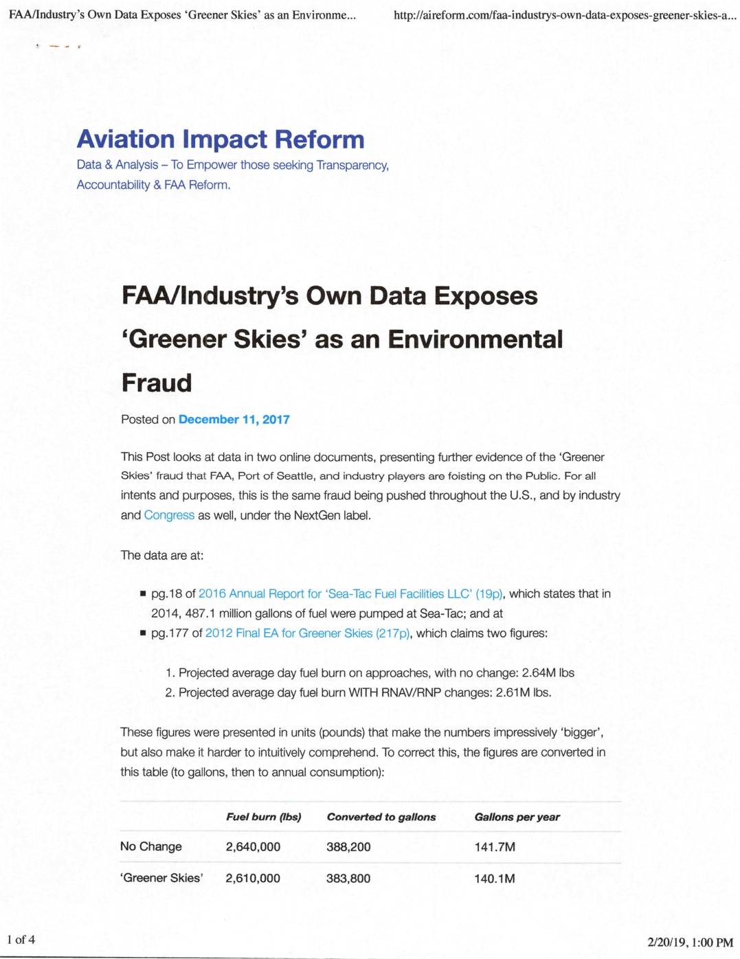
An analysis of FAA and industry data argues that the 'Greener Skies' flight procedure changes at Seattle-Tacoma International Airport provided negligible environmental benefits, saving only about 1.6 million gallons of fuel annually — less than one-third of one percent of the airport's total fuel consumption. Meanwhile, actual fuel use at Sea-Tac grew by hundreds of millions of gallons per year due to increased flight operations, completely overshadowing the claimed savings. The article contends that the program was essentially a public relations campaign that shifted noise burdens onto surrounding neighborhoods without delivering meaningful environmental improvements. -
 2017-11-28
Proposed 2018 City/Port Interlocal Agreement
This November 2017 City Council study session presentation outlines a proposed 2018 Interlocal Agreement (ILA) between the City of SeaTac and the Port of Seattle, which operates Seattle-Tacoma International Airport. Because Port properties make up 42% of SeaTac's total land area and the airport creates unique demands on city services, the two governments have used ILAs since 1997 to manage operational and authority issues. The proposed agreement, intended to replace the expiring February 2018 ILA, aims to improve efficiency, reduce costs, and avoid litigation through a mutually beneficial, comprehensive package of terms. -
 2017-11-15
Ultrafine particles near airports
Researchers from the University of Washington School of Public Health were commissioned by Washington State to study ultrafine particle air pollution near Sea-Tac Airport, the busiest international airport in the state. The study, presented in November 2017, required measuring ultrafine particulate matter within ten miles of the airport along flight paths, distinguishing aircraft emissions from other pollution sources, and comparing affected areas to unaffected ones. Findings and recommendations on whether to proceed with a second phase of research were due to the state legislature by December 1, 2019.