TagSea-Tac Airport(1835)
-
 2018-02-01
Aviation 2018 federal legislative agenda
The Port of Seattle's 2018 Federal Legislative Agenda outlines priorities for Seattle-Tacoma International Airport, including securing federal funding for infrastructure, expanding TSA and customs screening capacity, and addressing the airport's impact on surrounding communities. On noise and environmental issues, the Port sought greater FAA authority to engage local communities on flight path changes and noise concerns, supported studies on ultrafine particulate emissions, and pledged to monitor any proposed changes to the 65 DNL noise mitigation standard. The agenda also emphasized promoting sustainable aviation fuels, protecting immigrant workers, and improving quality of life for residents near the airport. -
 2018-01-30
2017 Q4 NorthSTAR program and North Satellite project (CIP C800556) briefing
This January 2018 Port of Seattle Commission briefing provides a quarterly update on the NorthSTAR Program, a joint Port of Seattle and Alaska Airlines effort to renovate and expand the North Satellite terminal at Seattle-Tacoma International Airport. The project involves growing the facility from 12 to 20 contact gates, modernizing existing infrastructure, and upgrading baggage handling systems, with construction on schedule and approximately $98.3 million spent of a $658.3 million budget. Key completed milestones include FAA-approved crane operations, structural steel erection, and installation of rainwater harvest tanks, while ongoing work includes chilled water piping replacement and escalator upgrades. -
 2018-01-30
Sea-Tac International Airport NorthSTAR Program fourth quarter 2017 program and North Satellite Project update
This January 2018 Port of Seattle presentation provides a Fourth Quarter 2017 update on the NorthSTAR Program and North Satellite (NSAT) renovation project at Seattle-Tacoma International Airport. The project expands the North Satellite terminal from 160,000 to 428,000 square feet and increases contact gate positions from 12 to 20, with key improvements including a marketplace, updated gate lobbies, seismic reinforcement, and new technology infrastructure. The renovation aims to enhance the passenger experience from curb to seat, improve safety, and increase overall level of service and passenger comfort. -
 2018-01-30
Sea-Tac International Airport economic impacts
A January 2018 Port of Seattle report presented to the Port Commission details the economic impacts of Seattle-Tacoma International Airport, showing that Sea-Tac supported approximately 87,300 jobs and generated over $11.4 billion in business revenue in 2017. The impacts span on-site airport activities—including airlines, cargo, and ground transportation—as well as visitor spending, which alone accounted for 68,200 jobs and nearly $5.9 billion in revenue. The report provides a comprehensive breakdown of wages, compensation, and business revenue across all airport-related sectors. -
 2018-01-30
Episode 1 – The briefing you should have had
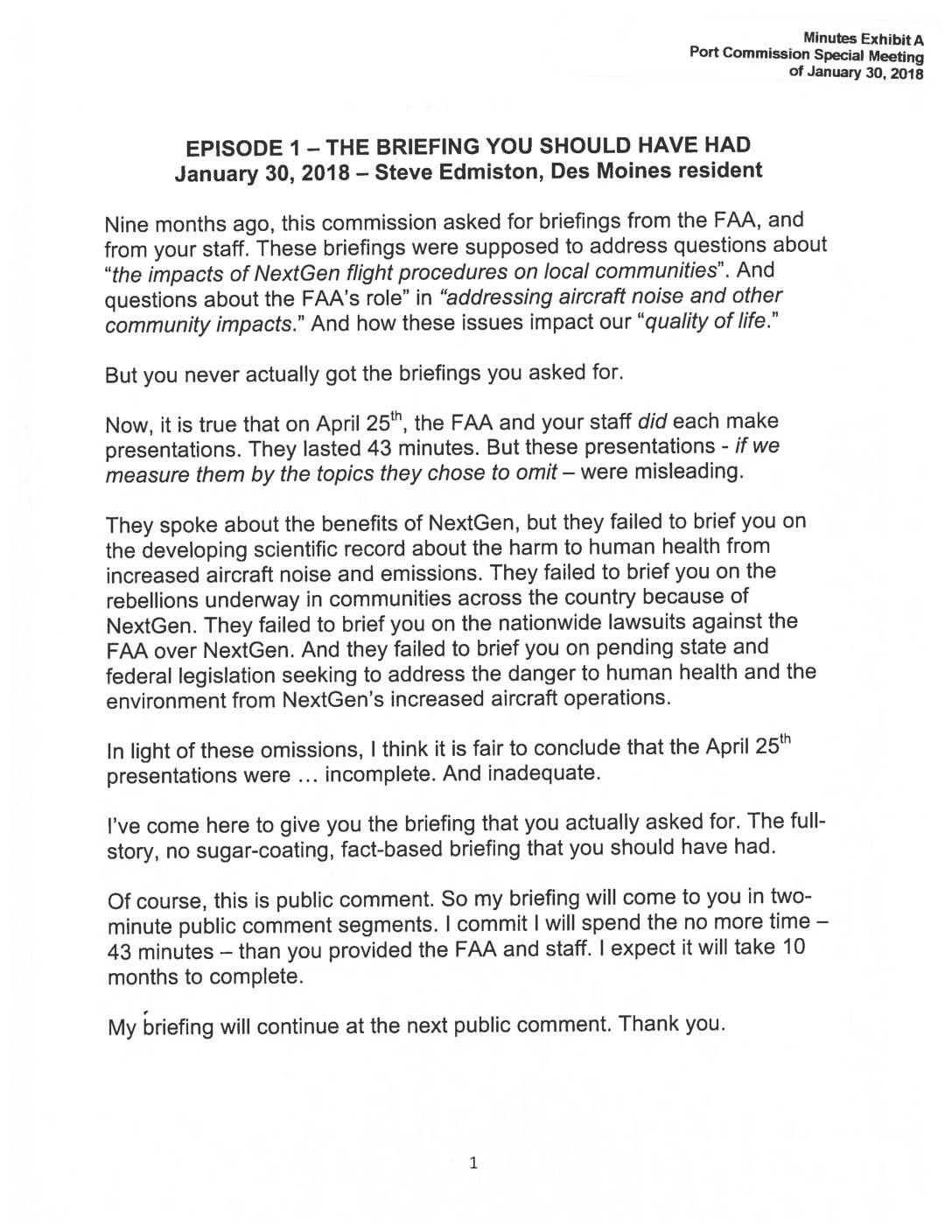
In January 2018, Des Moines resident and filmmaker Steve Edmiston addressed the Port of Seattle Commission, arguing that a prior FAA briefing on NextGen flight procedures omitted critical information about health harms from aircraft noise, nationwide community opposition, lawsuits against the FAA, and related legislation. Edmiston announced a project to deliver the full, fact-based briefing the Commission originally requested, presenting his information in two-minute public comment segments over an estimated 10 months. His goal was to push the Port to move beyond what he called 'selective environmentalism' and make better-informed decisions about the human and environmental costs of expanded flight operations at SeaTac Airport. -
 2018-01-24
Aircraft arrivals analysis: Progress update
This January 2018 progress update from ESA presents an analysis of aircraft arrivals at Seattle-Tacoma International Airport (SEA), examining whether notable changes occurred between 2013, 2015, and 2017. The study uses radar flight track data from July and December of each year to compare fleet mix, runway usage, and aircraft altitudes at six nautical miles from the airport. Key questions addressed include whether arrival numbers increased, whether traffic flow patterns shifted between north and south flow, and whether arriving aircraft were flying at different altitudes over the study period. -
 2018-01-12
2017 Airport Economic Impacts Study briefing
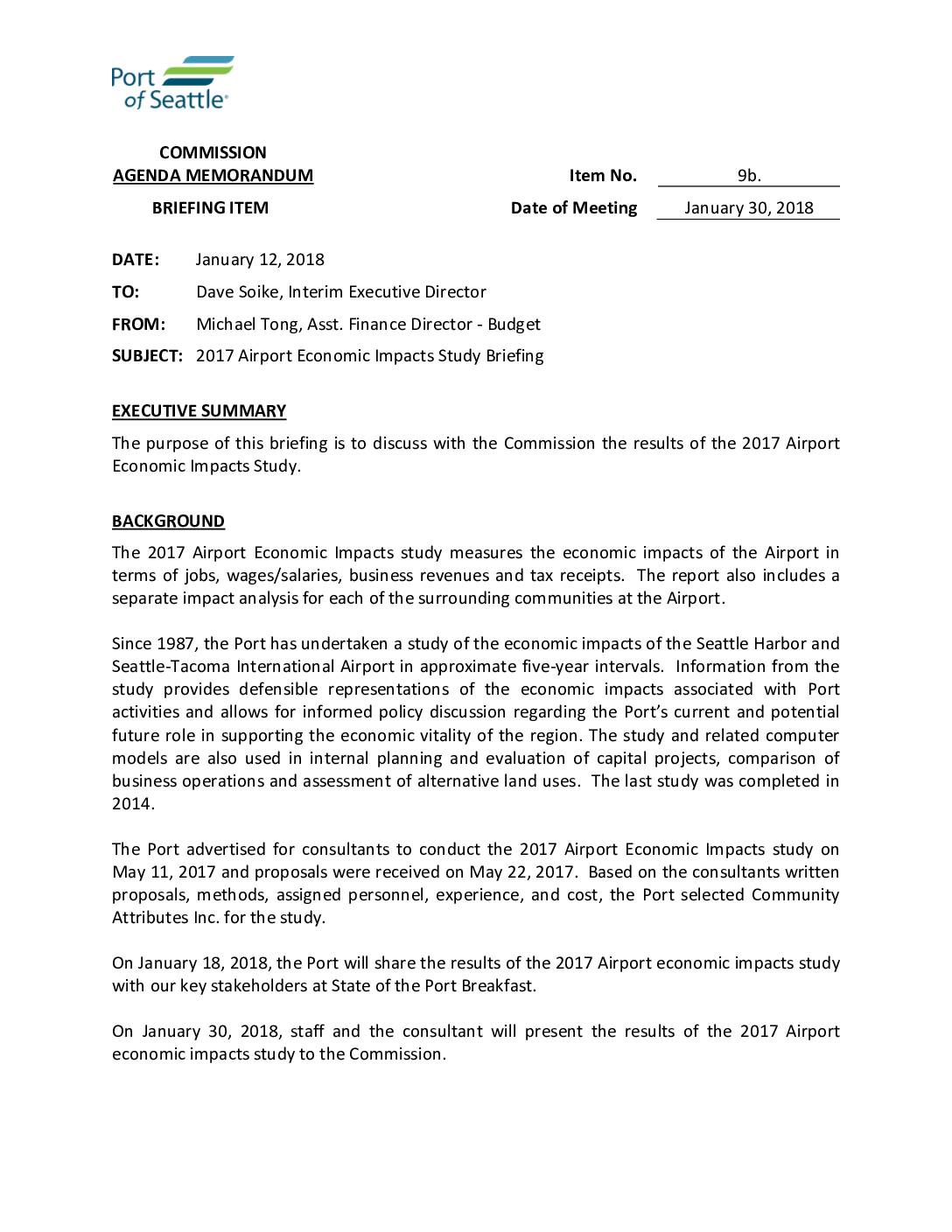
A January 2018 Port of Seattle memo prepared for the Commission outlines a briefing on the 2017 Airport Economic Impacts Study, which measures Seattle-Tacoma International Airport's effects on jobs, wages, business revenues, and tax receipts. The study, conducted by Community Attributes Inc., follows a series of similar assessments the Port has conducted roughly every five years since 1987. Results were shared with key stakeholders at a State of the Port Breakfast on January 18, 2018, ahead of a formal Commission presentation on January 30, 2018. -
 2018-01-01
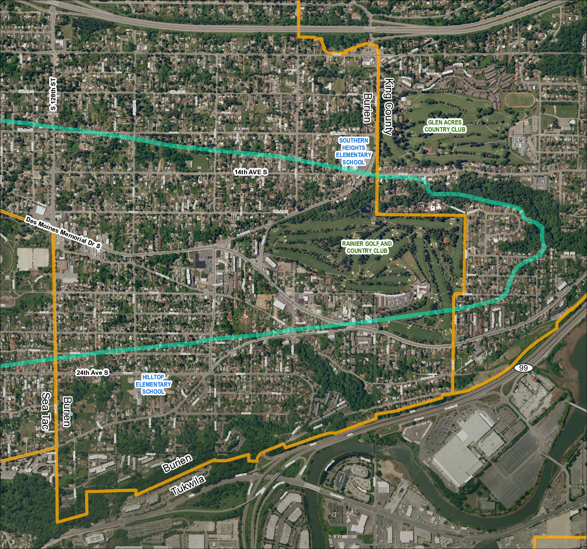
Grid 5: Sea-Tac Airport Area Map (2018)
This aerial map covers the residential and commercial areas surrounding Sea-Tac Airport, spanning portions of Burien, SeaTac, Tukwila, and unincorporated King County. It highlights key landmarks including Southern Heights Elementary School, Hilltop Elementary School, Rainier Golf and Country Club, and Glen Acres Country Club, along with major roadways such as SR 99, SR 599, Des Moines Memorial Drive S, and Military Road S. Turquoise boundary lines appear to delineate specific noise impact or study zones relevant to airport policy planning in the region. -
 2018-01-01
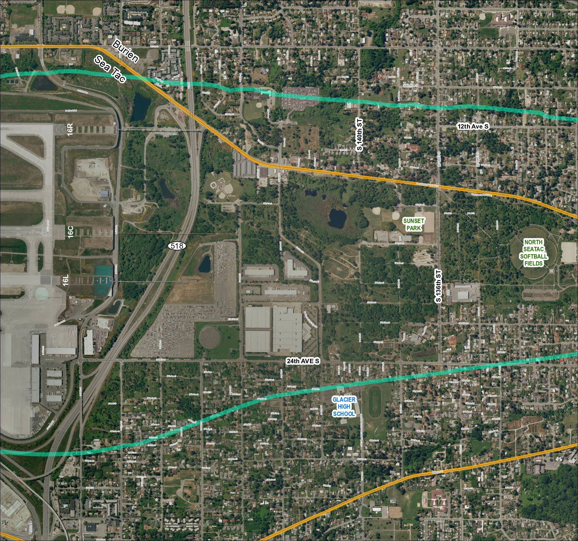
Grid 4 (2018): Aerial Map of Sea-Tac Area Including Glacier High School, Sunset Park, and North Sea-Tac Softball Fields
This map depicts the area surrounding Seattle-Tacoma International Airport, showing the airport's runway layout (including runways 16R, 16C, and 16L) alongside nearby neighborhoods in Burien and SeaTac. Two overlaid flight-path or noise-contour corridors (shown in teal/green and gold) arc across the surrounding residential and parkland areas, illustrating the geographic extent of aircraft noise impact. Notable landmarks within the affected area include Glacier High School, Sunset Park, and the North SeaTac Softball Fields, highlighting the communities exposed to airport-related noise. -
 2018-01-01
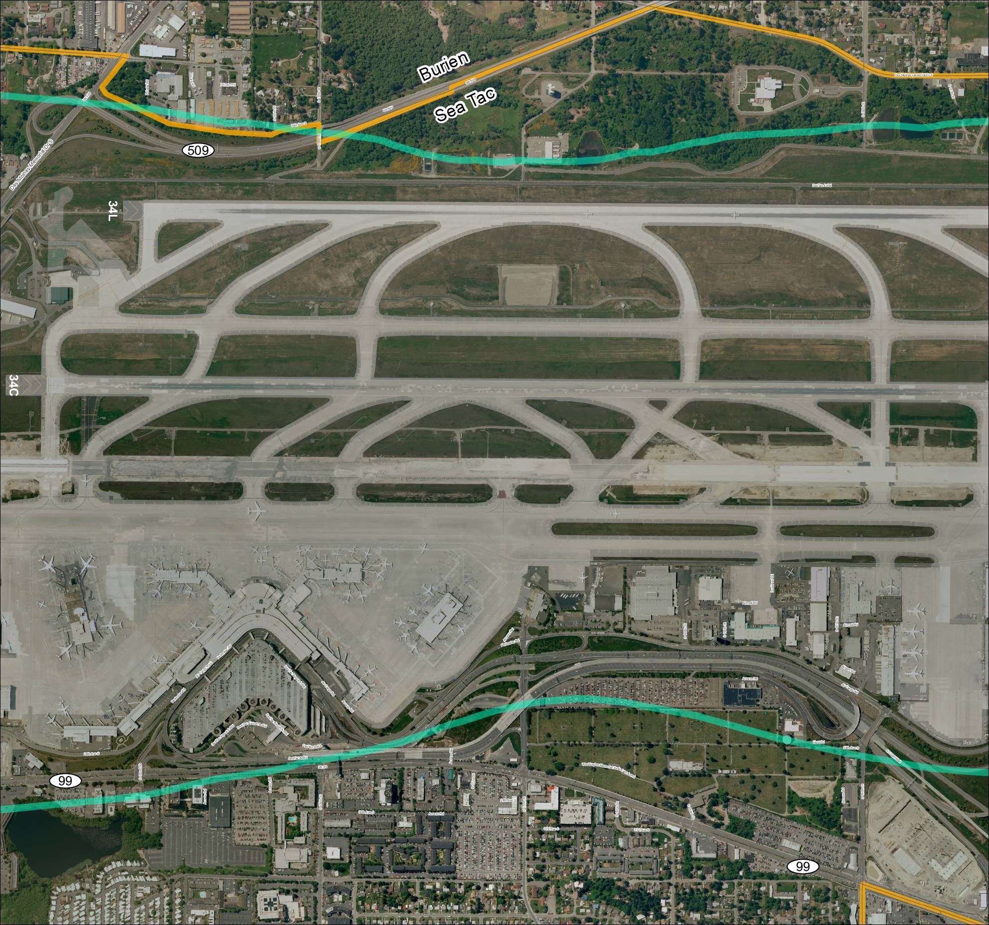
Grid 3: Sea-Tac Airport Aerial Map
This aerial map depicts Seattle-Tacoma International Airport (Sea-Tac) and its surrounding communities of Burien and SeaTac, showing the airport's runway layout including runways 34L and 34C, along with the local road network and key routes such as SR 99 and SR 509. The map highlights the ST Light Rail corridor and major access roads serving the airport, providing geographic context for understanding flight paths and noise exposure areas in the region. It serves as a reference for analyzing the relationship between airport operations and the residential and commercial areas situated beneath approach and departure corridors.