TagNoise(262)
-
2000-01-01
DCA Reagan National – Nighttime Noise Rule
DCA Nighttime Noise Rule History: Since 1941, Reagan National (DCA) has operated as a commercial airfield, 24-hours a day, 7-days a week. In the early 1980s, louder aircraft operating at Reagan National prompted the FAA – the original airport operator – to impose nighttime noise limits and the ability to fine non-compliant operations between 10 p.m. and 6:59 a.m. which became known -
 1998-11-18
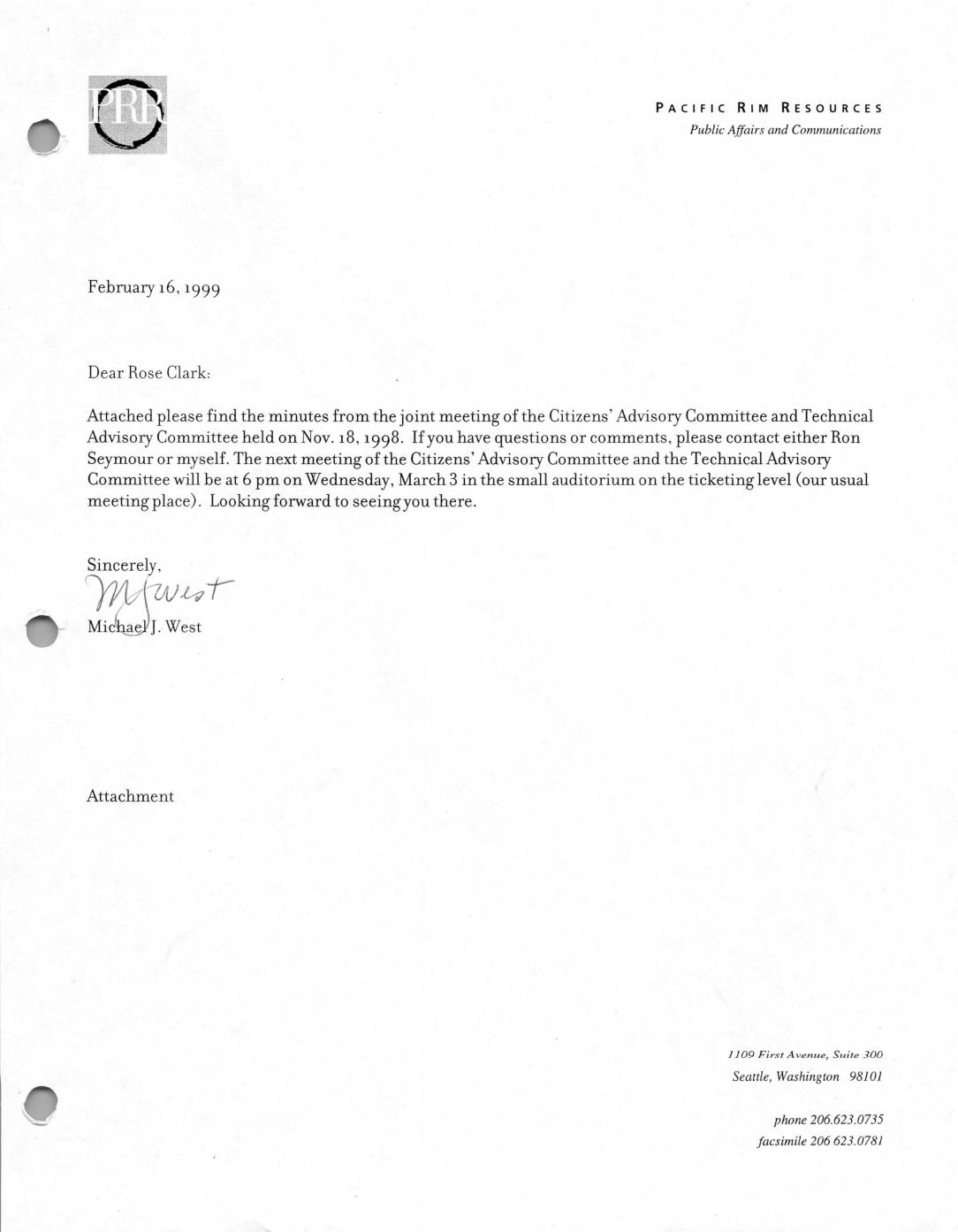
Sea-Tac Part 150 Noise Study: Minutes of the Joint Meeting of the Citizens’ Advisory Committee and Technical Advisory Committee, November 18, 1998
These are the minutes from a November 18, 1998 joint meeting of the Citizens' Advisory Committee and Technical Advisory Committee for the Sea-Tac Airport Part 150 Noise Study, held at Sea-Tac International Airport. The meeting covered the presentation of a preliminary noise contour map, updates on subcommittee activities related to airport operations and noise data analysis, and announcements about upcoming public events. Key discussion topics included run-ups, adherence to flight tracks, Fly Quiet programs, and how noise data would be measured and presented to the public. -
 1998-11-17
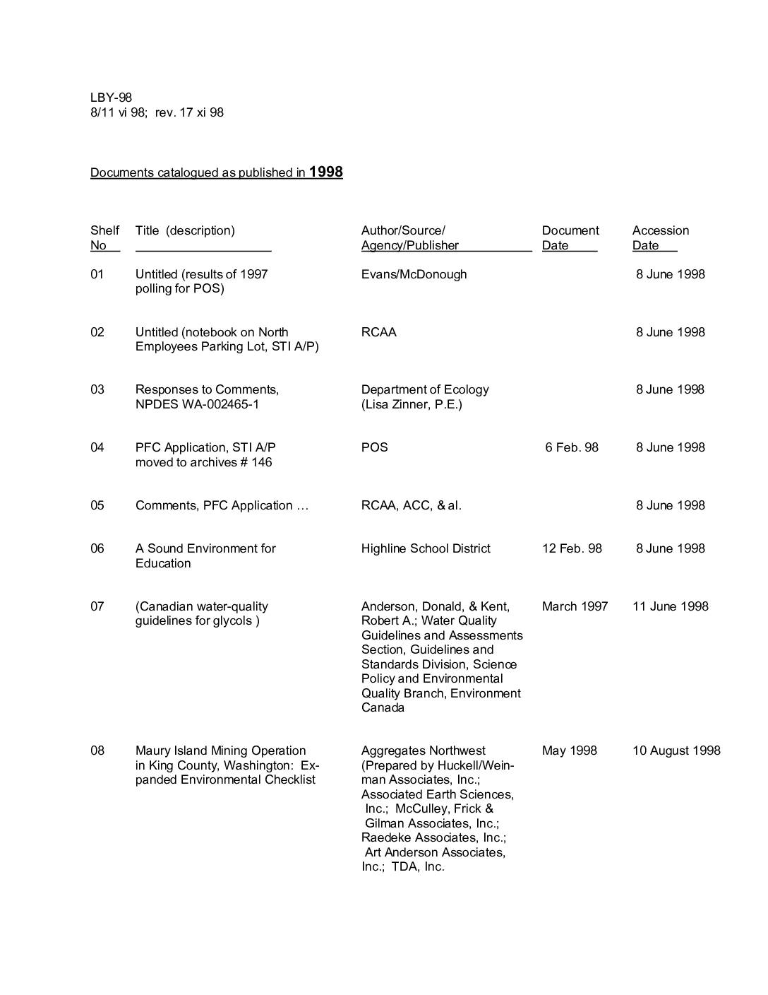
Documents catalogued as published in 1998
This is a catalog of 27 documents acquired by a library or archive in 1998, covering topics related to Seattle-Tacoma International Airport and its surrounding communities. The collection includes environmental reports, noise studies, NPDES water-quality permits, stormwater monitoring data, FAA safety materials, and a third-runway geotechnical study, as well as community-focused documents addressing aircraft noise impacts on local schools and residential areas. Each entry lists the document title, author or agency, original publication date, and the date it was added to the collection. -
 1998-07-01
Glossary of Commonly Used Acoustic and Air Traffic Control Terms
This Port of Seattle glossary defines key acoustic and air traffic control terms used in airport noise policy discussions. It explains measurements like decibels (dB), A-weighted decibels (dBA), and the Day-Night Noise Level (DNL), which is a 24-hour average used to map noise exposure around Sea-Tac Airport. It also covers Federal Aviation Regulations (Parts 36, 91, and 161) that govern aircraft noise standards, phase-out schedules for older noisy aircraft, and the process for airports to adopt new noise rules. -
 1998-06-11
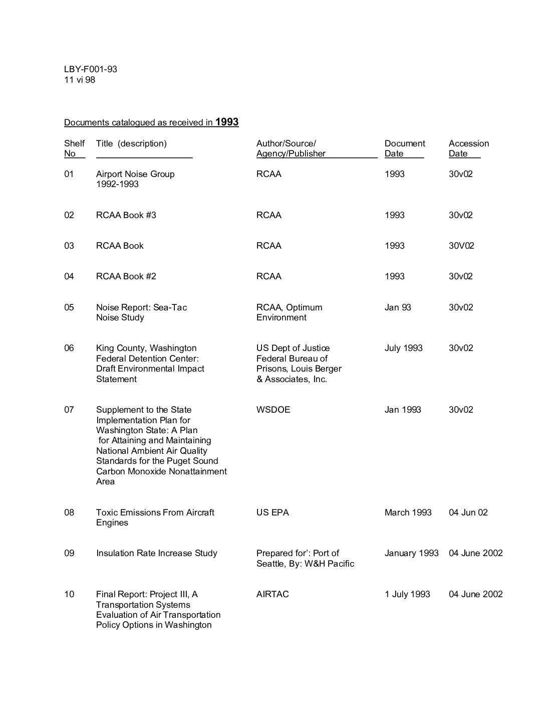
Documents catalogued as received in 1993
This catalog lists documents received in 1993 related to Sea-Tac International Airport and regional air transportation policy, covering topics such as airport noise studies, environmental impact statements, and air quality plans for the Puget Sound area. Sources include the FAA, US EPA, Washington State DOE, and various consulting firms. The collection spans noise compatibility programs, aircraft deicing environmental concerns, wetlands restoration, and long-range aviation forecasts for the Pacific Northwest. -
 1998-06-11
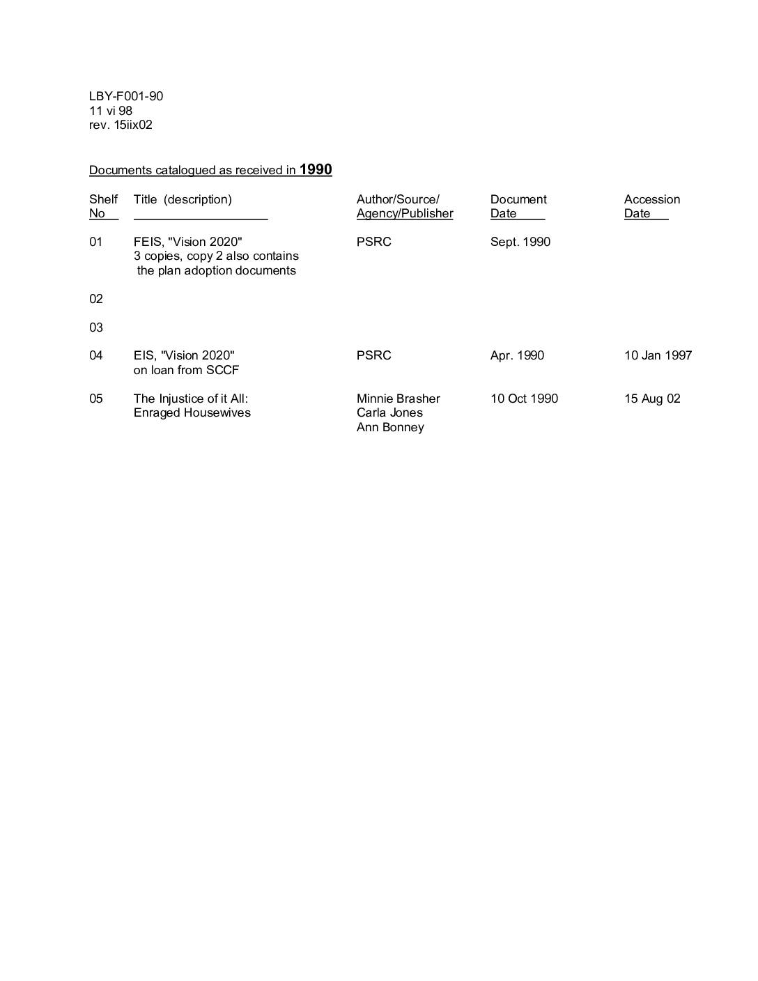
Documents catalogued as received in 1990 and 1992
This library catalog covers documents received in 1990 and 1992 relating to aviation planning and noise policy in the Puget Sound region, with a focus on Sea-Tac Airport. Key items include environmental impact statements for the 'Vision 2020' and 'Flight Plan Project' plans, Sea-Tac noise exposure map updates, community association comments on airport expansion, and technical reports on aircraft modifications. The catalog records each document's title, author or agency, original publication date, and accession date, and notes donor information where applicable. -
 1998-06-01
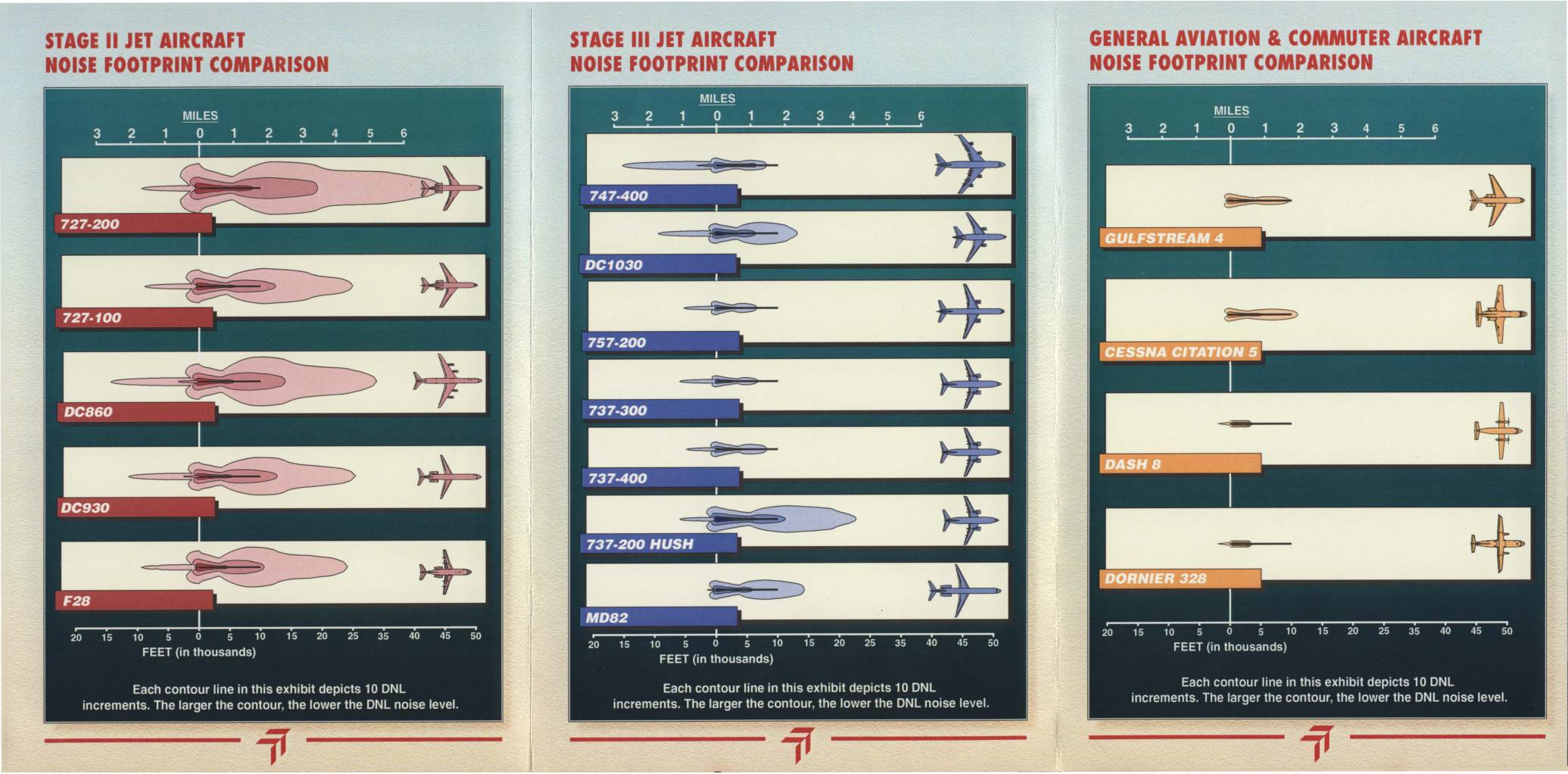
Sea-Tac International Airport: Commercial Aircraft Noise Footprint Comparison
This Sea-Tac International Airport brochure, prepared by the Port of Seattle in Summer 1998, compares the noise footprints of Stage II jets, Stage III jets, and general aviation/commuter aircraft to help residents understand the noise impacts of different aircraft types. It explains that Stage III aircraft are significantly quieter than Stage II aircraft, and that replacing older Stage II planes with newer Stage III models would meaningfully reduce noise levels in surrounding communities. The document also defines key noise measurement terminology, including DNL (Day-Night Average Sound Level), and notes that nighttime flights carry a 10-decibel penalty in noise accounting. -
 1997-09-01
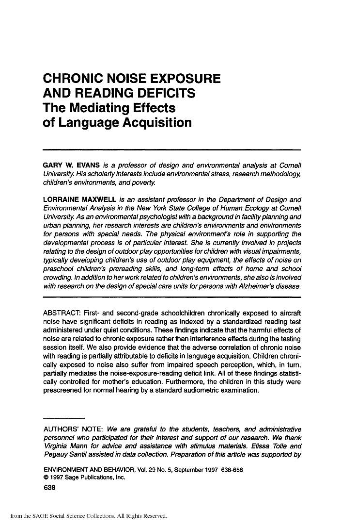
Chronic noise exposure and reading deficits: The mediating effects of language acquisition
A 1997 Cornell University study found that elementary school children chronically exposed to aircraft noise showed significant reading deficits, even when tested under quiet conditions — meaning the harm stems from long-term exposure, not just momentary distraction. The researchers identified impaired language acquisition, particularly speech perception, as a key reason why noise-exposed children fall behind in reading. These findings have direct relevance for communities near busy airports, where sustained noise levels may quietly undermine children's academic development. -
 1997-02-01
Sea-Tac International Airport impact mitigation study: Initial assessment and recommendations
★ 32The HOK Study. 1997 initial assessment and recommendations report for the Sea-Tac International Airport Impact Mitigation Study, prepared by Hellmuth, Obata + Kassabaum and Raytheon Infrastructure Services. The study was funded by a State of Washington grant on behalf of the cities of Burien, Des Moines, Federal Way, Normandy Park, and Tukwila, as well as -
 1996-04-25
Puget Sound Regional Council Executive Board Meeting Agenda – April 25, 1996
The Puget Sound Regional Council (PSRC) held an Executive Board Meeting on April 25, 1996, at the Olympic Room, Seattle Center, beginning at 9:00 A.M. A key agenda item was a communications packet regarding an Expert Arbitration Panel's decision on airport noise and demand/system management issues, with follow-up action on noise also listed under New Business. The meeting covered additional regional transportation matters, including certification of local comprehensive plan transportation elements and amendments to the 1996–98 Transportation Improvement Program (TIP).