TagSea-Tac Airport(1835)
-
 2020-05-29
Study of the Current and Ongoing Effects of the Operation of the Seattle-Tacoma International Airport: Appendix A, Section 10 – Light
This section of a 2020 study examines how the operation of Seattle-Tacoma International Airport affects nighttime light conditions in surrounding communities, using satellite imagery data collected between 1998 and 2018. Researchers analyzed 'skyglow' — light pollution caused by electric fixtures and light reflected off surfaces like roads and parking lots — across the broader Central Puget Sound region. The study notes that nighttime light emission readings can vary by 15–20% due to factors such as weather, seasonal vegetation, and imaging conditions, and it identifies specific light fixture types that contribute most to sky glow. -
 2020-05-29
Appendix A, Section 9: Groundwater and Soil Quality — Study of the Current and Ongoing Effects of the Operation of the Seattle-Tacoma International Airport
This 2020 environmental study examines groundwater and soil quality at and around Seattle-Tacoma International Airport from 1997 to 2019, tracking changes in contamination levels and evaluating whether they stem from airport operations, other pollution sources, or stormwater runoff. The report draws on data from the Port of Seattle, surrounding cities, and state environmental agencies to assess the effectiveness of the airport's cleanup efforts and identify any contamination that may have spread beyond airport property. The underlying geology—dense glacial till soils—generally slows the movement of contaminants through the ground in the area. -
 2020-05-29
Sea-Tac Airport Communities Impact Study: Appendix A, Section 7 – Mobility
This 2020 report examines how Seattle-Tacoma International Airport has affected mobility in surrounding communities between 1997 and 2019, focusing on traffic congestion, residential parking, and pedestrian access. It documents major infrastructure changes such as the 2010 consolidation of rental car facilities to an off-site location 1.5 miles from the terminal and the expansion of the main parking garage from 10,000 to roughly 13,000 spaces. The analysis draws on data from government agencies including the Port of Seattle, WsDOT, Sound Transit, and King County Metro to identify transportation impacts and recommend future tracking measures. -
 2020-05-27
South King County Fund update
In November 2018, the Port of Seattle Commission set aside $10 million over five years (2019–2023) to benefit near-airport communities in South King County, with funds intended to address airport noise and support environmental health and sustainability projects. In June 2019, the Commission adopted eight guiding principles to govern the fund, emphasizing community input, equity, innovation, and matching funds where possible. This May 2020 presentation to the Highline Forum provided an update on the fund's progress and priorities. -
 2020-05-27
Noise programs update
This May 2020 update from Seattle-Tacoma International Airport outlines the status of its noise abatement and mitigation programs. Citizen noise complaints were averaging 400 per day, while the Noise Abatement Corridor saw 98% compliance and the Late Night Noise Limitation Program recorded an average of 11 exceedances per night in Q1 2020. COVID-19 delayed sound insulation construction projects for single-family homes and condominiums, pushing estimated start dates into 2021. -
 2020-05-16
Re: Burien Airport Committee agenda packet – May 19, 2020
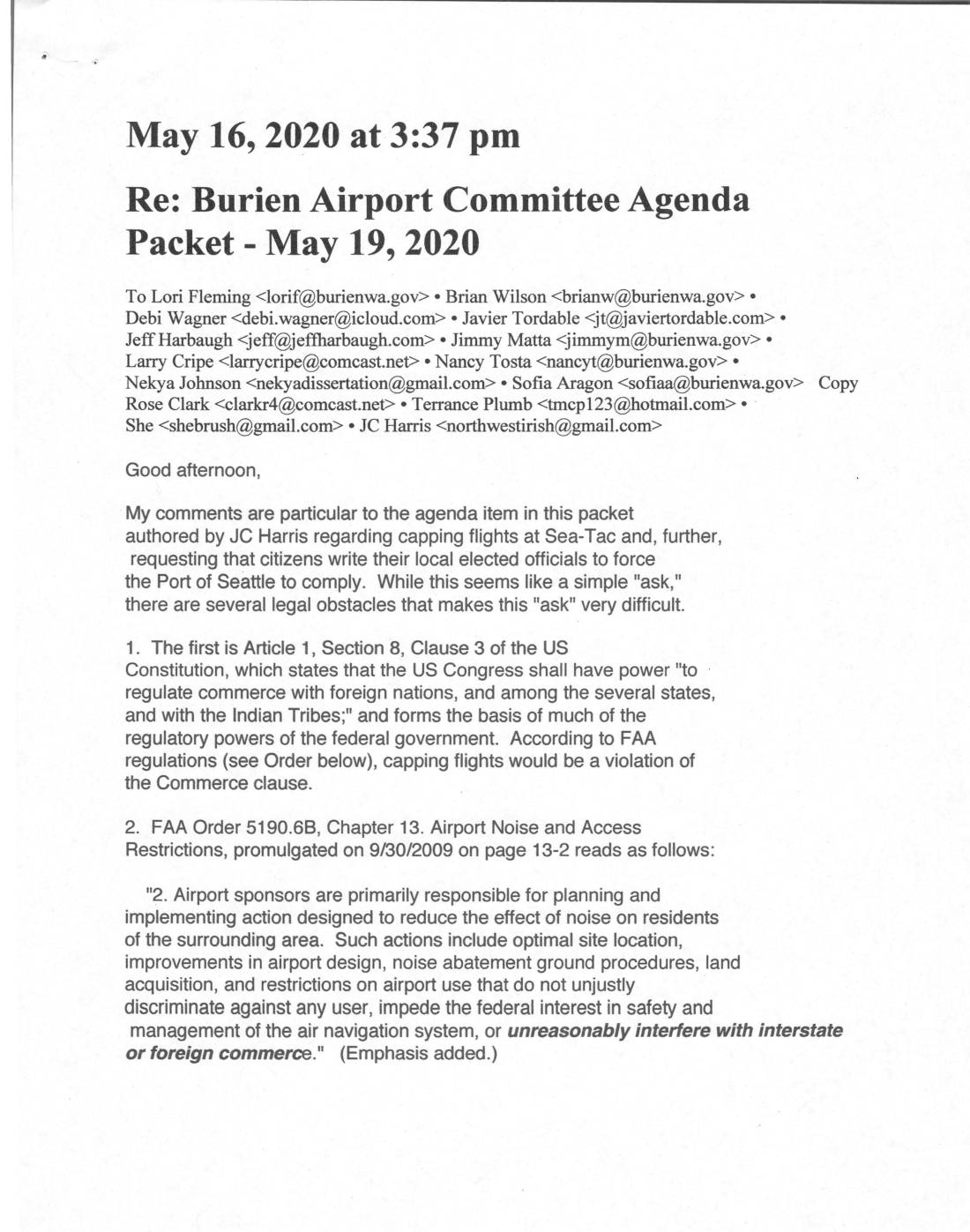
This document contains correspondence related to Sea-Tac Airport noise and flight operations concerns, including a legal analysis explaining why capping flights would face significant obstacles under the U.S. Commerce Clause and FAA regulations, along with alternative approaches such as Part 161 Studies and state emissions legislation. It also includes a letter from the cities of Burien and Des Moines outlining conditions for rejoining the Sea-Tac Airport Round Table (StART), demanding meeting recordings, reversal of a $10 million design expenditure made without proper environmental review, and responses to outstanding written concerns that had gone unanswered by the Port of Seattle. -
 2020-05-02
Invoice #1150 and monthly status report – Arlington County consulting services
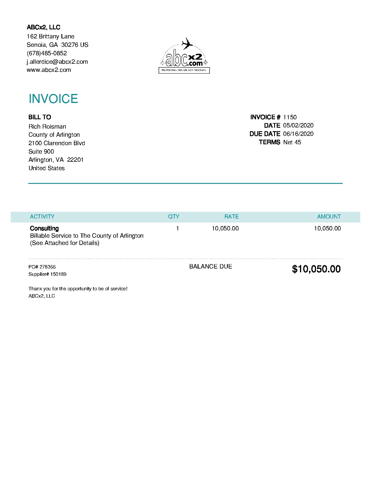
This document is an invoice and monthly status report from ABCx2, LLC, a consulting firm based in Senoia, Georgia, billing the County of Arlington, Virginia $10,050.00 for consulting services rendered in April 2020. The work involved nine consultants logging a total of 34.5 hours across tasks such as Smartsheet setup, social media and web strategy planning, and setting up a DCA airspace model in collaboration with a company called Vianair. Note that this document pertains to Arlington County aviation-related consulting and does not appear to be directly related to Sea-Tac Airport noise policy. -
 2020-04-21
Letter to FAA Administrator Steve Dickson regarding SeaTac Airport environmental assessment
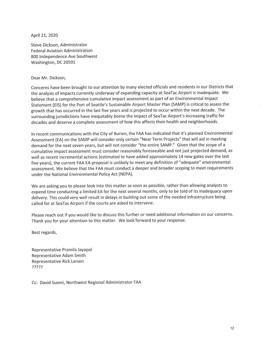
In April 2020, U.S. Representatives Pramila Jayapal, Adam Smith, and Rick Larsen wrote to FAA Administrator Steve Dickson urging a full Environmental Impact Statement (EIS) for the Port of Seattle's Sustainable Airport Master Plan (SAMP), arguing that the FAA's planned limited Environmental Assessment was inadequate. The lawmakers contended that a comprehensive cumulative impact review was necessary to properly evaluate decades of growing noise and health impacts on communities surrounding Sea-Tac Airport. They warned that proceeding with a narrower assessment risked legal challenges that could delay critical airport infrastructure projects. -
 2020-03-24
Resolution No. 3771: Flight Corridor Safety Program 2019 property interests
The Port of Seattle Commission adopted Resolution No. 3771 in March 2020 to authorize the acquisition of property easements and access rights around Seattle-Tacoma International Airport as part of the 2019 Flight Corridor Safety Program. The program aims to remove trees and other obstructions that interfere with aircraft landing and takeoff corridors, in compliance with FAA requirements and state law. The Port is directed to first pursue voluntary negotiations with affected property owners, but is authorized to use eminent domain condemnation proceedings if those negotiations fail. -
 2020-03-12
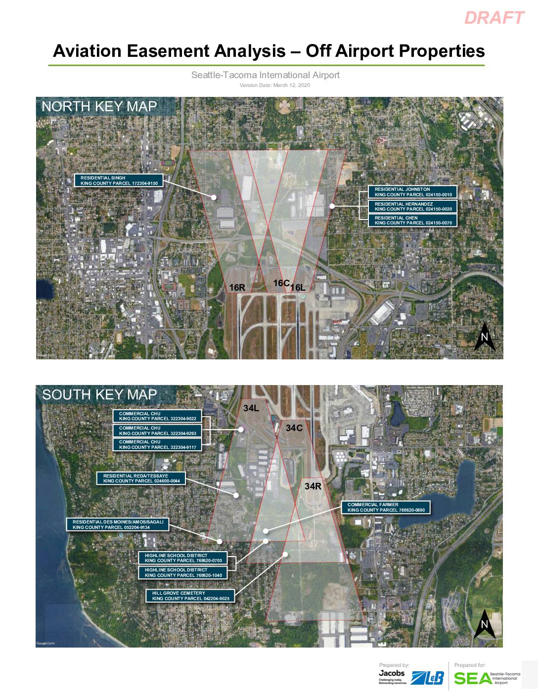
Aviation Easement Analysis – Off Airport Properties: Seattle-Tacoma International Airport (Highline School District Parcels 768620-0705 and 768620-1040)
This draft report, prepared by Jacobs and ZLB for Seattle-Tacoma International Airport in March 2020, analyzes aviation easements for off-airport properties located near the airport's runways. It focuses on two Highline School District parcels (King County Parcels 768620-0705 and 768620-1040), documenting the removal of 26 trees that previously penetrated federally defined airspace protection surfaces, including approach, departure, and transitional surfaces. The analysis confirms that all identified obstacles have been removed as part of a construction package, and provides detailed elevation and coordinate data for parcel boundary points relative to runway thresholds.