TagSea-Tac Airport(1835)
-
 2020-02-25
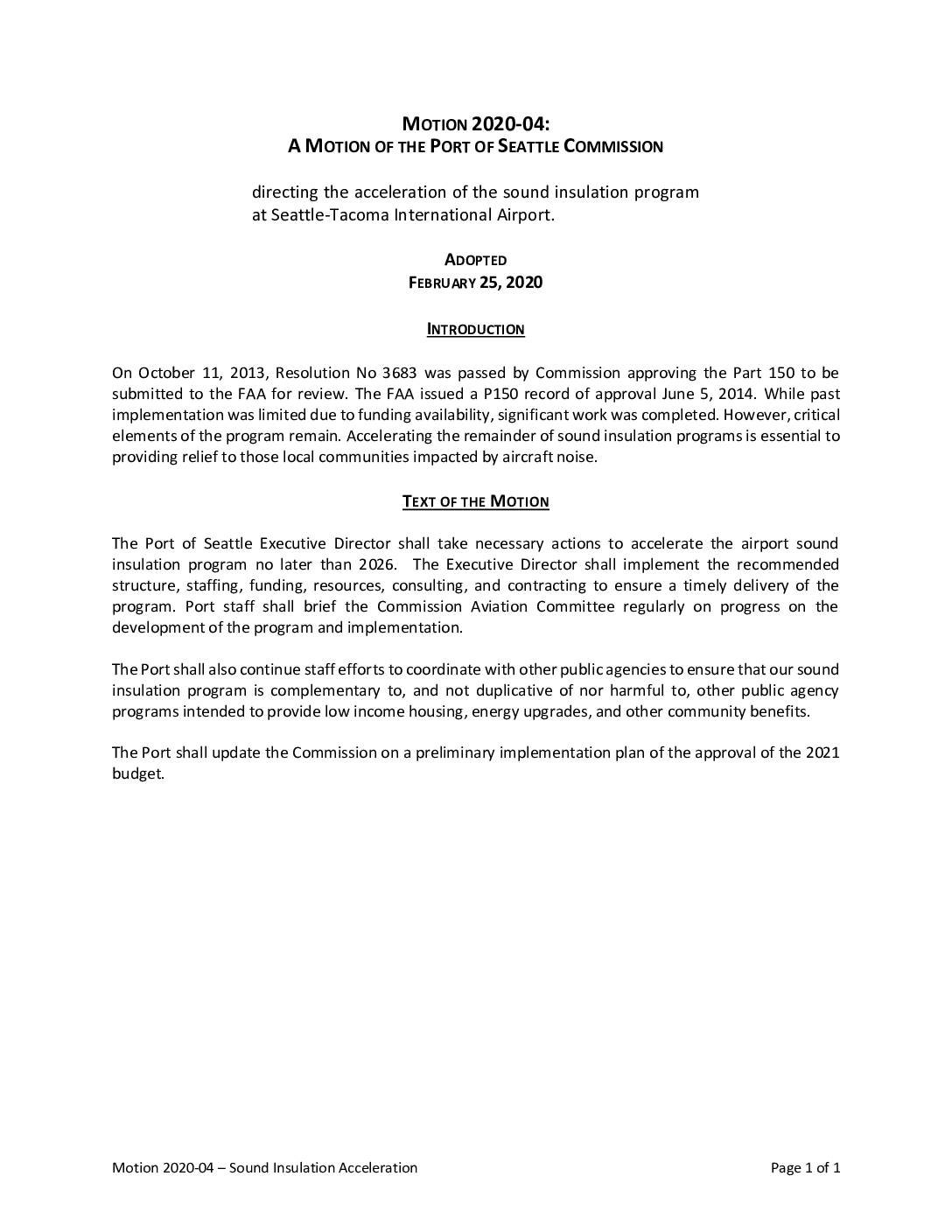
Motion 2020-04: A motion of the Port Of Seattle Commission directing the acceleration of the sound insulation program at Seattle-Tacoma International Airport
In February 2020, the Port of Seattle Commission adopted Motion 2020-04, directing the Executive Director to accelerate the sound insulation program at Seattle-Tacoma International Airport and complete it no later than 2026. The motion calls for appropriate staffing, funding, and contracting to deliver the program on time, with regular progress updates to the Commission's Aviation Committee. The Port is also directed to coordinate with other public agencies to ensure the program complements, rather than duplicates, existing efforts related to low-income housing and energy upgrades. -
 2020-02-25
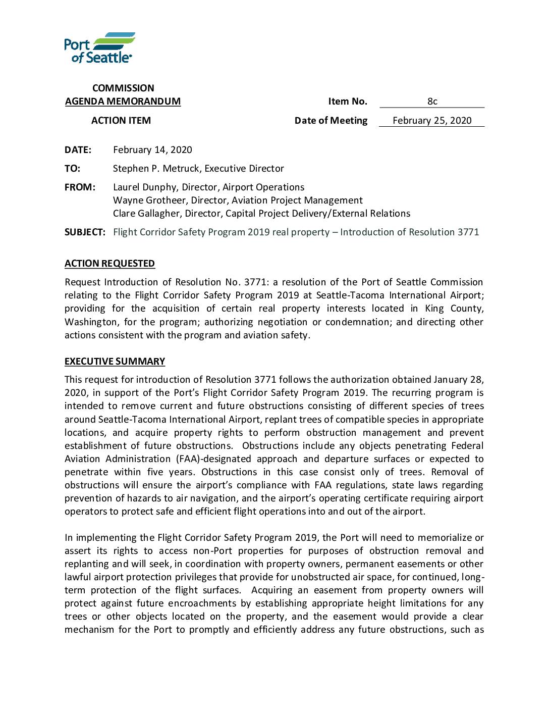
Flight Corridor Safety Program 2019 real property – Introduction of Resolution 3771
The Port of Seattle Commission is introducing Resolution 3771 to support the Flight Corridor Safety Program 2019, which involves removing trees near Seattle-Tacoma International Airport that obstruct FAA-designated flight approach and departure paths. The program seeks to acquire permanent easements on private properties to prevent future obstructions and ensure ongoing compliance with FAA regulations and the airport's operating certificate. If voluntary negotiations with property owners fail, the Port is authorized to pursue condemnation as a last resort to secure the necessary property rights. -
 2020-02-25
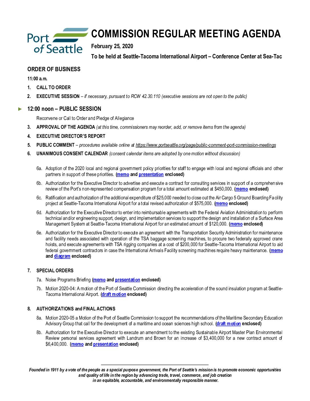
Port of Seattle Commission agenda – February 25, 2020
The Port of Seattle Commission held a regular meeting on February 25, 2020, at Seattle-Tacoma International Airport, covering a range of airport and maritime topics. Key noise-related items included a Noise Programs Briefing and Motion 2020-04, which directed the acceleration of the sound insulation program at Sea-Tac Airport. Additional agenda items addressed airport infrastructure, security upgrades, and the Sustainable Airport Master Plan Environmental Review. -
 2020-02-21
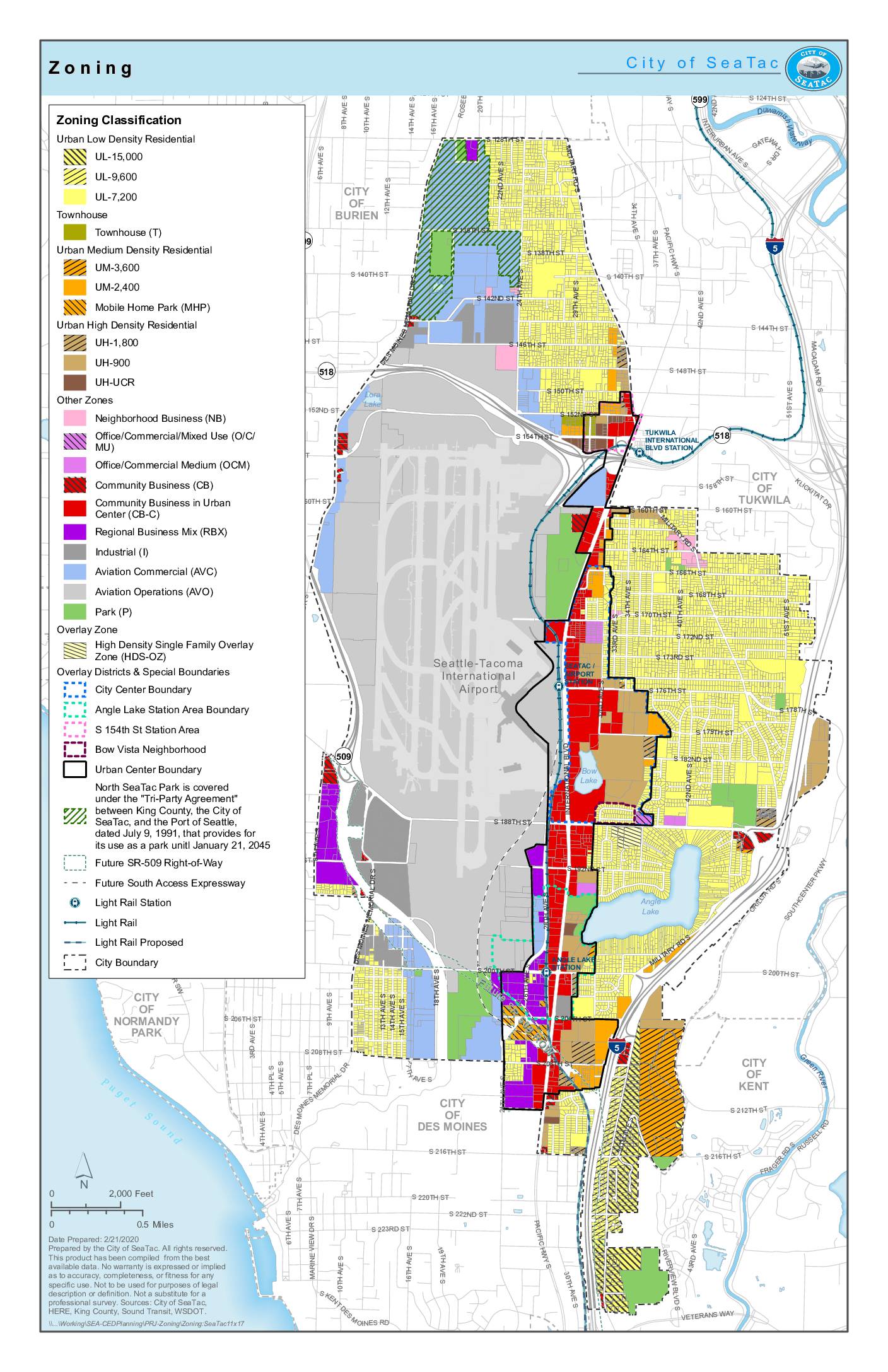
City of SeaTac zoning map
This is the official zoning map for the City of SeaTac, Washington, prepared in February 2020, showing land-use classifications across the city. It covers a range of zones including low-, medium-, and high-density residential areas, commercial and industrial districts, aviation-related zones, and parks, alongside overlay districts and special boundaries such as the Urban Center and Angle Lake Station Area. The map also depicts infrastructure features including light rail stations, the Seattle-Tacoma International Airport footprint, and planned future rights-of-way for SR-509. -
Center Runway Reconstruction
The Port of Seattle completed reconstruction of the center runway (designated as 16C/34C) at Seattle-Tacoma International Airport in 2015. The runway was originally built in 1969 and had some brief closures during 2016 in order to complete adjoining projects with taxiways and blast pads. The project included installation of a new LED runway lighting system and an -
SEA Airport Approaches Capacity and Faces Difficult Decisions
Steinbrueck, Peter The Puget Sound Regional Council (PSRC) recently published preliminary findings of an air capacity study that shows what Port leadership and the traveling public have known for a while — the region is rapidly approaching a crisis. Seattle-Tacoma International Airport (SEA) has one of the smallest footprints of any major airport in the -
 2020-01-22
StART Noise Working Group update
This January 2020 update from the Sea-Tac Stakeholder Advisory Round Table (StART) Noise Working Group covers three main areas: a Ground Noise Study collecting 2019 operations data from airlines, an Aircraft Departure Profiles Analysis showing that the 'distant departure' procedure reduces noise the most for nearby communities, and a Late Night Noise Limitation Program identifying EVA Air, FedEx Express, and China Airlines Cargo as the carriers with the most noise violations in Q4. The study was scheduled to produce a final report with mitigation options by October/November 2020. The update was presented at the Highline Forum on January 22, 2020. -
 2020-01-15
Billing Backup for City Shares of Lockridge Grindal Nauen Invoices for Sea-Tac Airport SAMP Review
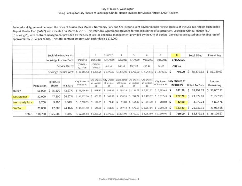
The City of Burien, Washington managed billing for a joint legal consulting contract with Lockridge Grindal Nauen PLLP to review the Sea-Tac Airport Sustainable Airport Master Plan (SAMP) on behalf of four cities: Burien, Des Moines, Normandy Park, and SeaTac. The $175,000 contract was funded proportionally based on each city's population at approximately $1.50 per capita, with costs shared across eight invoices between September 2018 and January 2020. As of the most recent billing, approximately $88,879 of the total contract had been billed, leaving roughly $86,121 remaining. -
 2020-01-15
Billing Backup for City Shares of Lockridge Grindal Nauen Invoices for Sea-Tac Airport SAMP Review
The City of Burien, Washington managed billing for a joint legal consulting contract with Lockridge Grindal Nauen PLLP to review the Sea-Tac Airport Sustainable Airport Master Plan (SAMP) on behalf of four cities: Burien, Des Moines, Normandy Park, and SeaTac. The $175,000 contract was funded proportionally based on each city's population at approximately $1.50 per capita, with costs shared across eight invoices between September 2018 and January 2020. As of the most recent billing, approximately $88,879 of the total contract had been billed, leaving roughly $86,121 remaining. -
 2020-01-15
City of Burien Billing Backup for City Shares of Lockridge Grindal Nauen Invoices for Sea-Tac Airport SAMP Review
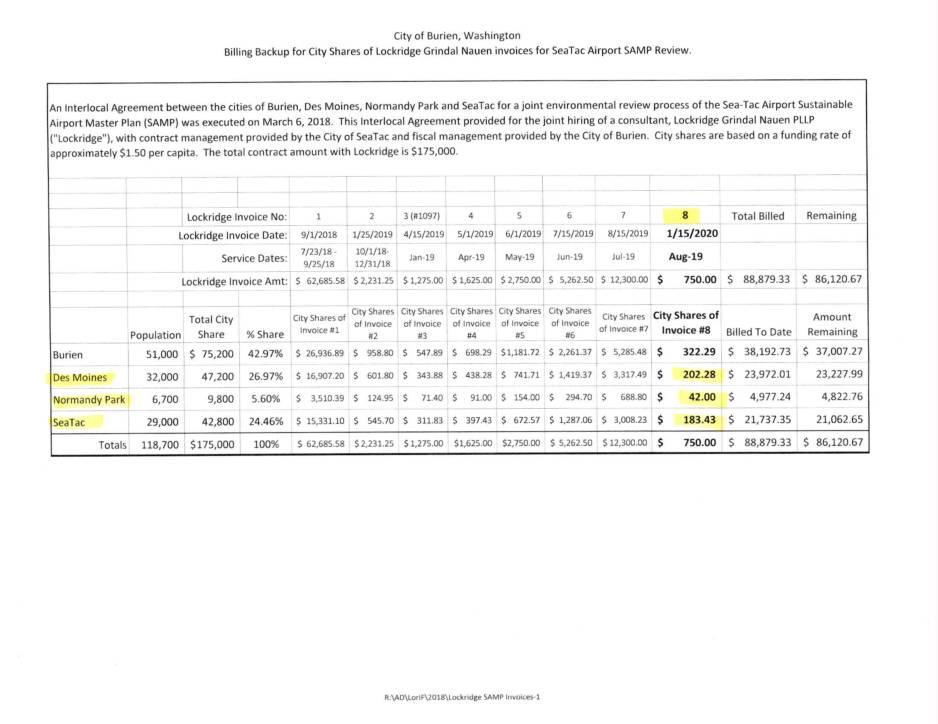
This document details billing records for the City of Burien, Washington, related to the Sea-Tac Airport Sustainable Airport Master Plan (SAMP) environmental review. Four cities — Burien, Des Moines, Normandy Park, and SeaTac — jointly hired law firm Lockridge Grindal Nauen PLLP under a $175,000 contract, with each city's share calculated at approximately $1.50 per capita. Through eight invoices spanning 2018 to early 2020, a total of $88,879.33 had been billed, leaving a remaining balance of $86,120.67.