Notes
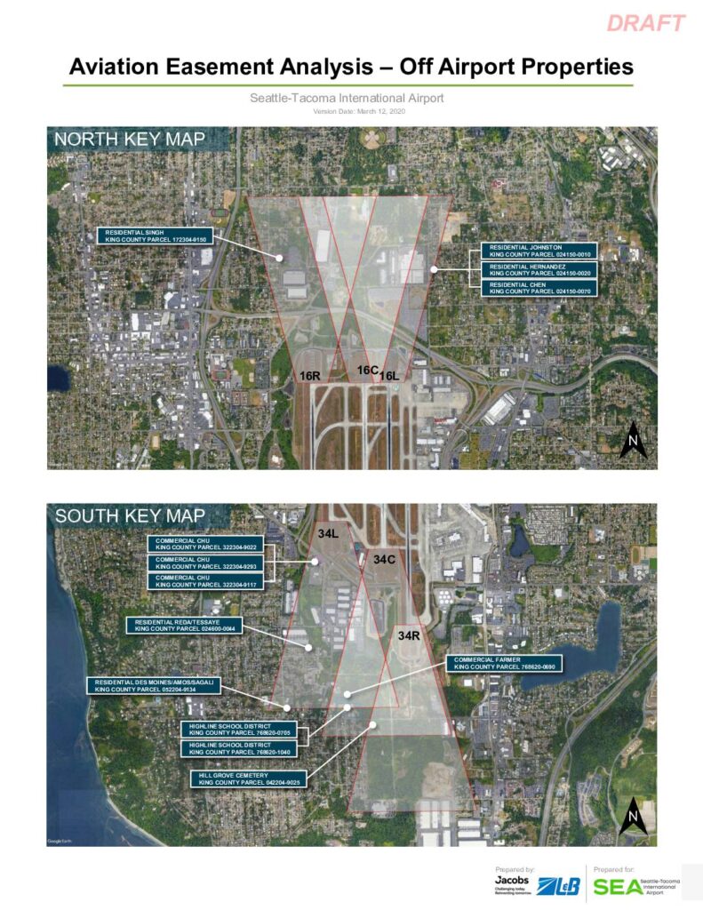
Draft avigation easement analysis prepared by Jacobs and ZLB for Sea-Tac Airport covering off-airport properties, focusing on Highline School District King County Parcels 768620-0705 (North Parcel) and 768620-1040 (South Parcel). Documents Part 77 surface obstacle analysis including Inner Approach (50-1), Inner Transitional (INTR), Threshold Siting Surface (TSS/34-1), Departure Surface (40-1), and Low Close-In (LCI) surface elevations in NAVD88 MSL. Identifies 26 trees (all removed under JOC-Package1-SD5) on both parcels near runways 16R, 16C, 16L, 34C, 34L, 34R, with LIDAR survey data from June 2018. Also references residential and commercial off-airport parcels including Singh (172304-9150), Johnston (024150-0010), Hernandez (024150-0020), Chen (024150-0070), Reda/Tessaye (024600-0044), Des Moines/Amos/Sagali (052204-9134), Chu (322304-9022, 322304-9293, 322304-9117), Farmer (768620-0690), Hill Grove Cemetery (042204-9025).