TagSea-Tac Airport(1835)
-
 2022-08-20
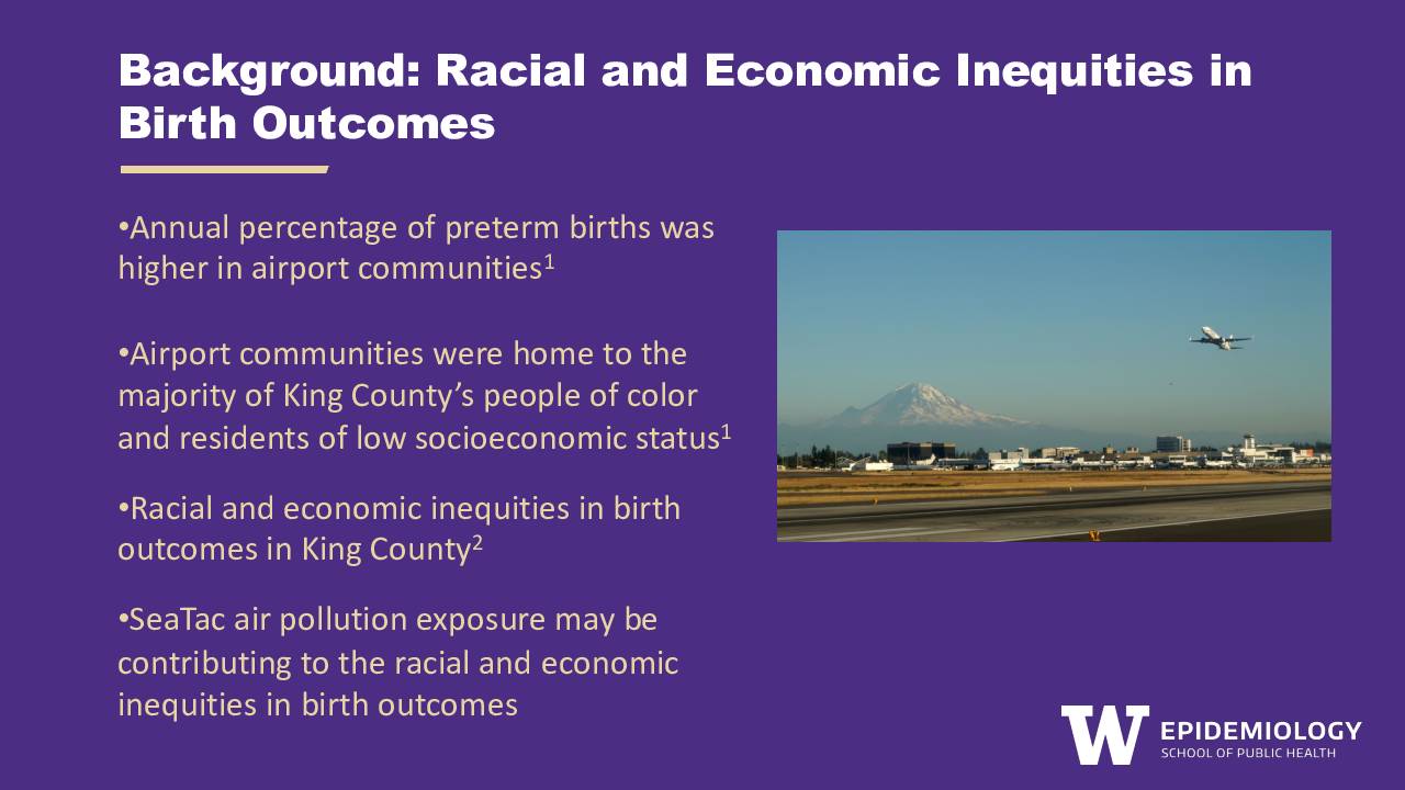
Background: Racial and economic inequities in birth outcomes
A University of Washington Epidemiology researcher, Anna Harrington, presents findings showing that communities near Seattle-Tacoma International Airport have higher rates of preterm births and are home to a disproportionate share of King County's people of color and low-income residents. The presentation proposes a qualitative research study to explore how airport community stakeholders perceive the public health risks of SeaTac air pollution on pregnant people, and what barriers they face in reducing that exposure. The study aims to understand whether risk perceptions and mitigation strategies differ based on the racial identity and income level of pregnant individuals. -
 2022-08-19
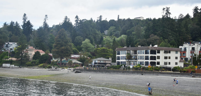
Waterfront Community with Aviation Infrastructure
Image shows a waterfront community with residential buildings, beach area, and forested hills in the background. Several people are visible on the beach, and the scene appears to be in the Pacific Northwest region near what could be an airport-impacted community. -
 2022-08-08
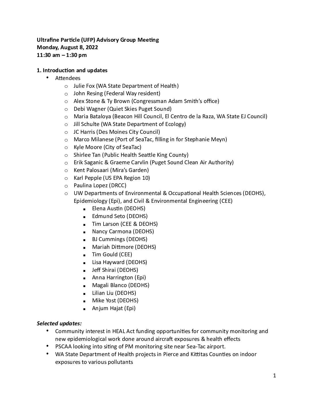
UFP Advisory Group Meeting Minutes: August 8, 2022
A University of Washington research team presented findings to a community advisory group showing that HEPA air purifiers in classrooms near Sea-Tac Airport reduced ultrafine particle (UFP) levels from 50% down to just 10% of outdoor concentrations. The meeting, held August 8, 2022, also covered a small pilot health study suggesting short-term cardiovascular and respiratory differences in people exposed to aircraft UFPs while walking under flight paths. Participants from government agencies, community organizations, and public health departments discussed next steps including expanded outdoor monitoring, wildfire response planning, and potential new funding through the HEAL Act. -
 2022-08-07
Port Package Problems Example: Rotted Wood Framing At Building Base
Close-up photograph of Port Package problem 0812: Severely deteriorated and rotted wood framing or sill plate at the base of a structure. The wood exhibits extensive decay with fragmented, crumbling pieces scattered around the affected area. PVC pipe and painted wood trim elements are also visible in the image. -
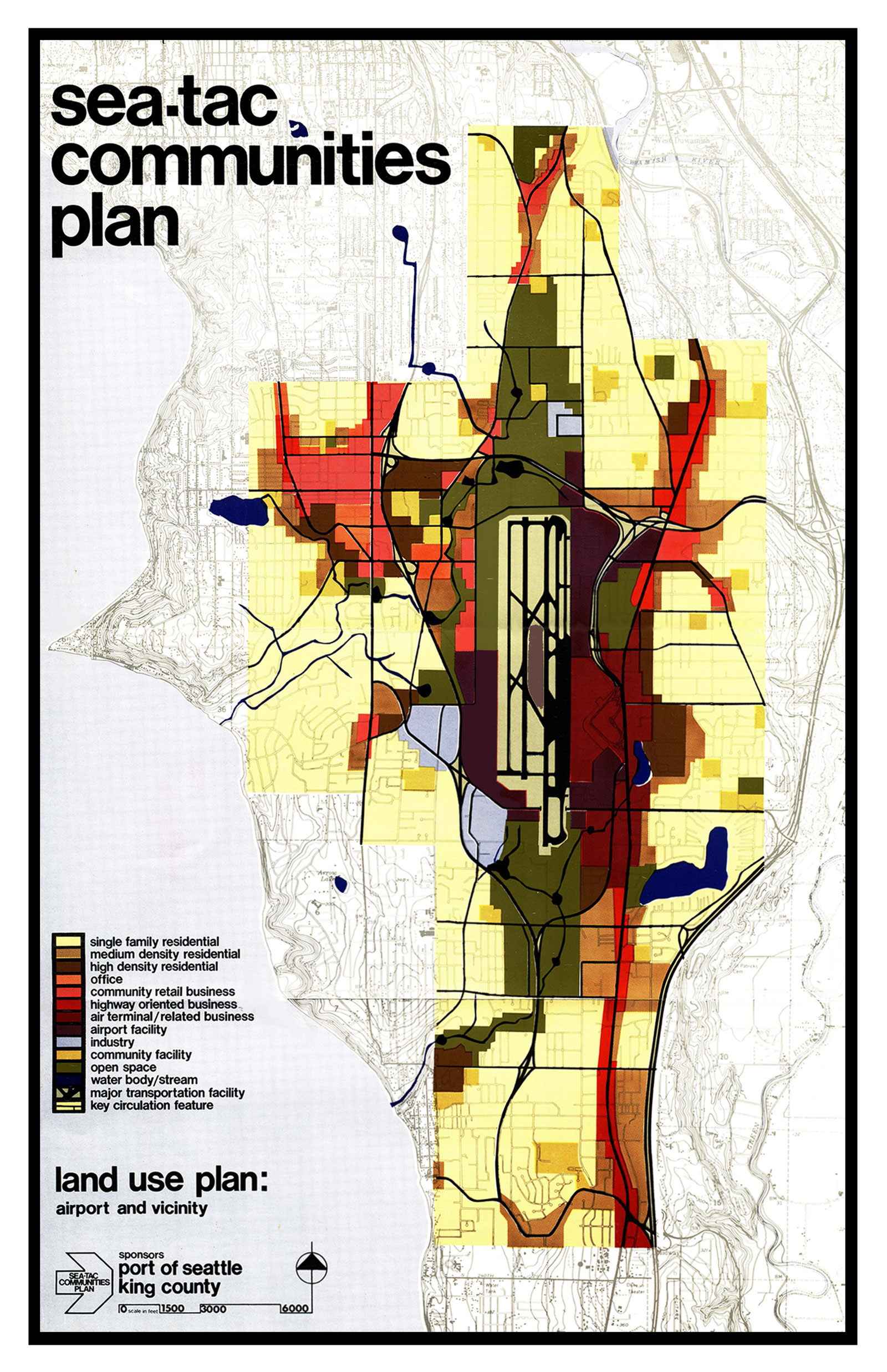
Sea Tac Communities Plan 1600
A land use planning map produced under the Sea-Tac Communities Plan, sponsored by the Port of Seattle and King County, showing zoning categories (residential, commercial, office, airport facility, open space, etc.) for the area surrounding Seattle-Tacoma International Airport. The legend identifies uses including air terminal/related business, highway-oriented business, community retail, industry, and key circulation features, with a scale bar indicating coverage at 1:500 to 6,000 feet. -
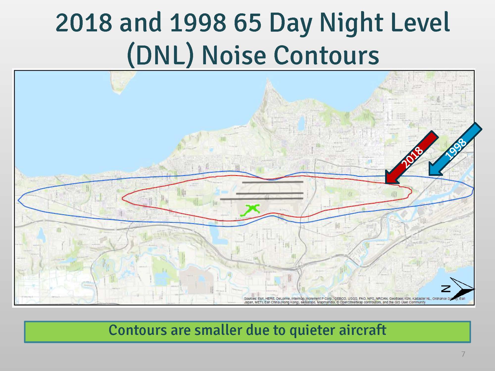
DNL65 NEM Part 150 Noise Contour Boundary 2018 Pages from 2016_10_11_SM_6b_supp
Slide 7 from a Sea-Tac Airport presentation comparing the 65 Day Night Level (DNL) noise contours for 1998 (blue outline) and 2018 (red outline), overlaid on a regional map. The caption notes that the 2018 contour is smaller than the 1998 contour due to quieter aircraft technology. -
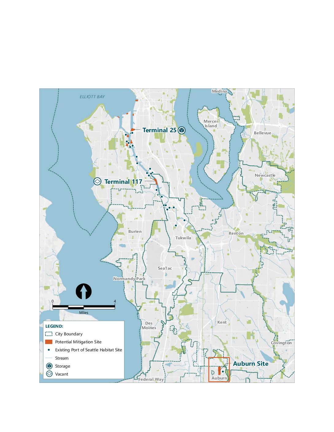 2022-07-31
Mitigation bank project sites map
A map showing potential mitigation sites and existing Port of Seattle habitat sites in the greater Seattle area, including Terminal 25, Terminal 117, and the Auburn Site. The map covers cities including Seattle, Burien, Tukwila, SeaTac, Des Moines, Federal Way, Kent, Renton, and Auburn. Sites are categorized by land use type including storage, vacant, and -
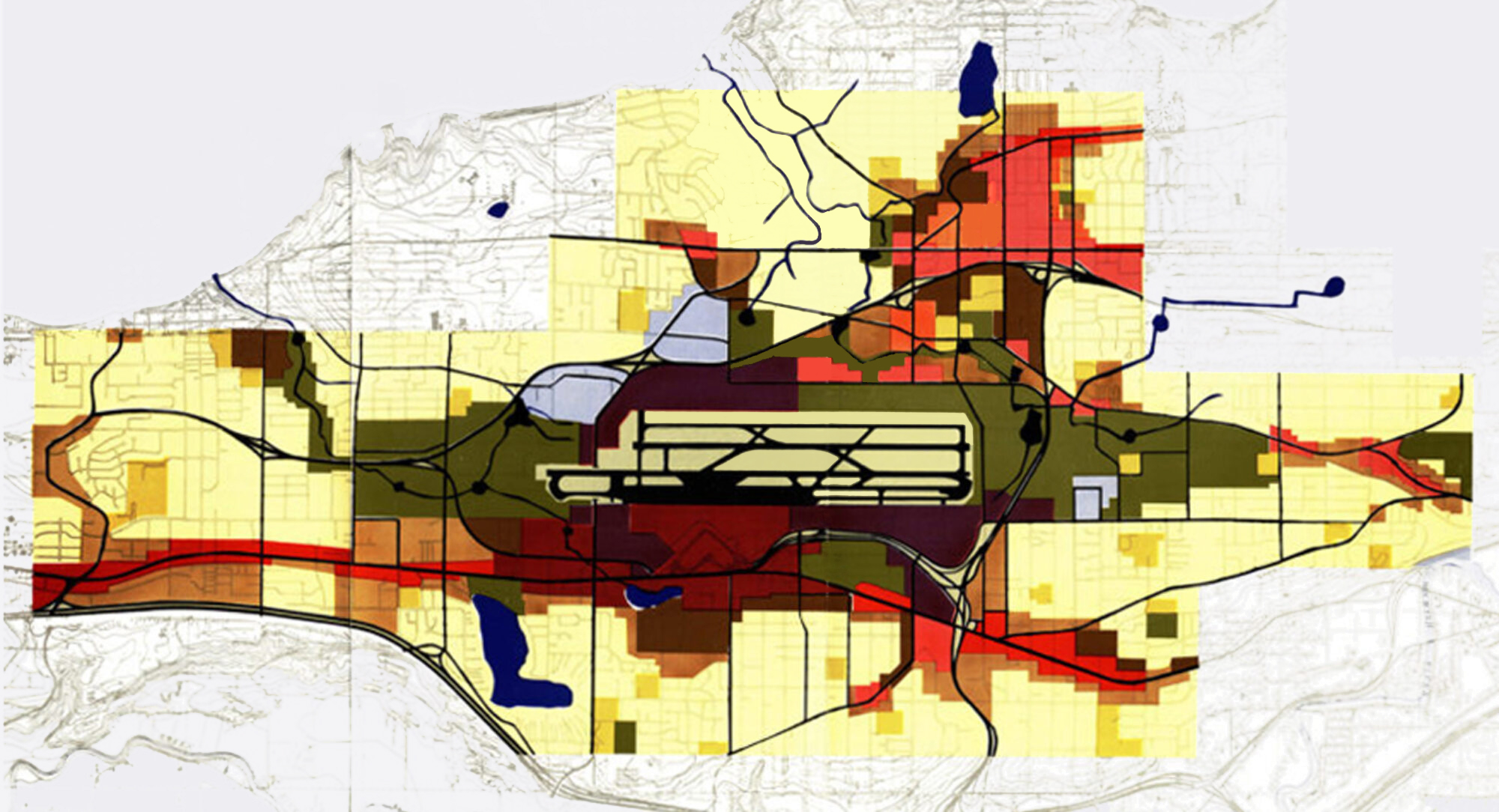
Sea-Tac Community Plan Land Use Sideways
A color-coded GIS-style map overlay showing noise contour zones or land-use impact areas surrounding what appears to be a major airport runway complex at center. Colors ranging from light yellow to deep red and dark olive likely represent varying levels of noise exposure or compatible/incompatible land uses, with road networks shown in black and red lines. -
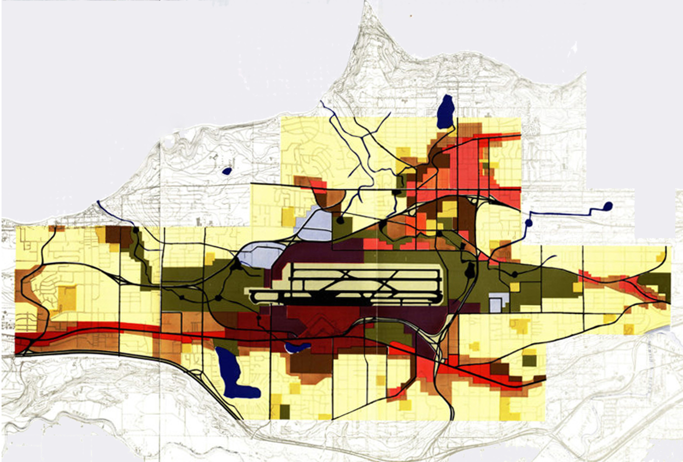
SCP_sideways
A color-coded planning map showing noise contour zones or land-use impact areas radiating from a central airport runway facility, depicted in shades of yellow, red, brown, and dark olive-green. Blue lines appear to represent waterways or transportation corridors, and bold black lines indicate road or grid infrastructure overlaid on a topographic base map. -
 2022-07-28
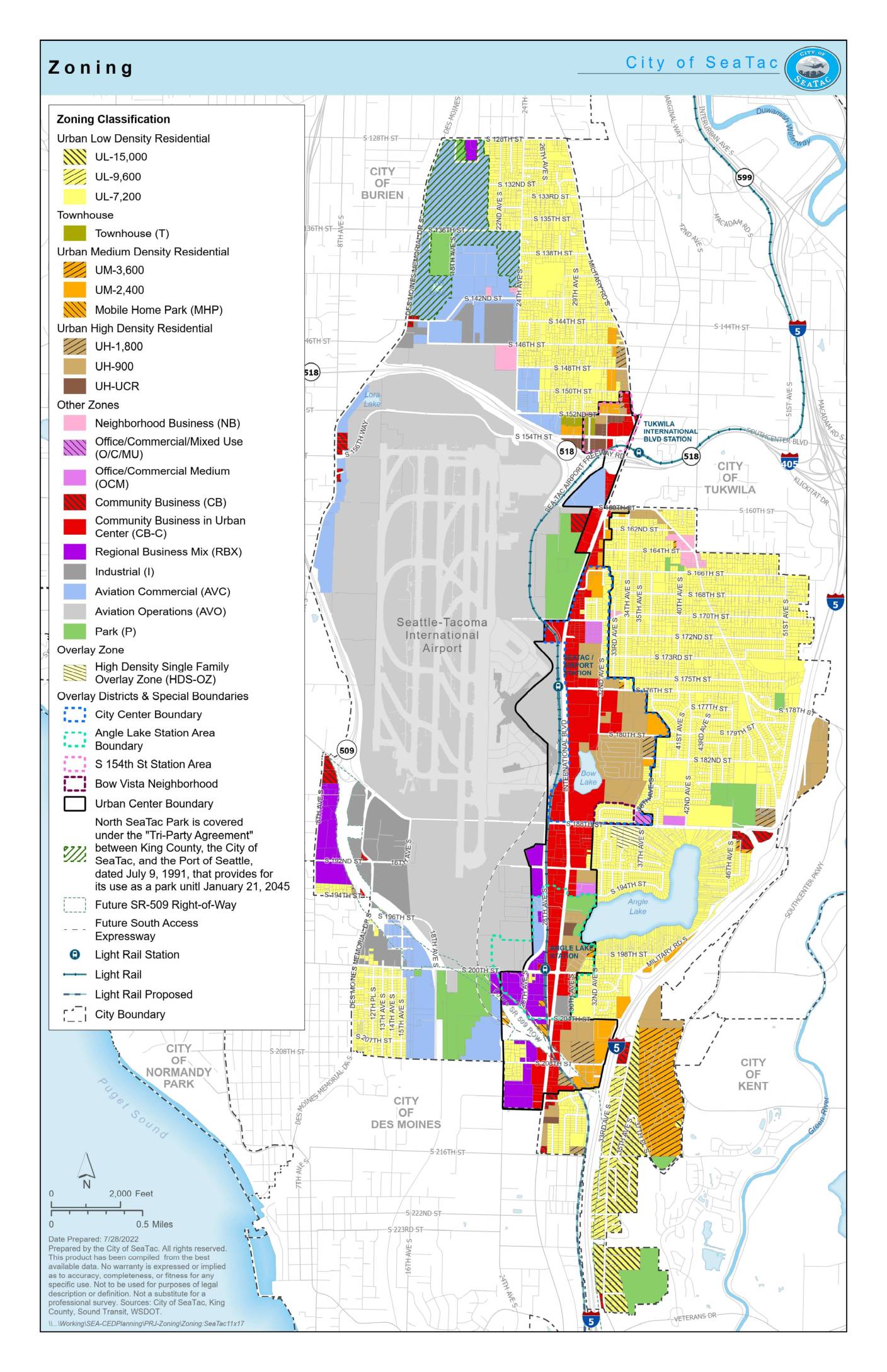
Zoning: City of SeaTac
This zoning map from the City of SeaTac (prepared July 28, 2022) shows land-use classifications throughout the city, which borders Seattle-Tacoma International Airport. The map identifies a range of residential, commercial, industrial, and aviation-related zones — including Aviation Commercial (AVC) and Aviation Operations (AVO) designations — that reflect the airport's significant influence on surrounding land use and development policy. Special overlay districts, light rail corridors, and station area boundaries are also depicted, highlighting the city's efforts to manage growth and compatibility with airport noise and operations.