TagSea-Tac Airport(1855)
-
 2023-08-27
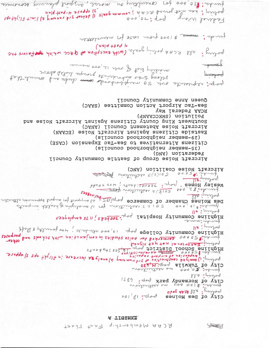
RCAA membership fact sheet
This document is a membership fact sheet for the Regional Civil Aviation Authority (RCAA), listing dozens of member organizations opposed to Sea-Tac Airport noise and expansion, including neighborhood councils, city governments, and advocacy groups such as the Aircraft Noise Coalition (ANC) and Citizens Alternatives to Sea-Tac Expansion (CASE). Member cities include Des Moines, Normandy Park, and Tukwila, alongside institutions like Highline Community Hospital and Highline School District. The sheet highlights the broad coalition of community stakeholders united around aircraft noise abatement and opposition to airport expansion in the Seattle-Tacoma region. -
 2023-08-27
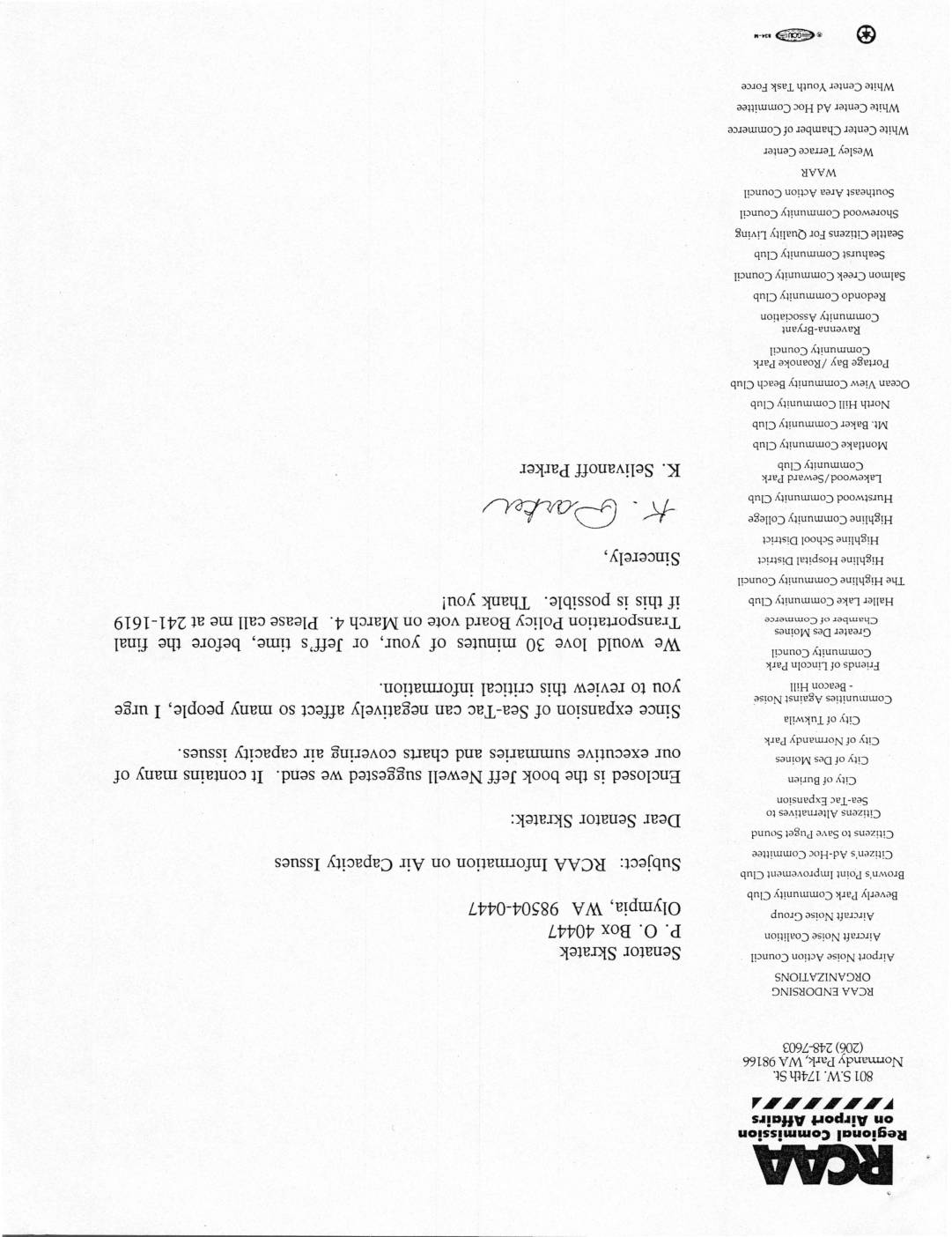
RCAA information on air capacity issues
A letter from the Regional Commission on Airport Affairs (RCAA) to Senator Skratek urges review of air capacity issues related to Sea-Tac Airport expansion, noting that the expansion could negatively affect many people. The letter encloses a book suggested by Jeff Newell containing executive summaries and charts covering air capacity issues, and requests 30 minutes of the Senator's time before the final Transportation Policy Board vote on March 4. The letter is endorsed by a wide range of community organizations, cities, and advocacy groups opposed to or concerned about Sea-Tac expansion. -
 2023-08-25
New York Times – Aviation Close Calls
New York Times investigative article, "Airline Close Calls Happen Far More Often Than Previously Known" (Aug 2023) — reporting on the rise in near-miss air traffic incidents nationally, including sections on air traffic control staffing and specific close-call incidents. -
 2023-08-23
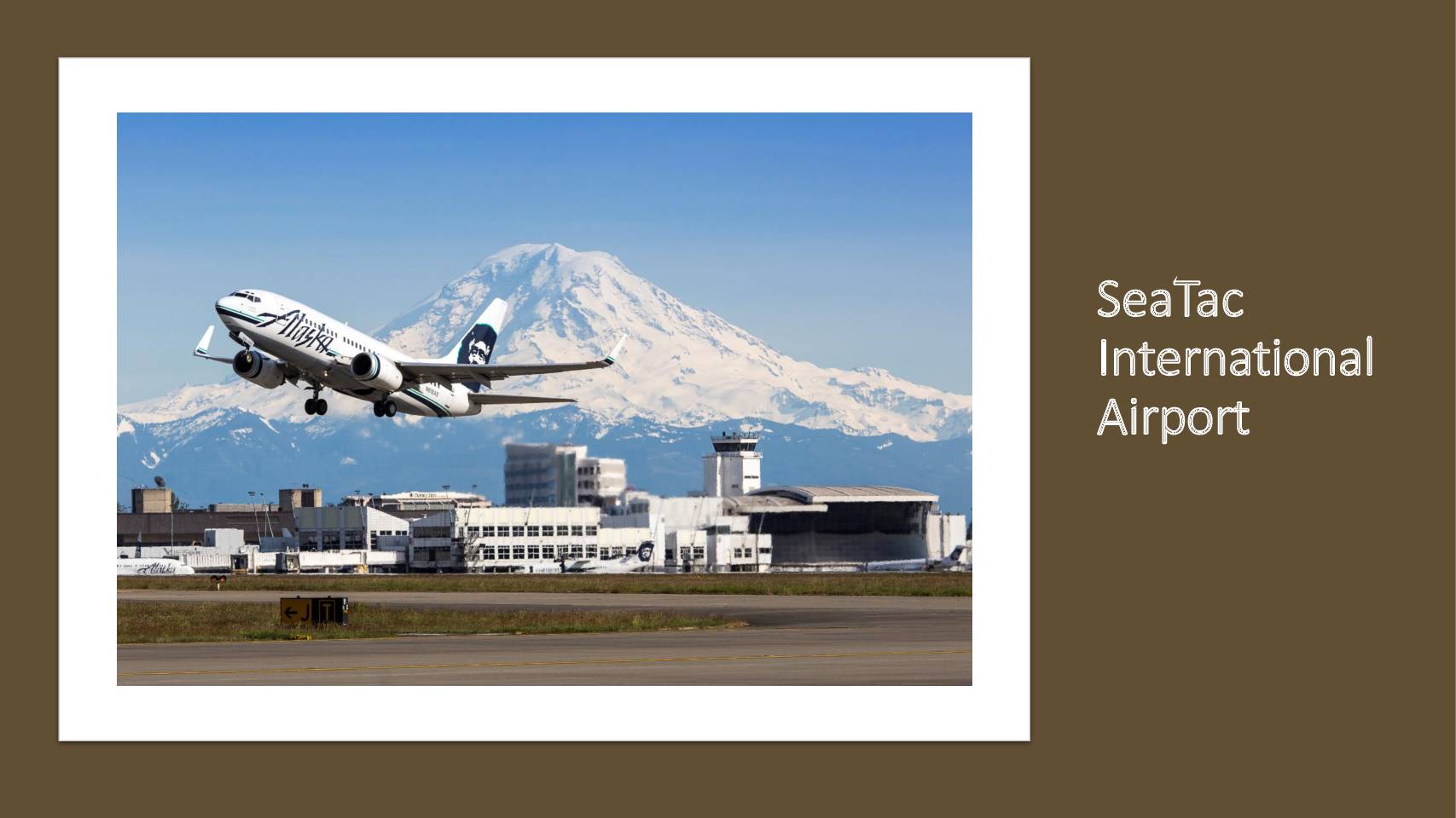
SeaTac International Airport: Trifecta for change
This presentation addresses environmental and health concerns surrounding Seattle-Tacoma International Airport, framing the issue as more than a mere noise nuisance by highlighting the health impacts of Jet A fuel pollution, specifically ultrafine particles. It outlines a 'Trifecta for Change' strategy that includes shifting public dialogue, engaging the University of Washington to study pollution prevalence, and building local, state, and federal partnerships to advance mitigation efforts. -
 2023-08-22
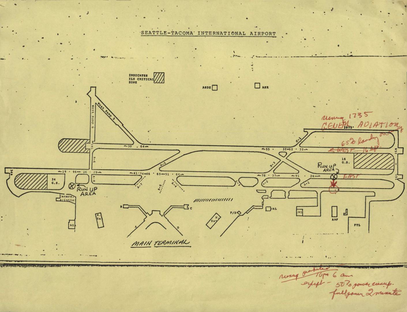
Seattle-Tacoma International Airport map
This document is an airport diagram of Seattle-Tacoma International Airport showing runways, taxiways, run-up areas, and terminal facilities. Handwritten annotations in red ink reference noise abatement procedures, including a note about 'General Aviation' operations and restrictions on runways, specifying limits such as '650 landings' and directions (East/West). Additional handwritten notes at the bottom outline runway use prohibitions from 10 PM to 6 AM, with exceptions for 50% power run-ups and full-power checks limited to 2 minutes. -
 2023-08-22
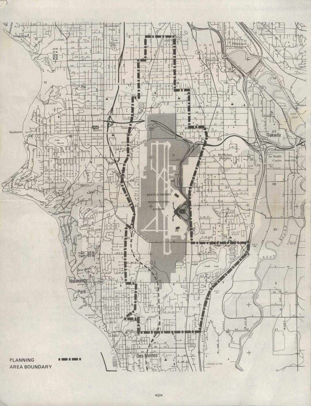
Seattle-Tacoma International Airport Planning Area Boundary Map
This map depicts the planning area boundary surrounding Seattle-Tacoma International Airport and its neighboring communities, including Burien, Normandy Park, Des Moines, Tukwila, and Riverton. The shaded region highlights the airport's footprint and immediate environs, while the dashed boundary line delineates the study area used for airport-related land use and noise planning purposes. The document appears to be part of an environmental or community planning effort assessing the impact of Sea-Tac Airport on surrounding residential and commercial areas. -
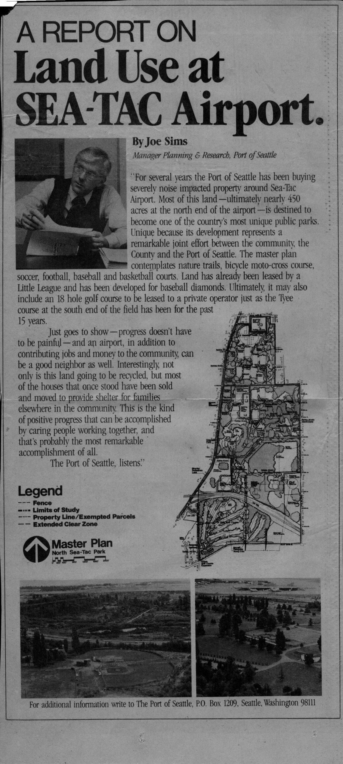
Port Of Seattle Advertisement: Joe Sims Report on Land Use and North Sea-Tac Park
An article by Joe Sims, Manager of Planning & Research for the Port of Seattle, reporting on the Port's acquisition of noise-impacted properties around Sea-Tac Airport, with plans to develop nearly 450 acres at the airport's north end into a public park (North Sea-Tac Park) featuring nature trails, sports courts, a bicycle moto-cross course, and a possible 18-hole golf course. The piece includes a master plan map of North Sea-Tac Park and aerial photographs of the site, with contact information directing readers to The Port of Seattle, P.O. Box 1209, Seattle, Washington 98111. -
 2023-08-22
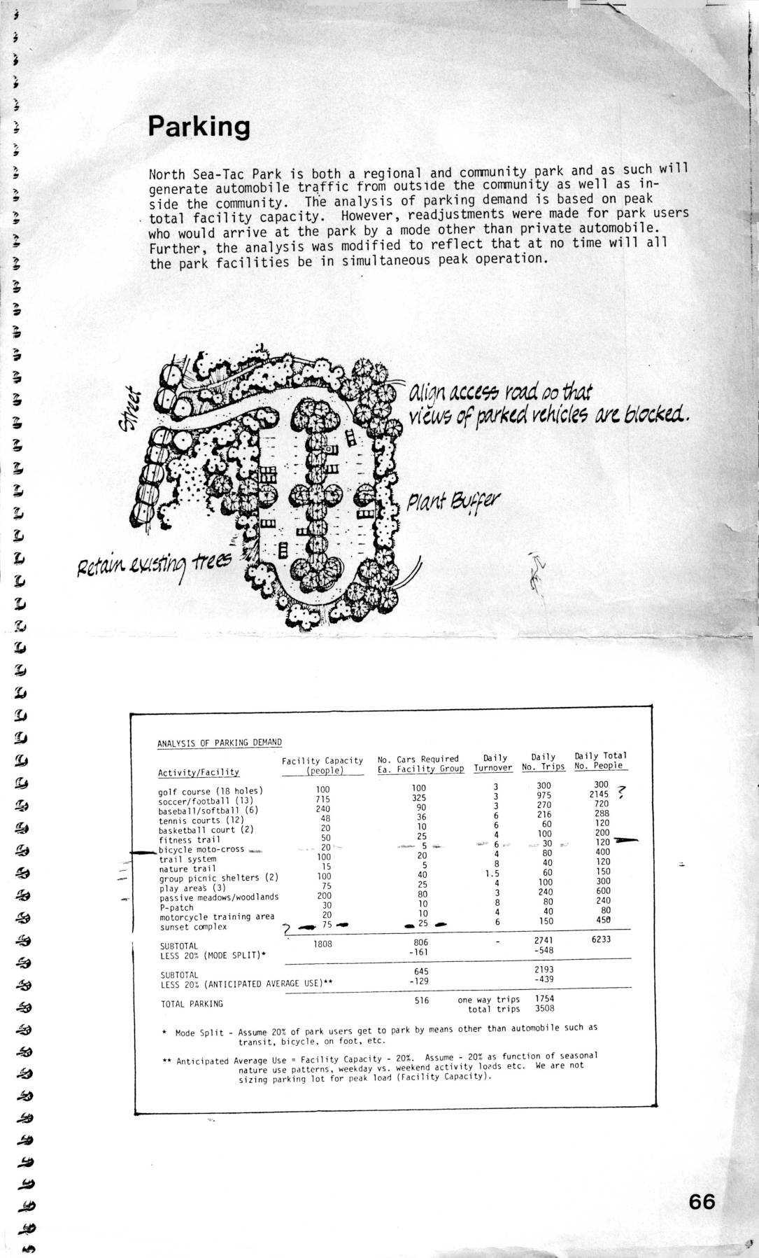
Parking analysis for North Sea-Tac Park
This document covers planning considerations for North Sea-Tac Park, including an analysis of parking demand across various recreational facilities such as golf courses, sports fields, and trail systems, estimating a total parking need of 516 spaces based on adjusted peak usage. It also addresses air support facility requirements near Sea-Tac Airport, describing clear zone and extended clear zone boundaries where land use is restricted to prevent hazards to aircraft. Within these clear zones, tall buildings, smoke-producing facilities, bird-attracting features, and large gatherings of people are prohibited to minimize risk to approaching and departing aircraft. -
 2023-08-14
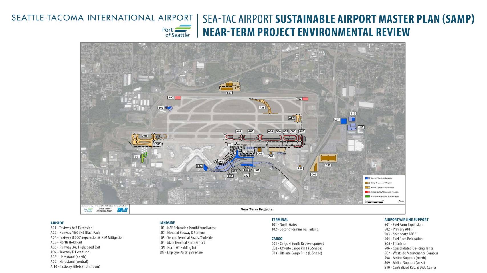
Sea-Tac Airport Sustainable Airport Master Plan (SAMP): Near-Term Project Environmental Review Map
The Sea-Tac Airport Sustainable Airport Master Plan (SAMP) Near-Term Project Environmental Review outlines a comprehensive set of planned improvements at Seattle-Tacoma International Airport, covering airside, landside, terminal, cargo, and airport support facilities. Key projects include taxiway and runway upgrades, a new second terminal with associated roads and parking, cargo facility expansions, and sustainability initiatives such as sustainable aviation fuel infrastructure and consolidated de-icing tanks. These near-term projects are intended to enhance airport capacity, safety, and operational efficiency while supporting the airport's long-term growth strategy. -
 2023-08-14
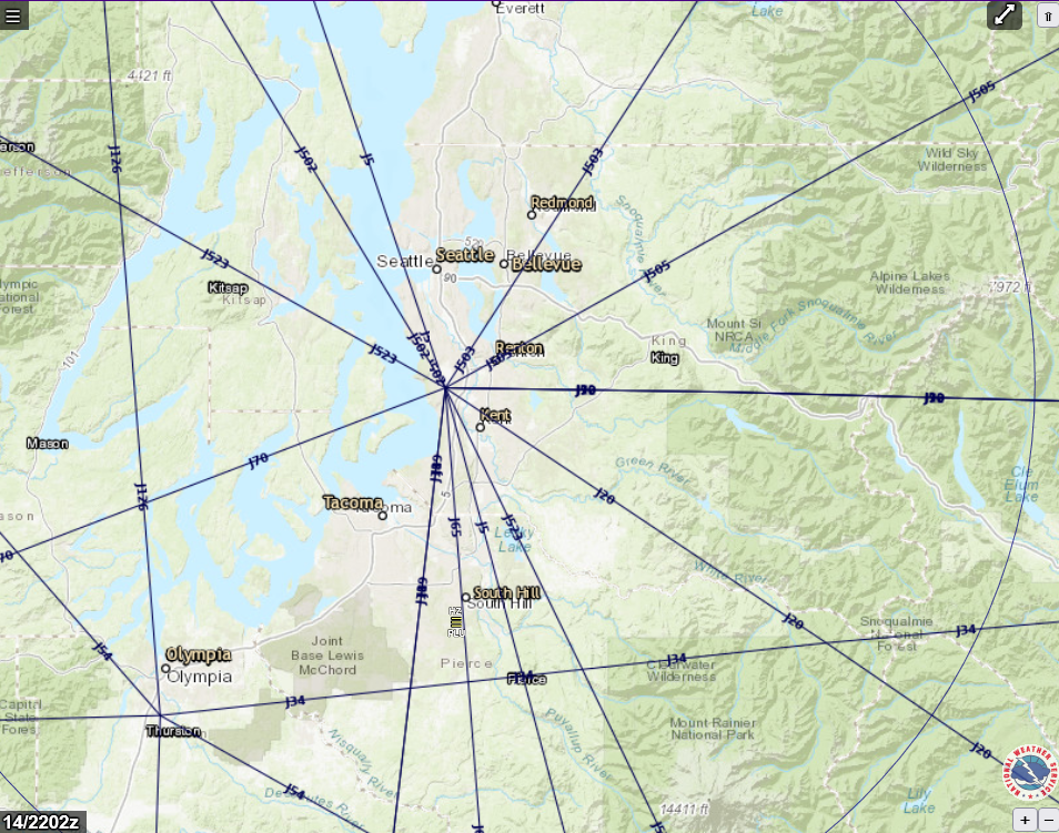
FAA Jet Route Chart Centered on Seattle-Tacoma Area – 14/2202z
A National Weather Service (NWS)-branded interactive aviation map showing FAA high-altitude jet routes (J-routes) radiating from a central fix near Seattle-Tacoma International Airport (Sea-Tac), with surrounding cities including Seattle, Bellevue, Renton, Kent, Tacoma, and Olympia visible. The map is timestamped 14/2202z and displays multiple labeled jet airways (J20, J34, J90, J523, etc.) overlaid on a terrain basemap of the greater Puget Sound region.