TagSea-Tac Airport(1835)
-
 2013-01-01
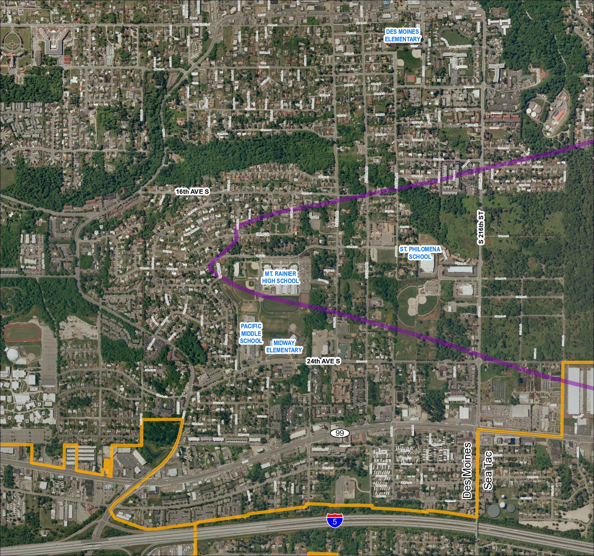
Grid 1: 2013 Baseline Map — Des Moines and Sea-Tac Area Schools
This map covers the Des Moines and SeaTac area in Washington State, showing residential streets, major roads including SR 99, SR 509, SR 516, and Interstate 5, along with several schools such as Mt. Rainier High School, Pacific Middle School, Midway Elementary, Des Moines Elementary, and St. Philomena School. A purple diagonal corridor crosses the map, likely representing a flight path or noise contour zone associated with Seattle-Tacoma International Airport, while an orange boundary outlines a specific study or impact area in the southern portion of the map. The document appears to be part of an airport noise or land-use planning study examining how SeaTac flight operations affect surrounding communities. -
 2013-01-01
POS Part 150 Your Comments Are Welcome Post Card
A public-outreach card issued by the Port of Seattle inviting community comments on the Seattle-Tacoma International Airport Part 150 Noise Compatibility Study. Contact channels listed include email (seapart150comments@landrum-brown.com), a study website (www.airportsites.net/sea-part150), and a Port of Seattle noise-notification page (portseattle.org/community/environment/noise.shtml). -
 2013-01-01
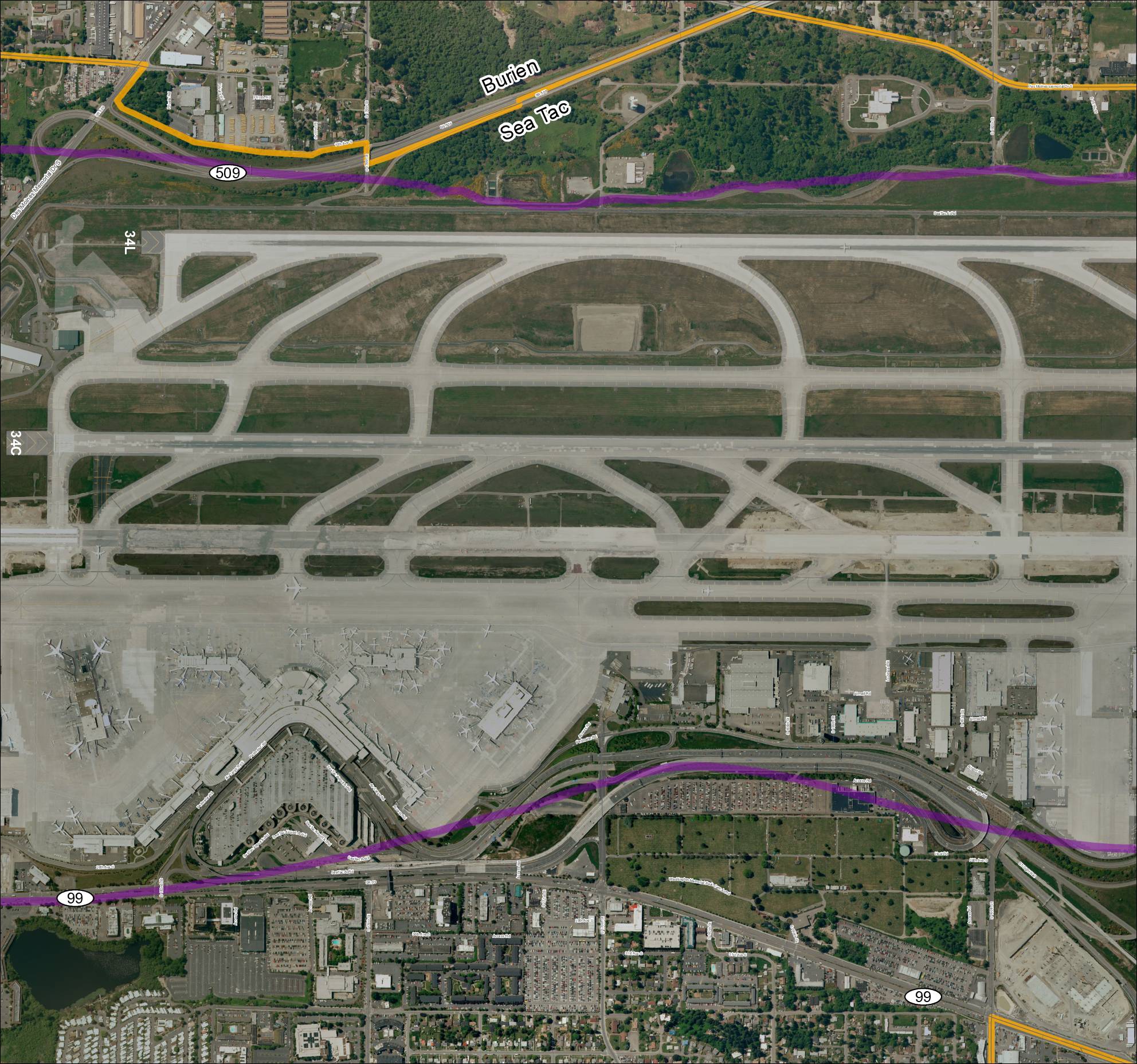
Grid 3 2013 Baseline Map: Sea-Tac Airport Runways and Surrounding Area
This aerial map depicts Seattle-Tacoma International Airport (Sea-Tac) and its surrounding communities of Burien and SeaTac, showing the airport's runway layout including runways 34L and 34C, along with key roadways such as SR 99, SR 509, and various access roads. Highlighted routes in purple and orange appear to mark designated corridors or boundary lines relevant to airport planning or noise study areas. The map provides a geographic reference for understanding the airport's footprint and its relationship to neighboring residential and commercial zones. -
 2012-12-31
Comprehensive annual financial report for the year ended December 31, 2012
This is the Port of Seattle's Comprehensive Annual Financial Report for the fiscal year ended December 31, 2012, covering the financial activities of the port authority that operates Seattle-Tacoma International Airport and Seattle's seaport facilities. The report was prepared by the Port's Accounting and Financial Reporting Department and provides a detailed accounting of the organization's revenues, expenditures, and overall financial position. While primarily a financial document, it reflects the broader operations of the Port of Seattle, which administers infrastructure and policies—including noise mitigation programs—affecting the Sea-Tac Airport region. -
 2012-11-01
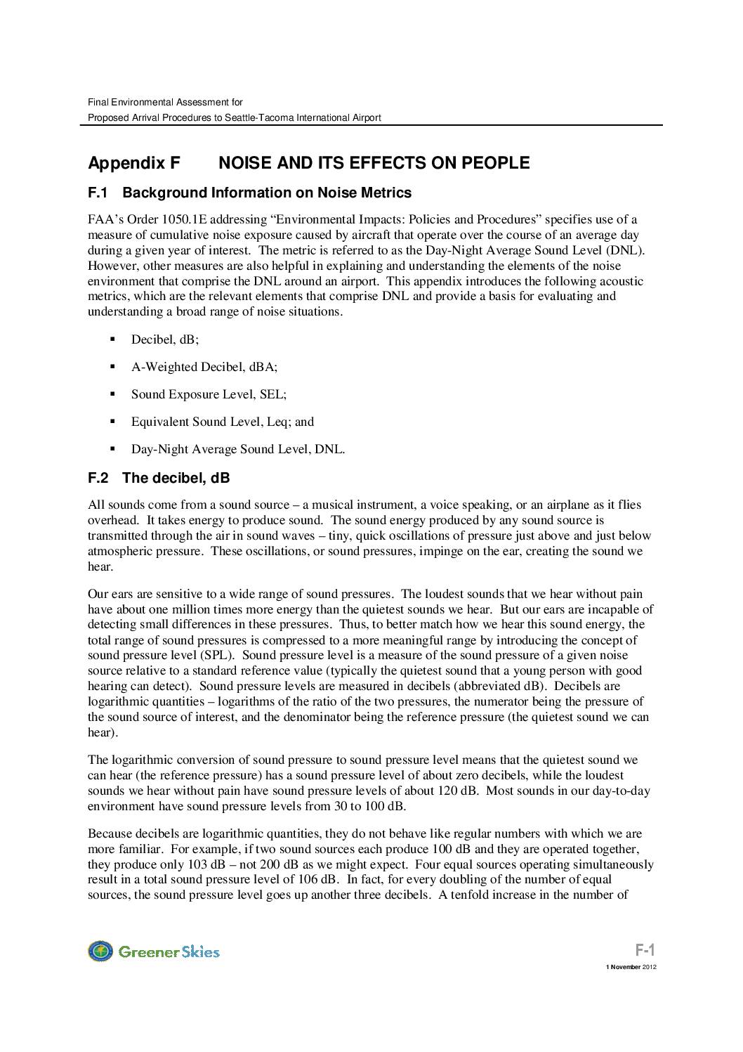
Final Environmental Assessment for Proposed Arrival Procedures to Seattle-Tacoma International Airport: Appendix F — Noise and Its Effects on People
This document explains the noise metrics used to evaluate aircraft noise around Seattle-Tacoma International Airport, including decibels (dB), A-weighted decibels (dBA), and the Day-Night Average Sound Level (DNL). It describes how sound is measured on a logarithmic scale, meaning noise levels don't add up the way ordinary numbers do, and explains why A-weighted measurements are the standard used by the FAA and EPA because they best match how human ears perceive sound. These concepts form the technical foundation for assessing the environmental impact of proposed flight arrival procedures at Sea-Tac. -
 2012-11-01
HAWKZ RNAV VER 4.2: Targets Files for Proposed New Routings — Final Environmental Assessment for Proposed Arrival Procedures to Seattle-Tacoma International Airport, Appendix D
This document is Appendix D of the Final Environmental Assessment for proposed new arrival flight procedures at Seattle-Tacoma International Airport, dated November 1, 2012. It contains TARGETS files—technical routing data packages used to define new RNAV (area navigation) flight paths, such as the HAWKZ RNAV Version 4.2 procedure, which charts a series of waypoints guiding arriving aircraft toward Sea-Tac from the south. The files were prepared in coordination with Seattle ARTCC and are intended to support evaluation of how the new routes may affect noise levels in surrounding communities. -
 2012-11-01
Appendix C: Current Published Approach Procedures Affected by the Proposed Action
This appendix from a 2012 Environmental Assessment documents the published arrival flight procedures at Seattle-Tacoma International Airport that would be affected by proposed changes to how aircraft approach the airport. It includes detailed charts for routes such as the JAWBN Three Arrival and Olympia Seven Arrival, showing waypoints, altitudes, and speed restrictions for aircraft arriving from various directions including Canada and southern Washington. These procedures define the flight paths aircraft must follow when descending into Sea-Tac, directly influencing the noise experienced by communities surrounding the airport. -
 2012-09-26
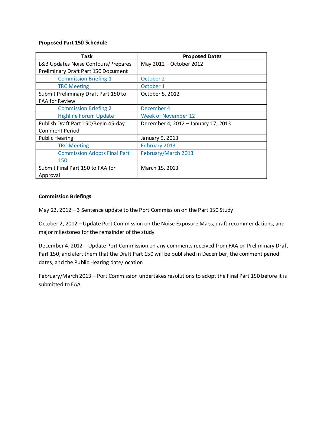
Proposed Part 150 Schedule
This document outlines the proposed schedule for Sea-Tac Airport's Part 150 Noise Compatibility Study, running from May 2012 through March 2013. Key milestones include submitting a preliminary draft to the FAA in October 2012, a public comment period and hearing in January 2013, and final submission to the FAA by March 15, 2013. The schedule also details four Port Commission briefings at which officials would be updated on noise exposure maps, FAA feedback, and the formal adoption of the final Part 150 document. -
 2012-09-11
Airport Sustainability Master Plan
This September 2012 Port of Seattle presentation outlines the Airport Sustainability Master Plan for Seattle-Tacoma International Airport, comparing existing and future airport layout conditions. The plan maps proposed near-term development projects across the airfield, terminal areas, parking facilities, and surrounding grounds. It serves as a long-range planning framework intended to guide responsible airport growth while reflecting the Port of Seattle's sustainability commitments. -
 2012-06-11
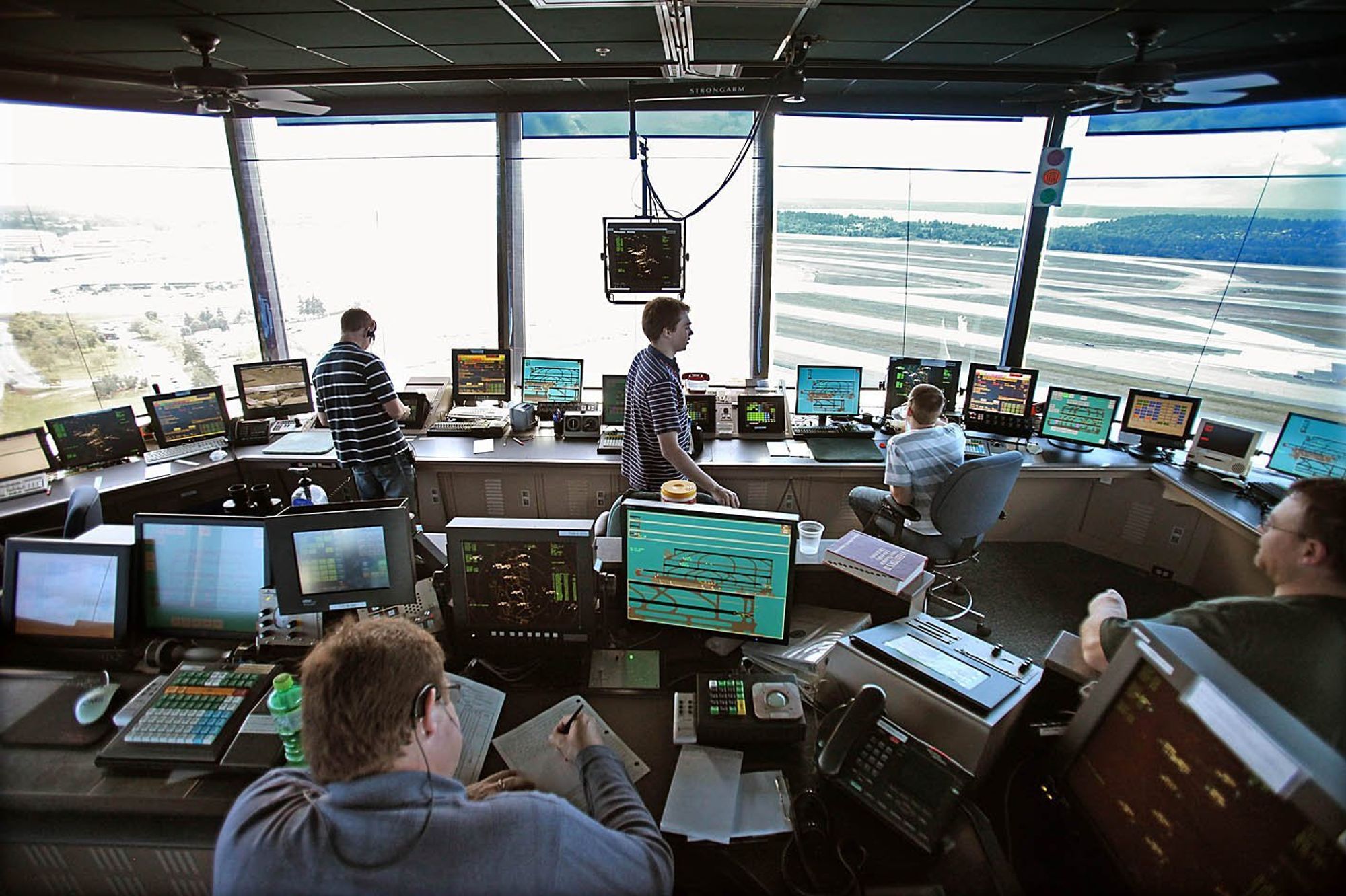
Sea-Tac Airport Air Traffic Control Tower Interior
Interior of an airport traffic control tower cab showing multiple controllers at workstations equipped with radar displays, surface movement screens, and radio equipment. A label reading 'STRONGARM' is visible on ceiling-mounted equipment, and runway infrastructure is visible through the wraparound windows below.