TagSchools(15)
-
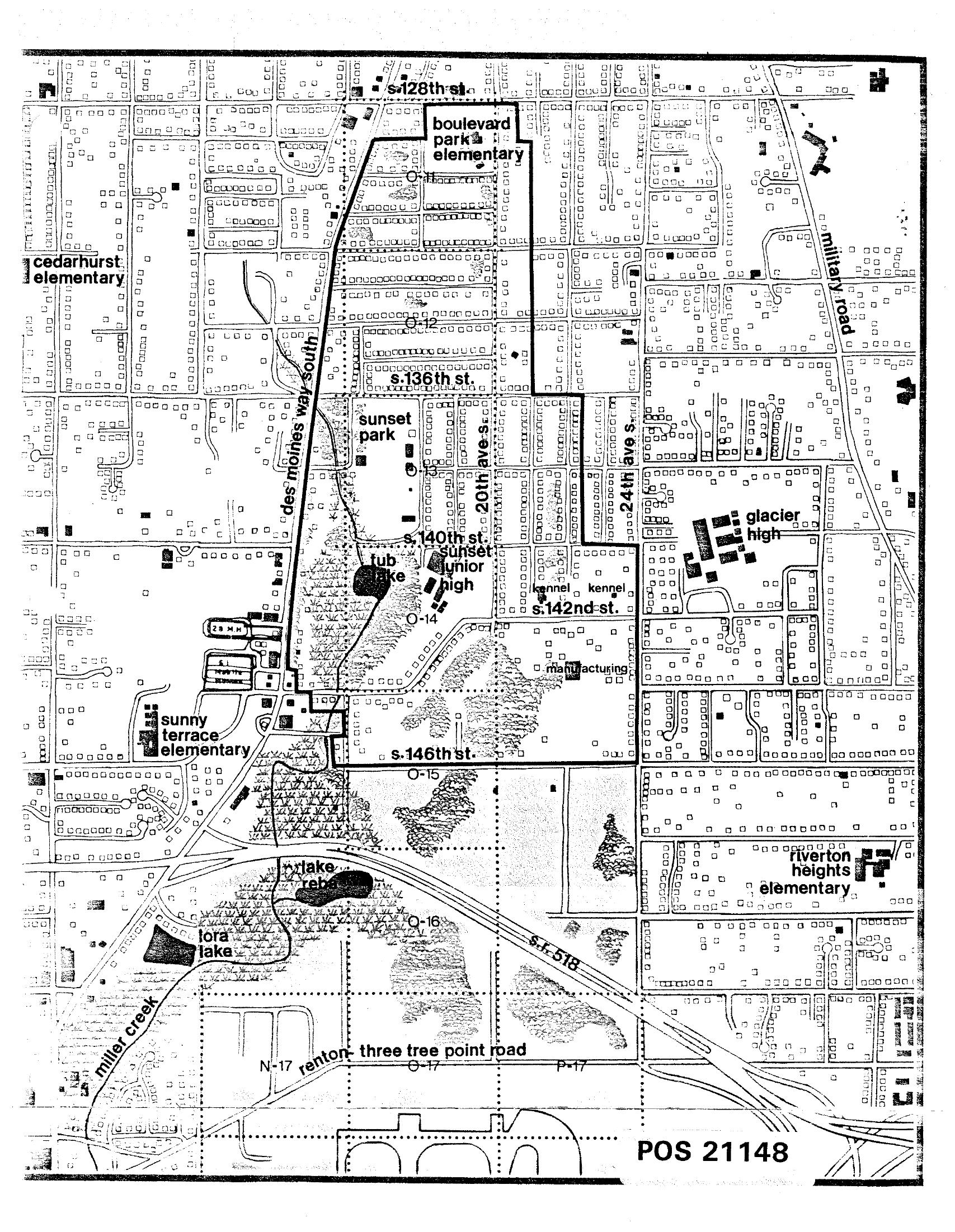
STCP Street Map with School Locations and Noise Zone Overlays, South Seattle/Burien Area
A detailed urban planning or noise-impact map labeled POS 21148 depicting the south Seattle/Burien area near Sea-Tac Airport, showing street grid references including S. 128th St., S. 136th St., S. 140th St., S. 142nd St., and S. 146th St., along with named landmarks such as Boulevard Park Elementary, Cedarhurst Elementary, Sunset Junior High, Glacier High, Sunny Terrace Elementary, Riverton Heights Elementary, Tub Lake, Lake Rebecca, Lora Lake, Miller Creek, Des Moines Way South, Military Road, and SR-518 (Renton–Three Tree Point Road). Zone designations (O-12 through O-17, N-17, P-17) suggest noise contour or land-use overlay classifications consistent with airport noise policy planning. -
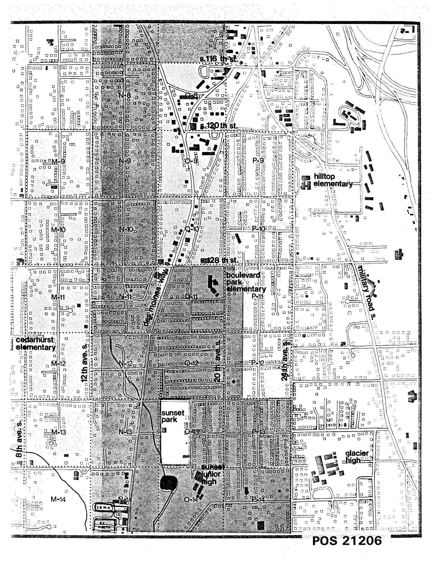
STCP Street Map with Labeled Schools South of Seattle
A detailed street grid map labeled POS 21206 showing a residential area south of Seattle, including named landmarks such as Hilltop Elementary, Boulevard Park Elementary, Cedarhurst Elementary, Sunset Junior High, and Glacier High School. Streets visible include S. 116th St., S. 120th St., S. 128th St., 8th Ave. S., 12th Ave. S., 24th Ave. S., Des Moines Way, and Military Road S., with grid squares labeled M through P and rows 8 through 14. -

Department of Defense Community Noise Mitigation Program
The Community Noise Mitigation Program is a competitive grant program designed to assist state, local governments and tribal entities impacted by military fixed-wing aviation noise – to include those impacted by both active and guard/reserve installations. On this page Overview Sign Up for Updates Eligibility and Requirements Second Competition Additional Resources Past Grantees Program Updates -
 2024-08-27
Oak Harbor’s $136 Million Win: A Lifeline for Our Schools, But More Work Remains
Oak Harbor Public Schools Empowering Students. Growing Together. #OneOakHarbor Message from Superintendent – Oak Harbor’s $136 Million Win: A Lifeline for Our Schools, But More Work Remains Michelle Kuss-Cybula, Ed.D. • a year ago • Tuesday, Aug 27 at 2:07 PM • Oak Harbor Public Schools, OHPS News, OHPS School Board Oak Harbor’s $136 Million -
 2023-06-07
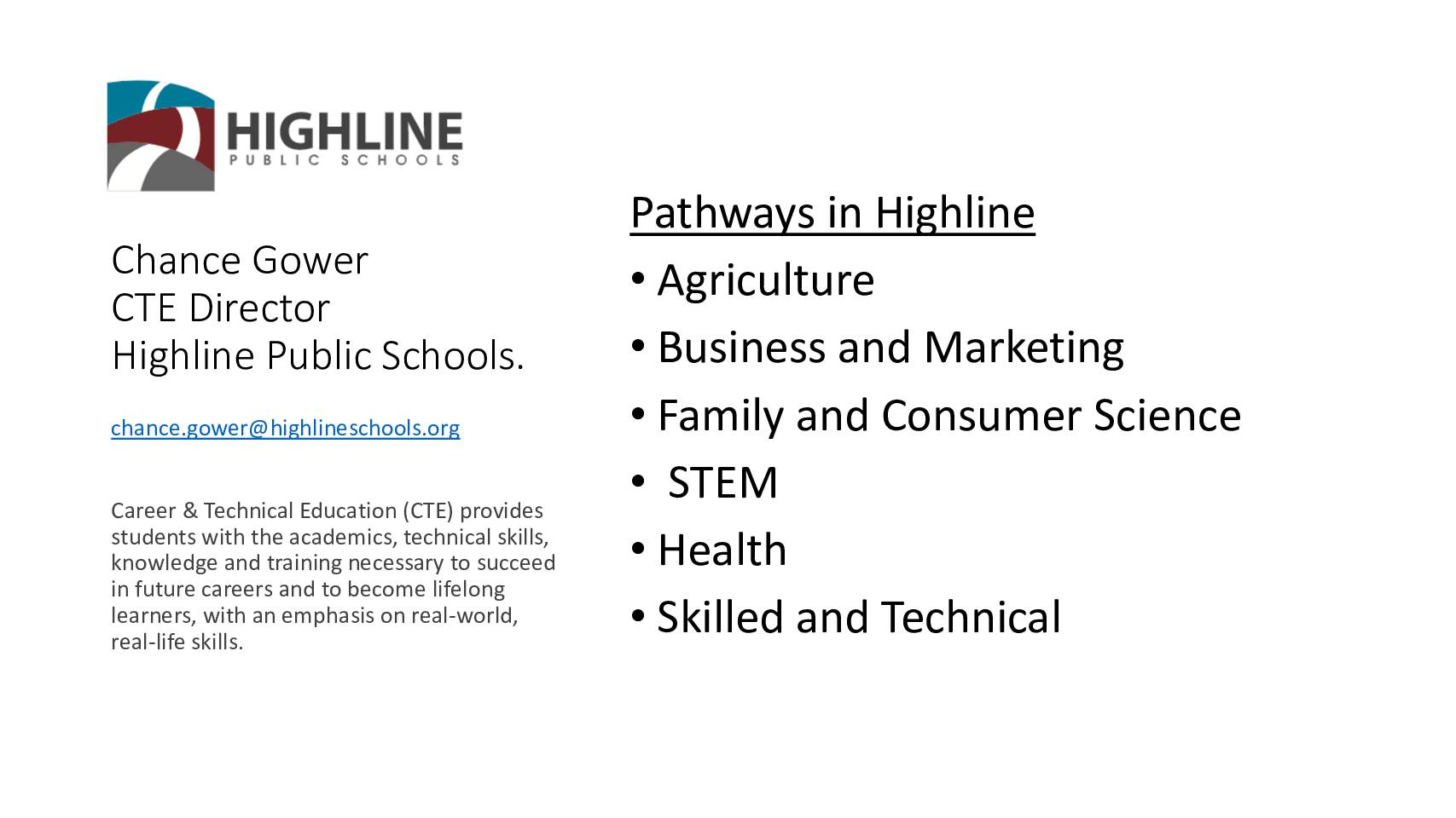
Highline Public Schools CTE pathways presentation
This document presents an overview of Career and Technical Education (CTE) at Highline Public Schools in the Seattle area, led by CTE Director Chance Gower. The district offers 92 courses across 18 schools in pathways such as Agriculture, STEM, Health, and Skilled and Technical trades, serving nearly 6,000 middle and high school students. Students have opportunities to earn college credits and industry certifications, and can now fulfill graduation requirements through a CTE Pathway. -
 2022-09-28
HPS highlights
This September 2022 presentation by Highline Public Schools Chief Academic Officer Jenniffer Reinig outlines the district's core promise to ensure every student is known by name, strength, and need, and graduates prepared for the future they choose. It highlights three key areas for delivering on that promise: continued partnership and innovation, a Superintendent Entry Plan, and the Highline Schools Bond. Note that this document focuses on school district academic priorities and does not contain information related to Sea-Tac Airport noise policy. -
 2021-01-01
Healthy Air, Healthy Schools study executive summary
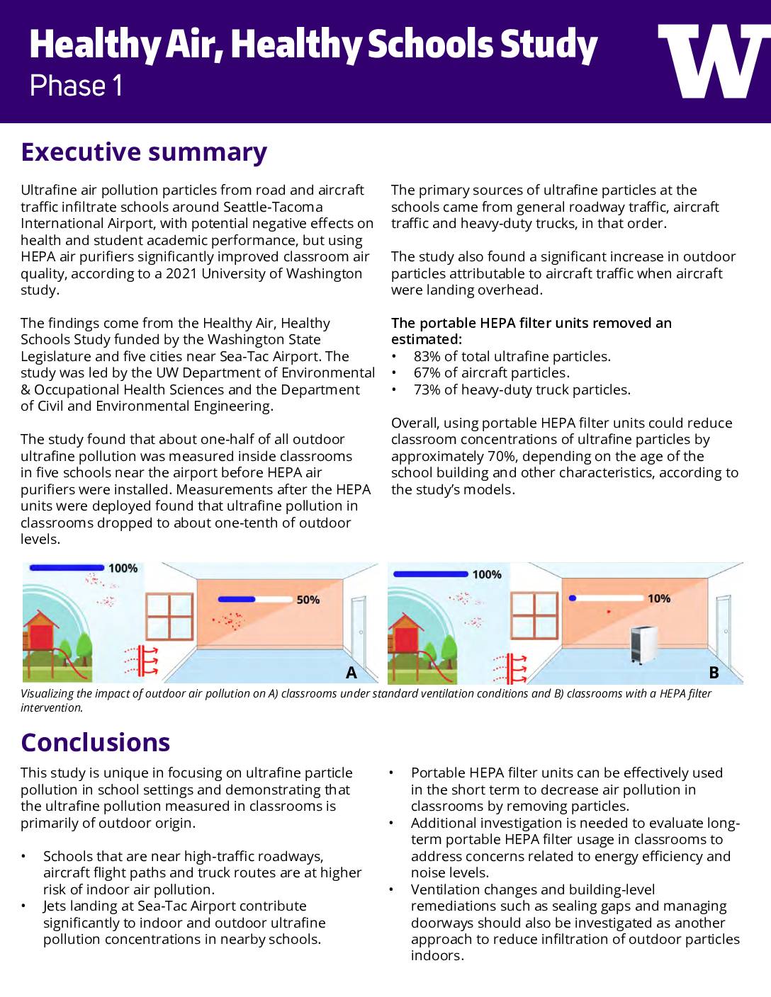
A 2021 University of Washington study found that ultrafine air pollution particles from road and aircraft traffic near Seattle-Tacoma International Airport were infiltrating nearby school classrooms, with indoor levels reaching roughly half of outdoor concentrations before any intervention. Installing portable HEPA air purifiers reduced classroom ultrafine particle levels to about one-tenth of outdoor levels, cutting overall particle concentrations by an estimated 70%. A follow-up Phase 2 study is now underway in 30 Washington schools to examine longer-term air quality improvements and their effects on student health and academic performance. -
 2020-10-19
Funding of Phase I of a University of Washington study in partnership with the cities of Des Moines, Federal Way, Normandy Park, and SeaTac — School resilience to air pollution
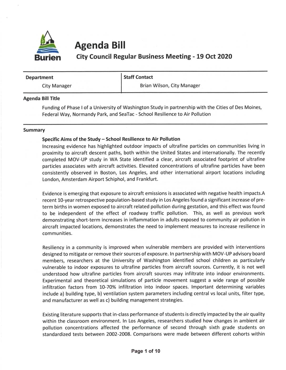
In October 2020, the City of Burien considered joining Des Moines, Federal Way, Normandy Park, and SeaTac in funding a $62,500 University of Washington study examining how ultrafine particles from aircraft emissions penetrate school buildings near Sea-Tac Airport. The first phase of the study would assess the air filtration efficiency of five schools located north and south of the airport, while a proposed second phase ($250,000) would test interventions to improve indoor air quality and measure their impact on student health and academic performance. Each participating city was asked to contribute $12,500, with the City Manager recommending approval of an Interlocal Agreement to move the project forward. -
 2018-01-01
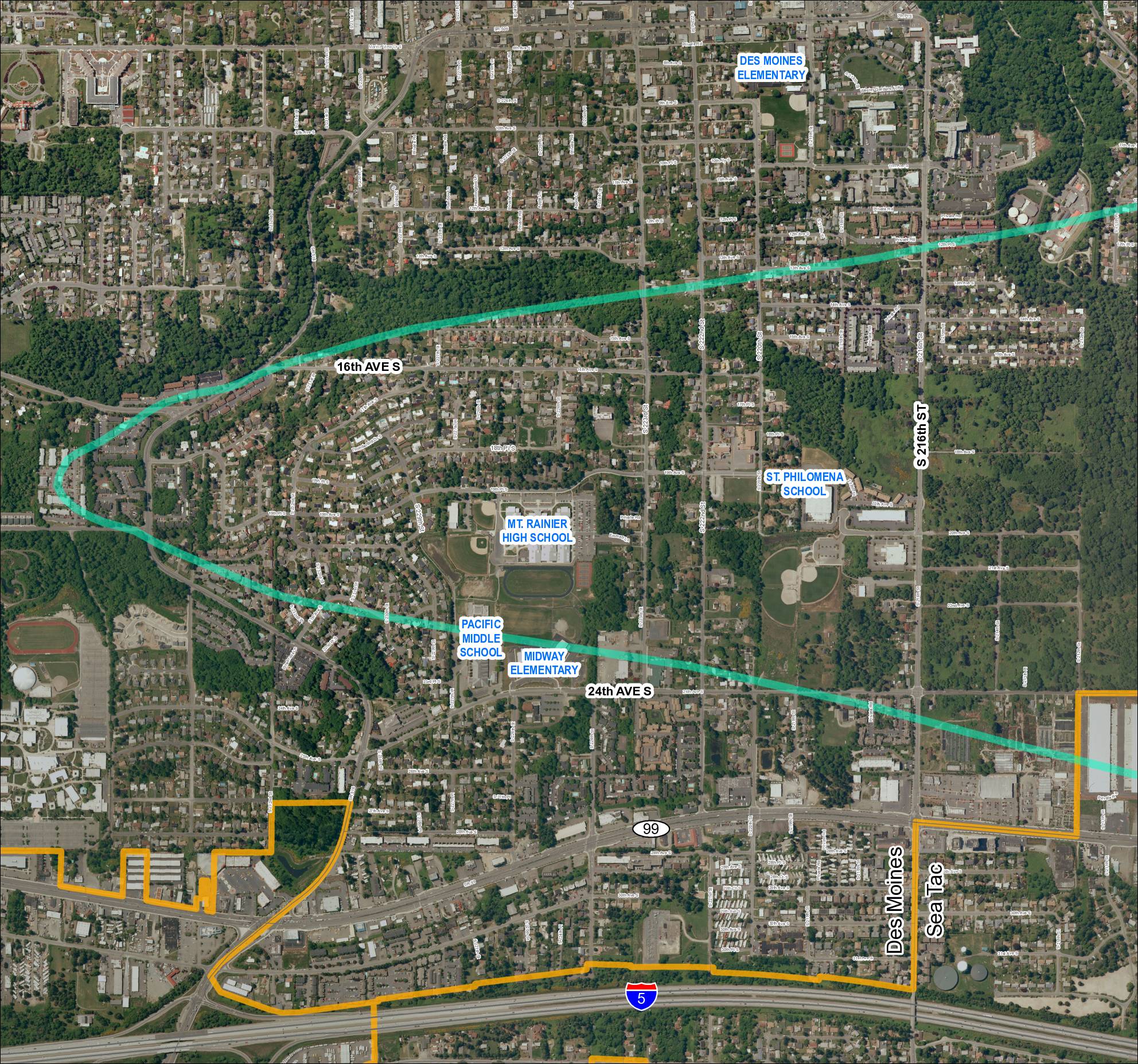
Grid 1: Des Moines and Sea-Tac Area Schools and Flight Corridor Map (2018)
This map shows the Des Moines and SeaTac area of Washington State, highlighting a noise impact corridor (shown in teal) that sweeps across the region near Sea-Tac Airport. The corridor passes over several schools including Mt. Rainier High School, Pacific Middle School, Midway Elementary, St. Philomena School, and Des Moines Elementary, indicating these institutions fall within the airport's noise-affected zone. A separate boundary (shown in orange) outlines what appears to be an airport-related land use or acquisition area in the southern portion of the map near Interstate 5. -
 2013-05-22
Cities, Schools and the Port: What We Have in Common and What We Can Do Together – The Argument for Real Partnership
A May 2013 presentation by City of Burien staff to the Highline Forum explores potential partnerships between local cities, the Highline School District, and the Port of Seattle, focusing on shared community interests and collaboration opportunities. The presentation covers Burien's community vision, historical context, current conditions, school performance data, and specific areas where the city has a stake in local schools. It lays out a case for deeper, more structured cooperation among these regional institutions to strengthen the broader South King County community.