TagMap(375)
-
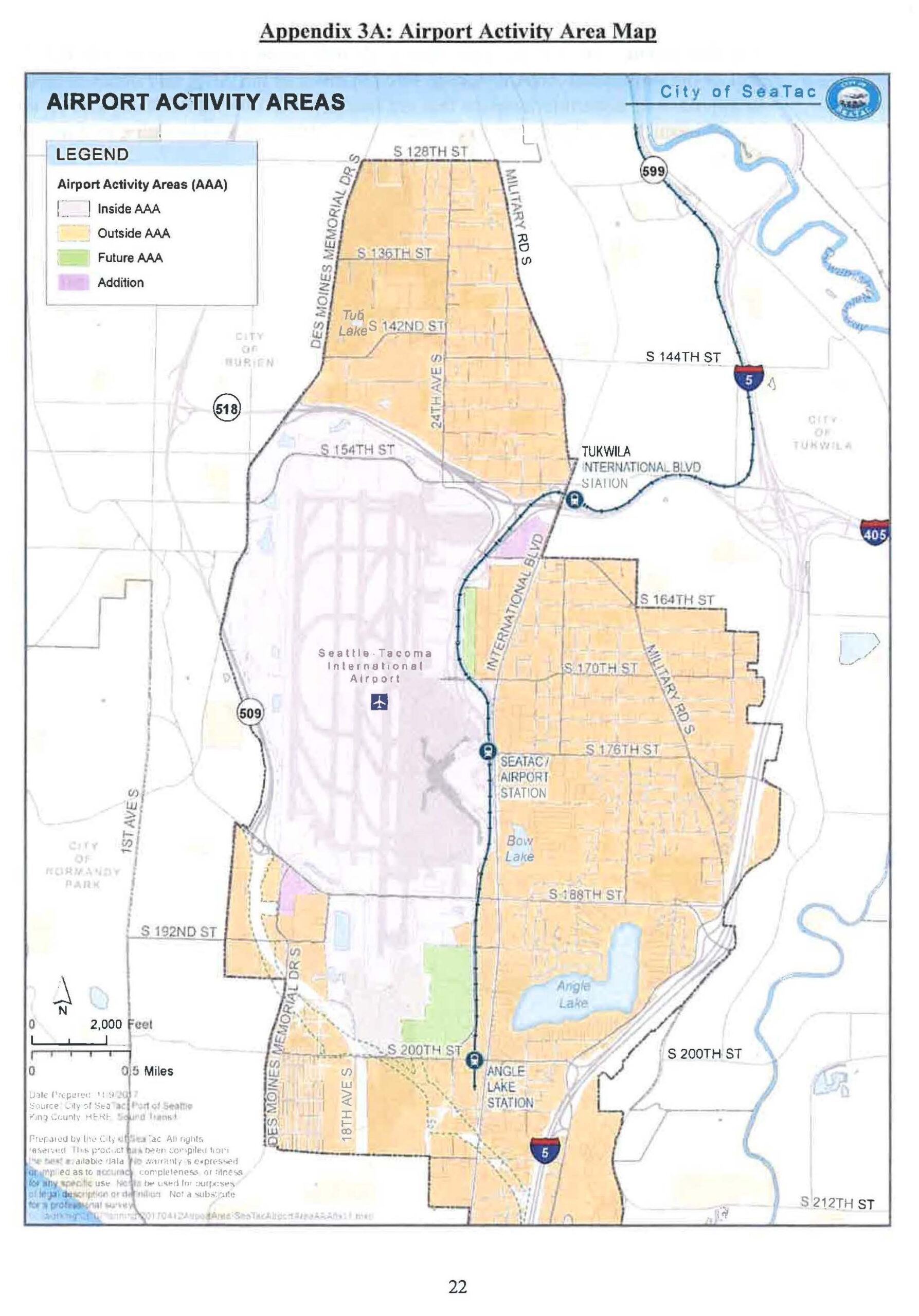
ILA SeaTac 2018 Pg 22 Airport Activity Areas
This official map from the City of SeaTac depicts Airport Activity Areas (AAA) surrounding Seattle-Tacoma International Airport, distinguishing zones inside the AAA, outside the AAA, future AAA, and additions. The map shows surrounding streets, neighboring cities (Burien, Tukwila, Normandy Park), light rail stations (SeaTac/Airport, Tukwila International Blvd, Angle Lake), major highways (I-5, I-405, SR-509, SR-518, SR-599), and was prepared on 11/9/2007 by the City of SeaTac/Port of Seattle using King County, HBIS, and Sound Transit data. -
 2018-12-04
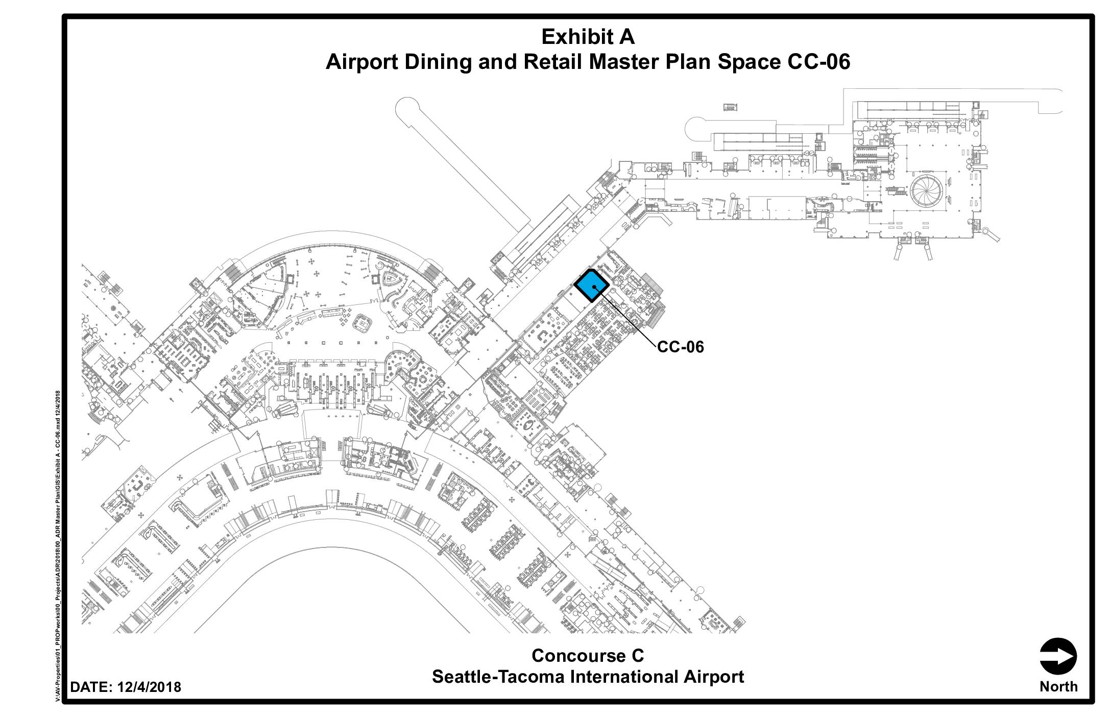
Exhibit A: Airport Dining and Retail Master Plan Space CC-06
This document is a floor plan exhibit from Seattle-Tacoma International Airport's Airport Dining and Retail Master Plan, dated December 4, 2018, identifying a specific retail or dining space designated CC-06 located in Concourse C. The highlighted space is shown on a detailed map of the concourse layout, pinpointing its position along the main concourse corridor. The exhibit was produced for planning and leasing reference purposes related to the airport's dining and retail program. -
 2018-12-04
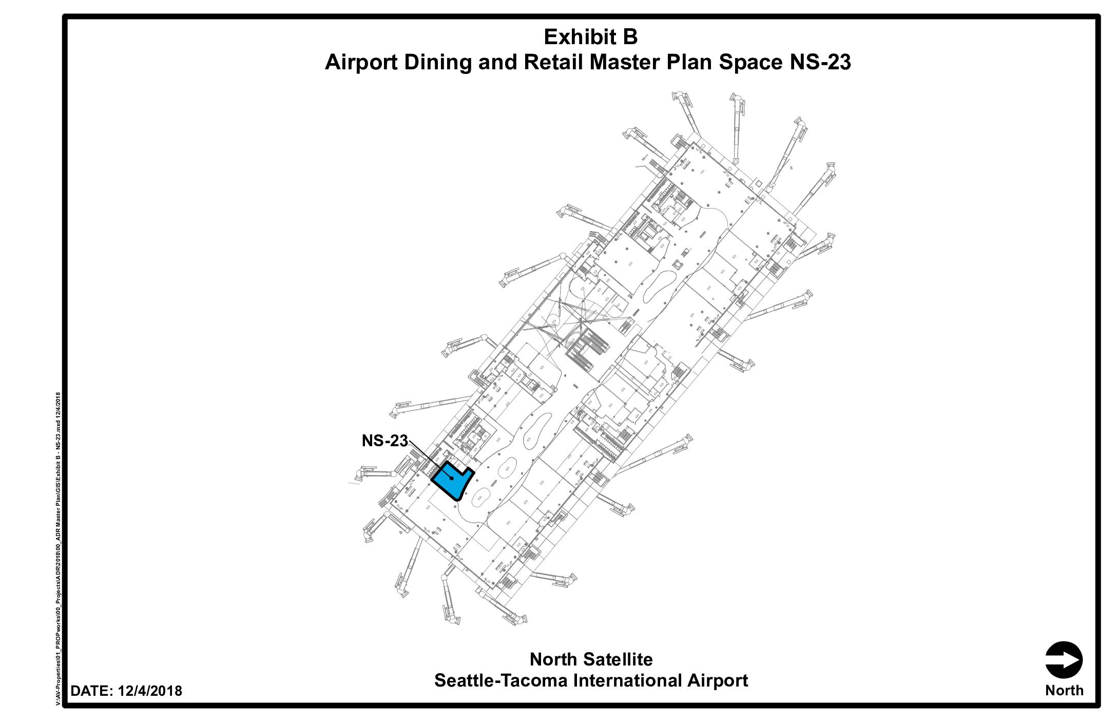
Exhibit B: Airport Dining and Retail Master Plan Space NS-23
This document is a floor plan exhibit identifying retail or dining space NS-23 located in the North Satellite terminal at Seattle-Tacoma International Airport, dated December 4, 2018. The highlighted space is part of the Airport Dining and Retail Master Plan and is shown in blue on the terminal map. It serves as a reference document for leasing or planning purposes related to commercial concession spaces within the North Satellite. -
 2018-03-01
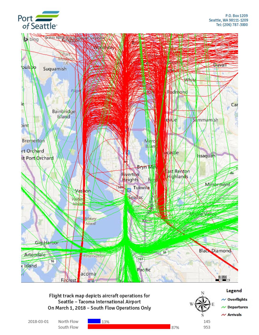
Flight track map depicts aircraft operations for Seattle – Tacoma International Airport on March 1-2, 2018
These flight track maps from the Port of Seattle show aircraft arrival, departure, and overflight paths at Seattle-Tacoma International Airport on March 1–2, 2018. On March 1, the airport operated predominantly in South Flow (87% of operations, 953 flights), with a brief period of North Flow (13%, 145 flights); on March 2, all 1,118 operations were conducted entirely in South Flow. The maps illustrate how flight corridors shift direction depending on the flow configuration, affecting which surrounding communities—such as those north of the airport near Shoreline and Mountlake Terrace versus those to the south near Auburn and Pacific—experience the greatest noise exposure. -
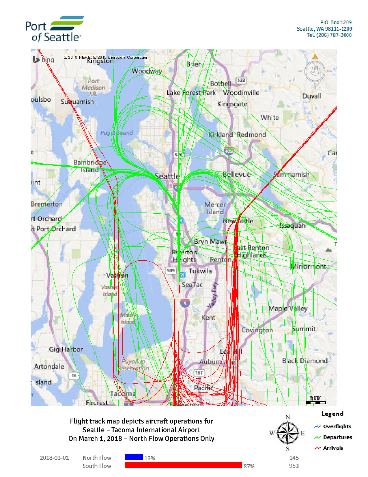 2018-03-01
Sea-Tac Airport Daily Flight Track Map by Flow — North Flow Operations, March 1, 2018
Port of Seattle flight track map showing aircraft operations at Seattle-Tacoma International Airport on March 1, 2018, depicting North Flow operations only. The map displays overflights (blue), departures (green), and arrivals (red), with data indicating North Flow accounted for 13% of operations (145 flights) and South Flow 87% (953 flights) on that date. -
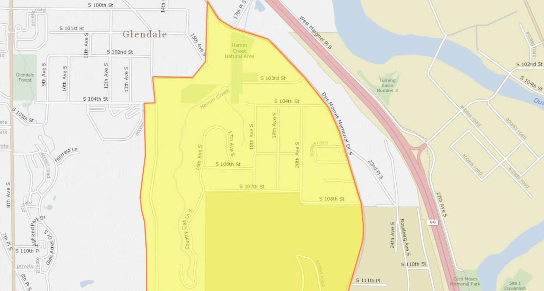 2018-01-01
DNL65 Boundary Map (2018)
This document contains a series of maps outlining a highlighted geographic zone spanning several Seattle-area neighborhoods, including Glendale, Southern Heights, Boulevard Park, and North SeaTac. The yellow-shaded areas, bordered in red, appear to delineate a specific study or policy boundary likely related to Sea-Tac Airport noise impact zones. Streets and landmarks such as Hamm Creek Natural Area, Des Moines Memorial Drive, and Southern Heights Park are visible within and around the designated boundary. -
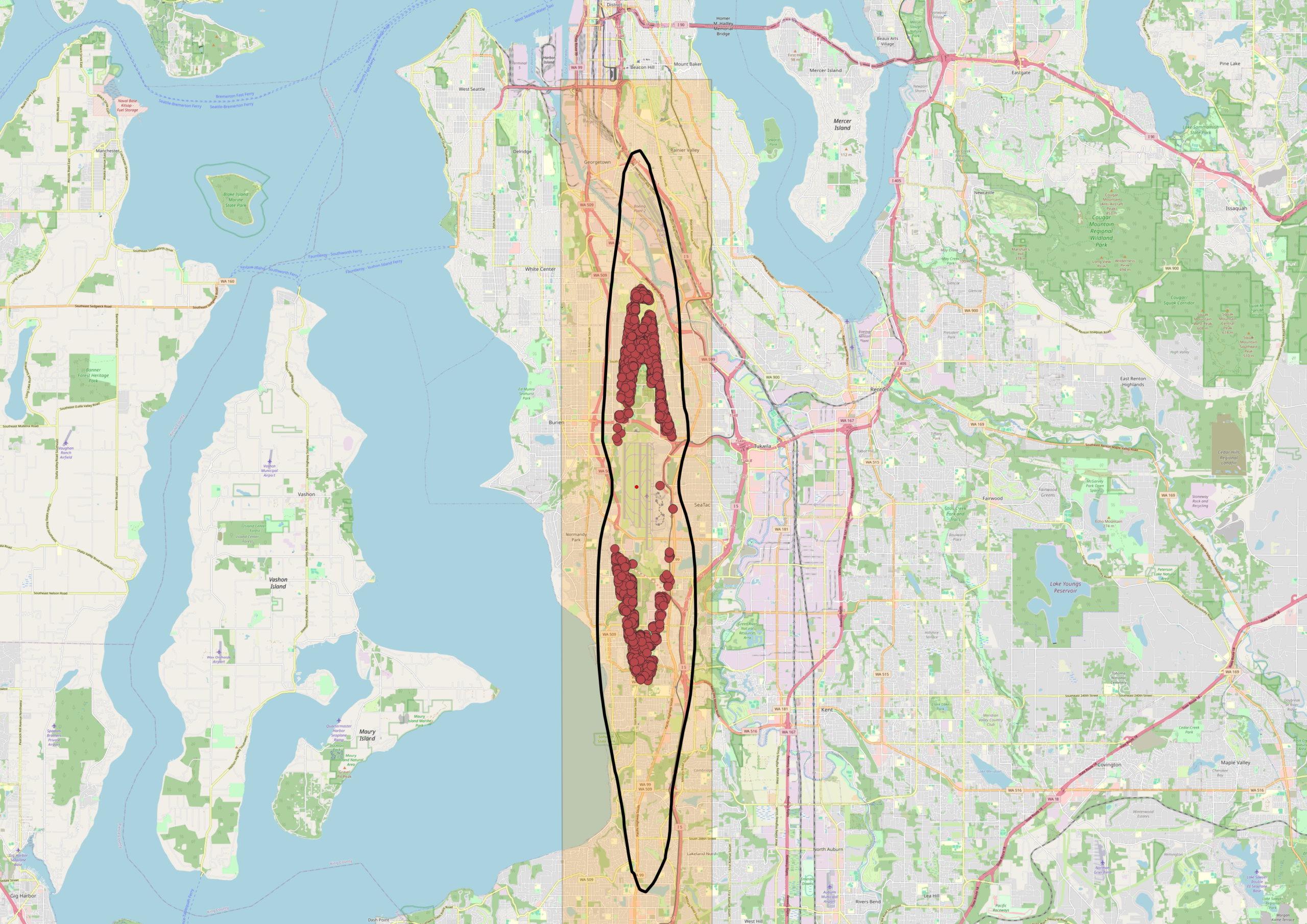 2018-01-01
Sea-Tac Airport DNL 65 Noise Contour Map with 2018 Noise Complaints — Burien, White Center, and Tukwila
An OpenStreetMap-based map of the Seattle–Tacoma area showing Sea-Tac Airport's flight corridor, marked with a highlighted orange corridor zone and a black oval outline indicating the primary noise impact area. Red dot clusters represent noise complaints or flight track incidents concentrated over the Burien, White Center, and Tukwila neighborhoods south of Seattle, with a secondary cluster further south near Federal Way. -
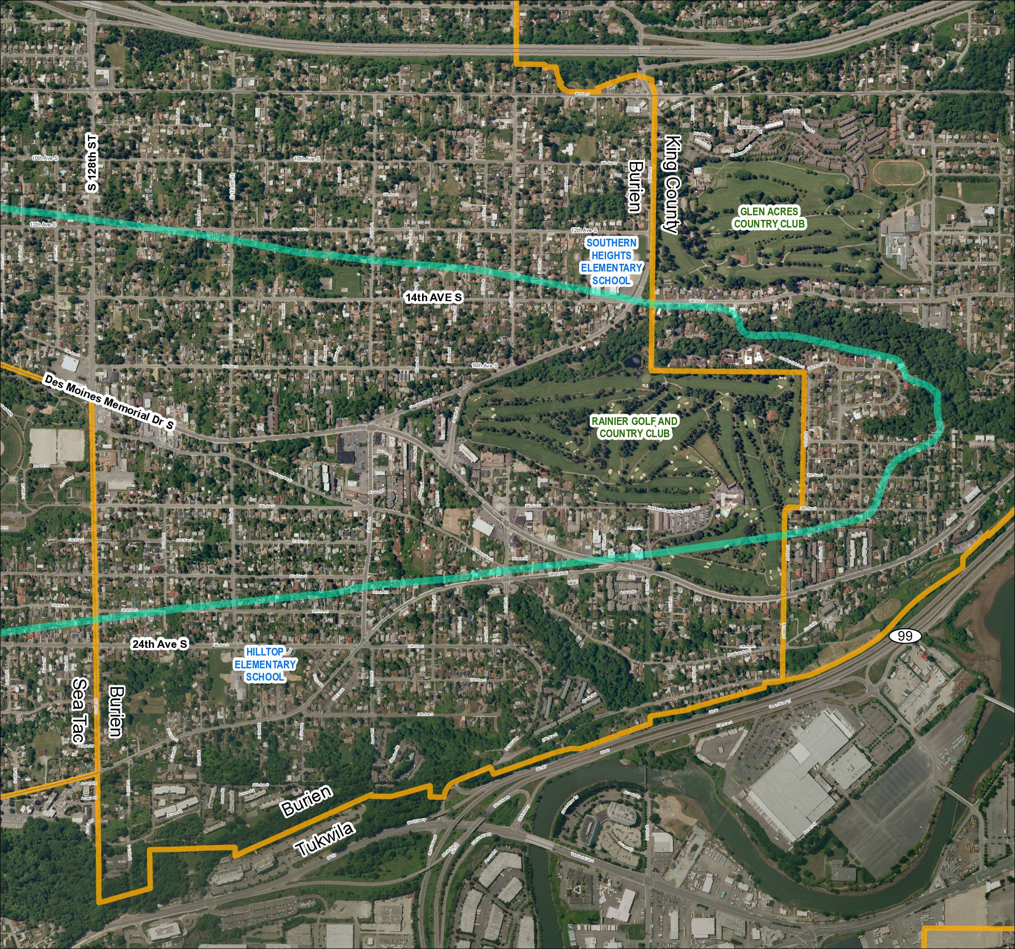 2018-01-01
Grid 5: Sea-Tac Airport Area Map (2018)
This aerial map covers the residential and commercial areas surrounding Sea-Tac Airport, spanning portions of Burien, SeaTac, Tukwila, and unincorporated King County. It highlights key landmarks including Southern Heights Elementary School, Hilltop Elementary School, Rainier Golf and Country Club, and Glen Acres Country Club, along with major roadways such as SR 99, SR 599, Des Moines Memorial Drive S, and Military Road S. Turquoise boundary lines appear to delineate specific noise impact or study zones relevant to airport policy planning in the region. -
 2018-01-01
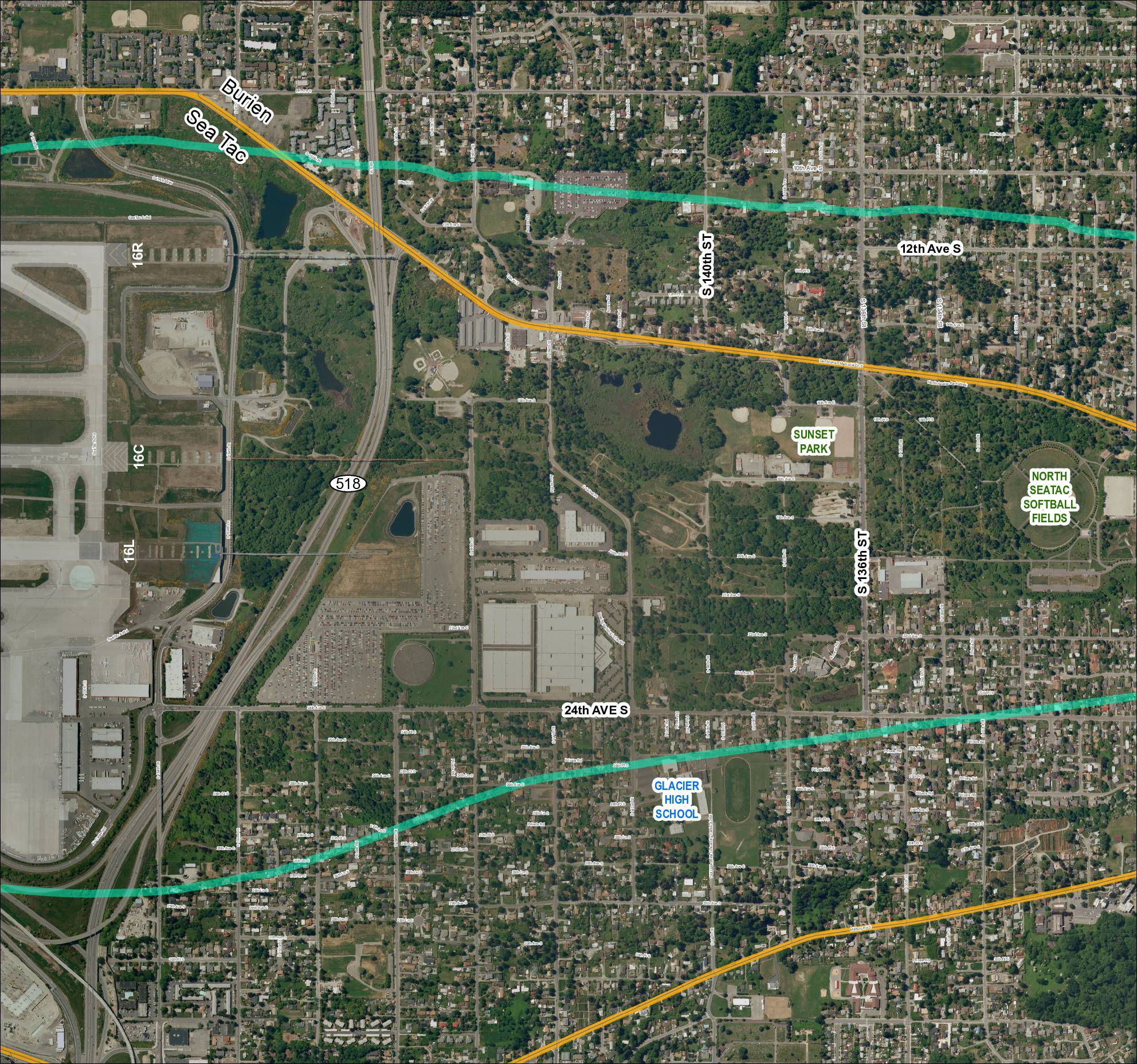
Grid 4 (2018): Aerial Map of Sea-Tac Area Including Glacier High School, Sunset Park, and North Sea-Tac Softball Fields
This map depicts the area surrounding Seattle-Tacoma International Airport, showing the airport's runway layout (including runways 16R, 16C, and 16L) alongside nearby neighborhoods in Burien and SeaTac. Two overlaid flight-path or noise-contour corridors (shown in teal/green and gold) arc across the surrounding residential and parkland areas, illustrating the geographic extent of aircraft noise impact. Notable landmarks within the affected area include Glacier High School, Sunset Park, and the North SeaTac Softball Fields, highlighting the communities exposed to airport-related noise.