TagMap(375)
-
Resized-SR-509-map
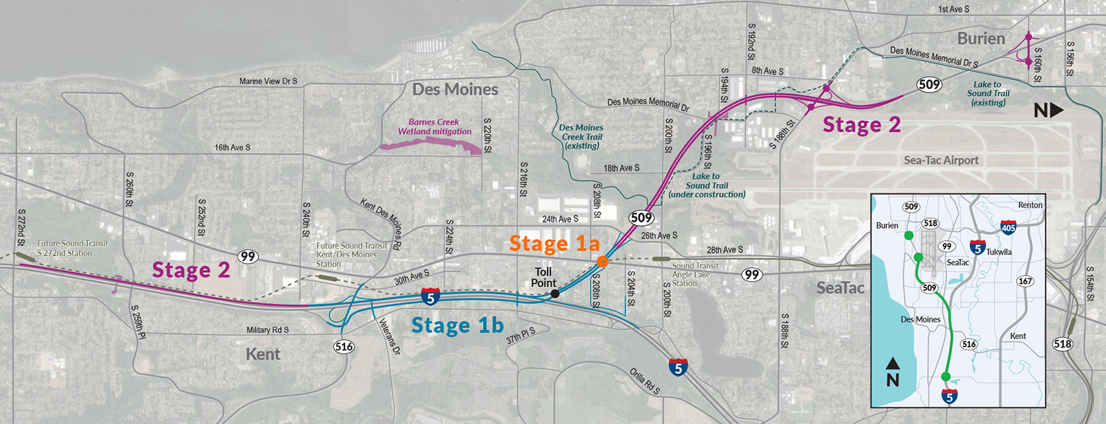
This map depicts the Washington State SR-509 extension project, showing three construction stages: Stage 1a (at Toll Point near S 208th St), Stage 1b (along I-5 through Kent), and Stage 2 (connecting Burien via Des Moines Memorial Drive to the existing Lake to Sound Trail). The map also identifies future Sound Transit stations, Barnes Creek Wetland mitigation, the Des Moines Creek Trail, and the Lake to Sound Trail under construction near Sea-Tac Airport. -
 2022-03-29
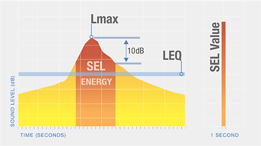
Fundamentals of Noise and Sound | Federal Aviation Administration
Noise Metrics Noise Contours Sound is energy transferred through the air that our ears detect as small changes in air pressure. The more energy put into making a sound, the louder it will be. Try whispering. Then yell. You can feel how much more energy goes into yelling. Noise is sound that is unwanted. Some -
SR-509 Stage 2 Des Moines Creek Park
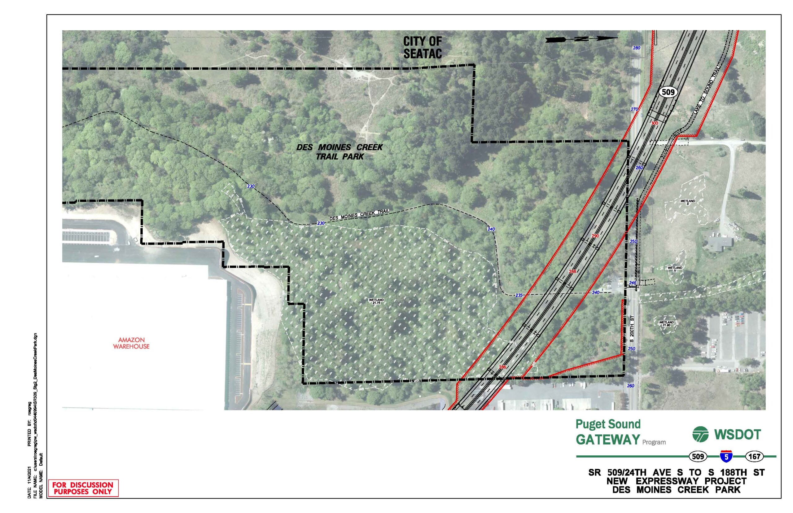
A WSDOT aerial planning map dated 11/6/2021 showing the proposed SR 509 New Expressway alignment (red lines) relative to Des Moines Creek Trail Park, with project boundaries (dashed black lines), wetland areas, contour elevations, and adjacent features including an Amazon Warehouse and the City of SeaTac boundary. The document is labeled 'For Discussion Purposes Only' and is part of the Puget Sound Gateway Program involving SR 509, I-5, and SR 167. -
SR509 Stages Map
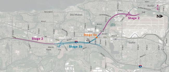
A project staging map shows the SR 509 extension and I-5 connector route divided into Stage 1a (toll point near Des Moines Memorial Drive), Stage 1b (along Military Road S toward Kent), and Stage 2 (extending northwest toward Burien and southeast toward Kent via SR 99). The map covers the Des Moines, SeaTac, Burien, and Kent areas of Washington State, with route numbers 99, 509, 316, and 5 visible. -
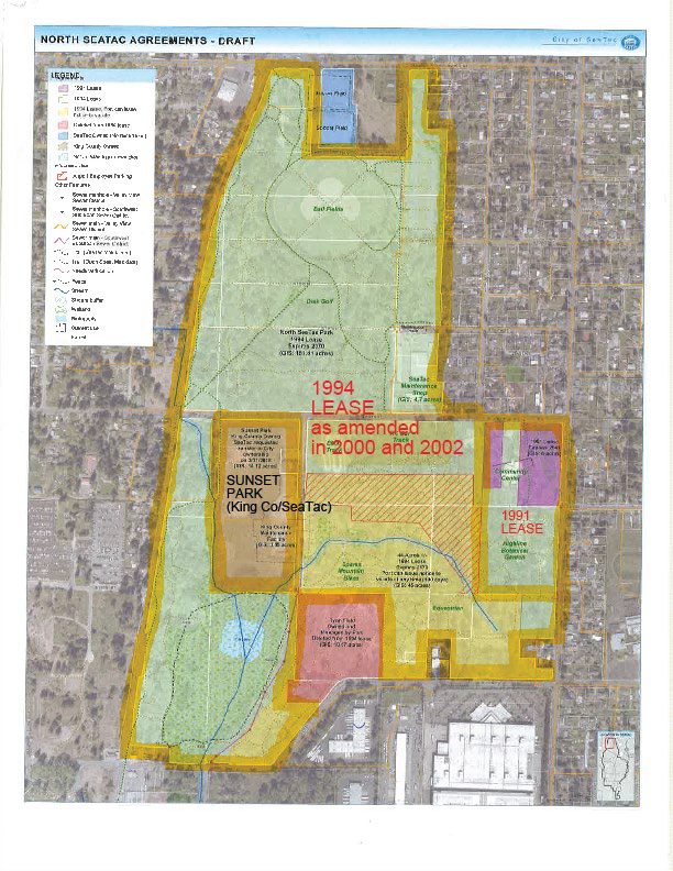
North SeaTac Park Lease Map
A draft aerial map produced by the City of SeaTac depicting land use agreements in the North SeaTac area, including the 1991 Lease, the 1994 Lease as amended in 2000 and 2002, and Sunset Park (King County/SeaTac). The map uses color-coded overlays and a legend to delineate lease boundaries, City-owned parcels, and facilities such as a Community Center and SeaTac Maintenance area. -
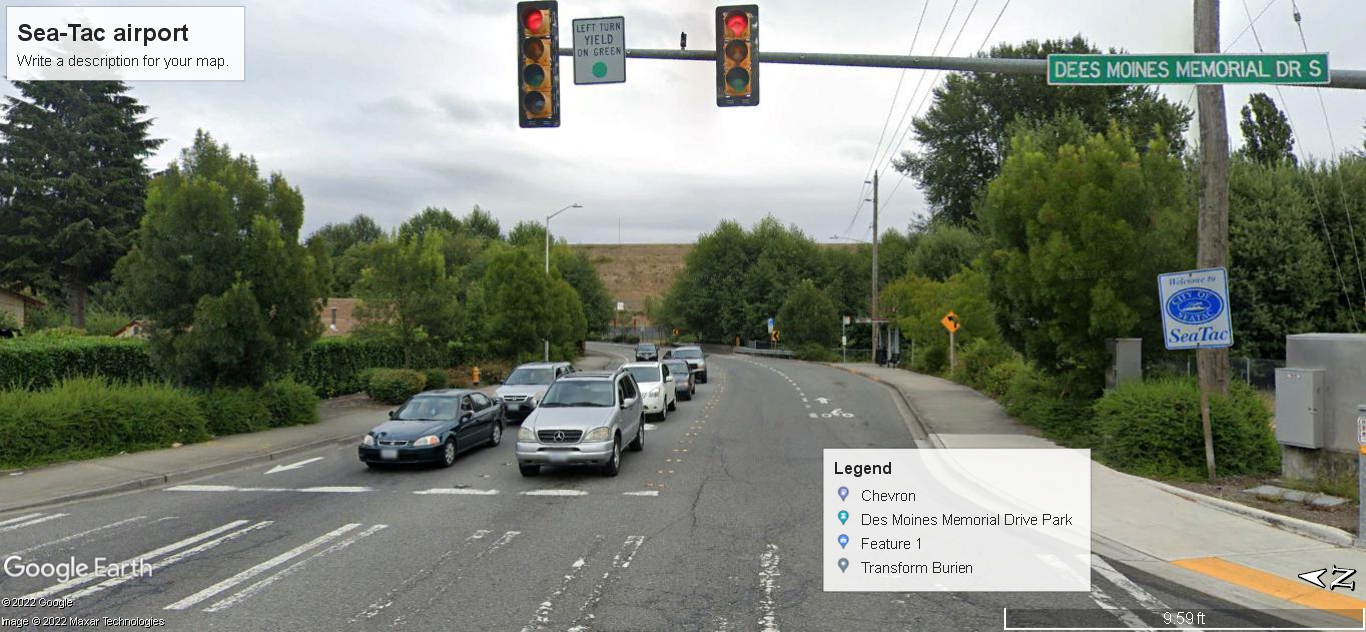 2022-01-01
Des Moines Memorial Drive S at SeaTac City Boundary — Google Earth Street View
Google Earth street-view image (© 2022 Google / Maxar Technologies) looking north along Des Moines Memorial Drive S at the signalized intersection marking the SeaTac city boundary, as indicated by the visible 'Welcome to SeaTac' city sign on the right. A Google My Maps overlay labels nearby points of interest including Chevron, Des Moines Memorial Drive Park, and Transform Burien, in the context of a Sea-Tac Airport mapping project. -
 2022-01-01
A Property Value Study for King County and Port Affected Areas
A property value study prepared by Saundra Mock of John L. Scott Real Estate examines how home values in King County and areas affected by Sea-Tac Airport air traffic compare to surrounding communities without an air traffic freeway overhead. Using data from the Northwest Multiple Listing Service, the study presents maps, zip codes, and median home values for affected and unaffected cities in the Seattle area, allowing readers to draw their own conclusions about the impact of airport noise on local real estate. -
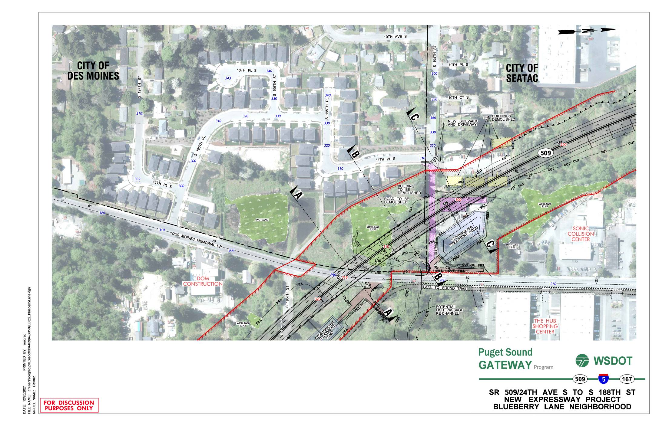 2021-12-20
SR 509/24th Ave S to S 188th St new expressway project: Blueberry Lane neighborhood
This WSDOT Puget Sound Gateway Program document presents preliminary design plans for a new SR 509 expressway segment running from 24th Ave S to S 188th St through the Blueberry Lane neighborhood, spanning the cities of Des Moines and SeaTac. The plans show proposed roadway construction, stormwater treatment ponds, wetland areas, and several buildings and roads slated for demolition to accommodate the new highway alignment. Cross-sectional diagrams illustrate the elevation changes and right-of-way boundaries relative to existing neighborhoods, trails, and local streets. -
 2021-12-08
King County 2021 Districting Plan Map
This document presents King County's 2021 Districting Plan, adopted December 8, 2021, showing the boundaries of the county's nine council districts as mapped by the King County GIS Center. The map covers the greater Seattle metropolitan area, including surrounding cities and unincorporated areas, with district lines redrawn following the 2020 census. The plan establishes the geographic representation boundaries used for King County Council elections going forward. -
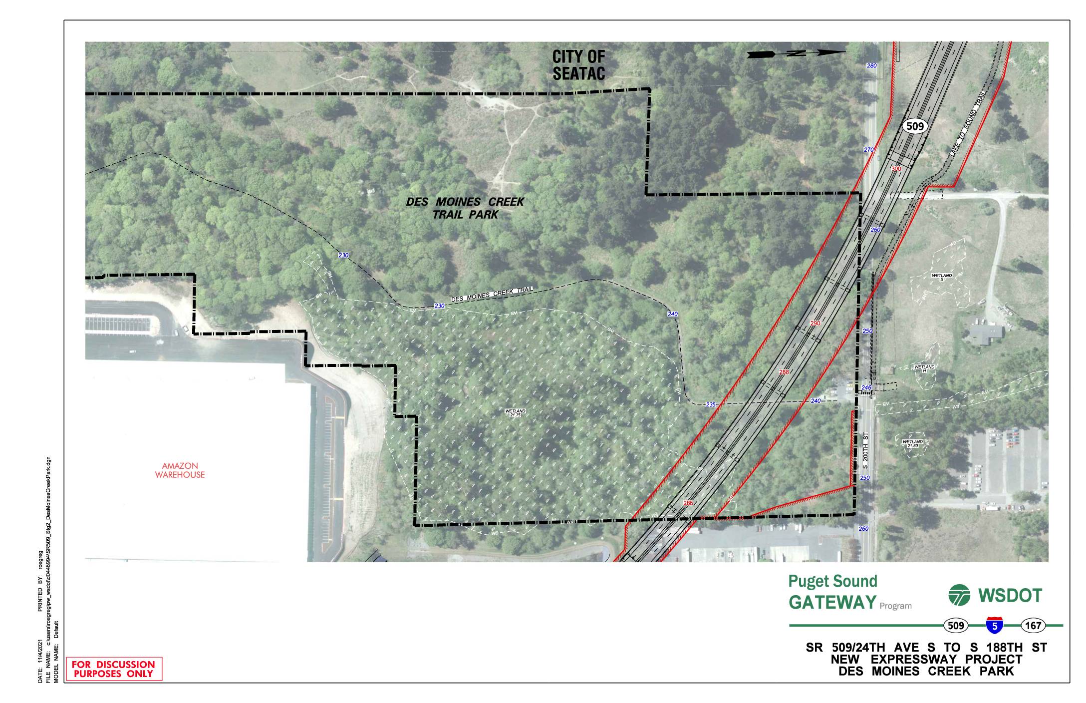 2021-11-04
SR 509/24th Ave S to S 188th St new expressway project: Des Moines Creek Park
This WSDOT discussion document from November 2021 shows a planning map for the SR 509 Puget Sound Gateway Program's new expressway project, spanning from 24th Ave S to S 188th St near Des Moines Creek Park in the City of SeaTac. The map highlights the proposed highway alignment (shown in red) running adjacent to Des Moines Creek Trail Park, identifying wetland areas, contour elevations, and nearby features such as an Amazon warehouse and the Lake to Sound Trail. The project represents a major infrastructure expansion in the SeaTac area that would affect the Des Moines Creek Park corridor and surrounding natural resources.