TagMap(375)
-
 2014-12-31
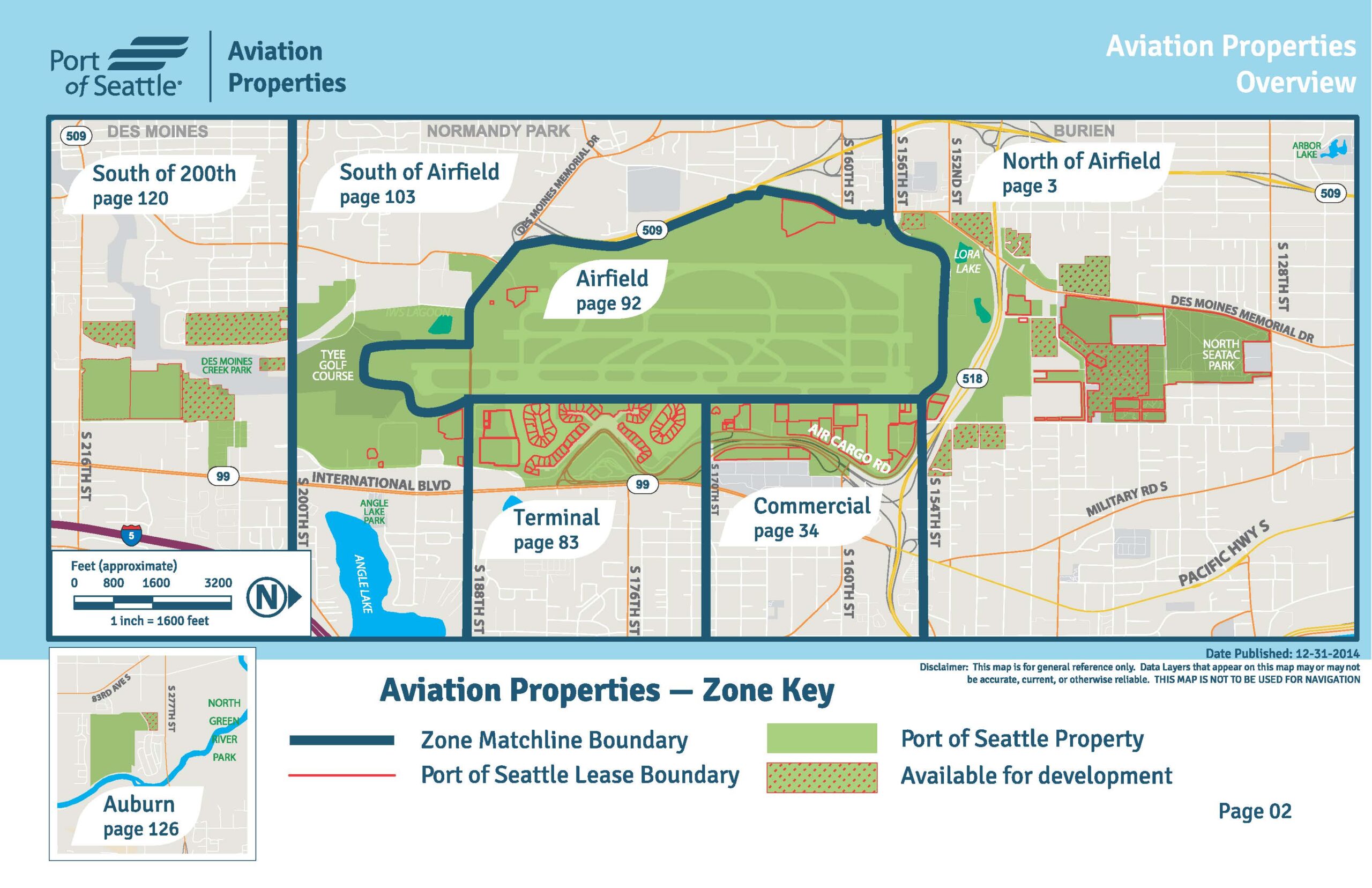
Port Of Seattle Aviation Properties Overview Map — December 2014
This is an official Port of Seattle Aviation Properties Overview map (Page 02), published December 31, 2014, depicting zone boundaries around Seattle-Tacoma International Airport (Sea-Tac). The map identifies six named zones — Airfield (p.92), Terminal (p.83), Commercial (p.34), North of Airfield (p.3), South of Airfield (p.103), and South of 200th (p.120) — plus an Auburn inset (p.126), with a zone key distinguishing Port of Seattle property, lease boundaries, zone matchline boundaries, and land available for development. -
 2014-12-31
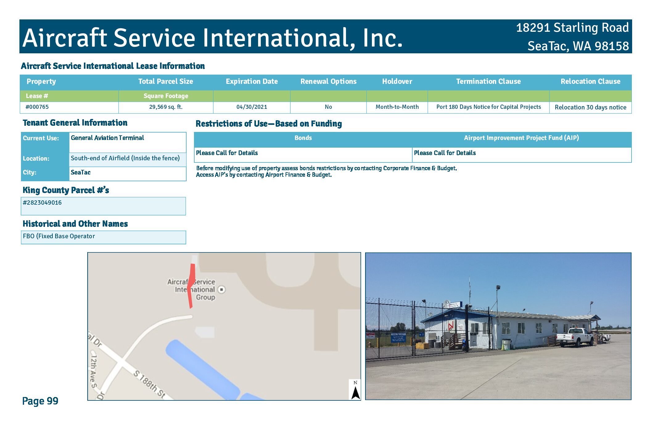
Aircraft Service International, Inc. lease information
Aircraft Service International, Inc. leases 29,569 square feet at 18291 Starling Road in SeaTac, WA (Lease #000765), located at the south end of the Sea-Tac Airfield inside the security fence, where it operates as a Fixed Base Operator (FBO) providing general aviation terminal services. The lease expired April 30, 2021, with no renewal options, transitioning to a month-to-month holdover arrangement, and includes a termination clause requiring 180 days notice for capital projects and a 30-day relocation notice. Parties seeking to modify the property's use must consult Corporate Finance & Budget regarding bond restrictions and Airport Finance & Budget regarding Airport Improvement Project (AIP) funding conditions. -
 2014-12-31
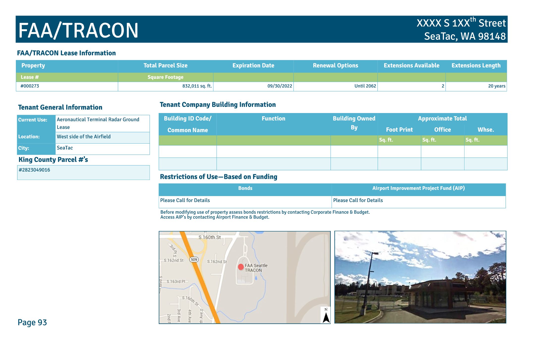
FAA/TRACON lease information
This document describes a Port of Seattle ground lease (Lease #000273) with the FAA/TRACON facility located on the west side of the airfield in SeaTac, Washington. The lease covers approximately 832,011 square feet, was set to expire on September 30, 2022, and includes two renewal options extending until 2062, each for a period of 20 years. The facility serves an aeronautical terminal radar function and is subject to bond and Airport Improvement Project (AIP) funding restrictions that require coordination with Airport Finance & Budget before any changes in property use. -
 2014-06-15
Airport Key Map: Sea-Tac Airport Property Zones
★ 32This Airport Key Map, published by the Port of Seattle on June 15, 2014, provides a general reference overview of property zones surrounding Seattle-Tacoma International Airport. It identifies distinct areas including the Airfield, Terminal, Commercial, South of Airfield, South of 200th, and North of Airfield zones, and distinguishes between Port of Seattle property, lease boundaries, non-Port property, land available for redevelopment, and the proposed SR 509 corridor. The aerial photo, taken in Spring 2012, is intended for general reference only and is not approved for navigation use. -
 2013-09-24
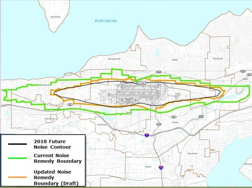
Part 150 Noise Boundary Zones Map — Sea-Tac Airport Commission Presentation
Map showing three overlapping noise boundary zones around Seattle-Tacoma International Airport: the 2018 Future Noise Contour (black), the Current Noise Remedy Boundary (green), and the Updated Noise Remedy Boundary in draft form (orange). The map covers the surrounding communities including Des Moines, Normandy Park, Burien, SeaTac, and Tukwila, adjacent to Puget Sound. -
 2013-08-24
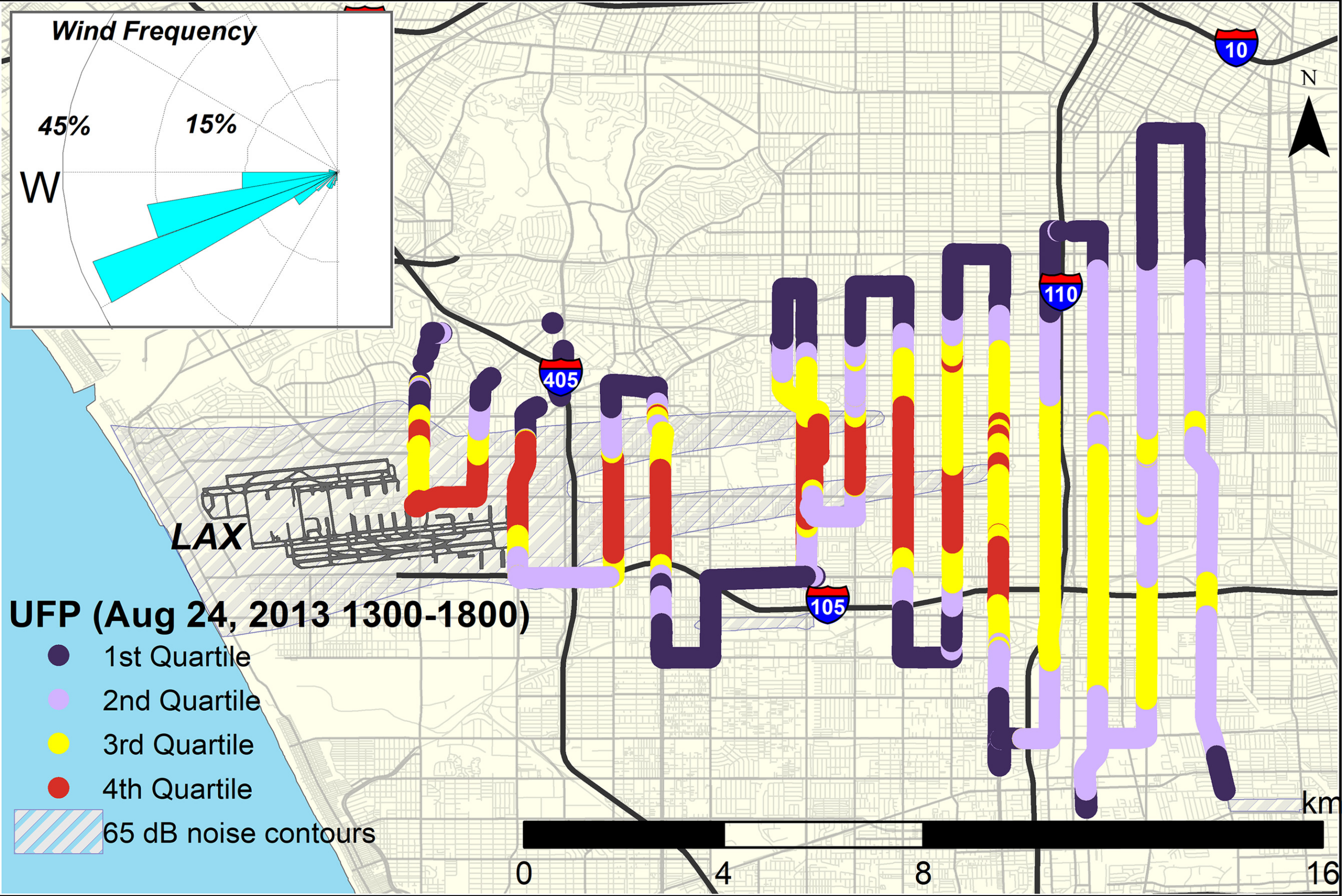
LAX ultrafine particle (UFP) concentrations map, August 2013
This map displays ultrafine particle (UFP) concentrations measured by quartile along driving routes near Los Angeles International Airport (LAX) on August 24, 2013, between 1300–1800 hours. The map includes a wind rose showing predominant westerly winds, 65 dB noise contours from LAX flight paths, and nearby freeways I-405, I-110, and I-105. -
 2013-05-30
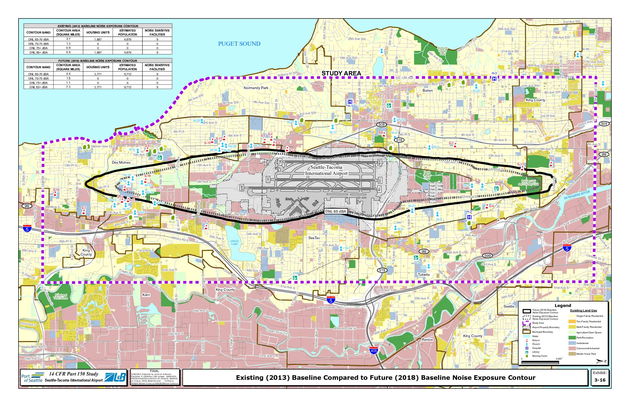
Existing (2013) baseline compared to future (2018) baseline noise exposure contour
This exhibit from the Seattle-Tacoma International Airport 14 CFR Part 150 Noise Study compares the existing 2013 baseline noise exposure contours with projected 2018 baseline contours around Sea-Tac Airport. The data shows that the DNL 65+ dBA noise contour area is expected to shrink from 7.3 to 5.9 square miles, with affected housing units dropping from 3,771 to 1,887 and estimated population exposure falling from 9,712 to 4,879. Nine noise-sensitive facilities remain within the contour in both scenarios, and the maps illustrate how the impacted area covers portions of SeaTac, Burien, Des Moines, Tukwila, and unincorporated King County. -
 2013-01-22
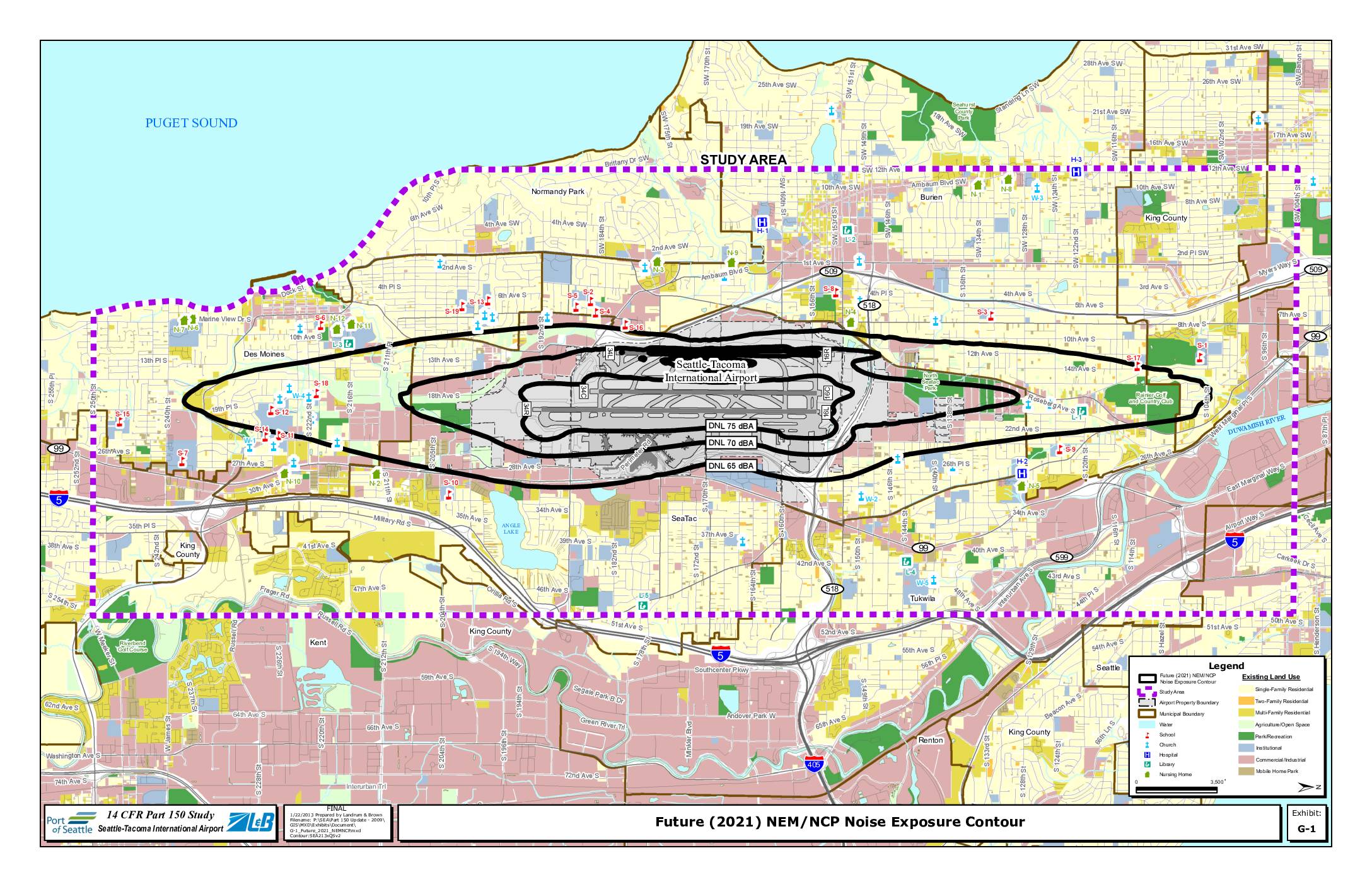
Exhibit G-1: Future (2021) NEM/NCP Noise Exposure Contour
This map, prepared by Landrum & Brown on January 22, 2013 as part of the 14 CFR Part 150 Study for Seattle-Tacoma International Airport, shows projected future (2021) noise exposure contours around Sea-Tac Airport at DNL 65, 70, and 75 dBA levels. The contours extend across surrounding communities including SeaTac, Burien, Des Moines, Tukwila, and portions of Renton and Kent, with sensitive land uses such as schools, churches, hospitals, and residential areas identified within the noise impact zones. The study was conducted to inform noise compatibility planning and policy decisions aimed at reducing aviation noise impacts on affected neighborhoods. -
 2013-01-01
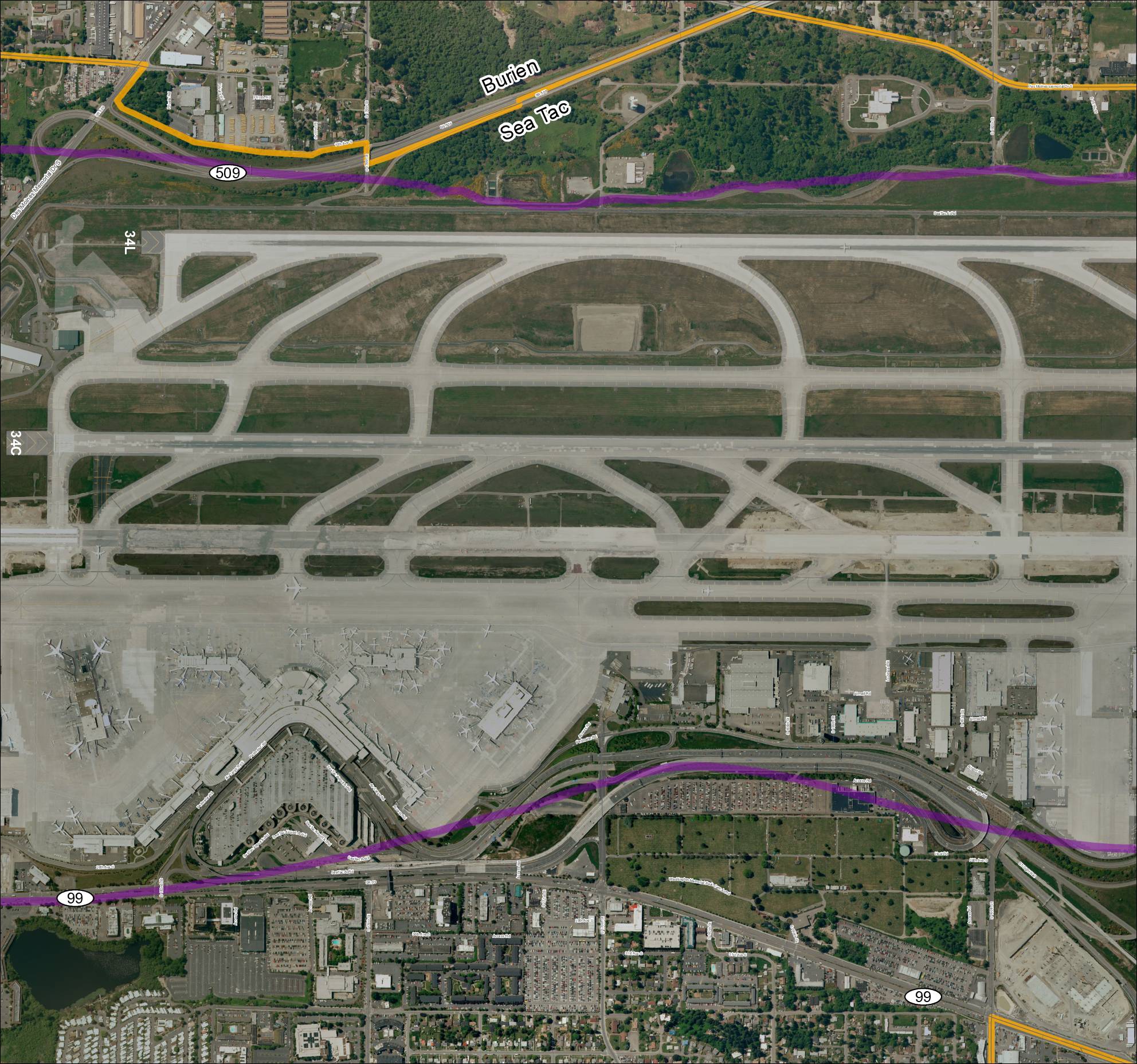
Grid 3 2013 Baseline Map: Sea-Tac Airport Runways and Surrounding Area
This aerial map depicts Seattle-Tacoma International Airport (Sea-Tac) and its surrounding communities of Burien and SeaTac, showing the airport's runway layout including runways 34L and 34C, along with key roadways such as SR 99, SR 509, and various access roads. Highlighted routes in purple and orange appear to mark designated corridors or boundary lines relevant to airport planning or noise study areas. The map provides a geographic reference for understanding the airport's footprint and its relationship to neighboring residential and commercial zones. -
 2013-01-01
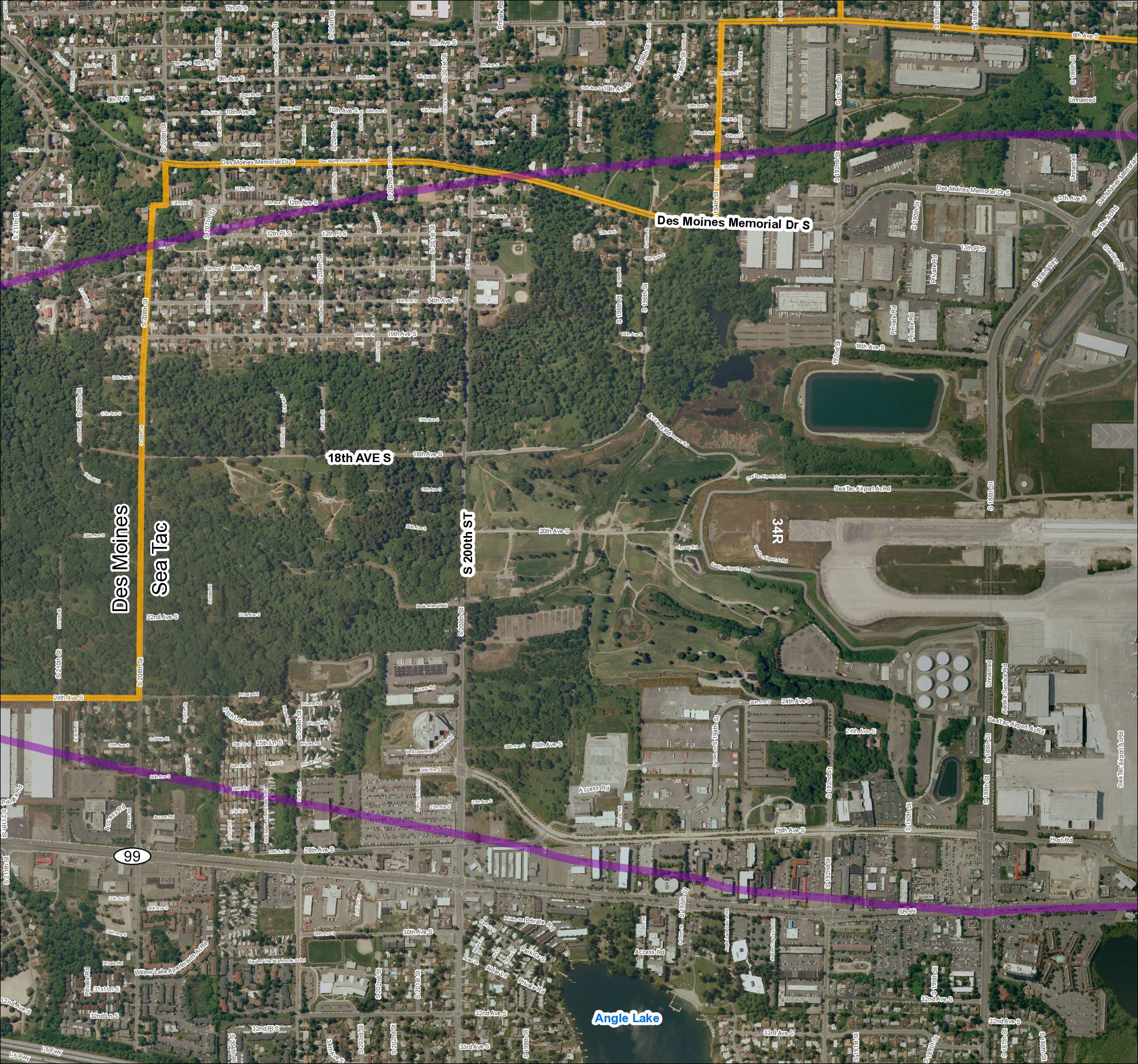
Grid 2: 2013 Baseline Map — Des Moines / Sea-Tac Area
This document is an aerial map of the area surrounding Seattle-Tacoma (Sea-Tac) International Airport, covering the cities of Des Moines and SeaTac in Washington State. It highlights key roadways such as Des Moines Memorial Drive S, SR 99, S 200th Street, and 18th Avenue S, along with airport-specific features including runway 34R and various airport access roads. The map appears to delineate study or noise impact boundaries marked in orange and purple, likely used for airport noise planning and policy analysis purposes.