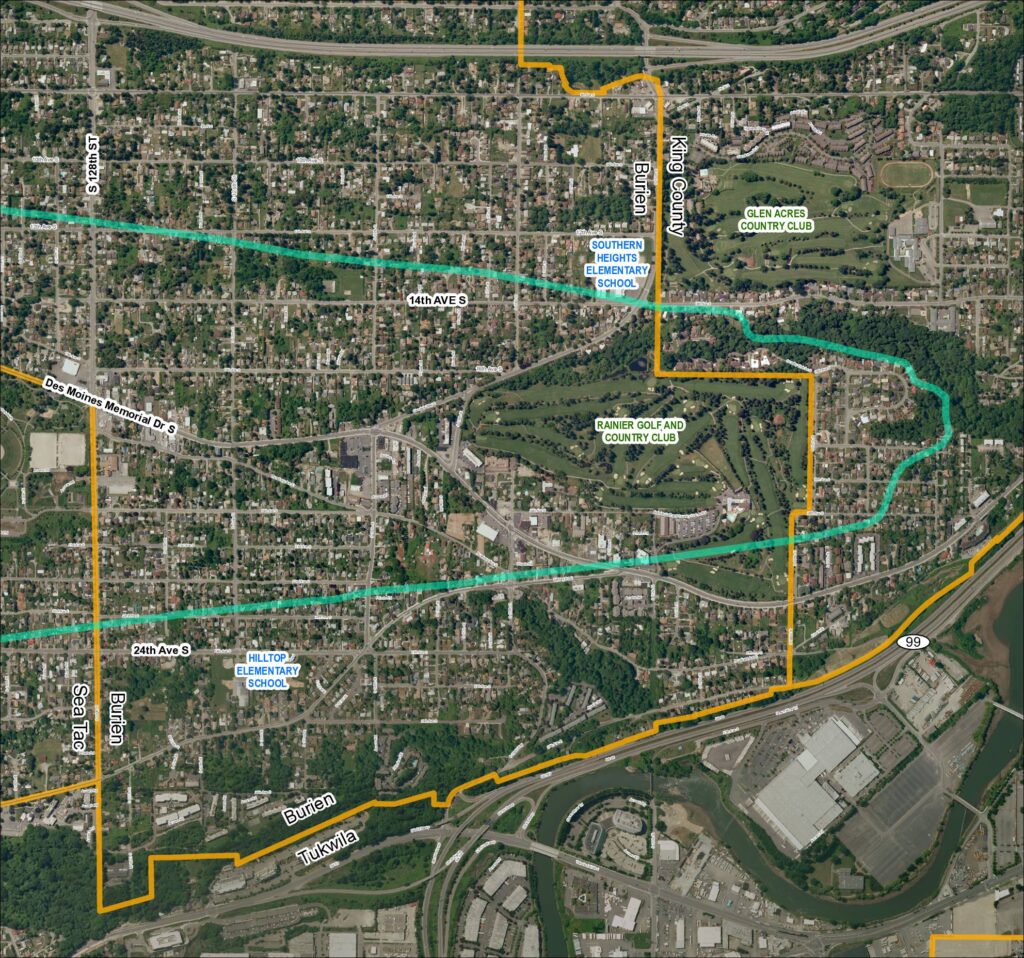
Grid 5: Sea-Tac Airport Area Map (2018)

This aerial map covers the residential and commercial areas surrounding Sea-Tac Airport, spanning portions of Burien, SeaTac, Tukwila, and unincorporated King County. It highlights key landmarks including Southern Heights Elementary School, Hilltop Elementary School, Rainier Golf and Country Club, and Glen Acres Country Club, along with major roadways such as SR 99, SR 599, Des Moines Memorial Drive S, and Military Road S. Turquoise boundary lines appear to delineate specific noise impact or study zones relevant to airport policy planning in the region.

Notes

Aerial satellite map (Grid 5, 2018) of the Sea-Tac Airport surrounding area showing street grid, municipal boundaries, and landmarks in Burien, SeaTac, Tukwila, and King County. Features SR 99, SR 599, Des Moines Memorial Dr S, Military Rd S, and cross streets including S 128th St, S 124th St, S 116th St, S 112th St. Identifies Southern Heights Elementary School, Hilltop Elementary School, Rainier Golf and Country Club, and Glen Acres Country Club. Cyan/teal overlay lines indicate study corridors or noise contours; orange boundary line delineates project or study area boundary.

V V