TagMap(375)
-
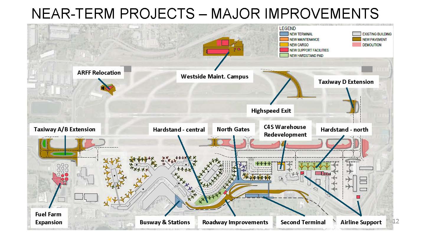
180620-SAMP-Presentation-Public-Meeting 12 NTP Major Improvements
A planning slide titled 'Near-Term Projects – Major Improvements' showing an aerial map of an airport with labeled infrastructure projects including a Second Terminal, Taxiway A/B and D Extensions, Westside Maintenance Campus, Fuel Farm Expansion, Busway & Stations, Roadway Improvements, North Gates, Hardstand areas, ARFF Relocation, Highspeed Exit, C4S Warehouse Redevelopment, and Airline Support facilities. The map uses a color-coded legend distinguishing new terminal, maintenance, cargo, support facilities, hardstand pads, existing buildings, new pavement, and demolition areas. -
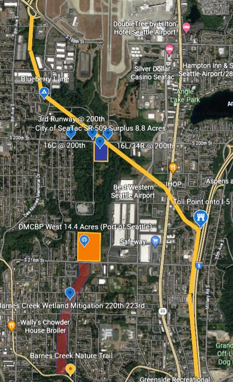
sr509 earth 3 (3)
Aerial map of the Sea-Tac Airport vicinity showing labeled parcels including the 'City of SeaTac SR-509 Surplus 8.8 Acres,' 'DMCBP West 14.4 Acres (Port of Seattle),' runway designations 16C and 16L/34R at 200th Street, and Barnes Creek Wetland Mitigation area between S 220th and S 223rd. Nearby landmarks including DoubleTree by Hilton Hotel Seattle Airport, Best Western Seattle Airport, IHOP, Safeway, and I-5 toll point are also visible. -
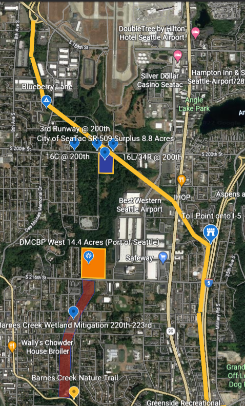
SR-509 Stage 2
Aerial map of the Sea-Tac Airport vicinity showing labeled parcels and points of interest relevant to noise and land use policy, including the 3rd Runway at 200th Street, City of SeaTac SR-509 Surplus 8.8 Acres, DMCBP West 14.4 Acres (Port of Seattle), Barnes Creek Wetland Mitigation area at 220th-223rd, and runway designations 16C/34C and 16L/34R at 200th. Nearby landmarks including DoubleTree by Hilton Hotel Seattle Airport, Best Western Seattle Airport, Safeway, IHOP, and Angle Lake Park are also visible. -
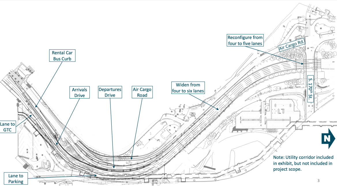
Sea-Tac Airport Roadway Reconfiguration Site Plan
An architectural/engineering site plan for Seattle-Tacoma International Airport showing proposed roadway modifications including widening Air Cargo Road from four to six lanes, reconfiguring from four to five lanes near Air Cargo Rd. and S. 170th St., and labeled features including Arrivals Drive, Departures Drive, Rental Car Bus Curb, and lanes to GTC and Parking. A note indicates the utility corridor is shown but not included in project scope. -
sr509 earth (2)
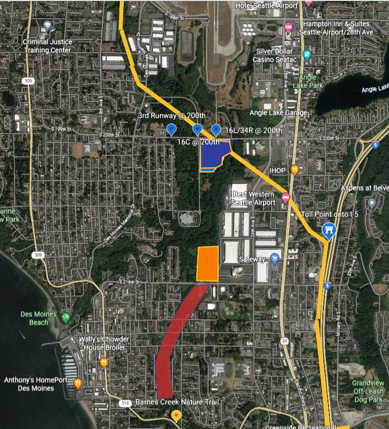
Satellite map of the SeaTac/Des Moines, Washington area showing Seattle-Tacoma International Airport and surrounding neighborhoods, with color-coded overlays marking specific runway corridor points labeled '3rd Runway @ 200th,' '16C @ 200th,' and '16L/34R @ 200th,' along with orange and red highlighted zones near S 216th Street suggesting noise impact or land-use study areas. Visible landmarks include Angle Lake, Best Western Seattle Airport, IHOP, Safeway, Barnes Creek Nature Trail, and Interstate 5. -
SR-509 surplus-cropped
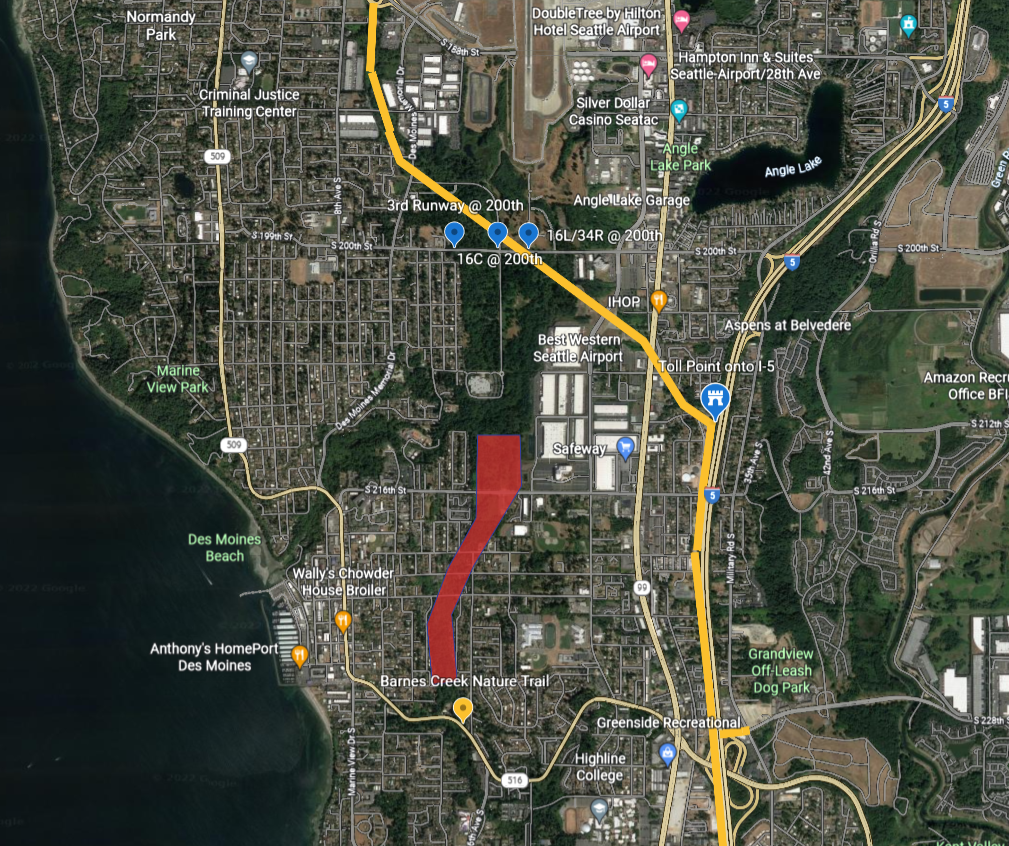
Satellite map of the Des Moines/SeaTac area south of Seattle showing marked approach corridors for Sea-Tac Airport runways 16C, 16L/34R, and the 3rd Runway at S 200th Street. A red polygon highlights a noise-impact or study zone extending southward through residential Des Moines roughly between S 216th Street and S 228th Street, near Barnes Creek Nature Trail and Des Moines Beach. -
SR-509 Stage 2 2022_07_12_RM_10b_Presentation_Des-Moines-Creek-West-Ground-Lease
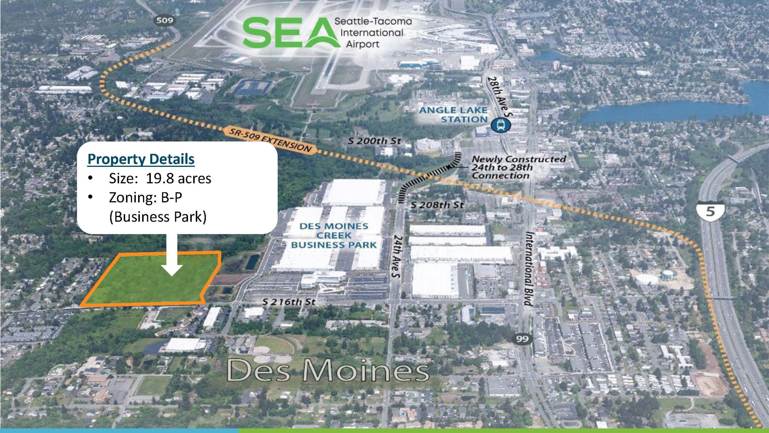
Aerial marketing map depicting a 19.8-acre Business Park (B-P) zoned property in Des Moines, Washington, located adjacent to the Des Moines Creek Business Park and near Seattle-Tacoma International Airport (SEA). The map highlights the SR-509 Extension corridor, Angle Lake Station, the newly constructed 24th-to-28th Street connection, and proximity to Interstate 5 and Highway 99. -
Barnes Creek Trail Mitigation Transportation Committee 09 Jun 2022 Agenda Pdf
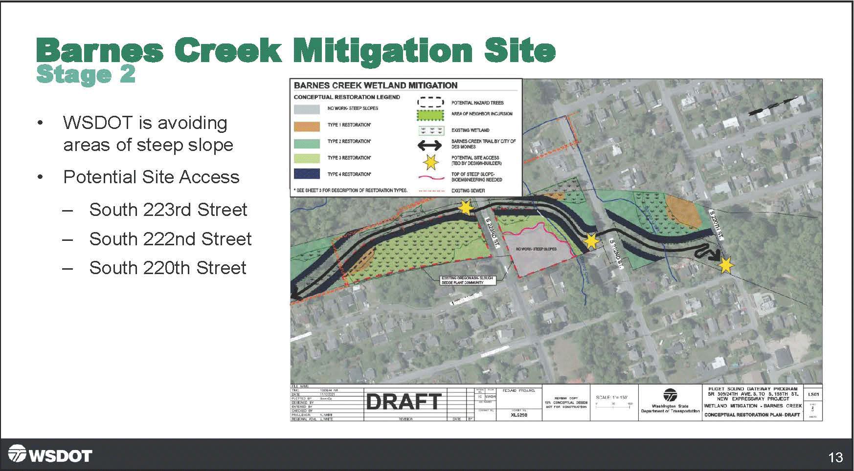
A Washington State Department of Transportation (WSDOT) presentation slide labeled 'Barnes Creek Mitigation Site – Stage 2' showing a draft conceptual restoration plan map for Barnes Creek Wetland Mitigation, part of the Puget Sound Gateway Program SR 509/24th Ave. S. to S. 188th St. New Expressway Project. The slide notes WSDOT is avoiding steep slope areas and identifies three potential site access points at South 223rd Street, South 222nd Street, and South 220th Street. -
 2022-07-14
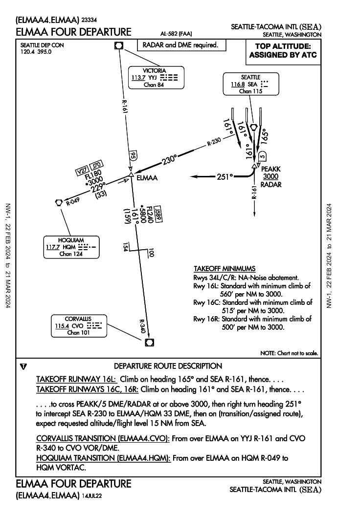
ELMAA Four Departure (ELMAA4.ELMAA) — Seattle-Tacoma International Airport Standard Instrument Departure
The ELMAA Four Departure is a standard instrument departure procedure for Seattle-Tacoma International Airport (SEA) that routes aircraft southward after takeoff on runways 16L, 16C, or 16R. Departing aircraft climb on headings of 161°–165°, cross the PEAKK waypoint at or above 3,000 feet, then turn right to intercept the SEA R-230 radial toward the ELMAA fix, with onward transitions available to Hoquiam (HQM) or Corvallis (CVO). Notably, departures from runways 34L, 34C, and 34R are not authorized due to noise abatement restrictions, and minimum climb gradients of up to 560 feet per nautical mile are required depending on the runway used. -
 2022-07-09
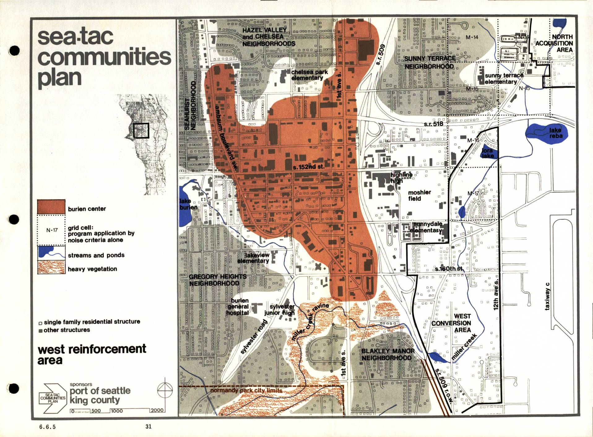
Sea-Tac Communities Plan: West Reinforcement Area Map (Section 6.6.5)
The Sea-Tac Communities Plan, sponsored by the Port of Seattle and King County, maps the West Reinforcement Area surrounding Seattle-Tacoma International Airport, identifying neighborhoods such as Hazel Valley, Chelsea, Seahurst, Gregory Heights, Sunny Terrace, and Blakley Manor that are affected by aircraft noise. The map highlights the Burien Center commercial core, grid cells where program eligibility is determined by noise criteria alone, and features such as streams, ponds, and heavy vegetation. It distinguishes between single-family residential structures and other buildings to guide noise mitigation and land-use planning efforts in the impacted communities.