Notes
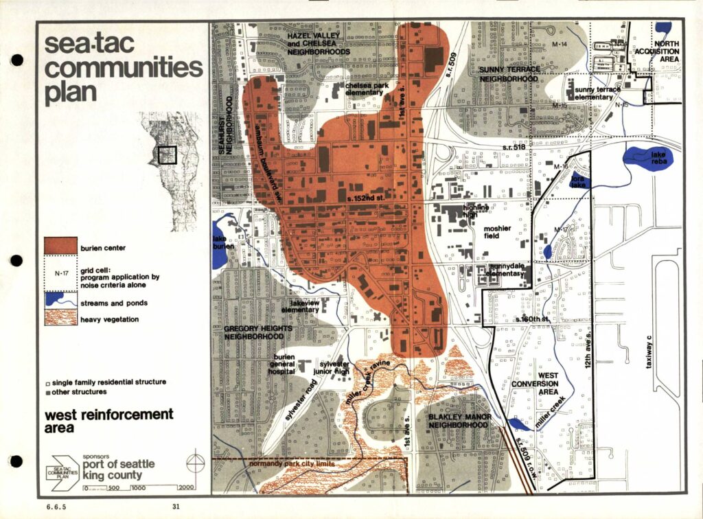
Map from the Sea-Tac Communities Plan (STCP), Section 6.6.5, depicting the West Reinforcement Area near Burien center, sponsored by Port Of Seattle and King County. Shows Burien center boundary (red shading), grid cells for program application by noise criteria alone (e.g., N-14, N-15, N-16, N-17), streams and ponds including Lake Burien, Miller Creek, Lora Lake, Lake Reba, heavy vegetation areas including Miller Creek ravine, single family residential structures, and other structures. Neighborhoods identified include Seahurst, Hazel Valley and Chelsea, Sunny Terrace, Gregory Heights, and Blakley Manor. Features schools (Chelsea Park Elementary, Sunny Terrace Elementary, Lakeview Elementary, Sunnydale Elementary, Highline High), Burien General Hospital, Sylvester Junior High, Moshier Field, and roads including S. 152nd St., S. 160th St., S.R. 509, S.R. 518, Sylvester Road, 12th Ave. S., and Taxiway C. Also shows West Conversion Area and North Acquisition Area.