TagMap(375)
-
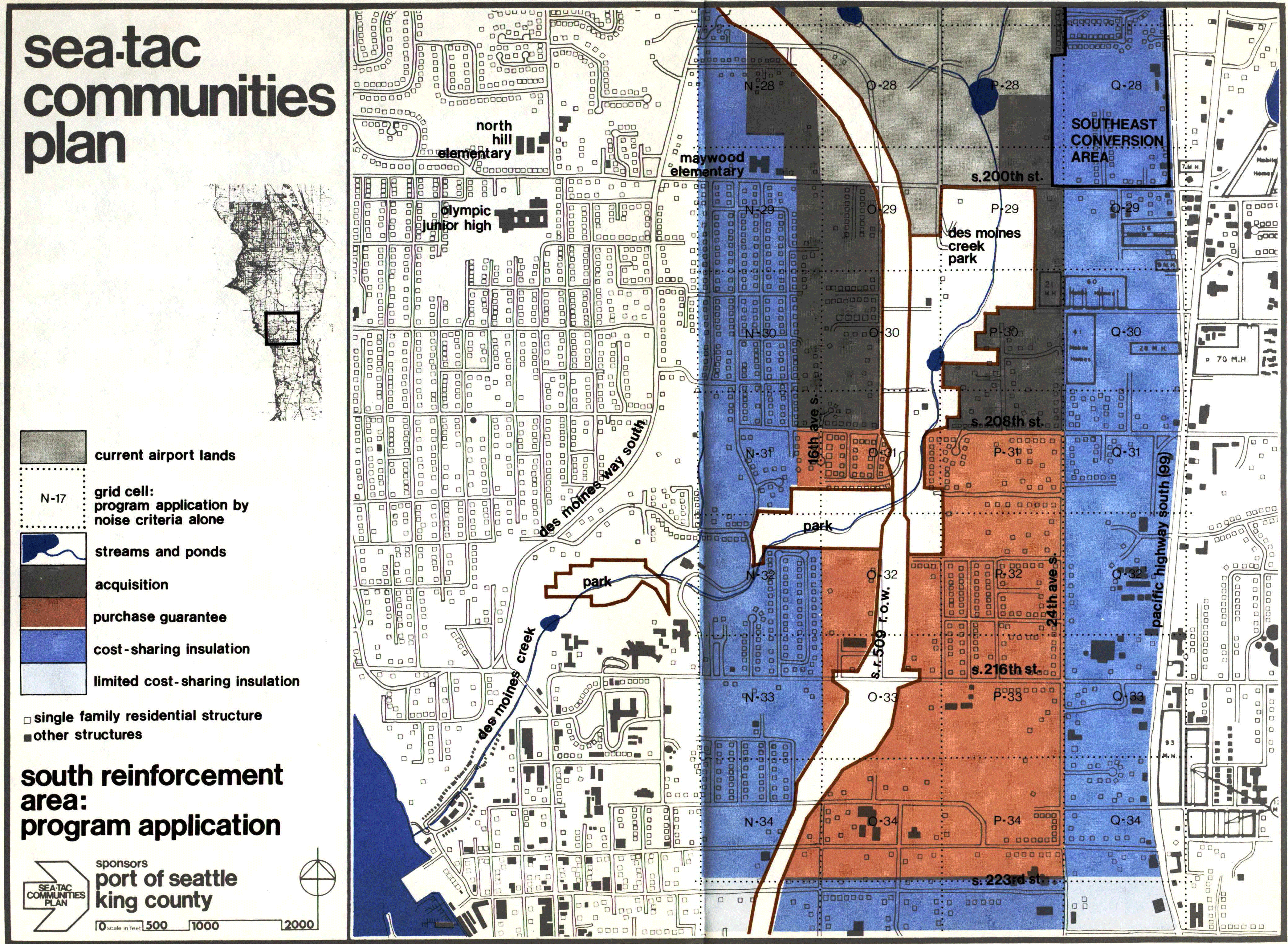
STCP-6.6.5-26-south
A planning map from the Sea-Tac Communities Plan, sponsored by the Port of Seattle and King County, showing the South Reinforcement Area program application. The map uses color coding to designate zones for acquisition, purchase guarantee, cost-sharing insulation, and limited cost-sharing insulation in the area bounded roughly by S. 200th St. to the north and S. 223rd St. to the south, including grid cells along 16th Ave. S., 24th Ave. S., and Pacific Highway South (SR-99), with a Southeast Conversion Area noted in the upper right. -
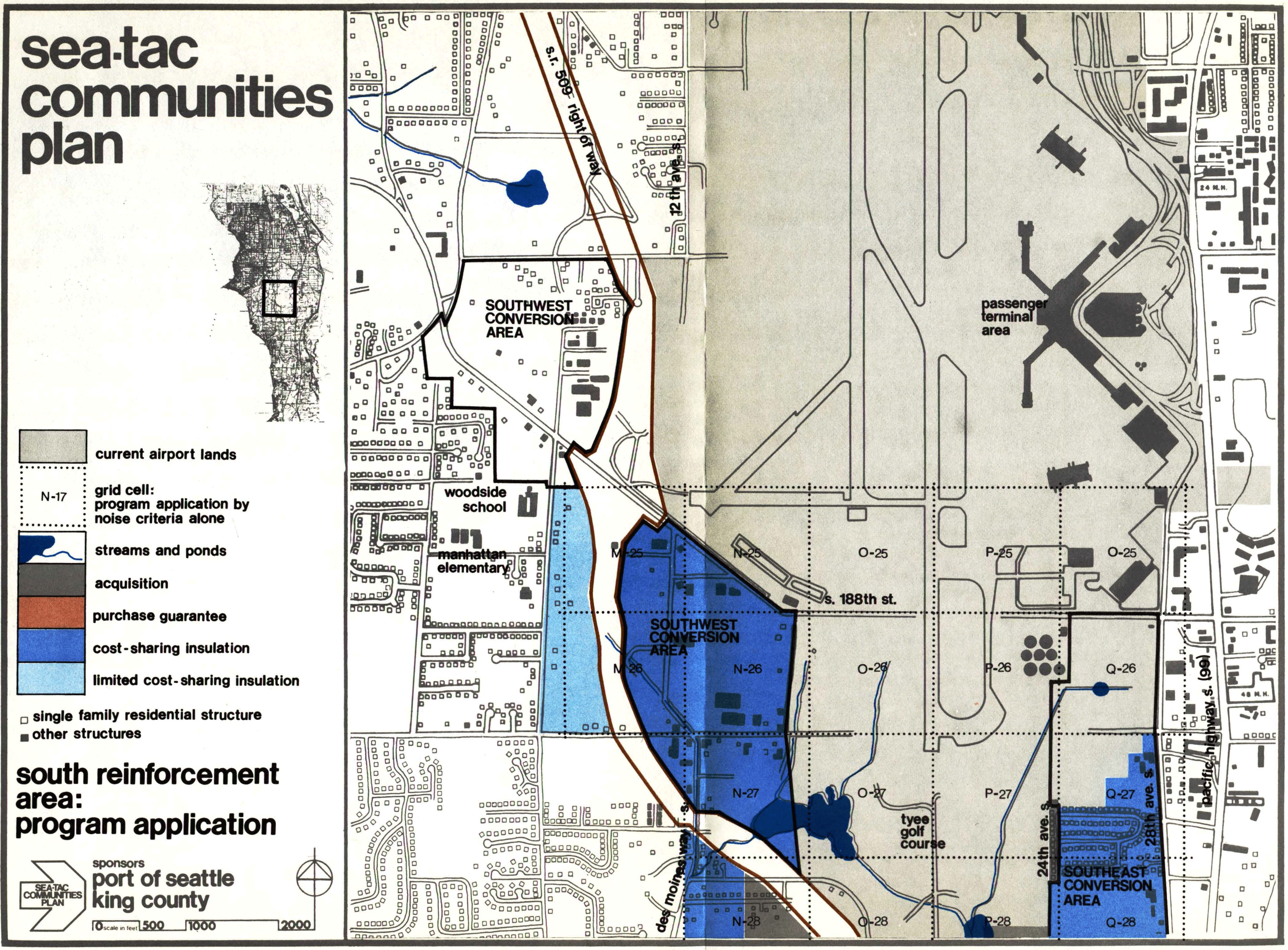
STCP-6.6.5-25-south
A planning map produced under the Sea-Tac Communities Plan, sponsored by the Port of Seattle and King County, depicting the South Reinforcement Area program application near Seattle-Tacoma International Airport. The map identifies land-use zones including the Southwest Conversion Area, Southeast Conversion Area, and color-coded program interventions such as acquisition, purchase guarantee, cost-sharing insulation, and limited cost-sharing insulation, with grid cells referenced by noise criteria (e.g., N-25 through Q-28) and landmarks including Woodside School, Manhattan Elementary, and Tyee Golf Course. -
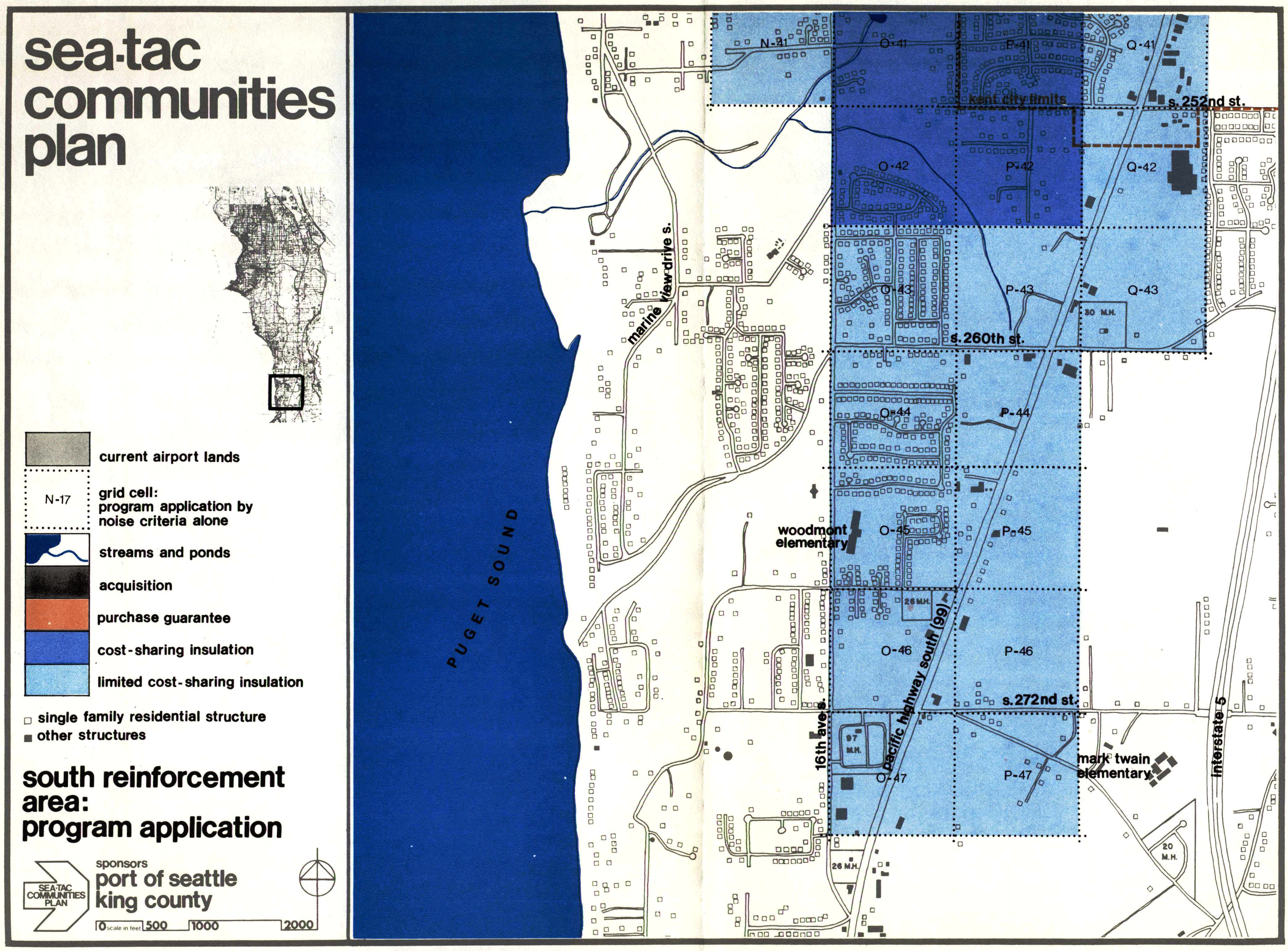
STCP-6.6.5-28-south
A planning map from the Sea-Tac Communities Plan, sponsored by the Port of Seattle and King County, showing the South Reinforcement Area program application. The map uses color-coded grid cells (labeled N-41 through P-47) to designate zones for acquisition, purchase guarantee, cost-sharing insulation, and limited cost-sharing insulation relative to airport noise impacts, covering the area between approximately S. 252nd St. and S. 272nd St. along Puget Sound, including landmarks such as Woodmont Elementary and Mark Twain Elementary schools. -
 2022-07-24
North SeaTac agreements – draft
This draft map from the City of SeaTac outlines land-use agreements for North SeaTac Park, showing eight numbered zones with different lease arrangements between the Port of Seattle, King County, and the City of SeaTac. Key areas include ball fields, a soccer field, a community garden, and a Highline Botanical Garden, governed primarily by 1991 and 1994 leases expiring in 2070. Some parcels are subject to Port termination rights with 180 days' notice, reflecting the airport's ongoing influence over surrounding land use and open space management. -
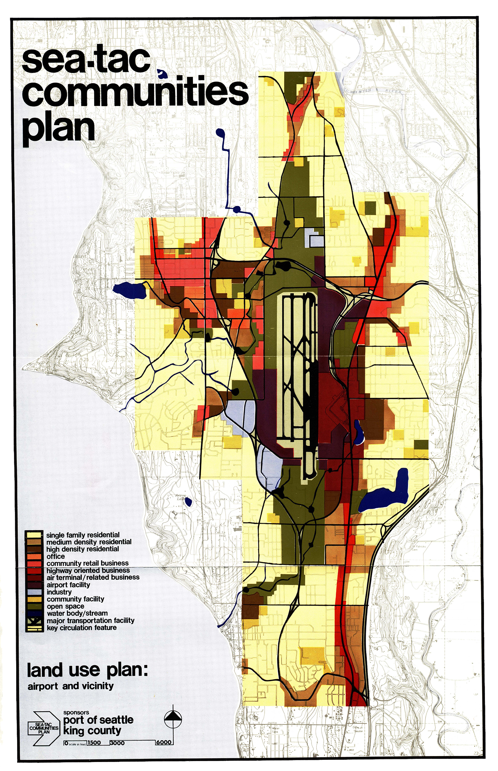
Sea-Tac Communities Plan 6.7 Land Use Plan-1600
A color-coded land use planning map produced under the Sea-Tac Communities Plan, sponsored by the Port of Seattle and King County, showing proposed zoning categories (residential, commercial, industrial, airport facility, open space, etc.) for the area surrounding Seattle-Tacoma International Airport. The map includes a full legend and scale bar, with key circulation features and water bodies marked. -
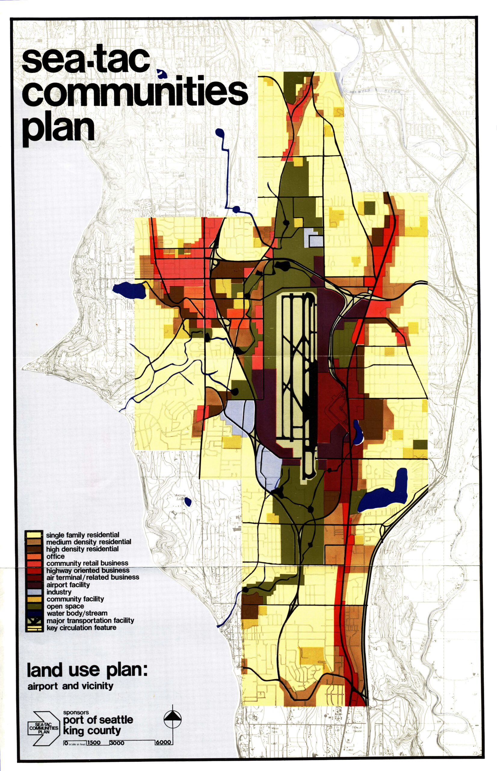
Sea-Tac Communities Plan 6.7 Land Use Plan
A color-coded land use planning map produced under the Sea-Tac Communities Plan, sponsored by the Port of Seattle and King County, depicting zoning categories (single-family residential, commercial, industrial, airport facility, open space, etc.) and circulation features in the area surrounding Seattle-Tacoma International Airport. The map's legend, title text, sponsor logos, and scale bar are all clearly legible. -
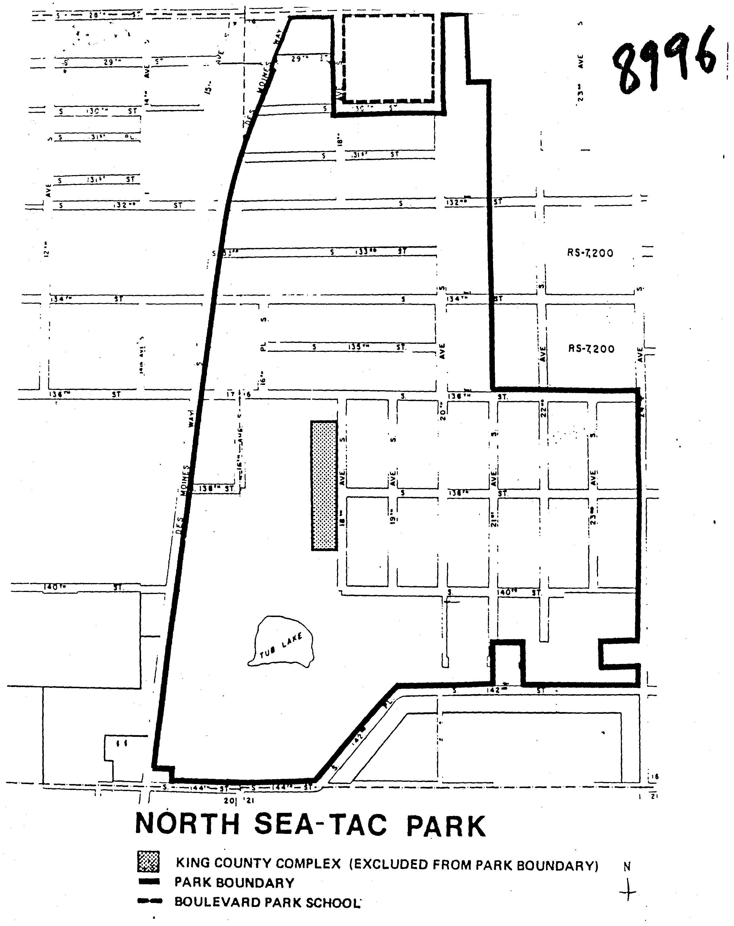
North Sea-Tac Park Original Map King County #8996
A zoning and boundary map of North Sea-Tac Park showing the park boundary (bold solid line), Boulevard Park School boundary (bold dashed line), and the excluded King County Complex (hatched area). The map identifies RS-7,200 zoning designations, street grid from approximately S 128th to S 144th Streets, Tub Lake, Des Moines Way, and is numbered 8996 in the upper right corner. -
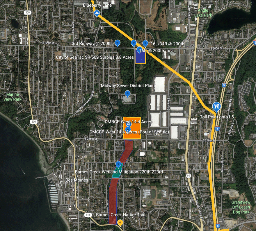
sr509 earth 4 cropped
Aerial map of the SeaTac/Des Moines, Washington area showing labeled land parcels relevant to Sea-Tac Airport planning, including the City of SeaTac SR-509 Surplus 8.8 Acres, DMCBP West 14.4 Acres (Port of Seattle), Barnes Creek Wetland Mitigation 220th–223rd, and runway reference points (3rd Runway @ 200th, 16L/34R @ 200th, 16C @ 200th). The map also identifies the Midway Sewer District Plant, Barnes Creek Nature Trail, and major roadways including SR-509 and I-5. -
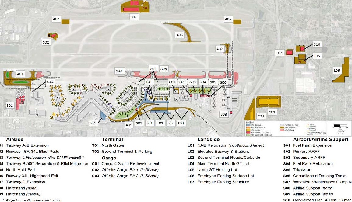
180620-SAMP NTP Presentation-Public-Meeting 16-NTP-Environmental Review-cropped
An aerial planning map of Seattle-Tacoma International Airport (Sea-Tac) showing proposed capital improvement projects categorized into Airside, Terminal, Cargo, Landside, and Airport/Airline Support elements. Projects are color-coded by type (new terminal, new pavement, new cargo, new support facilities, demolition, new hardstand/hold pad) and labeled with alphanumeric identifiers including runway extensions, taxiway relocations, new terminal gates, cargo redevelopment areas, and employee parking structures. -
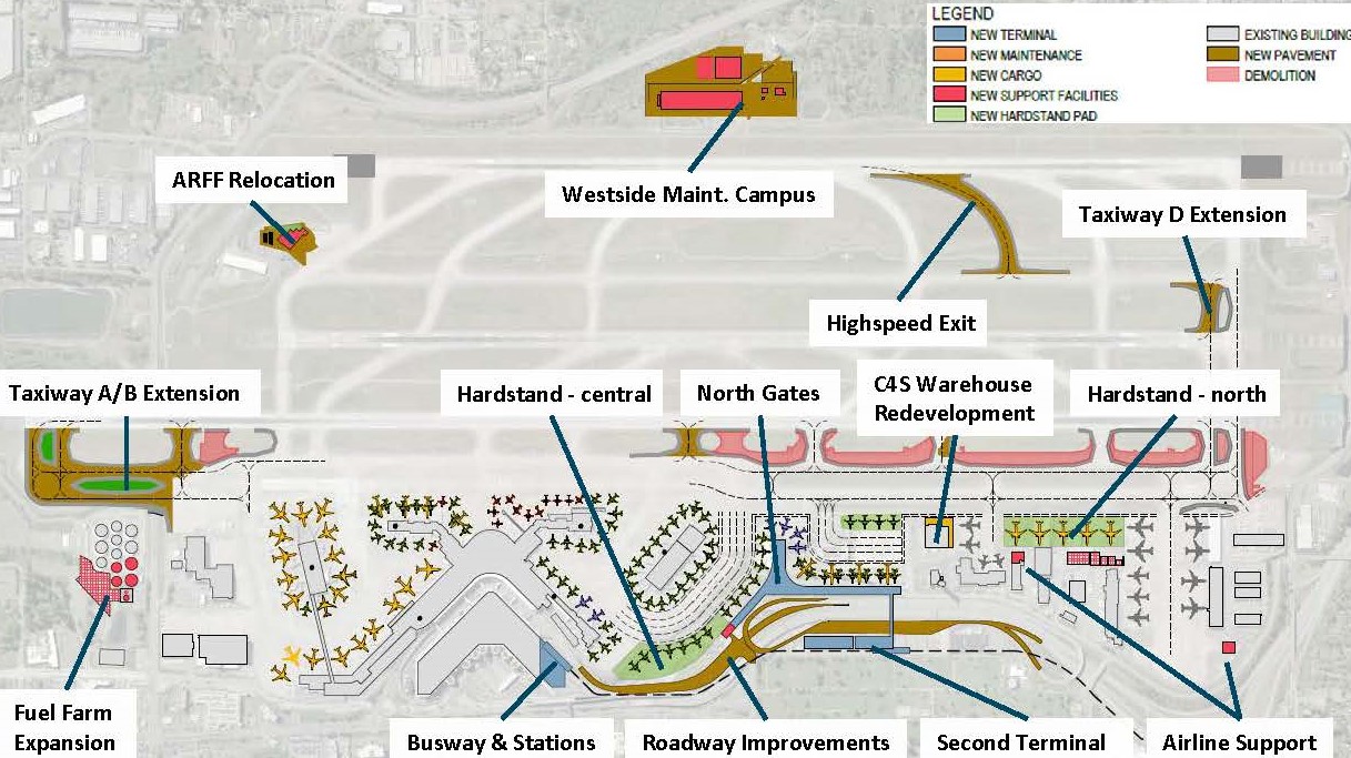
180620-SAMP-Presentation-Public-Meeting 12 NTP Major Improvements-cropped
An aerial planning map of Seattle-Tacoma International Airport showing proposed capital improvements including a Second Terminal, North Gates, Busway & Stations, Taxiway A/B and D Extensions, Westside Maintenance Campus, Fuel Farm Expansion, C4S Warehouse Redevelopment, Hardstand pads, ARFF Relocation, and Roadway Improvements. The legend distinguishes new terminal, maintenance, cargo, support facilities, hardstand pads, existing buildings, new pavement, and demolition areas.