TagKing County(422)
-
 2022-08-24
Sea-Tac Communities Plan: Map Supplement to Sixth Month Report
The Sea-Tac/Communities Plan is a planning study co-sponsored by the Port of Seattle and King County, funded through a federal grant under the Airport and Airways Development Act of 1970. It serves as a map supplement to a sixth-month report, covering community trends and characteristics, land use, ground transportation and traffic, aesthetic and visual qualities, and natural determinants in the communities surrounding Seattle-Tacoma International Airport. The 1973 report includes demographic data such as median age, the percentage of residents under 20, and the percentage of residents 65 and older, mapped across 1970 census tracts in the Sea-Tac area. -
 2022-08-24
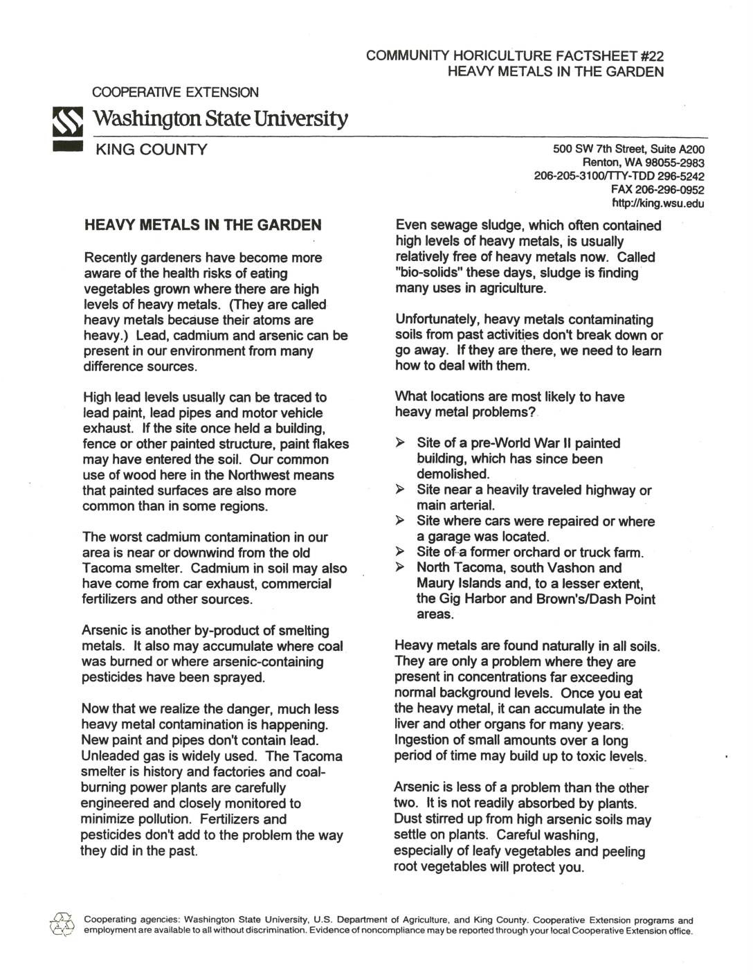
Heavy metals in the garden
This Washington State University Cooperative Extension factsheet explains the risks of heavy metals such as lead, cadmium, and arsenic in garden soils, with a focus on the greater Seattle-Tacoma region. It identifies locations most likely to have contamination, including sites near old painted buildings, heavily traveled roads, and areas affected by the former Tacoma smelter. The factsheet offers practical gardening tips to reduce exposure, such as growing fruiting crops, adding organic matter, liming soil, and washing produce thoroughly. -
 2022-08-20
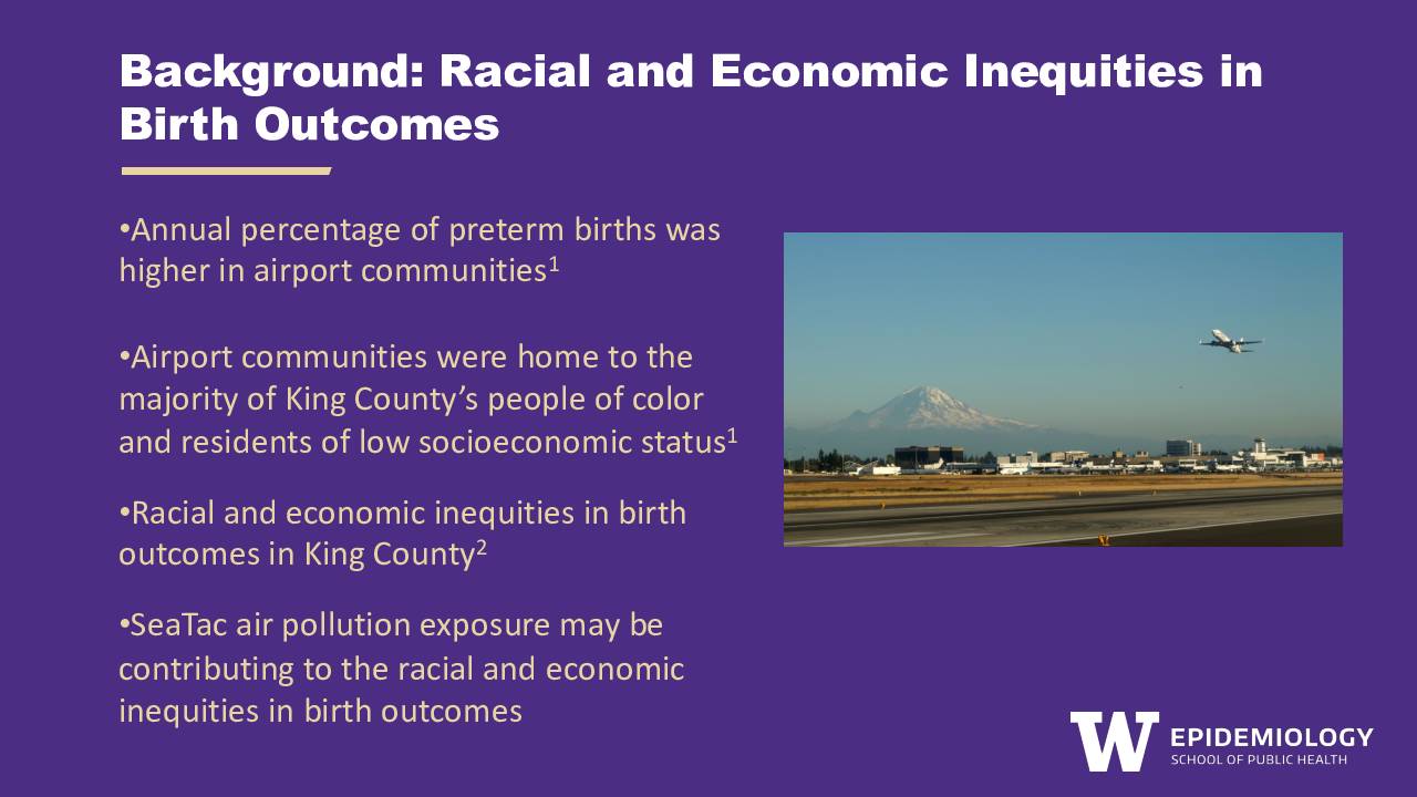
Background: Racial and economic inequities in birth outcomes
A University of Washington Epidemiology researcher, Anna Harrington, presents findings showing that communities near Seattle-Tacoma International Airport have higher rates of preterm births and are home to a disproportionate share of King County's people of color and low-income residents. The presentation proposes a qualitative research study to explore how airport community stakeholders perceive the public health risks of SeaTac air pollution on pregnant people, and what barriers they face in reducing that exposure. The study aims to understand whether risk perceptions and mitigation strategies differ based on the racial identity and income level of pregnant individuals. -
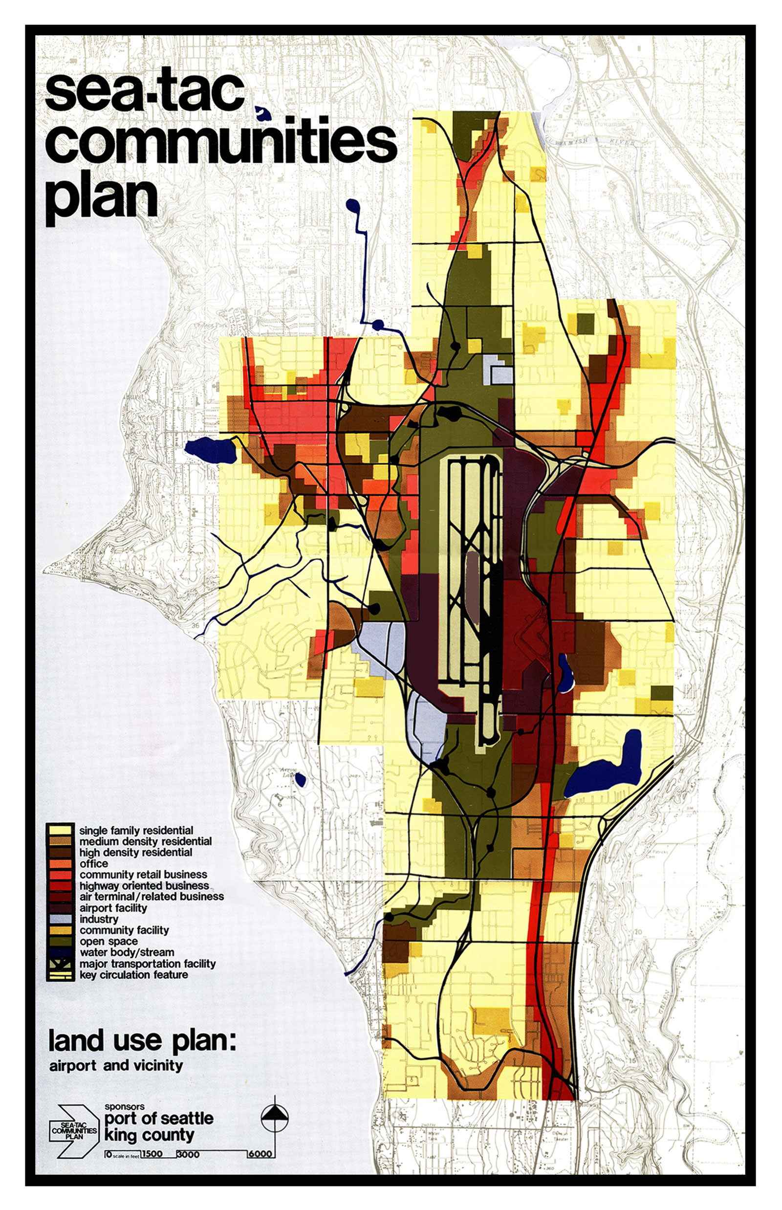
Sea Tac Communities Plan 1600
A land use planning map produced under the Sea-Tac Communities Plan, sponsored by the Port of Seattle and King County, showing zoning categories (residential, commercial, office, airport facility, open space, etc.) for the area surrounding Seattle-Tacoma International Airport. The legend identifies uses including air terminal/related business, highway-oriented business, community retail, industry, and key circulation features, with a scale bar indicating coverage at 1:500 to 6,000 feet. -
 2022-08-01
King County Communitywide Geographic Greenhouse Gas Emissions: Puget Sound Regional Emissions Analysis
This August 2022 report by Cascadia Consulting Group analyzes greenhouse gas emissions across King County, Washington, examining where emissions come from, what is driving trends over time, and how the county can meet its climate goals. The report covers sectors including transportation, electricity, natural gas, solid waste, and land use, tracking data from multiple inventory years and comparing per-capita emissions across jurisdictions. It also models future emissions scenarios to assess the impact of federal, state, and regional policies on reaching reduction targets through 2050. -
 2022-07-31
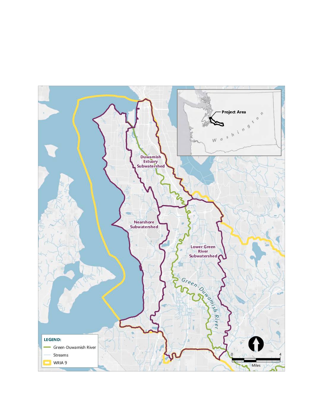
Port of Seattle proposed Mitigation bank service area map
A map showing the mitigation bank service area within WRIA 9 (Water Resource Inventory Area 9), encompassing three subwatersheds: the Lower Green River Subwatershed, the Duwamish Estuary Subwatershed, and the Nearshore Subwatershed. The map displays the Green-Duwamish River and its associated streams in the greater Seattle/King County area of Washington State. An inset map shows -
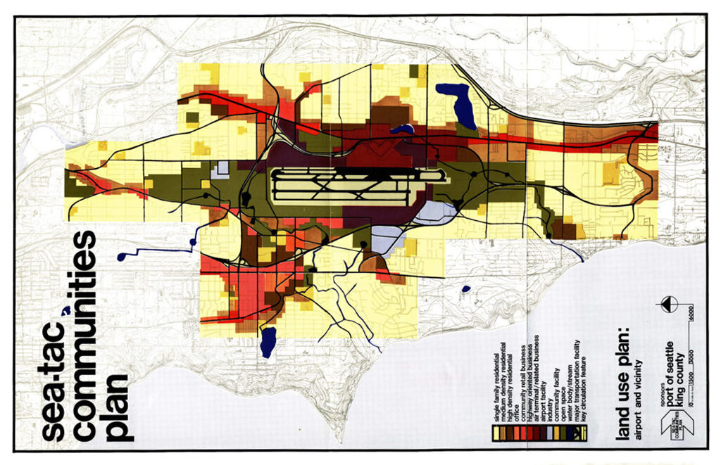
Sea Tac Communities Plan 6.7 Land Use Plan 1600 661×1024
A color-coded land use planning map produced by the Port of Seattle and King County as part of the Sea-Tac Communities Plan, showing zoning categories (residential, commercial, office, airport facility, open space, and circulation features) in the airport vicinity. The legend identifies uses including single-family residential, high-density residential, highway-oriented retail, air terminal/related business, community facility, open body/stream, major transportation facility, and key circulation features. -
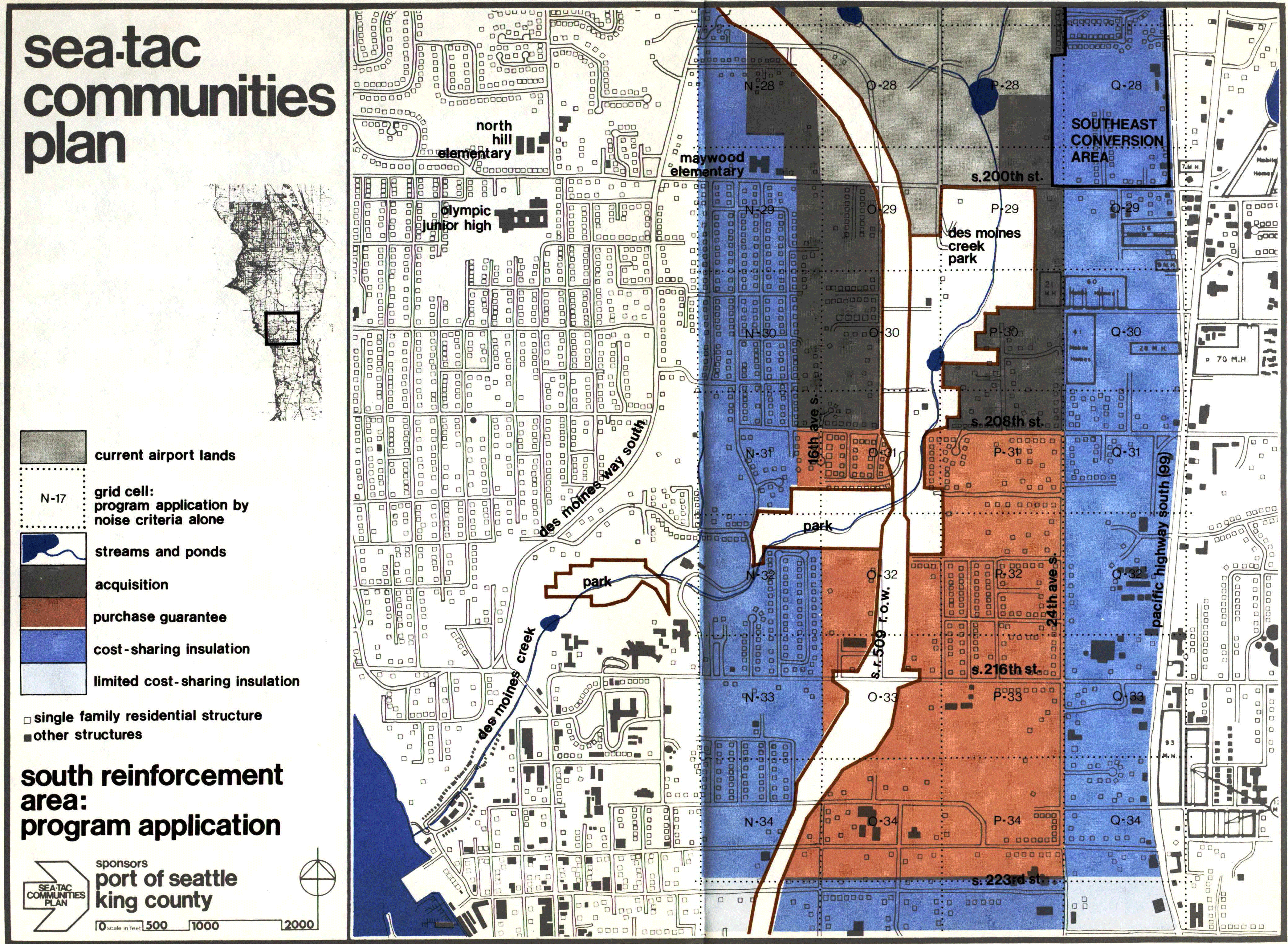
STCP-6.6.5-26-south
A planning map from the Sea-Tac Communities Plan, sponsored by the Port of Seattle and King County, showing the South Reinforcement Area program application. The map uses color coding to designate zones for acquisition, purchase guarantee, cost-sharing insulation, and limited cost-sharing insulation in the area bounded roughly by S. 200th St. to the north and S. 223rd St. to the south, including grid cells along 16th Ave. S., 24th Ave. S., and Pacific Highway South (SR-99), with a Southeast Conversion Area noted in the upper right. -
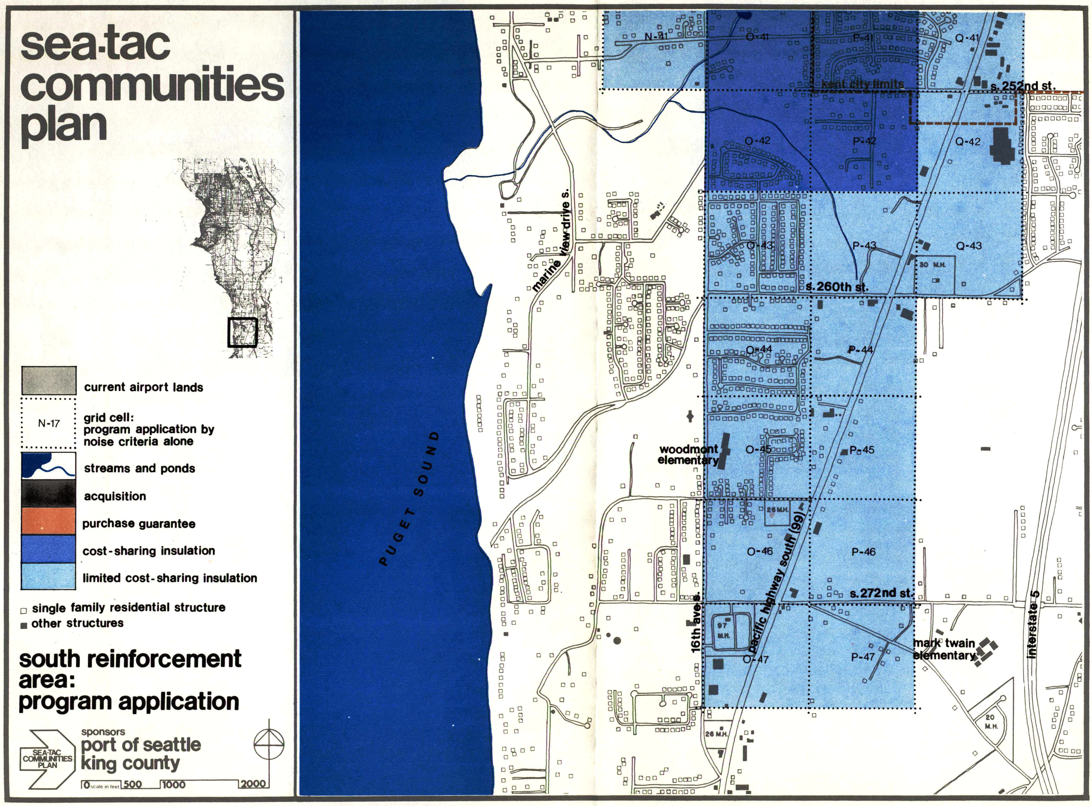
STCP-6.6.5-28-south
A planning map from the Sea-Tac Communities Plan, sponsored by the Port of Seattle and King County, showing the South Reinforcement Area program application. The map uses color-coded grid cells (labeled N-41 through P-47) to designate zones for acquisition, purchase guarantee, cost-sharing insulation, and limited cost-sharing insulation relative to airport noise impacts, covering the area between approximately S. 252nd St. and S. 272nd St. along Puget Sound, including landmarks such as Woodmont Elementary and Mark Twain Elementary schools. -
 2022-07-24
North SeaTac agreements – draft
This draft map from the City of SeaTac outlines land-use agreements for North SeaTac Park, showing eight numbered zones with different lease arrangements between the Port of Seattle, King County, and the City of SeaTac. Key areas include ball fields, a soccer field, a community garden, and a Highline Botanical Garden, governed primarily by 1991 and 1994 leases expiring in 2070. Some parcels are subject to Port termination rights with 180 days' notice, reflecting the airport's ongoing influence over surrounding land use and open space management.