TagKing County(422)
-
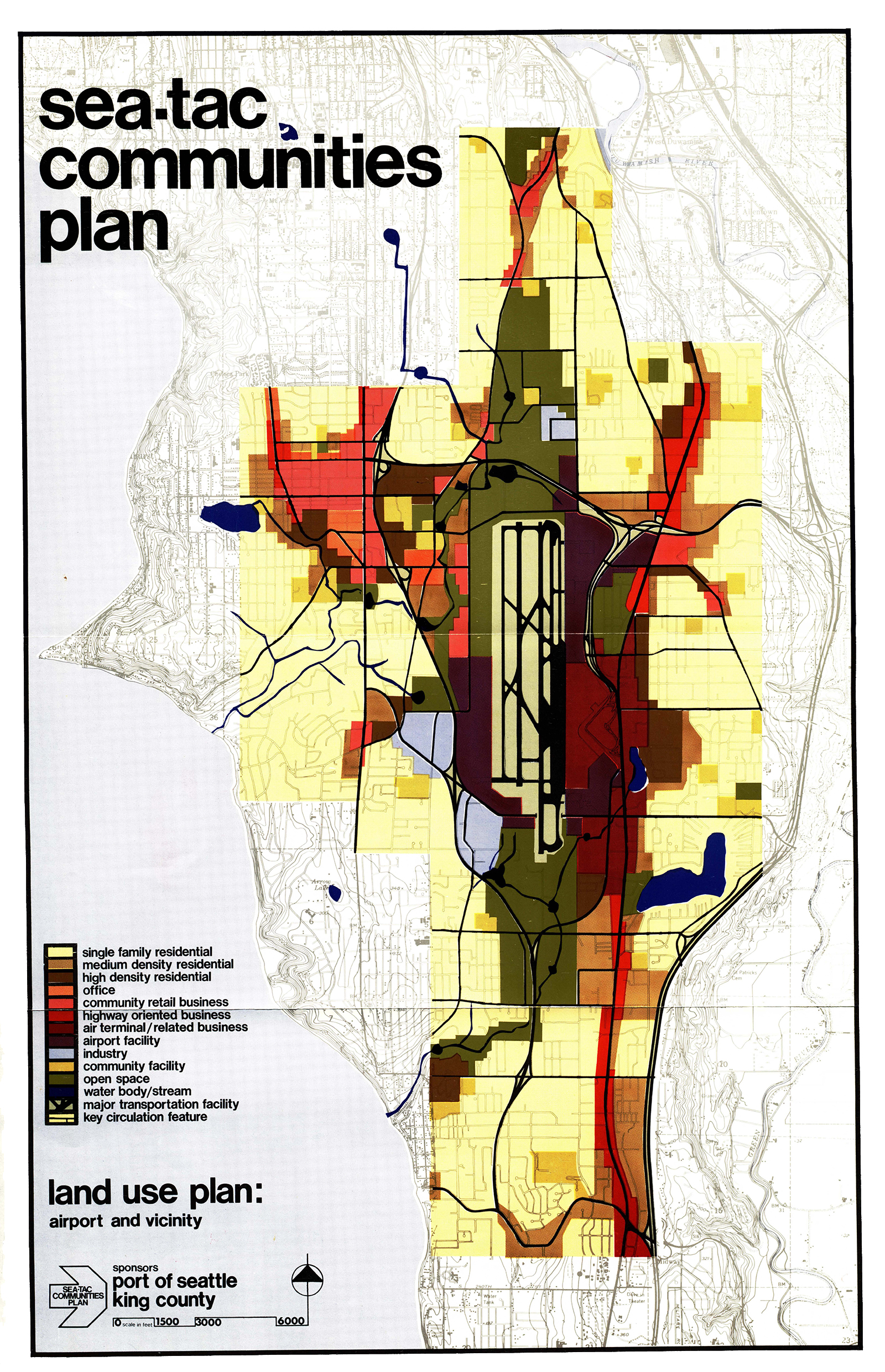
Sea-Tac Communities Plan 6.7 Land Use Plan-1600
A color-coded land use planning map produced under the Sea-Tac Communities Plan, sponsored by the Port of Seattle and King County, showing proposed zoning categories (residential, commercial, industrial, airport facility, open space, etc.) for the area surrounding Seattle-Tacoma International Airport. The map includes a full legend and scale bar, with key circulation features and water bodies marked. -
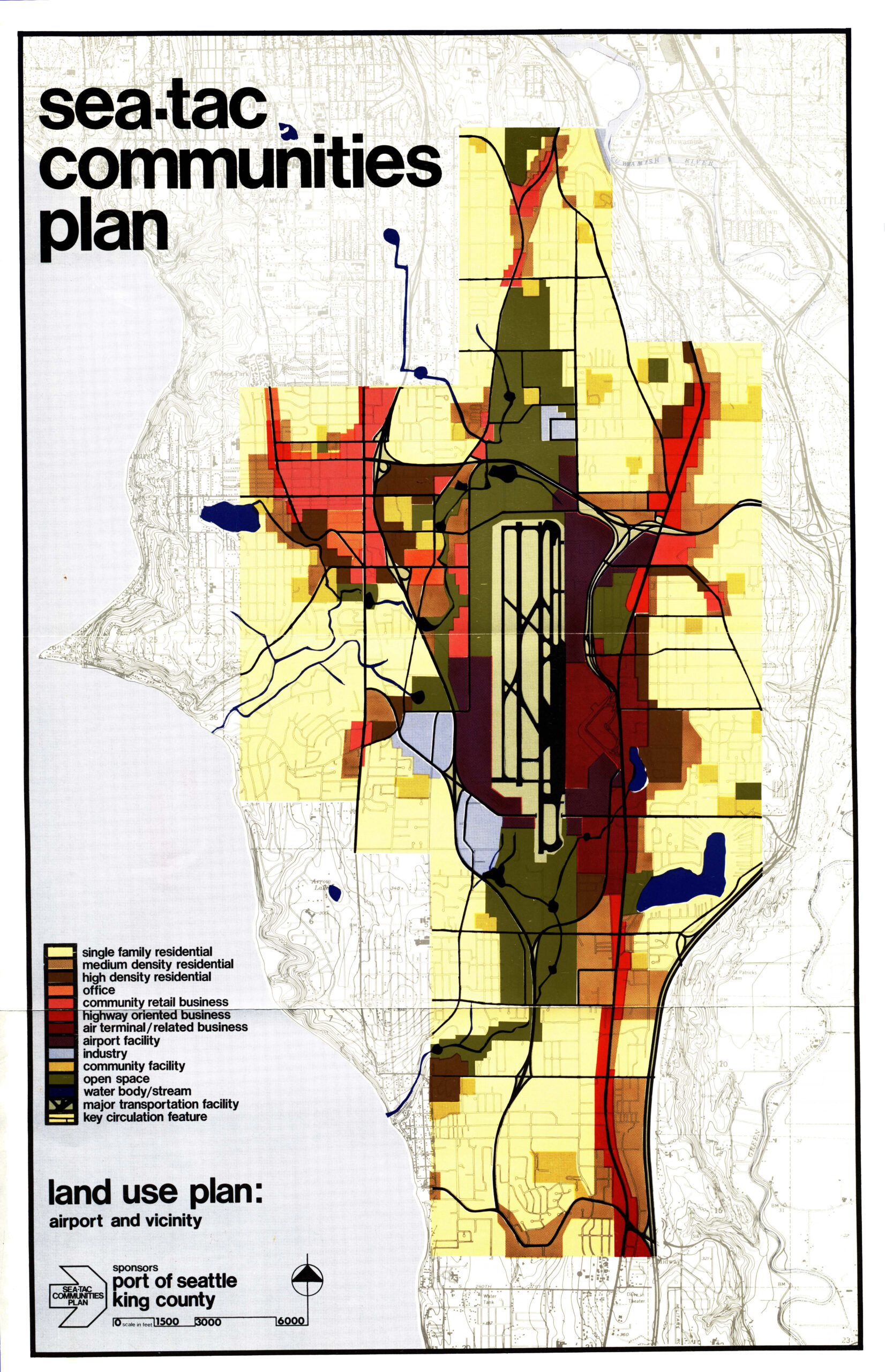
Sea-Tac Communities Plan 6.7 Land Use Plan
A color-coded land use planning map produced under the Sea-Tac Communities Plan, sponsored by the Port of Seattle and King County, depicting zoning categories (single-family residential, commercial, industrial, airport facility, open space, etc.) and circulation features in the area surrounding Seattle-Tacoma International Airport. The map's legend, title text, sponsor logos, and scale bar are all clearly legible. -
Sea-Tac Communities Plan Brochure Cover
Cover page of the 'Sea-Tac Communities Plan,' a joint planning document produced by the Port of Seattle and King County. The design features repeating arrow motifs in varying shades of blue on a light blue background, with the plan title in bold white text. -
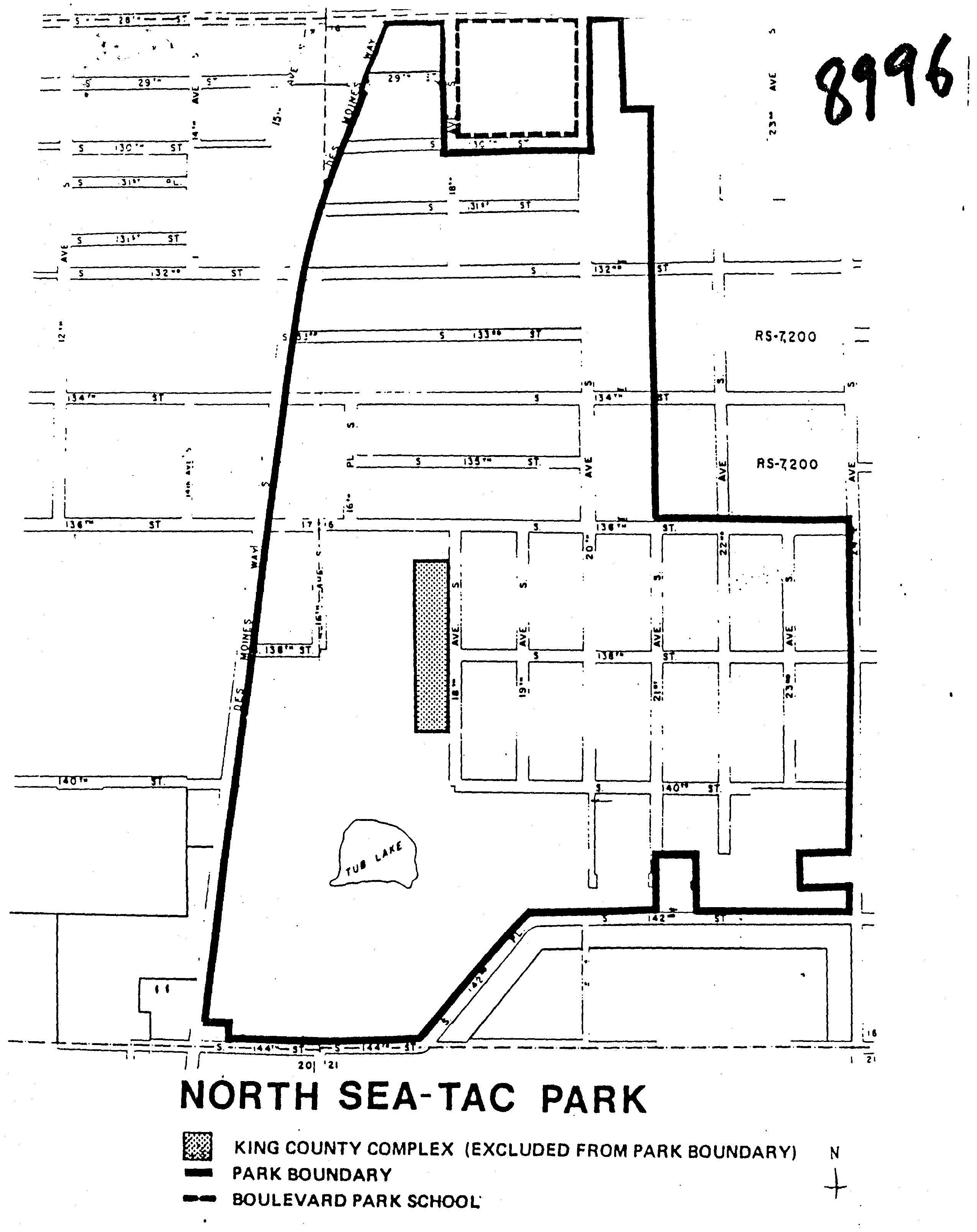
North Sea-Tac Park Original Map King County #8996
A zoning and boundary map of North Sea-Tac Park showing the park boundary (bold solid line), Boulevard Park School boundary (bold dashed line), and the excluded King County Complex (hatched area). The map identifies RS-7,200 zoning designations, street grid from approximately S 128th to S 144th Streets, Tub Lake, Des Moines Way, and is numbered 8996 in the upper right corner. -
 2022-07-23
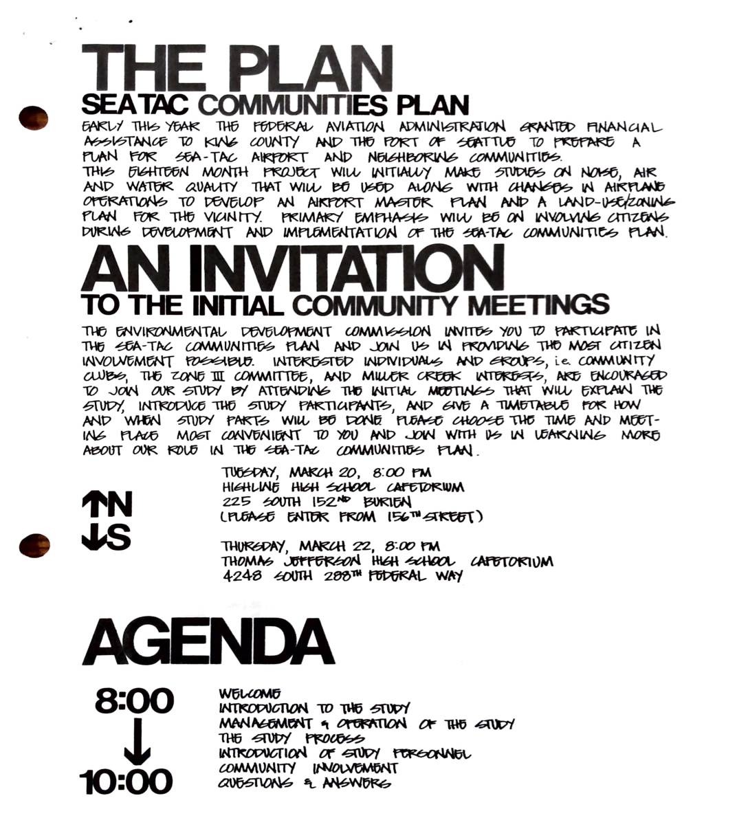
Sea-Tac Communities Plan: An invitation to the initial community meetings
The Sea-Tac Communities Plan was a federally funded, eighteen-month study sponsored by King County and the Port of Seattle to assess noise, air, and water quality impacts from Sea-Tac Airport and develop an airport master plan and land-use/zoning plan for surrounding neighborhoods. The Environmental Development Commission invited residents, community clubs, and local interest groups to participate in initial public meetings held at Highline and Thomas Jefferson High Schools in March. A central goal of the plan was to maximize citizen involvement in both the development and implementation of policies shaping the future of Sea-Tac Airport and its neighboring communities. -
 2022-07-10
Sea-Tac Communities Plan Part 8: References — Sea-Tac Plan Published Reports (Section 8.0.1)
This document lists the published reports produced as part of the Sea-Tac Airport and Vicinity Master Plan study, a collaborative effort by King County, the Port of Seattle, consultants, and community members. The reports cover a wide range of topics including aviation demand forecasting, air and water quality analysis, solid waste, and noise exposure analysis across multiple volumes. Copies of these references were made available at the King County Land Use Management Division and the Port of Seattle Planning and Research Department. -
 2022-07-10
Part 7, Chapter 7.1: Common Problems and Opportunities — Implementation (Sea-Tac Communities Plan)
This document, Part 7 (Implementation), Chapter 7.1, covers common problems and opportunities related to airport development, with a focus on the financial framework governing the Port of Seattle. It explains that the five-member Port of Seattle Commission is legally authorized to levy taxes on property within King County and to issue general obligation bonds, subject to strict limits—bonds cannot exceed 3/4 of 1% of the actual taxable property value in the district. Voter approval by 60% is required for bond issuances that go beyond the non-voter-authorized debt ceiling. -
 2022-07-10
Part 2: Use of the Report
This document outlines the official significance and structure of a comprehensive land use and community planning report for Sea-Tac International Airport and its surrounding communities, jointly produced by the Port of Seattle and King County. It serves as the primary guide for official decisions on land use, capital expenditures, and public and private development review. The report is organized into eight parts covering plans, policies, programs, background information, and implementation strategies. -
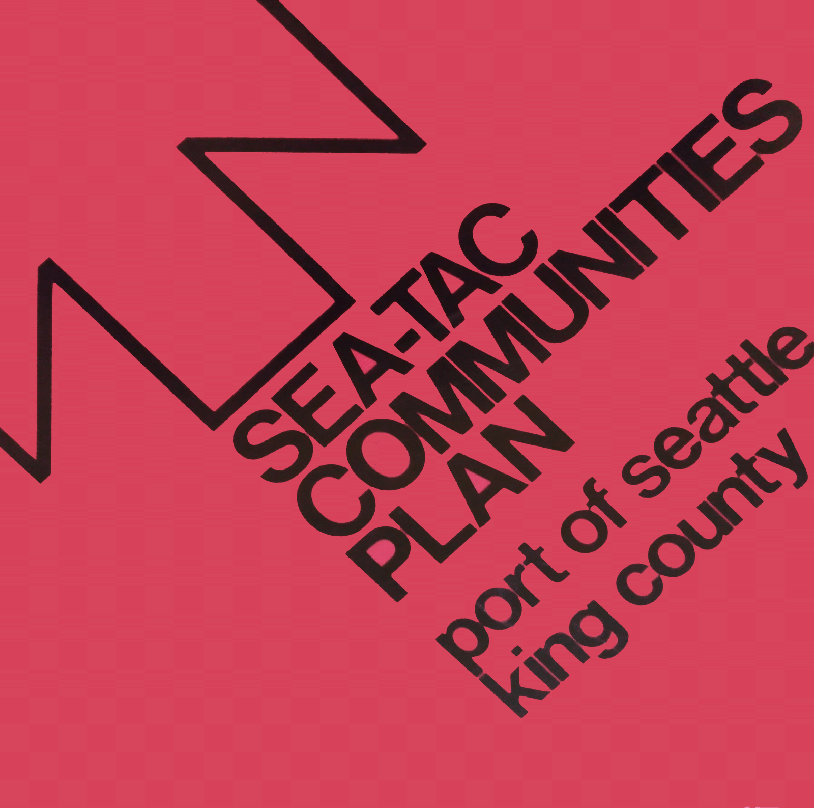
Sea-Tac Communities Plan Cover
Cover of the 'Sea-Tac Communities Plan,' a planning document jointly produced by the Port of Seattle and King County. The bold graphic design features diagonal typography on a red/pink background with a stylized chevron or flight-path symbol. -
seatac communities plan cover-smudged
Cover of the 'Sea-Tac Communities Plan,' a planning document jointly produced by the Port of Seattle and King County. The hot-pink cover features bold black typography and a stylized geometric logo, likely related to noise mitigation or land-use planning around Seattle-Tacoma International Airport.