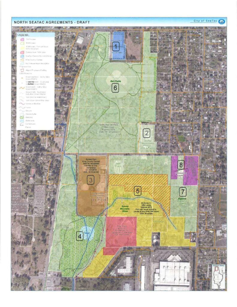
This draft map from the City of SeaTac outlines land-use agreements for North SeaTac Park, showing eight numbered zones with different lease arrangements between the Port of Seattle, King County, and the City of SeaTac. Key areas include ball fields, a soccer field, a community garden, and a Highline Botanical Garden, governed primarily by 1991 and 1994 leases expiring in 2070. Some parcels are subject to Port termination rights with 180 days' notice, reflecting the airport's ongoing influence over surrounding land use and open space management.Open full document
Notes
A draft map produced by the City of SeaTac showing land use agreements for North SeaTac Park and surrounding areas. The map identifies numbered parcels with different lease types, ownership status, and proposed uses including ball fields, a soccer field, community gardens, and a mountain bike facility. Key features include a 1994 Port of Seattle lease expiring 2070, King County-owned Sunset Park, and various sewer infrastructure overlays.