TagKing County(422)
-
 2023-08-22
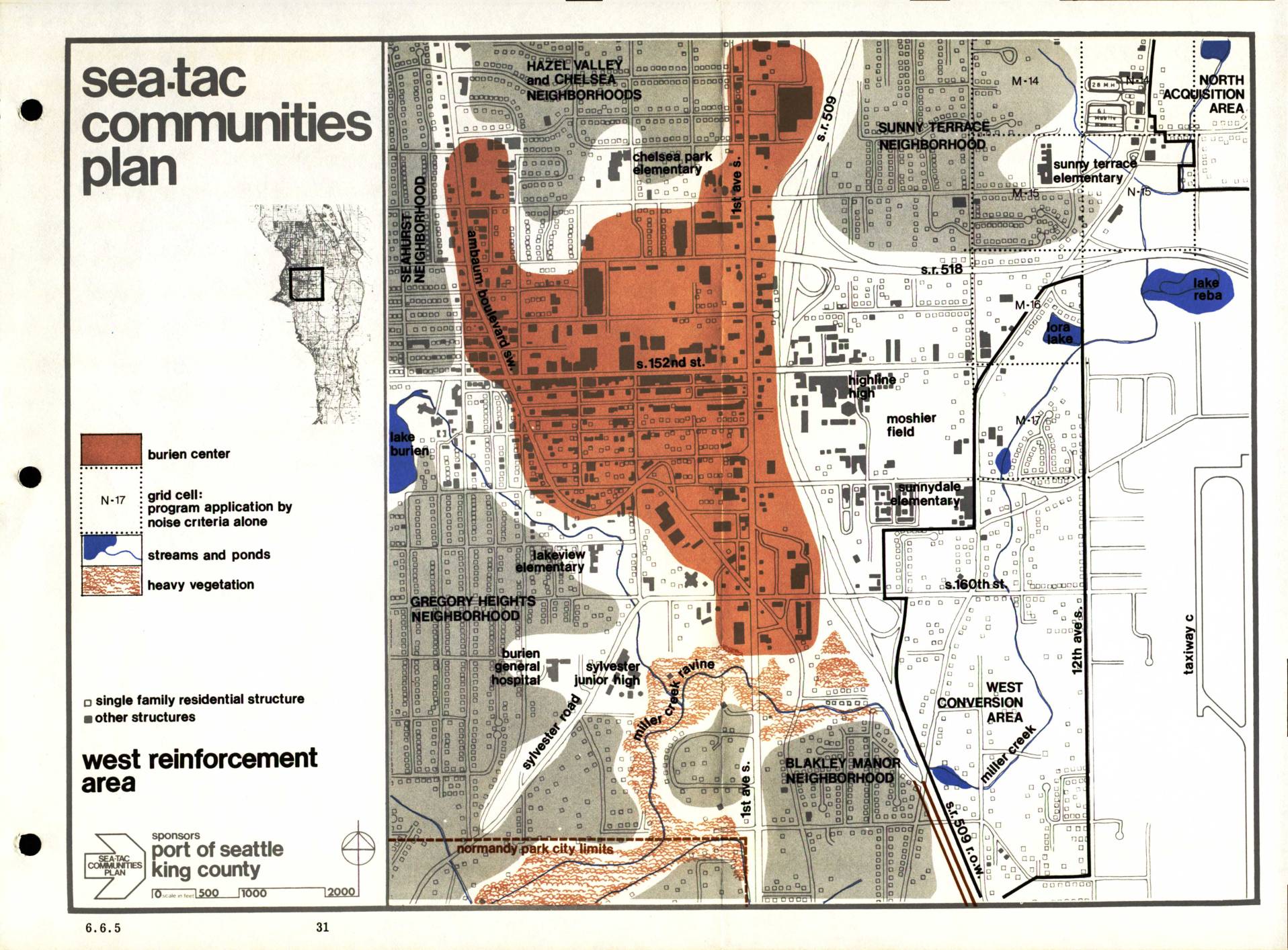
Sea-Tac Communities Plan: West Reinforcement Area Map (Section 6.6.5)
The Sea-Tac Communities Plan, sponsored by the Port of Seattle and King County, maps the West Reinforcement Area surrounding Seattle-Tacoma International Airport, identifying neighborhoods such as Hazel Valley, Chelsea, Sunny Terrace, Gregory Heights, and Blakley Manor that are affected by aircraft noise. The map uses color coding to highlight the Burien Center commercial core, grid cells where program eligibility is determined by noise criteria alone, streams and ponds, and areas of heavy vegetation. It distinguishes between single-family residential structures and other building types to guide noise mitigation and land-use planning decisions in communities near the airport. -
 2023-08-22
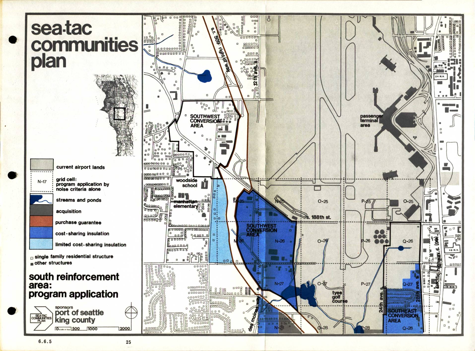
Sea-Tac Communities Plan: South Reinforcement Area Program Application (Section 6.6.5)
The Sea-Tac Communities Plan, sponsored by the Port of Seattle and King County, maps out noise mitigation programs for residential and other structures in communities surrounding Seattle-Tacoma International Airport. The plan designates specific zones for different types of assistance, including property acquisition, purchase guarantees, cost-sharing insulation, and limited cost-sharing insulation, with a focus on the South Reinforcement Area. Grid cells are identified by noise criteria to determine which program applies to each affected neighborhood, covering areas such as the Southwest and Southeast Conversion Areas near the airport's passenger terminal. -
 2023-08-22
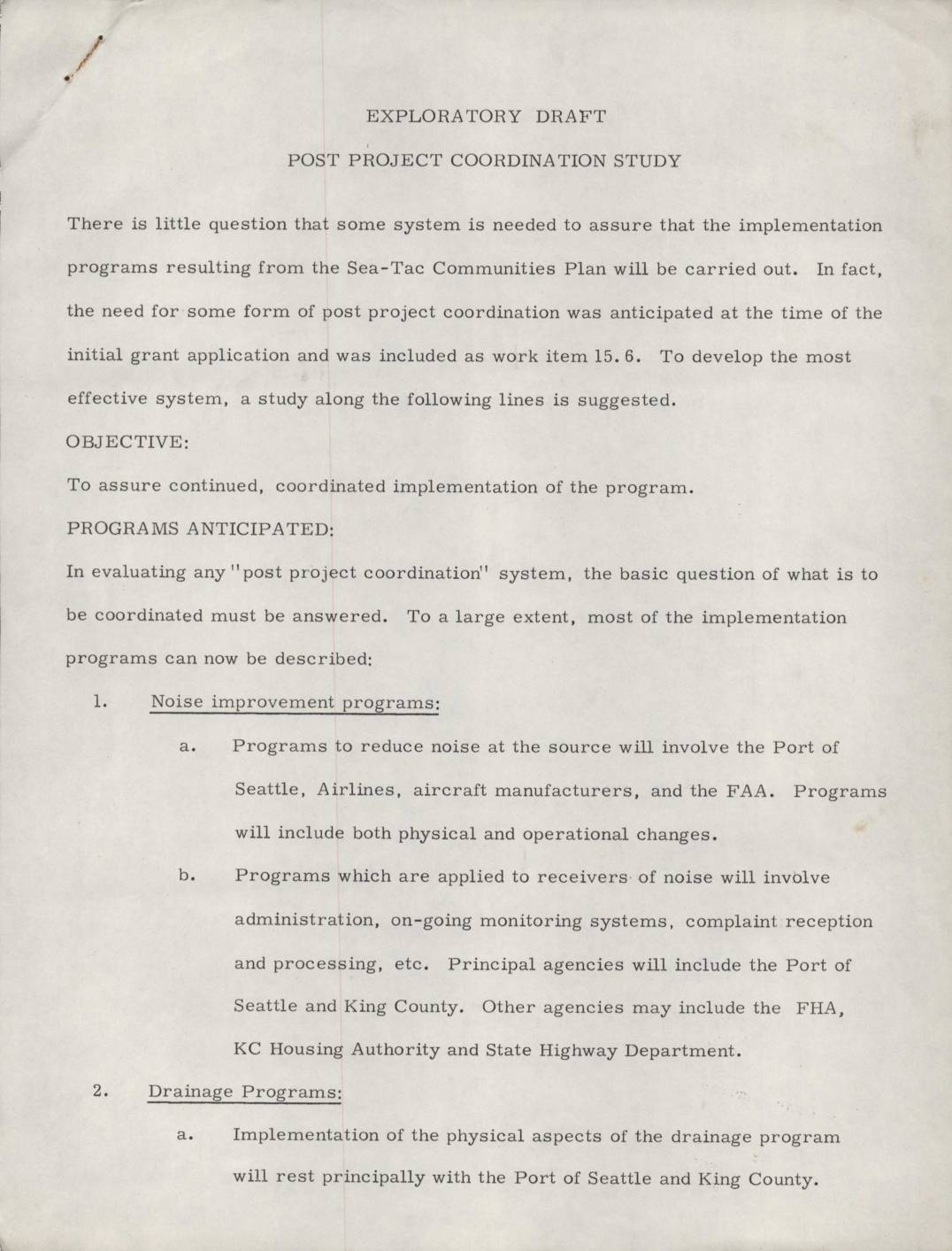
Exploratory draft: Post project coordination study
This exploratory draft outlines a proposed Post Project Coordination Study for the Sea-Tac Communities Plan, designed to ensure that implementation programs are carried out effectively. It identifies seven key program areas requiring coordination, including noise reduction, drainage improvements, community action, zoning guidelines, capital improvements, and legislative advocacy. The document calls for a methodical study to analyze coordination needs, define responsibilities, and assign authorities across agencies such as the Port of Seattle, King County, and the FAA. -
 2023-08-22
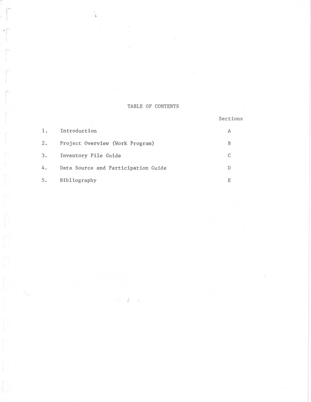
Sea-Tac/Communities Plan work program: Project overview and inventory
This document outlines the Sea-Tac/Communities Plan, a collaborative airport master planning study conducted by the Port of Seattle and King County with FAA funding, covering environmental, demographic, economic, and land-use impacts of Seattle-Tacoma International Airport on surrounding communities. The $642,000 study, two-thirds funded by a $427,978 FAA planning grant, hired multiple consultants to examine issues including noise exposure, air quality, water quality, and public opinion. The inventory phase aimed to compile comprehensive existing-conditions data within the first six months of the project, starting March 19, 1972. -
 2023-08-12
Des Moines Creek – A holistic approach to watershed restoration
This presentation by King County Department of Natural Resources & Parks outlines a holistic approach to restoring Des Moines Creek and its surrounding watershed, located in King County, Washington. It covers basin planning, environmental modeling, regulatory considerations, and project costs and scheduling. The project aims to address watershed health through comprehensive assessment and coordinated restoration strategies. -
 2023-08-09
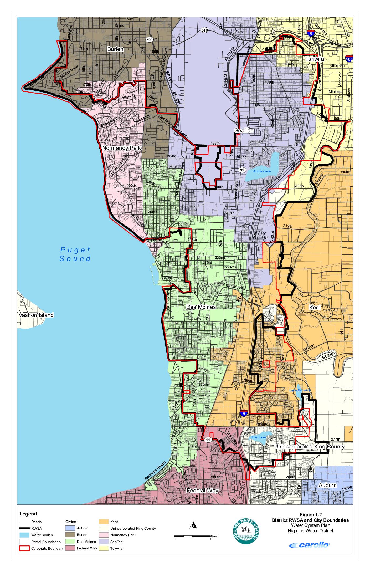
District RWSA and city boundaries – Water System Plan, Highline Water District
This map from Highline Water District's Water System Plan shows the district's Regional Water Service Area (RWSA) and surrounding city boundaries in the communities near Sea-Tac Airport, including Burien, Normandy Park, Des Moines, SeaTac, Tukwila, Kent, Federal Way, and unincorporated King County. The document depicts roads, water bodies such as Angle Lake, Lake Fenwick, and Star Lake, and parcel boundaries across the service area along the eastern shore of Puget Sound. While primarily a water infrastructure planning document, it provides detailed geographic context for the municipalities and neighborhoods in the Sea-Tac Airport vicinity. -
 2023-08-09
Water system facilities and pressure zones
This document is a water system facilities and pressure zones map for the Highline Water District, covering communities including SeaTac, Des Moines, Burien, Normandy Park, and Federal Way in the greater Seattle area. It shows the locations of water mains, pump stations, storage facilities, wells, water treatment plants, and pressure-reducing valves (PRVs) across more than a dozen distinct pressure zones. The map is part of the district's Water System Plan and was produced by engineering firm Carollo. -
 2023-08-09
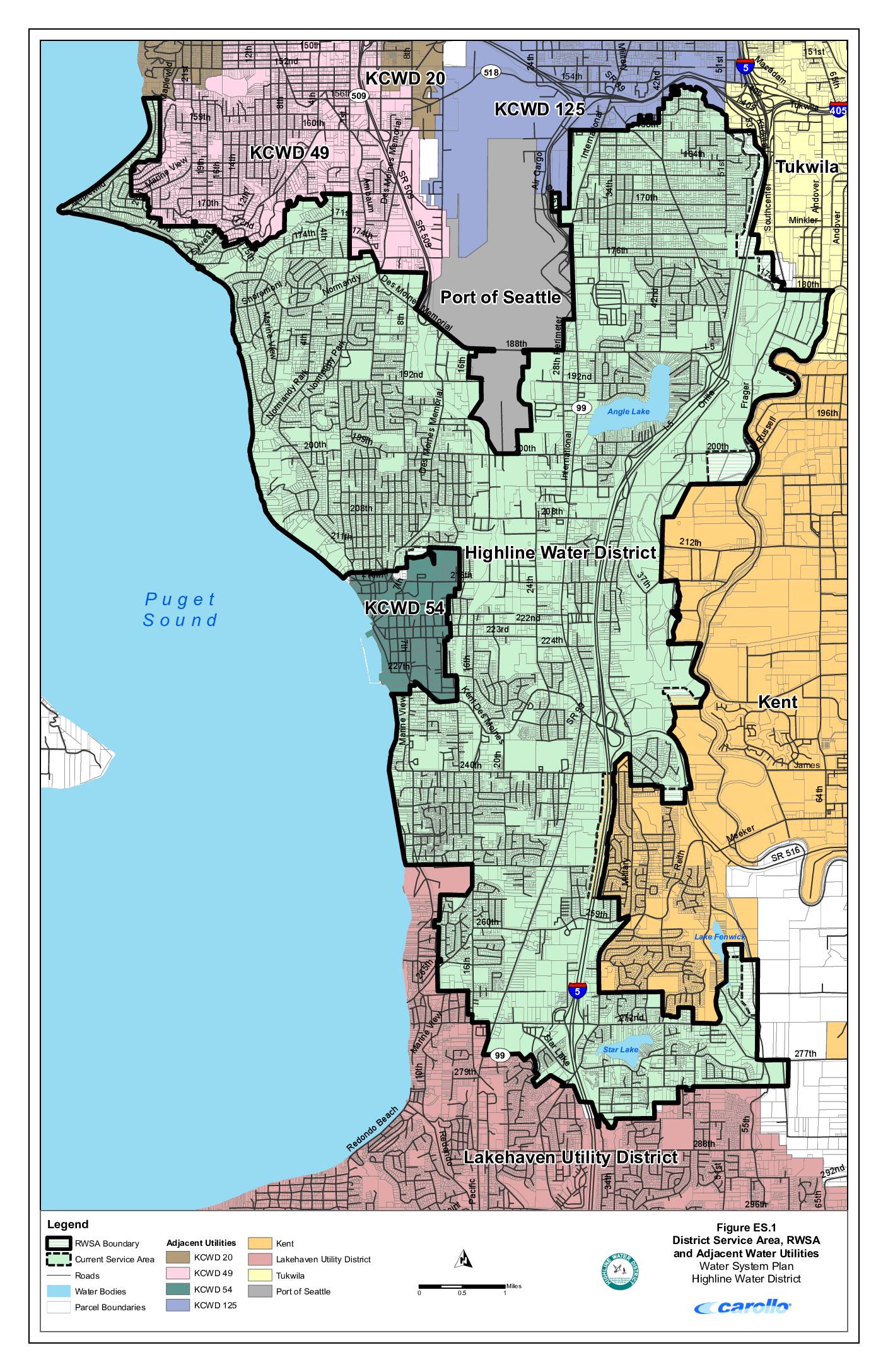
District service area, RWSA and adjacent water utilities – Highline Water District water system plan
This map from Highline Water District's Water System Plan shows the district's service area and surrounding water utilities in the communities south of Seattle, including areas near Sea-Tac Airport. It identifies neighboring providers such as the Port of Seattle, KCWD 20, KCWD 49, KCWD 54, KCWD 125, Tukwila, Kent, and Lakehaven Utility District, along with key landmarks like Angle Lake, Star Lake, and Lake Fenwick. The map delineates the Regional Water Service Area (RWSA) boundary and current service areas relative to major roads and Interstate 5. -
 2023-08-08
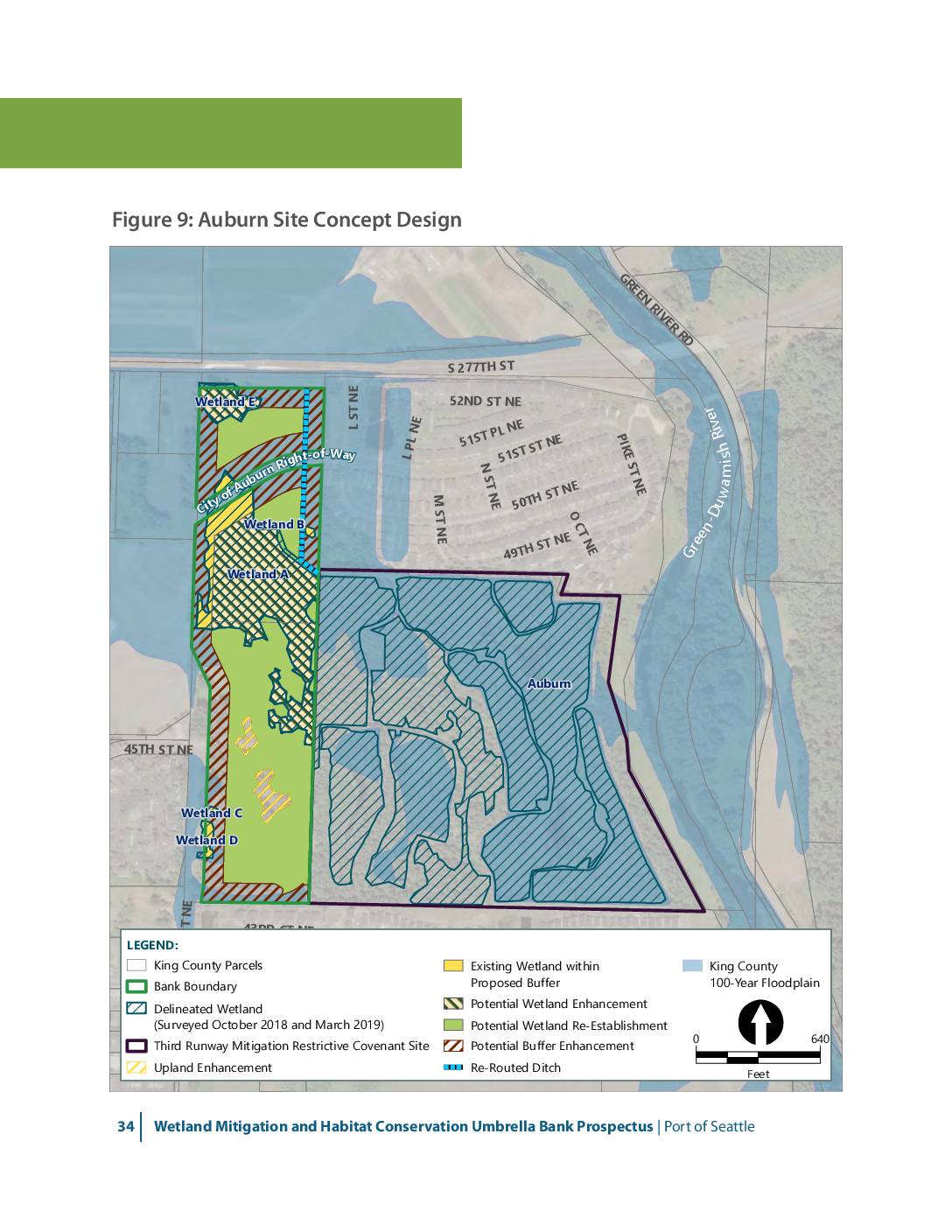
Auburn Wetlands site concept design
This map presents the concept design for the Auburn wetland mitigation site as part of the Port of Seattle’s Wetland Mitigation and Habitat Conservation Umbrella Bank Prospectus. The figure shows five delineated wetlands (A through E) along the Green-Duwamish River, with proposed enhancements including wetland re-establishment, buffer enhancement, upland enhancement, and re-routed ditches. The site -
 2023-07-30
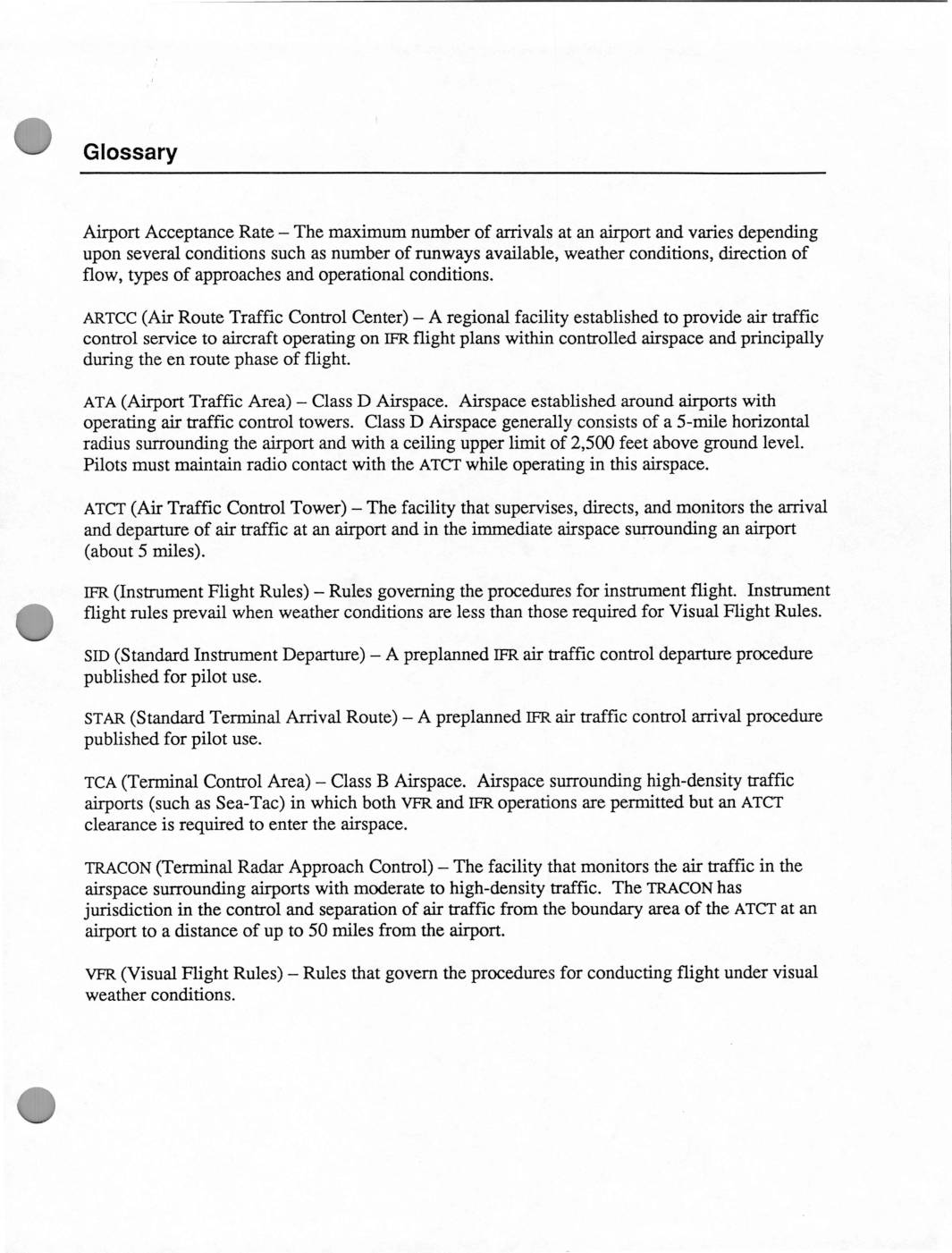
Glossary of air traffic control and airport operations terms
This document contains a glossary of air traffic control terms relevant to Sea-Tac Airport operations, including definitions for airspace classifications, flight rules, and control facilities such as TRACON and ATCT. It also includes building code amendments for King County requiring sound transmission controls, such as specialized ventilation duct designs with sound-absorbing linings and 90-degree bends, intended to reduce aircraft noise intrusion into residential structures. These regulations reflect efforts to mitigate the impact of airport noise on nearby homes and dwellings.