TagSea-Tac Airport(1835)
-
 2018-09-01
Billing Backup for City Shares of Lockridge Grindal Nauen Invoices for Sea-Tac Airport SAMP Review
In 2018, the cities of Burien, Des Moines, Normandy Park, and SeaTac entered into an Interlocal Agreement to jointly hire the law firm Lockridge Grindal Nauen PLLP for a combined $175,000 to review the Sea-Tac Airport Sustainable Airport Master Plan (SAMP). Costs were divided among the four cities based on population, at approximately $1.50 per capita, with Burien managing finances and SeaTac overseeing the contract. The first invoice, dated September 1, 2018, covered services from July 23 to September 25, 2018, totaling $62,685.58, which included legal research, document review, teleconferences, and planning activities related to the airport's master plan. -
 2018-09-01
Lockridge Grindal Nauen P.L.L.P. Statement No. 00001 to City of Burien
This is a legal billing statement dated September 1, 2018, from Lockridge Grindal Nauen P.L.L.P., a Minneapolis law firm, submitted to the City of Burien, Washington, totaling $62,685.58. The invoice covers attorney and staff time from July through September 2018 related to work on Sea-Tac Airport noise and airspace policy issues, including review of the airport's Sustainable Airport Master Plan (SAMP), SEPA/NEPA research, and strategy meetings with city officials. Work tasks included document review, legal research on airport procedures and noise impacts, teleconferences with clients and consultants, and preparation of planning documents in support of Burien's advocacy goals regarding Sea-Tac Airport operations. -
 2018-09-01
NTP environmental review schedule
The Port of Seattle outlined an environmental review schedule for the NTP (Noise Trajectory Program) at Seattle-Tacoma International Airport, spanning 2018 to 2019. Key steps included public scoping meetings held in September 2018 in cities such as Des Moines, Seattle, Federal Way, and Sea-Tac, followed by environmental analysis and the release of draft and final NEPA/SEPA documents through late 2019. Community members could submit scoping comments by September 28, 2018, via the project website, email, mail, or in person at scoping meetings. -
 2018-09-01
Lockridge Grindal Nauen P.L.L.P. Statement No. 00001 to City of Burien
This is a legal billing statement dated September 1, 2018, from Lockridge Grindal Nauen P.L.L.P., a Minneapolis law firm, submitted to the City of Burien, Washington, totaling $62,685.58. The invoice covers attorney and staff time from July through September 2018 related to work on Sea-Tac Airport noise and airspace policy issues, including review of the airport's Sustainable Airport Master Plan (SAMP), SEPA/NEPA research, and strategy meetings with city officials. Work tasks included document review, legal research on airport procedures and noise impacts, teleconferences with clients and consultants, and preparation of planning documents in support of Burien's advocacy goals regarding Sea-Tac Airport operations. -
 2018-08-22
Federal Way Mayor and City Council Letter Requesting 60-Day Extension of SAMP Scoping Public Comment Period
In August 2018, the Mayor and City Council of Federal Way, Washington, wrote to Port of Seattle commissioners requesting a 60-day extension—to November 27, 2018—of the public comment period for Sea-Tac Airport's Sustainable Airport Master Plan (SAMP). The letter cited the complexity of nearly 1,500 pages of technical documents and growing constituent concerns about aircraft noise and airport expansion. The council argued that the original four-month review window was insufficient for a project of this scale, which includes a new 19-gate terminal, taxiway extensions, and dozens of other infrastructure projects aimed at increasing passenger capacity from 46.9 million to 66 million by 2034. -
2018-08-22
Federal Way Mayor and City Council Letter Requesting 60-Day Extension of SAMP Scoping Public Comment Period
In August 2018, the Mayor and City Council of Federal Way, Washington, wrote to Port of Seattle commissioners requesting a 60-day extension—to November 27, 2018—of the public comment period for Sea-Tac Airport's Sustainable Airport Master Plan (SAMP). The letter cited the complexity of nearly 1,500 pages of technical documents and growing constituent concerns about aircraft noise and airport expansion. The council argued that the original four-month review window was insufficient for a project of this scale, which includes a new 19-gate terminal, taxiway extensions, and dozens of other infrastructure projects aimed at increasing passenger capacity from 46.9 million to 66 million by 2034. -
 2018-08-21
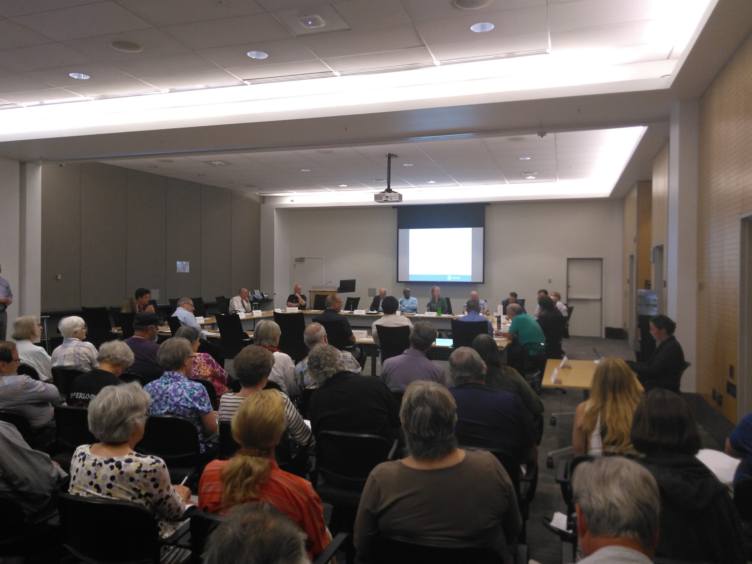
StART Meeting Photograph August 21, 2018
A large group of attendees, predominantly older adults, are seated at a U-shaped table at Sea-Tac Airport Conference Center Mezzanine for StART initial meeting -
 2018-08-16
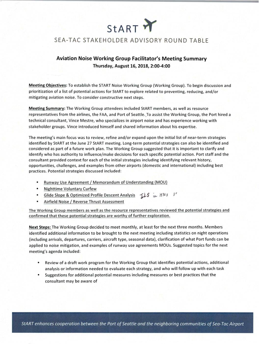
Aviation Noise Working Group facilitator’s meeting summary
The StART Aviation Noise Working Group held its first meeting on August 16, 2018, bringing together community stakeholders, airlines, the FAA, and Port of Seattle representatives to discuss strategies for reducing noise around Sea-Tac Airport. The group reviewed potential near-term actions including a Runway Use Agreement, a Nighttime Voluntary Curfew, Glide Slope and Optimized Profile Descent Analysis, and an Airfield Noise/Reverse Thrust Assessment. Members agreed to meet monthly and identified next steps such as gathering night operations data and drafting a work program to evaluate each noise-reduction strategy. -
 2018-08-06
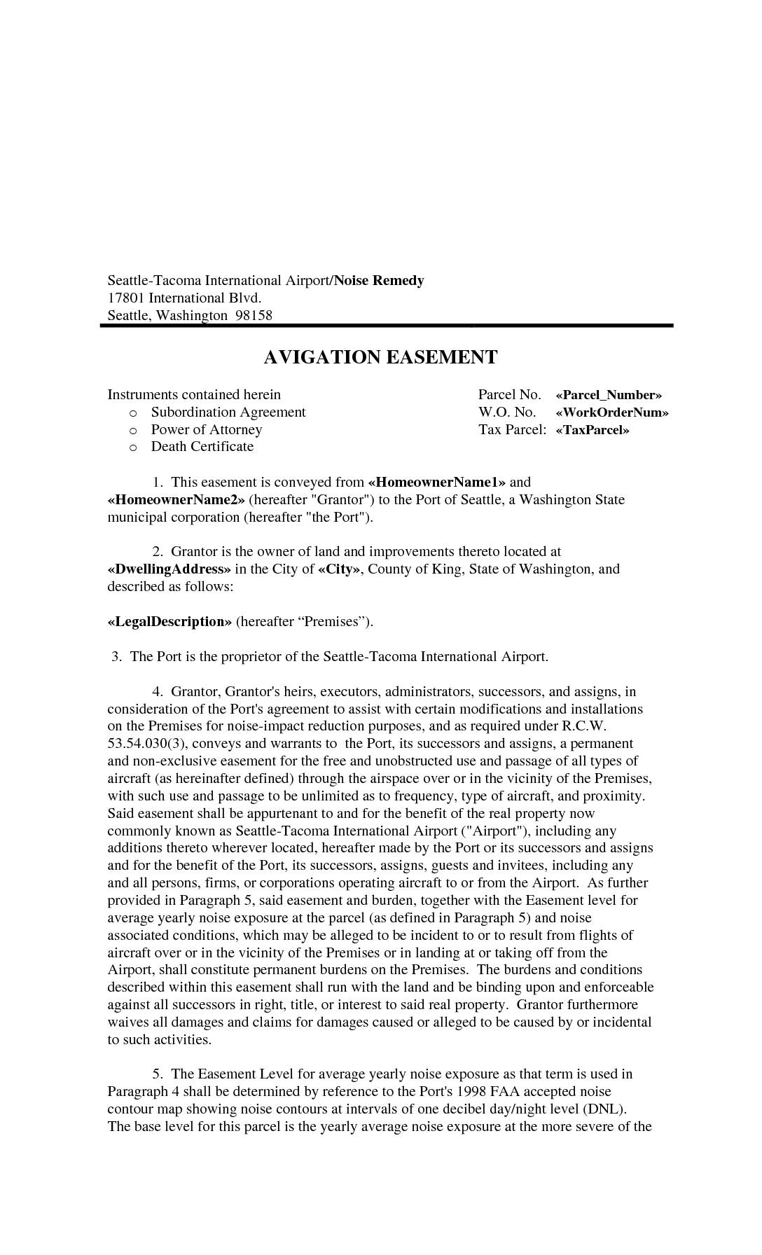
Avigation Easement
This Avigation Easement is a legal agreement in which a homeowner near Seattle-Tacoma International Airport grants the Port of Seattle permanent rights to use the airspace above their property for all types of aircraft, without restriction on frequency or proximity. In exchange, the Port assists with noise-reduction modifications to the home, and the homeowner waives all current and future claims for noise-related damages. The easement runs with the land permanently, binding all future owners of the property to the same terms. -
 2018-08-02
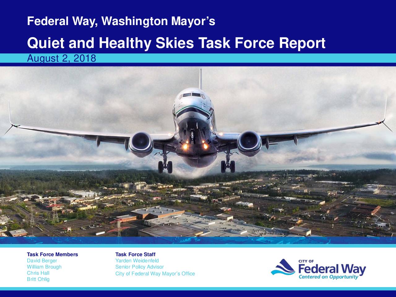
Federal Way Mayor’s Quiet and Healthy Skies Task Force Report
The Federal Way Mayor's Quiet and Healthy Skies Task Force Report (August 2018) examines the noise and health impacts of Seattle-Tacoma International Airport's Third Runway on Federal Way neighborhoods. It presents runway usage statistics from 2007–2017 showing a dramatic rise in flight operations, and references a 1997 impact mitigation study that identified over $148 million in recommended sound insulation and avigation easements for Federal Way communities affected by overflight noise.