TagMap(375)
-
 2002-10-23
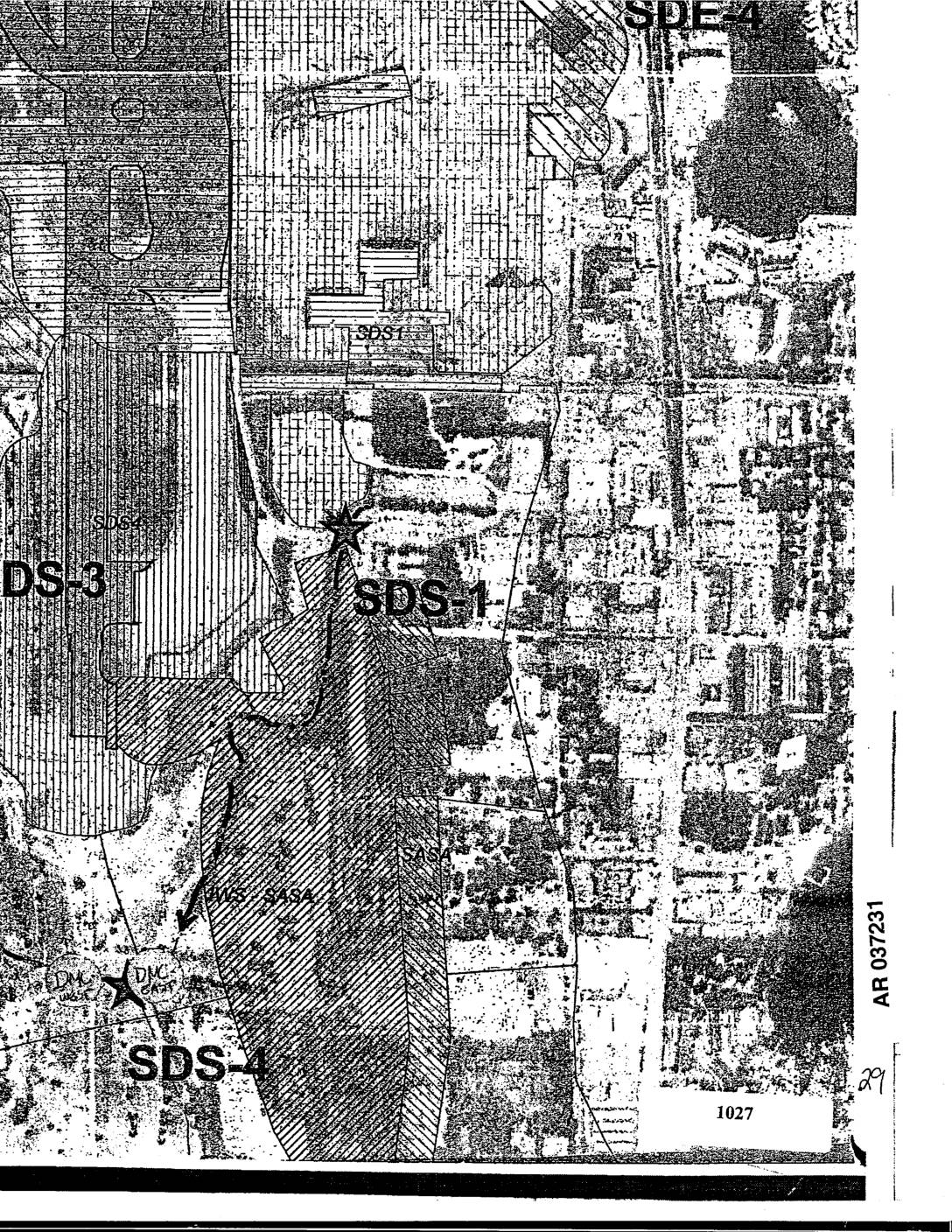
EXH AR037231: Sea-Tac Airport Area Map Showing SDS-1, SDS-3, SDS-4, SDE-4 Site Designations
Aerial map exhibit AR037231 showing site designation zones SDS-1, SDS-3, SDS-4, and SDE-4 in the Sea-Tac Airport vicinity, with DMC markers and parcel 1027 visible. Map includes hatched overlay areas indicating site boundaries and land use zones near Des Moines Creek and surrounding neighborhoods. Filed as exhibit in administrative record. -
 2002-10-22
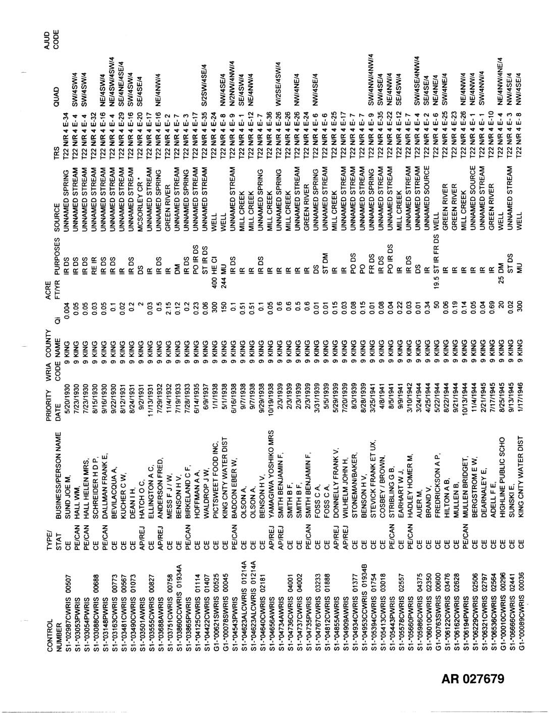
EXH AR027679: King County Water Rights Records — Priority Date Listing
Administrative Record AR027679–AR027681 comprising a multi-page tabular listing of water rights records in King County (WRIA Code 9), spanning priority dates from 1930 to 1958. Records identify control numbers, business/person names, type/status (CE, PE/CAN, AP/REJ, CE/RLQ), priority dates, acreage, quantities (Qi), purposes (IR, DS, MU, ST, FR, PO, DM), and water sources including Green River, -
 2002-10-22
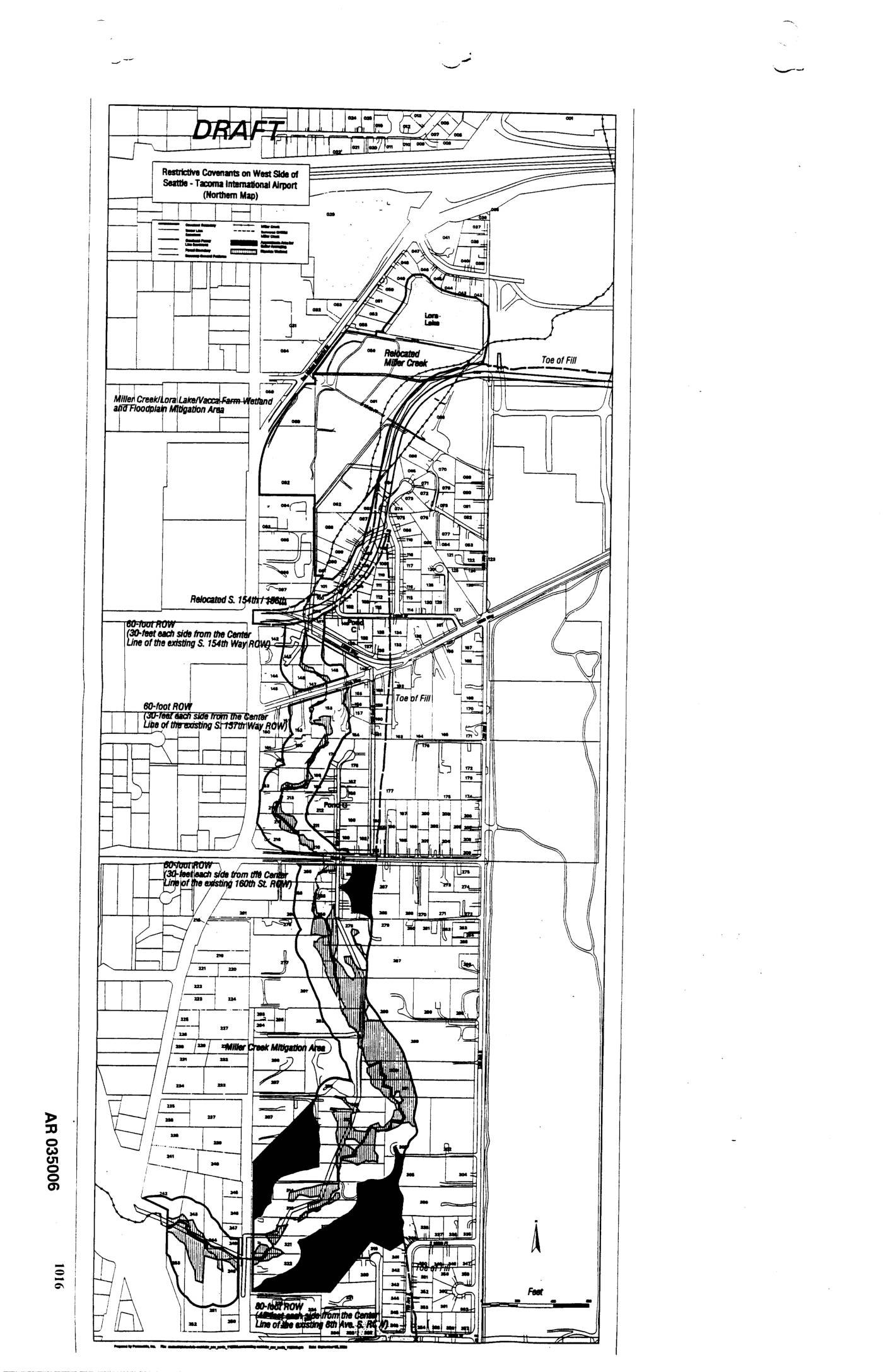
EXH AR035006: Draft Map — Restrictive Covenants on West Side of Seattle-Tacoma International Airport (Northern Map)
Draft map AR035006 showing restrictive covenants on the west side of Seattle-Tacoma International Airport (northern section). Features include Relocated Miller Creek, Lora Lake, Miller Creek/Lora Lake/Vacca Farm Wetland and Floodplain Mitigation Area, Miller Creek Mitigation Area, Toe of Fill boundaries, Relocated S. 154th Place, and multiple 60-foot ROW designations (30 feet each side from center -
 2002-10-22
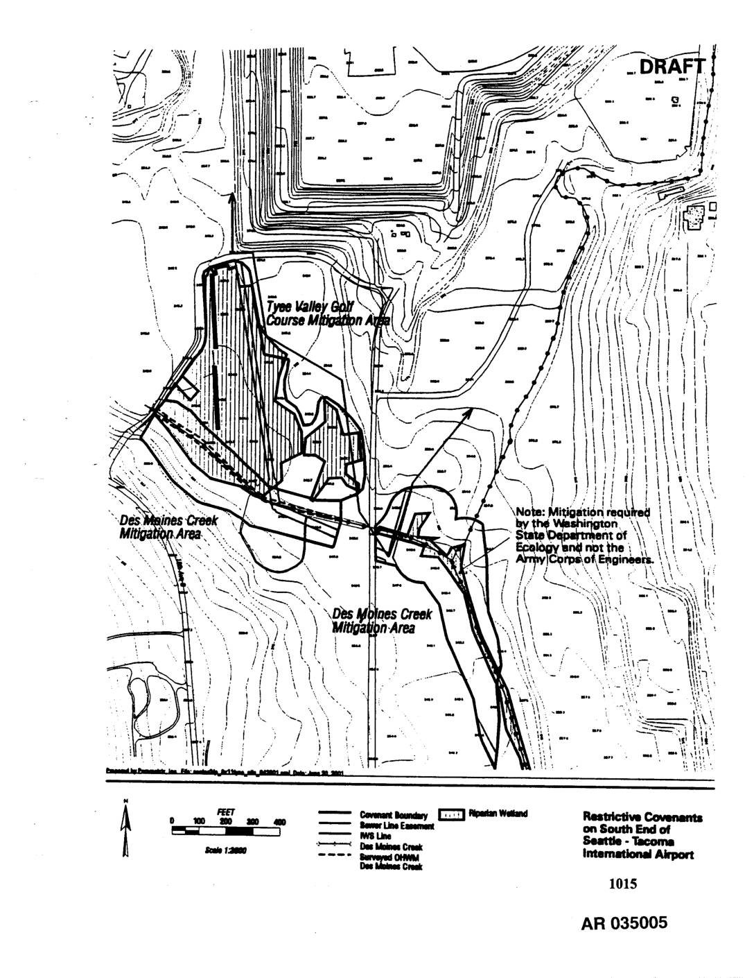
EXH AR1015: Restrictive Covenants on South End of Seattle-Tacoma International Airport — Draft Map
Draft map (AR 035005, Exhibit 1015) showing restrictive covenant boundaries, sewer line easements, IWS line, Des Moines Creek, and surveyed OHWM on the south end of Seattle-Tacoma International Airport. Identifies the Tyee Valley Golf Course Mitigation Area and Des Moines Creek Mitigation Area, with a note that mitigation was required by the Washington State Department -
 2002-10-21
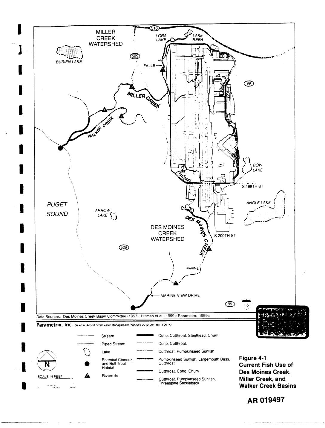
EXH AR019497: Figure 4-1 Current Fish Use Des Moines, Miller & Walker Creek Basins
This figure from the Sea-Tac Airport Stormwater Management Plan maps current fish habitat in the Des Moines Creek, Miller Creek, and Walker Creek watersheds near Sea-Tac Airport. It identifies the fish species present in various streams and lakes in the area, including Coho, Cutthroat, Steelhead, Chum, Chinook, Bull Trout, and Pumpkinseed Sunfish. The map also highlights piped stream segments and areas of potential Chinook and Bull Trout habitat within these interconnected watershed basins adjacent to Puget Sound. -
 2002-05-01
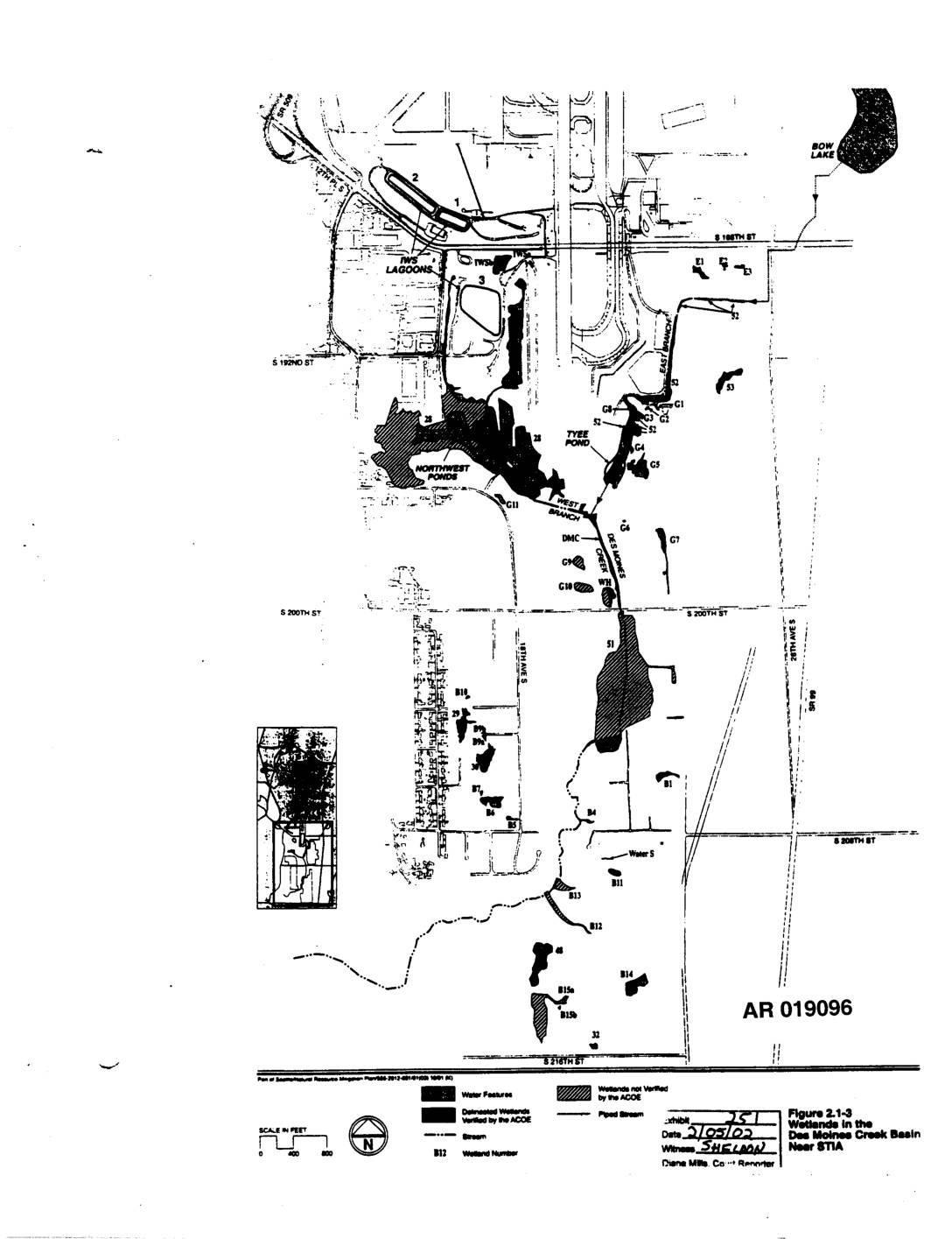
EXH AR019096: Figure 2.1-3 — Wetlands Des Moines Creek Basin Near STIA
This figure (2.1-3) is a map showing wetlands located in the Des Moines Creek Basin near Seattle-Tacoma International Airport (STIA). It identifies delineated wetlands verified by the Army Corps of Engineers (ACOE), water features, streams, and piped streams across the area, with individual wetlands labeled by alphanumeric codes. The map was submitted as part of a supplemental natural resources mitigation plan related to airport development activities in the region. -
 2002-03-05
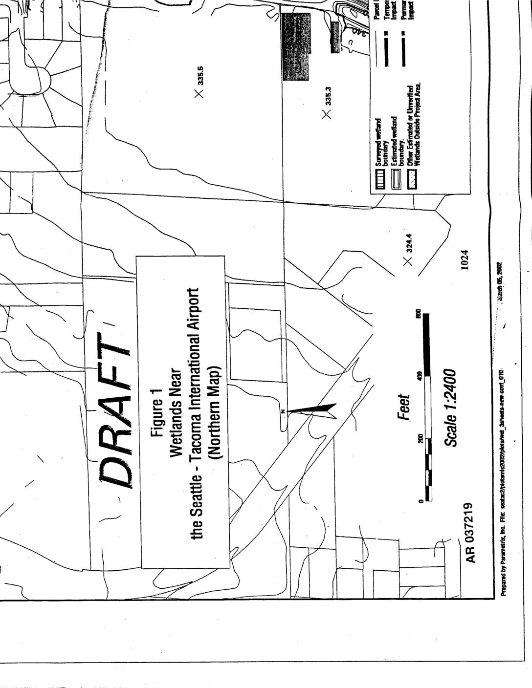
EXH AR037219: Draft Map — Wetlands Near Seattle-Tacoma International Airport (Northern Map)
Draft figure (AR 037219) prepared by Parametrix, Inc. on March 5, 2002, mapping wetlands near Seattle-Tacoma International Airport (northern section) at scale 1:2400. Shows surveyed wetland boundaries, estimated wetland boundaries, other estimated or unverified wetlands outside project area, parcel boundaries, temporary impacts, and permanent impacts. Elevation points marked at 335.5, 335.3, 324.4. Administrative Record number -
 2002-03-05
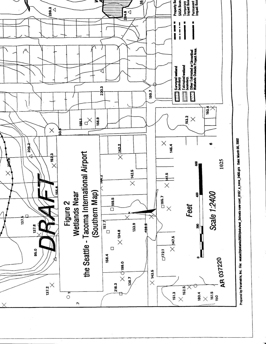
EXH AR037220: Draft Figure 2 — Wetlands Near the Seattle-Tacoma International Airport (Southern Map)
AR037220 draft wetland map (Figure 2, Southern Map) prepared by Parametrix, Inc., dated March 05, 2002, depicting wetlands near Seattle-Tacoma International Airport. Map shows surveyed wetland boundaries, estimated wetland boundaries, SASA boundaries, temporary and permanent impact boundaries, and wetlands outside project area at scale 1:2400. Includes elevation data points and wetland delineation markers across the -
 2002-02-20
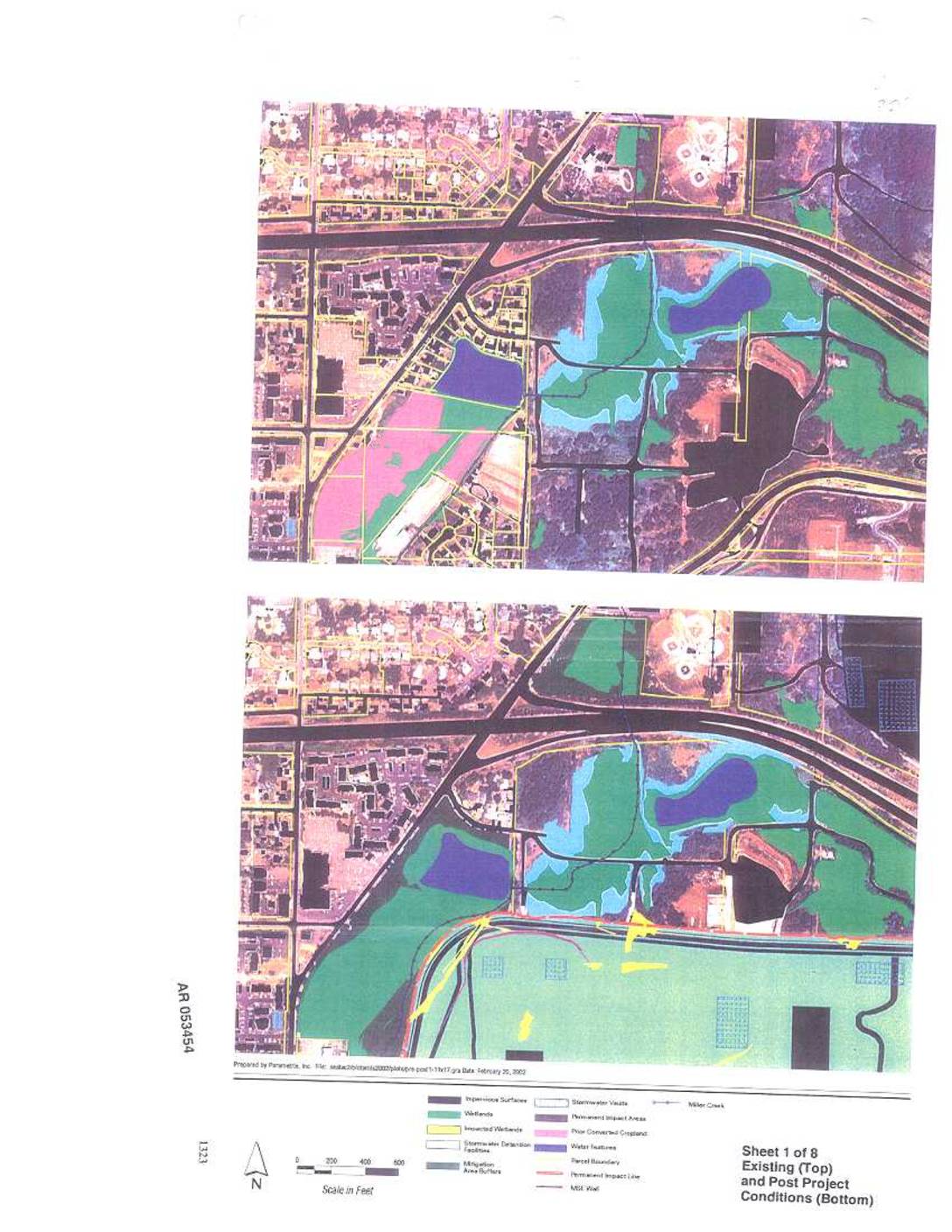
EXH AR053454: Existing and Post Project Conditions Maps, Sheets 1–3 of 8 — Sea-Tac Airport Wetlands and Miller Creek
Parametrix-prepared maps (Sheets 1-3 of 8, AR 053454-053456, dated February 20, 2002) depicting existing and post-project conditions near Sea-Tac Airport, showing wetlands, impacted wetlands, impervious surfaces, stormwater detention facilities, stormwater vaults, mitigation area buffers, permanent impact areas, prior converted cropland, Miller Creek, parcel boundaries, permanent impact lines, MSE wall, and airport navigation aids. Maps cover -
 2002-02-19
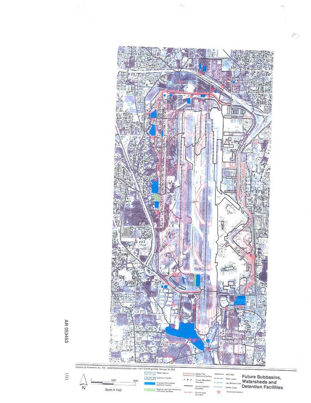
EXH AR053453: Future Subbasins, Watersheds and Detention Facilities Map
AR 053453. Map prepared by Parametrix, Inc. dated February 19, 2002, depicting future subbasins, watersheds, and detention facilities at Sea-Tac Airport. Shows water features including Miller Creek, Old Madres Creek, Walker Creek, detention facilities, proposed stormwater management facilities, reactive low-flow vaults and infiltration facilities, Master Plan impervious surfaces, future watershed boundaries, future subbasin boundaries, discharge